photo free
Home Images Vectors Videos

Stock image Gulf Of Georgia

stock image Abstract vector color map of Middle East country

Abstract Vector Color Map Of Middle East Country

Image, 0MB, 2842 × 3336 jpg
stock vector Florida United States political map

Florida United States Political Map

Vector, 3.05MB, 8333 × 7526 eps
stock image Vancouver Canada

Vancouver Canada

Image, 12.91MB, 5500 × 3671 jpg
stock vector Vector map of the East Coast, United States

Vector Map Of The East Coast, United States

Vector, 2.64MB, 3100 × 5493 eps
stock vector Alabama, AL, political map with the capital Montgomery, cities, rivers and lakes. State in the Southeastern region of the United States, nicknamed Yellowhammer State, Heart of Dixie, and Cotton State.

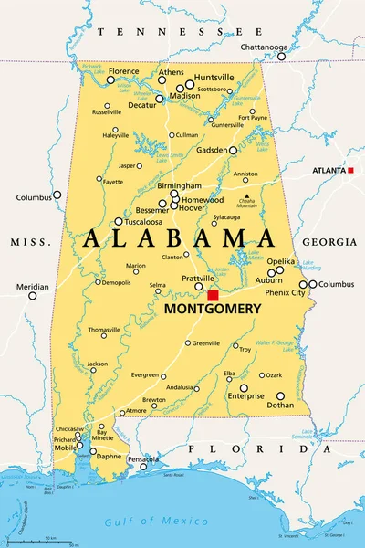
Alabama, AL, Political Map With The Capital Montgomery, Cities, Rivers And Lakes. State In The Southeastern Region Of The United States, Nicknamed Yellowhammer State, Heart Of Dixie, And Cotton State.

Vector, 4.33MB, 6000 × 9000 eps
stock image Abstract vector color map of Middle East country

Abstract Vector Color Map Of Middle East Country

Image, 0MB, 3270 × 3870 jpg
stock vector Middle East country

Middle East Country

Vector, 1.56MB, 3270 × 3870 eps
stock vector Persian gulf countries

Persian Gulf Countries

Vector, 1.39MB, 2858 × 3605 eps
stock vector Middle East

Middle East

Vector, 1.61MB, 4218 × 4980 eps
stock vector Middle-east

Middle-east

Vector, 1.65MB, 5163 × 6112 eps
stock vector Middle east political map with each country selectable independently

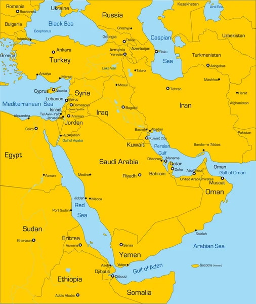
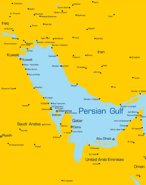
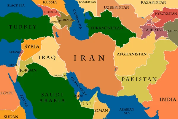
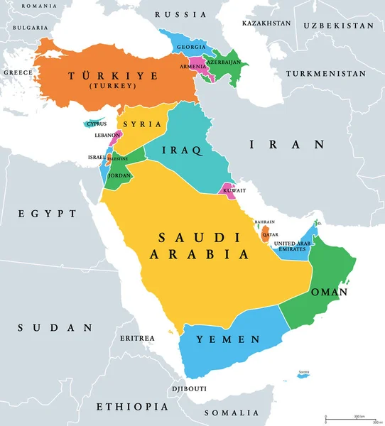
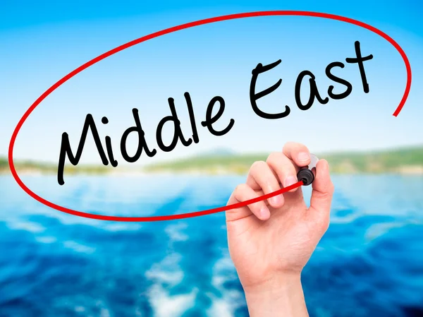
Middle East Political Map With Each Country Selectable Independently

Vector, 1.59MB, 4244 × 4996 eps
stock image Colored Map Of The Middle East

Colored Map Of The Middle East

Image, 3.15MB, 4000 × 2670 jpg
stock vector Western Asia, geoscheme and political map. Subregion of Asia, used for statistical purposes, covering geographical regions spanning from Anatolia, Caucasus, Levant, Mesopotamia till Arabian Peninsula.

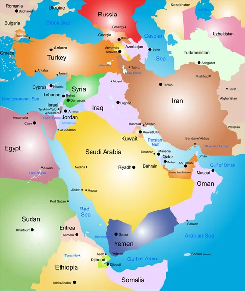
Western Asia, Geoscheme And Political Map. Subregion Of Asia, Used For Statistical Purposes, Covering Geographical Regions Spanning From Anatolia, Caucasus, Levant, Mesopotamia Till Arabian Peninsula.

Vector, 2.94MB, 6000 × 6632 eps
stock vector Florida region map

Florida Region Map

Vector, 8.34MB, 5012 × 4637 eps
stock vector Papua New Guinea Political Map

Papua New Guinea Political Map

Vector, 3.66MB, 9000 × 5403 eps
stock vector florida road map with national parks

Florida Road Map With National Parks

Vector, 2.23MB, 4562 × 4254 eps
stock image The southern live oak is the official state tree of Georgia.

The Southern Live Oak Is The Official State Tree Of Georgia.

Image, 6.81MB, 2592 × 3888 jpg
stock vector Middle East highly detailed physical map ,in vector format,with all the relief forms.

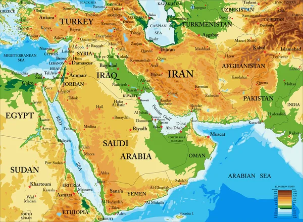
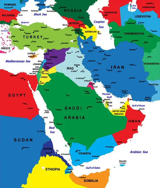
Middle East Highly Detailed Physical Map ,in Vector Format,with All The Relief Forms.

Vector, 5.63MB, 5000 × 3667 eps
stock vector North America Political Map. Highly detailed map. All elements are separated in editable layers clearly labeled. Vector

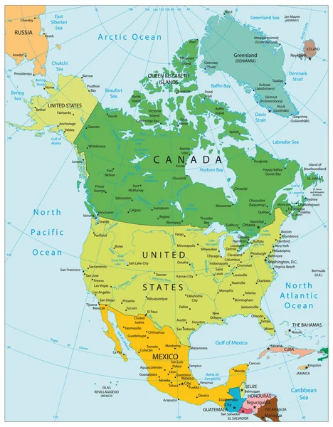
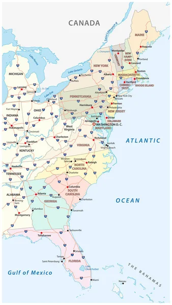
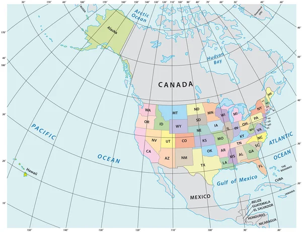
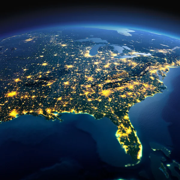
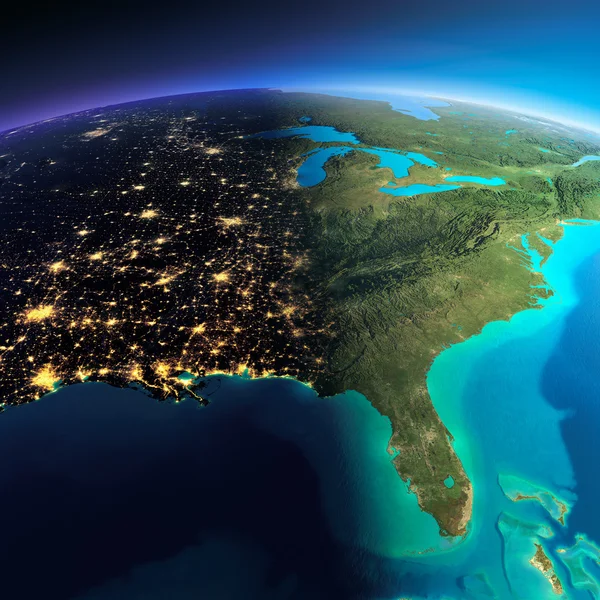
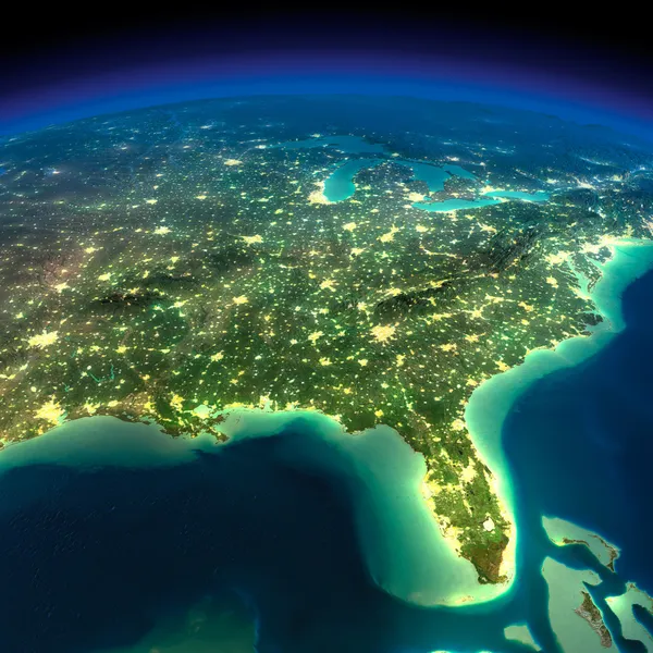
North America Political Map. Highly Detailed Map. All Elements Are Separated In Editable Layers Clearly Labeled. Vector

Vector, 12.15MB, 3767 × 4826 eps
stock vector Florida political map

Florida Political Map

Vector, 4.89MB, 8433 × 7616 eps
stock vector Persian gulf

Persian Gulf

Vector, 1.52MB, 4897 × 6128 eps
stock vector Highly detailed physical map of the US state of florida

Highly Detailed Physical Map Of The US State Of Florida

Vector, 2.33MB, 4538 × 4230 eps
stock image Public Ruckle Provincial Park shoreline on the Salt Spring Island

Public Ruckle Provincial Park Shoreline On The Salt Spring Island

Image, 13.64MB, 4608 × 3456 jpg
stock image White sand beach on a beautiful sunny summer day on Gabriola Island at Gabriola Sands Provincial Park in British Columbia Canada.

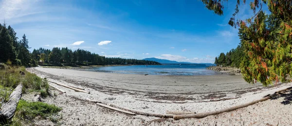
White Sand Beach On A Beautiful Sunny Summer Day On Gabriola Island At Gabriola Sands Provincial Park In British Columbia Canada.

Image, 23.81MB, 8964 × 3881 jpg
stock vector Florida region map

Florida Region Map

Vector, 8.24MB, 5012 × 4637 eps
stock image Detailed Earth. Gulf of Mexico and Florida

Detailed Earth. Gulf Of Mexico And Florida

Image, 10.71MB, 5000 × 5000 jpg
stock vector road map of the US American State of Alabama

Road Map Of The US American State Of Alabama

Vector, 1.6MB, 3100 × 3768 eps
stock image View of mountains and shoreline of Vesuvius Bay on Salt Spring Island, British Columbia, Canada

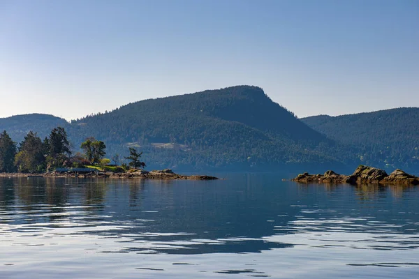
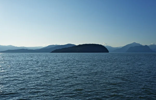
View Of Mountains And Shoreline Of Vesuvius Bay On Salt Spring Island, British Columbia, Canada

Image, 17.72MB, 6016 × 4016 jpg
stock image Strait of Georgia landscape in between Victoria and Vancouver British Columbia Canada

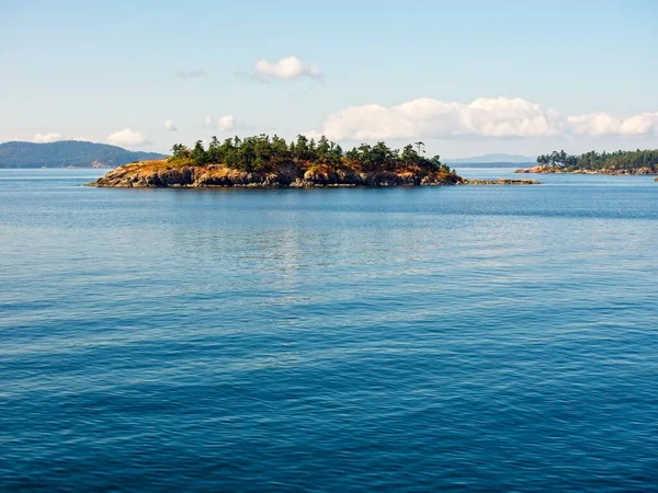
Strait Of Georgia Landscape In Between Victoria And Vancouver British Columbia Canada

Image, 11.63MB, 5380 × 3620 jpg
stock vector North America administrative vector map with latitude and longitude

North America Administrative Vector Map With Latitude And Longitude

Vector, 1.11MB, 4020 × 3100 eps
stock image magnolia trees against a bright blue sky

Magnolia Trees Against A Bright Blue Sky

Image, 15.6MB, 4896 × 3672 jpg
stock image Hunting boats on the levee of a swamp shore

Hunting Boats On The Levee Of A Swamp Shore

Image, 14.89MB, 4896 × 3672 jpg
stock image Gulf Islands

Gulf Islands

Image, 9.35MB, 4536 × 3402 jpg
stock vector North America map with USA, Canada and Mexico

North America Map With USA, Canada And Mexico

Vector, 14.92MB, 7002 × 6002 eps
stock vector North America Political Map Vintage Colors. Highly detailed map. All elements are separated in editable layers clearly labeled.

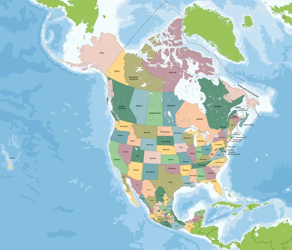
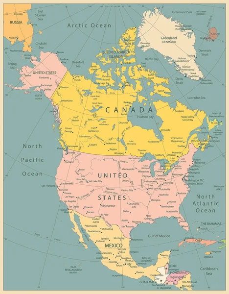
North America Political Map Vintage Colors. Highly Detailed Map. All Elements Are Separated In Editable Layers Clearly Labeled.

Vector, 12.9MB, 3767 × 4826 eps
stock image Gulf Islands

Gulf Islands

Image, 10.49MB, 4608 × 3456 jpg
stock image Gulf of Georgia Cannery Building

Gulf Of Georgia Cannery Building

Image, 10.2MB, 5500 × 3667 jpg
stock image British Columbia Canada

British Columbia Canada

Image, 8.36MB, 5000 × 3202 jpg
stock image swamp river with reflection of marsh and sky

Swamp River With Reflection Of Marsh And Sky

Image, 10.38MB, 3450 × 2293 jpg
stock image marsh land with cypress trees and a blue sky

Marsh Land With Cypress Trees And A Blue Sky

Image, 2MB, 4912 × 2760 jpg
stock vector road map of the US American State of California.

Road Map Of The US American State Of California.

Vector, 1.45MB, 3100 × 3398 eps
stock image pretty white arrow head flower in the swamppretty white arrow head flower in the swamp

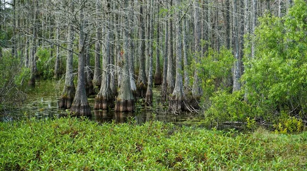
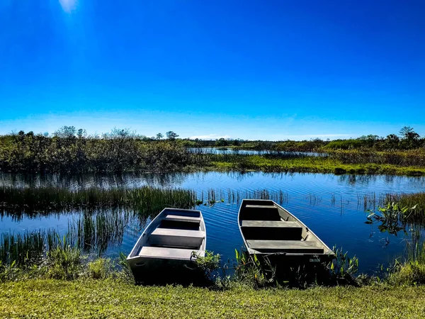
Pretty White Arrow Head Flower In The Swamppretty White Arrow Head Flower In The Swamp

Image, 1.48MB, 6000 × 4000 jpg
stock image Hurricane Ian in Florida. Earth seen from space. Extremely detailed and realistic high resolution 3D illustration. Elements of this render have been furnished by NASA.

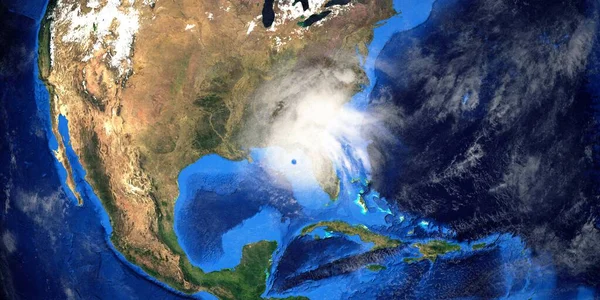
Hurricane Ian In Florida. Earth Seen From Space. Extremely Detailed And Realistic High Resolution 3D Illustration. Elements Of This Render Have Been Furnished By NASA.

Image, 11.99MB, 10000 × 5000 jpg
stock image Women Hand writing Middle East with black marker on visual scree

Women Hand Writing Middle East With Black Marker On Visual Scree

Image, 0.98MB, 3800 × 2848 jpg
stock image Detailed Earth. North America. USA. Gulf of Mexico and Florida o

Detailed Earth. North America. USA. Gulf Of Mexico And Florida O

Image, 12.32MB, 5000 × 5000 jpg
stock image Man Hand writing Middle East with black marker on visual screen

Man Hand Writing Middle East With Black Marker On Visual Screen

Image, 2.2MB, 3800 × 2848 jpg
stock vector Road map of the US state of Alabama with flag

Road Map Of The US State Of Alabama With Flag

Vector, 1.87MB, 3100 × 3804 eps
stock image Detailed Earth. Gulf of California, Mexico and the western U.S.

Detailed Earth. Gulf Of California, Mexico And The Western U.S.

Image, 9.62MB, 5000 × 5000 jpg
stock vector Fort Lauderdale city outline icon. elements of cityscapes illustration line icon. signs, symbols can be used for web, logo, mobile app, UI, UX

Fort Lauderdale City Outline Icon. Elements Of Cityscapes Illustration Line Icon. Signs, Symbols Can Be Used For Web, Logo, Mobile App, UI, UX

Vector, 0.41MB, 10000 × 5000 eps
stock image Night Earth. Gulf of Mexico and Florida

Night Earth. Gulf Of Mexico And Florida

Image, 9.53MB, 5000 × 5000 jpg
Page 1 >> Next