photo free
Home Images Vectors Videos

Stock image Karas Region page 2

stock image Quivertree under milky way

Quivertree Under Milky Way

Image, 23.56MB, 4285 × 6428 jpg
stock image old car in desert

Old Car In Desert

Image, 11.43MB, 5339 × 3559 jpg
stock image Panoramic view of quiver tree forest at Garas near Keetmanshoop

Panoramic View Of Quiver Tree Forest At Garas Near Keetmanshoop

Image, 11.95MB, 6654 × 3000 jpg
stock image 4x4 rental car equipped with a roof tent parks on a dirt road in Namibia

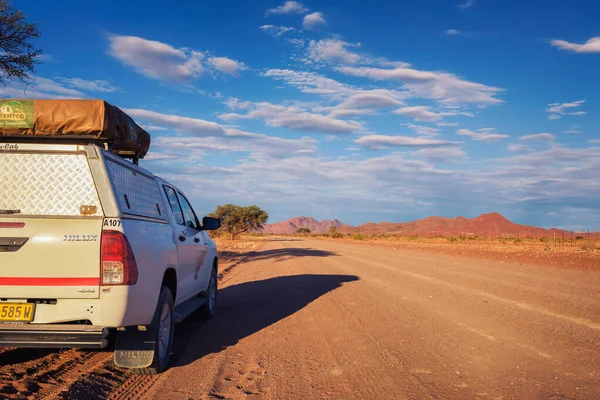
4x4 Rental Car Equipped With A Roof Tent Parks On A Dirt Road In Namibia

Image, 11.94MB, 6016 × 4016 jpg
stock image old car in desert

Old Car In Desert

Image, 13.15MB, 5429 × 3619 jpg
stock image beautiful mountain landscape in Africa

Beautiful Mountain Landscape In Africa

Image, 17.99MB, 6720 × 4480 jpg
stock image Cheetah animal, Acinonyx jubatus animal portrait

Cheetah Animal, Acinonyx Jubatus Animal Portrait

Image, 1.85MB, 6000 × 4000 jpg
stock image Interior of the abandoned hospital in Kolmanskop, Namibia, engulfed by sand and lit up by the warm light of the Namib Desert. Founded in 1908 for diamond exploration, the town was abandoned in 1956.

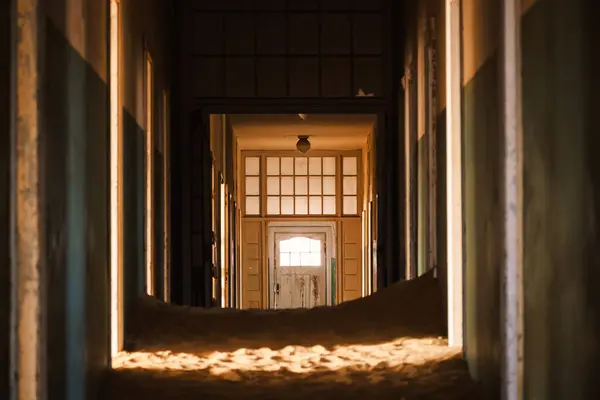
Interior Of The Abandoned Hospital In Kolmanskop, Namibia, Engulfed By Sand And Lit Up By The Warm Light Of The Namib Desert. Founded In 1908 For Diamond Exploration, The Town Was Abandoned In 1956.

Image, 6.57MB, 5196 × 3464 jpg
stock image Sunset view of quiver tree forest at Garas

Sunset View Of Quiver Tree Forest At Garas

Image, 6.88MB, 3595 × 2400 jpg
stock vector Karas region outline map set

Karas Region Outline Map Set

Vector, 4.65MB, 6000 × 3000 eps
stock image The railway station in Luderitz, Namibia, heritage of the German colonial era.

The Railway Station In Luderitz, Namibia, Heritage Of The German Colonial Era.

Image, 14.73MB, 5196 × 3464 jpg
stock image African landscape of river bed without water. Namibia Africa, Wilderness

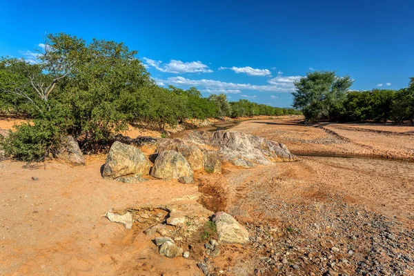
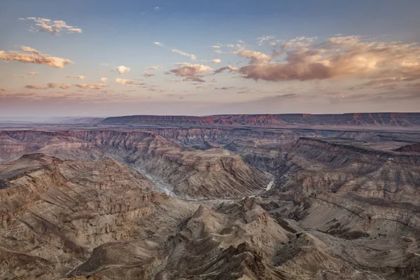
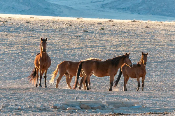
African Landscape Of River Bed Without Water. Namibia Africa, Wilderness

Image, 16.58MB, 5329 × 3553 jpg
stock image dry fish served with lemon, on dark wood board with pistachio, beer

Dry Fish Served With Lemon, On Dark Wood Board With Pistachio, Beer

Image, 1.9MB, 1928 × 2000 jpg
stock image views of the scenic Kalahari region

Views Of The Scenic Kalahari Region

Image, 11.31MB, 5472 × 3648 jpg
stock image The great Karas mountains, Namibia.

The Great Karas Mountains, Namibia.

Image, 19.45MB, 6661 × 3747 jpg
stock image Blue hour becomes golden hour at quiver tree forest

Blue Hour Becomes Golden Hour At Quiver Tree Forest

Image, 5.11MB, 3595 × 2400 jpg
stock image Road trip to Fish River Canyon, Namibia.

Road Trip To Fish River Canyon, Namibia.

Image, 12.81MB, 5787 × 3255 jpg
stock image Pulau Karas in the Ceram Sea, belonging to Indonesia, isolated on a bilevel elevation map, with distance scale

Pulau Karas In The Ceram Sea, Belonging To Indonesia, Isolated On A Bilevel Elevation Map, With Distance Scale

Image, 0.33MB, 2160 × 2160 jpg
stock image Pulau Karas in the Ceram Sea - belonging to Indonesia. Described location diagram with yellow shape of the island and sample maps of its surroundings

Pulau Karas In The Ceram Sea - Belonging To Indonesia. Described Location Diagram With Yellow Shape Of The Island And Sample Maps Of Its Surroundings

Image, 2.01MB, 3840 × 2160 jpg
stock image Pulau Karas in the Ceram Sea, belonging to Indonesia, isolated on a topographic, OSM Humanitarian style map, with distance scale

Pulau Karas In The Ceram Sea, Belonging To Indonesia, Isolated On A Topographic, OSM Humanitarian Style Map, With Distance Scale

Image, 0.29MB, 2160 × 2160 jpg
stock image Wild horses of the Namib walking at sunrise. Photo taken at Garub

Wild Horses Of The Namib Walking At Sunrise. Photo Taken At Garub

Image, 5.24MB, 3161 × 2100 jpg
stock image Pulau Karas in the Ceram Sea on a satellite image taken in January 20, 2020

Pulau Karas In The Ceram Sea On A Satellite Image Taken In January 20, 2020

Image, 5.24MB, 2880 × 1620 jpg
stock image Pulau Karas in the Ceram Sea on a topographic, OSM Humanitarian style map

Pulau Karas In The Ceram Sea On A Topographic, OSM Humanitarian Style Map

Image, 0.29MB, 2880 × 1620 jpg
stock image Cheetah (Acinonyx jubatus), Karas Region, Namibia, Africa

Cheetah (Acinonyx Jubatus), Karas Region, Namibia, Africa

Image, 3.57MB, 5619 × 3746 jpg
stock image Pulau Karas in the Ceram Sea, belonging to Indonesia, isolated on a satellite image taken in January 30, 2020, with distance scale

Pulau Karas In The Ceram Sea, Belonging To Indonesia, Isolated On A Satellite Image Taken In January 30, 2020, With Distance Scale

Image, 1.45MB, 2160 × 2160 jpg
stock image aggressive Cheetah animal, Acinonyx jubatus outdoors

Aggressive Cheetah Animal, Acinonyx Jubatus Outdoors

Image, 1.58MB, 6000 × 4000 jpg
stock image Pulau Karas in the Ceram Sea on a colored elevation map

Pulau Karas In The Ceram Sea On A Colored Elevation Map

Image, 0.85MB, 2880 × 1620 jpg
Previous << Page 2 >> Next