photo free
Home Images Vectors Videos

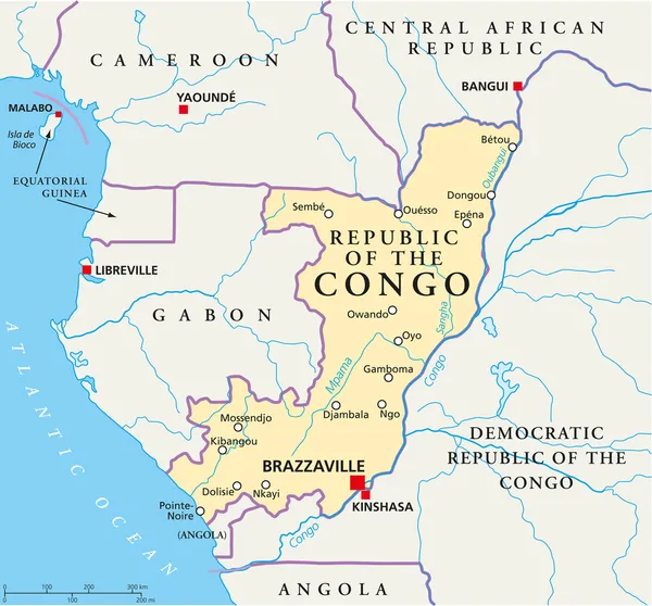
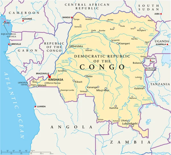
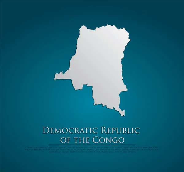
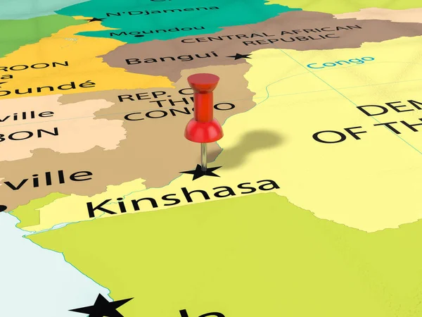
Stock image Map Of Congo

stock vector Republic of the Congo Political Map

Republic Of The Congo Political Map

Vector, 1.75MB, 6446 × 6000 eps
stock vector Map DR Congo

Map DR Congo

Vector, 1.49MB, 5906 × 5906 eps
stock vector Airplane over blue Africa map

Airplane Over Blue Africa Map

Vector, 1.29MB, 3835 × 4200 eps
stock image Businessman with map and flag of Congo

Businessman With Map And Flag Of Congo

Image, 2.84MB, 3888 × 2592 jpg
stock image Democratic Republic of the Congo map on  flag drawing ,grunge an

Democratic Republic Of The Congo Map On Flag Drawing ,grunge An

Image, 9.66MB, 6197 × 5000 jpg
stock vector Congo Democratic Republic Political Map

Congo Democratic Republic Political Map

Vector, 4.34MB, 6601 × 6000 eps
stock vector Democratic Republic of the Congo vector set.

Democratic Republic Of The Congo Vector Set.

Vector, 5.93MB, 3970 × 5671 eps
stock vector Democratic Republic of the Congo Map

Democratic Republic Of The Congo Map

Vector, 5.89MB, 5165 × 4839 eps
stock image congo territory on world map

Congo Territory On World Map

Image, 18.85MB, 5000 × 2649 jpg
stock vector Congo, The Democratic Republic Of The network map.

Congo, The Democratic Republic Of The Network Map.

Vector, 8.6MB, 8333 × 8333 eps
stock vector Africa vintage detailed map print poster design. Vector illustra

Africa Vintage Detailed Map Print Poster Design. Vector Illustra

Vector, 7.97MB, 5556 × 5556 eps
stock vector Africa Map - Vintage Detailed Vector Illustration

Africa Map - Vintage Detailed Vector Illustration

Vector, 9.25MB, 5623 × 5293 eps
stock vector Editable map of Africa with all countries.

Editable Map Of Africa With All Countries.

Vector, 3.28MB, 4167 × 4595 eps
stock vector Map markers with flags - Africa. Original colors.

Map Markers With Flags - Africa. Original Colors.

Vector, 3.53MB, 4000 × 4429 eps
stock vector Brazzaville Congo City Map in Retro Style. Outline Map. Vector Illustration.

Brazzaville Congo City Map In Retro Style. Outline Map. Vector Illustration.

Vector, 4.17MB, 8150 × 4702 eps
stock image Pushpin on Kinshasa map

Pushpin On Kinshasa Map

Image, 7.47MB, 5200 × 3900 jpg
stock vector Africa map and country contours - Illustration.

Africa Map And Country Contours - Illustration.

Vector, 6.32MB, 5400 × 4411 eps
stock vector Satellite map of Kinshasa (Leopoldville), is the capital and the largest city of the Democratic Republic of the Congo. Streets map and city center.

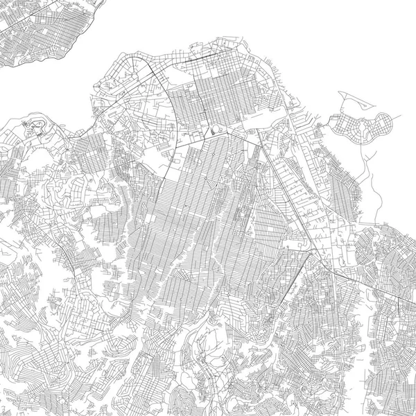
Satellite Map Of Kinshasa (Leopoldville), Is The Capital And The Largest City Of The Democratic Republic Of The Congo. Streets Map And City Center.

Vector, 4.71MB, 4717 × 4717 eps
stock vector Map of Africa.

Map Of Africa.

Vector, 2.69MB, 3065 × 3076 eps
stock vector Congo network map.

Congo Network Map.

Vector, 7.73MB, 8333 × 8333 eps
stock vector Map of Africa

Map Of Africa

Vector, 5.24MB, 5968 × 3013 eps
stock vector Map of Republic of the Congo. Vector illustration

Map Of Republic Of The Congo. Vector Illustration

Vector, 0.69MB, 6250 × 5000 eps
stock vector Blue map of Africa with flag against white background

Blue Map Of Africa With Flag Against White Background

Vector, 1.9MB, 6289 × 5907 eps
stock vector Africa Map on Vintage Handwriting Page

Africa Map On Vintage Handwriting Page

Vector, 2.56MB, 4035 × 4036 ai
stock vector Africa highly detailed and editable simple political map

Africa Highly Detailed And Editable Simple Political Map

Vector, 2.42MB, 2940 × 4176 eps
stock vector Pinned countries flags on map of Africa

Pinned Countries Flags On Map Of Africa

Vector, 0.25MB, 5000 × 4839 ai
stock vector Map of Africa

Map Of Africa

Vector, 4.07MB, 6216 × 3031 eps
stock vector blue map of africa

Blue Map Of Africa

Vector, 7.44MB, 7918 × 5269 eps
stock vector Map of Africa.

Map Of Africa.

Vector, 7.35MB, 3806 × 2786 eps
stock image Brazzaville, region of Republic of Congo. High resolution satellite map. Locations and names of major cities of the region. Corner auxiliary location maps

Brazzaville, Region Of Republic Of Congo. High Resolution Satellite Map. Locations And Names Of Major Cities Of The Region. Corner Auxiliary Location Maps

Image, 10.74MB, 4930 × 3770 jpg
stock vector Africa - highly detailed map.

Africa - Highly Detailed Map.

Vector, 6.75MB, 5001 × 3334 eps
stock vector Africa political map

Africa Political Map

Vector, 7.79MB, 4911 × 5198 eps
stock vector Vector map of Africa Continent with Countries, Capitals, Main Cities and Seas and islands names in strong brilliant colors.

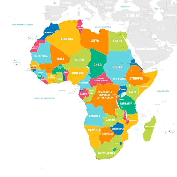
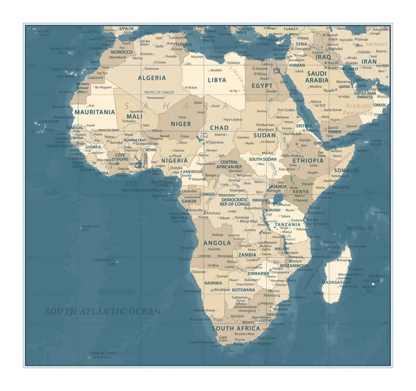
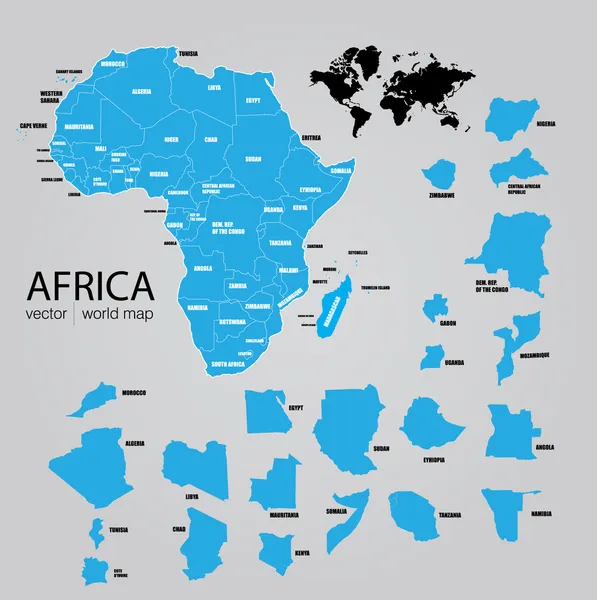
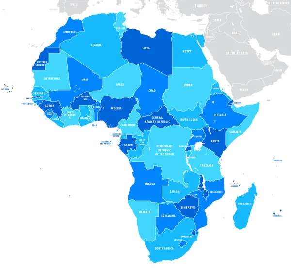
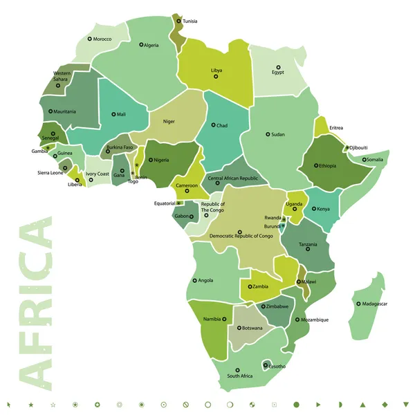
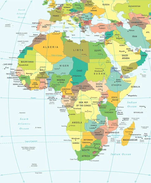
Vector Map Of Africa Continent With Countries, Capitals, Main Cities And Seas And Islands Names In Strong Brilliant Colors.

Vector, 3.84MB, 6000 × 5999 eps
stock vector Simple flat map of Africa continent with national borders and country name labels on blue background. Vector illustration

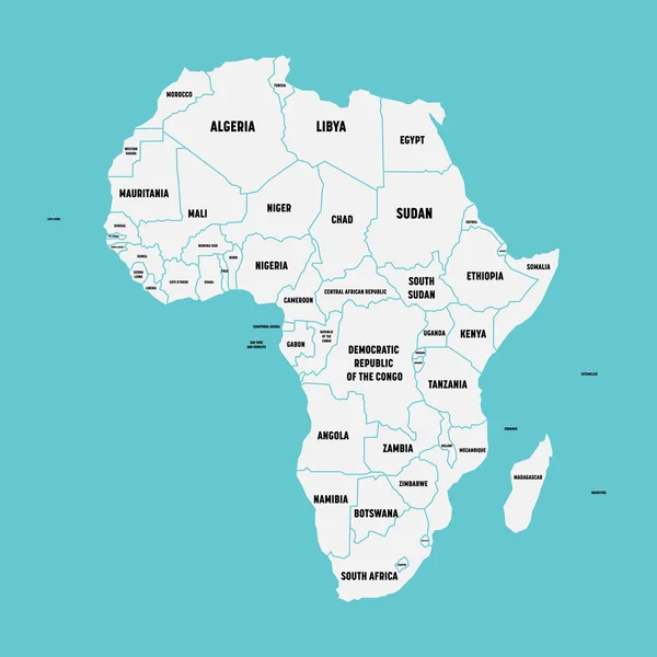
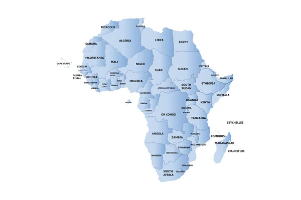
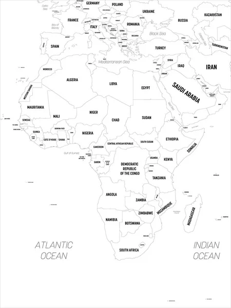
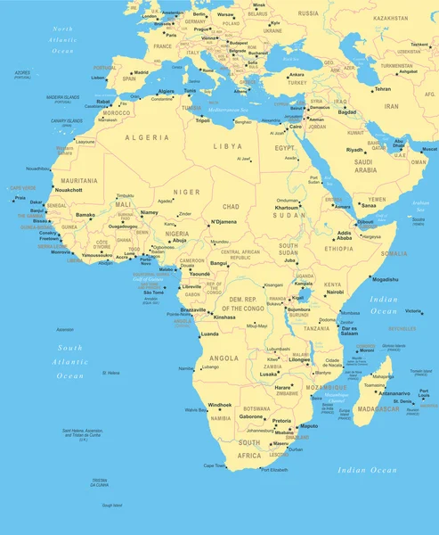
Simple Flat Map Of Africa Continent With National Borders And Country Name Labels On Blue Background. Vector Illustration

Vector, 0.62MB, 6000 × 6000 eps
stock vector watercolor map of Africa

Watercolor Map Of Africa

Vector, 12.59MB, 4167 × 5832 eps
stock vector Map of Africa.

Map Of Africa.

Vector, 3.78MB, 2775 × 2915 eps
stock image Africa map background

Africa Map Background

Image, 4.22MB, 4973 × 4852 jpg
stock vector Africa - map - illustration.

Africa - Map - Illustration.

Vector, 4.66MB, 5400 × 6561 eps
stock vector Map of Democratic Republic of the Congo

Map Of Democratic Republic Of The Congo

Vector, 0.76MB, 6250 × 5000 eps
stock vector Vector detailed map of Africa with borders and country names.

Vector Detailed Map Of Africa With Borders And Country Names.

Vector, 2.07MB, 5000 × 5000 eps
stock vector Africa

Africa

Vector, 0.39MB, 2520 × 2520 eps
stock vector Vector maps set.  High detailed 46 maps of African countries wit

Vector Maps Set. High Detailed 46 Maps Of African Countries Wit

Vector, 12.15MB, 6000 × 3600 eps
stock vector Africa map. High detailed political map of african continent with country, capital, ocean and sea names labeling

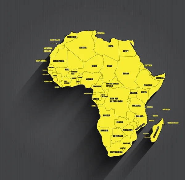
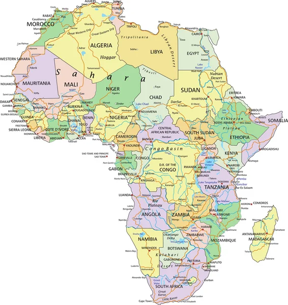
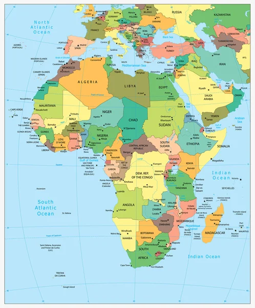
Africa Map. High Detailed Political Map Of African Continent With Country, Capital, Ocean And Sea Names Labeling

Vector, 4.09MB, 4500 × 6000 eps
stock vector Democratic republic Congo infographics, statistical data, sights

Democratic Republic Congo Infographics, Statistical Data, Sights

Vector, 1.03MB, 5000 × 5000 eps
stock vector Highly detailed political map of Africa

Highly Detailed Political Map Of Africa

Vector, 10.61MB, 6808 × 8192 eps
stock vector Africa - map - illustration.

Africa - Map - Illustration.

Vector, 7.52MB, 5400 × 6564 eps
stock image Detailed Earth. South Africa

Detailed Earth. South Africa

Image, 7.34MB, 5000 × 5000 jpg
stock vector Africa - map - illustration.

Africa - Map - Illustration.

Vector, 7.82MB, 5400 × 6567 eps
stock vector Map of Africa

Map Of Africa

Vector, 1.33MB, 4889 × 4900 eps
stock image Detailed Earth. South Africa on a moonlit night

Detailed Earth. South Africa On A Moonlit Night

Image, 7.92MB, 5000 × 5000 jpg
Page 1 >> Next