photo free
Home Images Vectors Videos

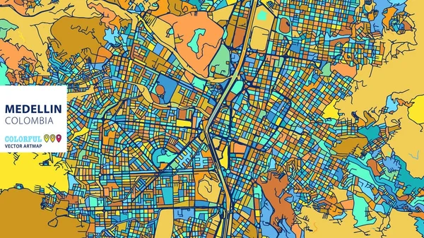
Stock image Medellin Map

stock vector Medellin,��Colombia, Colorful Vector Artmap

Medellin,��Colombia, Colorful Vector Artmap

Vector, 2.3MB, 8000 × 4500 eps
stock vector Administrative and political map of the Colombian Metropolitan Area of the Aburra Valley

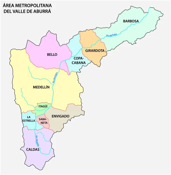
Administrative And Political Map Of The Colombian Metropolitan Area Of The Aburra Valley

Vector, 0MB, 3991 × 4000 zip
stock vector Administrative and political map of the Colombian city of Medellin

Administrative And Political Map Of The Colombian City Of Medellin

Vector, 0.69MB, 3100 × 3794 eps
stock vector Colombia - map and flag - Detailed Vector Illustration

Colombia - Map And Flag - Detailed Vector Illustration

Vector, 2.87MB, 5500 × 6437 eps
stock vector Colombia - infographic map and flag - Detailed Vector Illustration

Colombia - Infographic Map And Flag - Detailed Vector Illustration

Vector, 6.47MB, 5500 × 7963 eps
stock vector Map of Medellin in Colombia in grayscale. Contains layered vector with roads water, parks, etc.

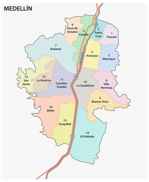
Map Of Medellin In Colombia In Grayscale. Contains Layered Vector With Roads Water, Parks, Etc.

Vector, 39.93MB, 2400 × 2400 eps
stock vector Blank map Colombia. High quality map Colombia with provinces  and municipalities on transparent background for your web site design, logo, app, UI.  EPS10.

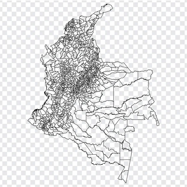
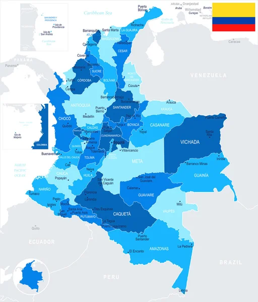
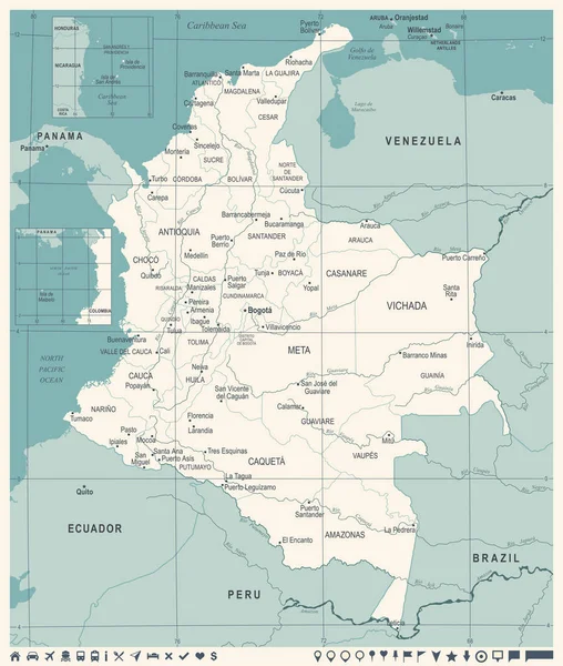
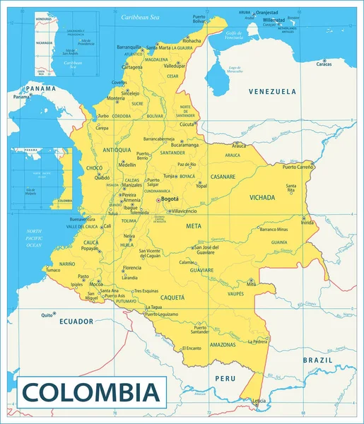
Blank Map Colombia. High Quality Map Colombia With Provinces And Municipalities On Transparent Background For Your Web Site Design, Logo, App, UI. EPS10.

Vector, 7.27MB, 5000 × 5000 eps
stock vector Blank map Colombia. High quality map Colombia with provinces on transparent background for your web site design, logo, app, UI. Stock vector. Vector illustration EPS10.

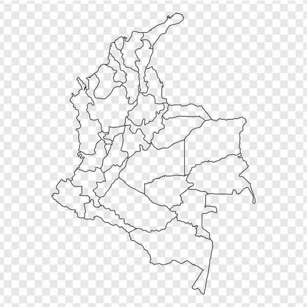
Blank Map Colombia. High Quality Map Colombia With Provinces On Transparent Background For Your Web Site Design, Logo, App, UI. Stock Vector. Vector Illustration EPS10.

Vector, 3.29MB, 5000 × 5000 eps
stock vector Colombia higt detailed map with subdivisions. Administrative map of Colombia with districts and cities name, colored by states and administrative districts. Vector illustration.

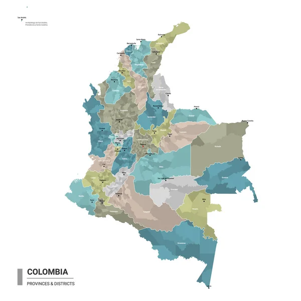
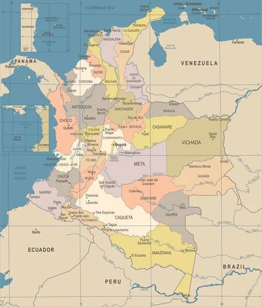
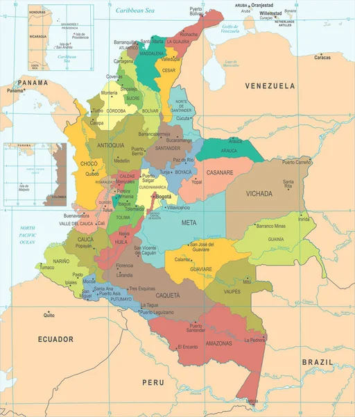
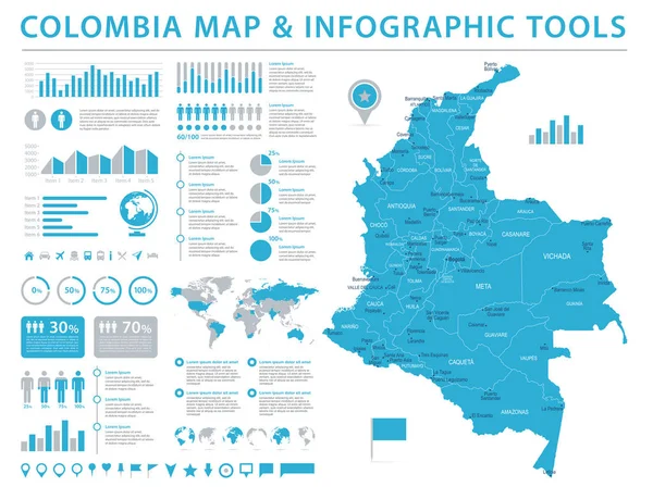
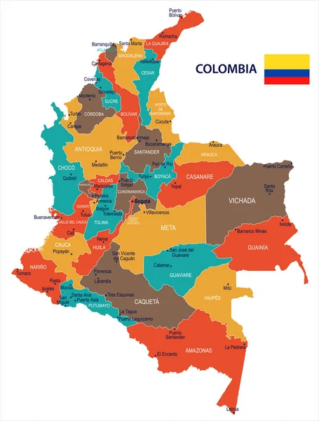
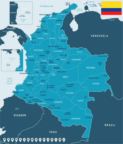
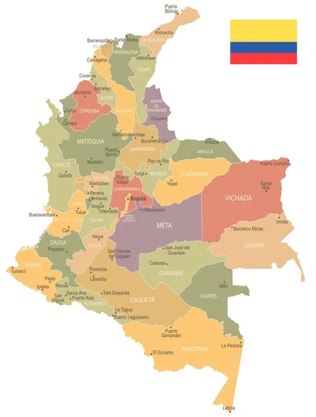
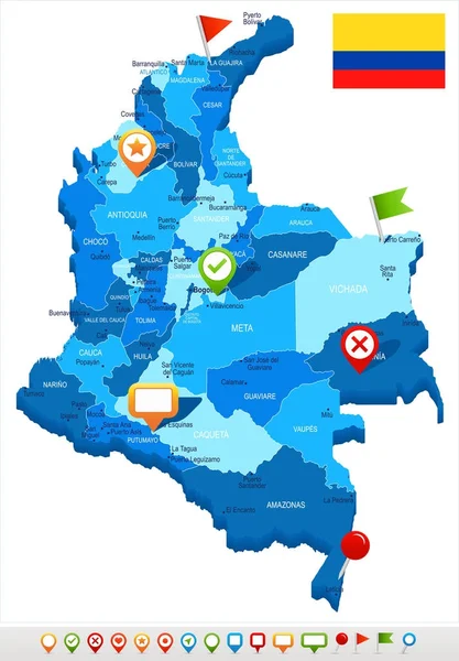
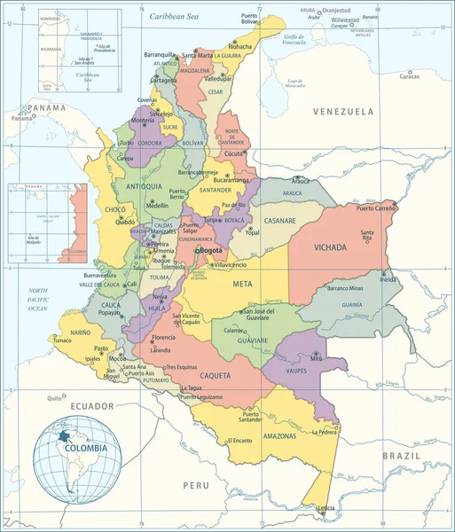
Colombia Higt Detailed Map With Subdivisions. Administrative Map Of Colombia With Districts And Cities Name, Colored By States And Administrative Districts. Vector Illustration.

Vector, 4.76MB, 4000 × 4000 eps
stock vector Colombia Map - Vintage Detailed Vector Illustration

Colombia Map - Vintage Detailed Vector Illustration

Vector, 3.85MB, 5500 × 6495 eps
stock vector Colombia Map - Vintage Detailed Vector Illustration

Colombia Map - Vintage Detailed Vector Illustration

Vector, 4.08MB, 5500 × 6436 eps
stock vector Colombia Map - Detailed Vector Illustration

Colombia Map - Detailed Vector Illustration

Vector, 4.24MB, 5500 × 6438 eps
stock vector Verctor Map of cities and roads in Colombia.

Verctor Map Of Cities And Roads In Colombia.

Vector, 5.9MB, 7087 × 7087 eps
stock vector Colombia Political Map

Colombia Political Map

Vector, 3.96MB, 6000 × 7301 eps
stock vector Colombia - infographic map and flag - Detailed Vector Illustration

Colombia - Infographic Map And Flag - Detailed Vector Illustration

Vector, 6.27MB, 5500 × 7592 eps
stock vector Colombia - infographic map - Detailed Vector Illustration

Colombia - Infographic Map - Detailed Vector Illustration

Vector, 6.51MB, 6978 × 5500 eps
stock vector Colombia Map - Detailed Vector Illustration

Colombia Map - Detailed Vector Illustration

Vector, 4.09MB, 5500 × 6421 eps
stock vector map of the natural regions, Colombia

Map Of The Natural Regions, Colombia

Vector, 0MB, 4864 × 6520 zip
stock vector Colombia - map and flag - Detailed Vector Illustration

Colombia - Map And Flag - Detailed Vector Illustration

Vector, 3.37MB, 5501 × 5500 eps
stock vector Columbia map on a world map with flag and map pointer. Vector illustration

Columbia Map On A World Map With Flag And Map Pointer. Vector Illustration

Vector, 2.44MB, 4167 × 4167 eps
stock vector Map with the main roads and rivers of Colombia

Map With The Main Roads And Rivers Of Colombia

Vector, 1.61MB, 3100 × 4152 eps
stock vector Colombia Map - Info Graphic Vector Illustration

Colombia Map - Info Graphic Vector Illustration

Vector, 12.36MB, 7178 × 5500 eps
stock vector medellin colombia city isometric financial economy condition concept for describe cities growth expand - vector

Medellin Colombia City Isometric Financial Economy Condition Concept For Describe Cities Growth Expand - Vector

Vector, 1.12MB, 6000 × 4000 eps
stock vector Colombia - map and flag Detailed Vector Illustration

Colombia - Map And Flag Detailed Vector Illustration

Vector, 2.94MB, 5500 × 6825 eps
stock vector Colombia - map and flag Detailed Vector Illustration

Colombia - Map And Flag Detailed Vector Illustration

Vector, 1.73MB, 5500 × 7245 eps
stock vector Colombia - map and flag - Detailed Vector Illustration

Colombia - Map And Flag - Detailed Vector Illustration

Vector, 2.71MB, 5500 × 6437 eps
stock vector Colombia - vintage map and flag - Detailed Vector Illustration

Colombia - Vintage Map And Flag - Detailed Vector Illustration

Vector, 1.7MB, 5500 × 7245 eps
stock vector Colombia - map and flag - Detailed Vector Illustration

Colombia - Map And Flag - Detailed Vector Illustration

Vector, 4MB, 5500 × 7898 eps
stock vector Colombia - vintage map and flag - Detailed Vector Illustration

Colombia - Vintage Map And Flag - Detailed Vector Illustration

Vector, 2.7MB, 5500 × 6394 eps
stock vector Medellin silhouette skyline. Colombia - Medellin vector city, colombian linear architecture, buildings. Medellin line travel illustration, landmarks. Colombia flat icon, colombian outline design

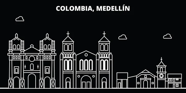
Medellin Silhouette Skyline. Colombia - Medellin Vector City, Colombian Linear Architecture, Buildings. Medellin Line Travel Illustration, Landmarks. Colombia Flat Icon, Colombian Outline Design

Vector, 2.57MB, 6000 × 3000 eps
stock vector Flag Colombia from brush strokes and Blank map Colombia. High quality map of Colombia   and flag on transparent background. Stock vector. Vector illustration EPS10.

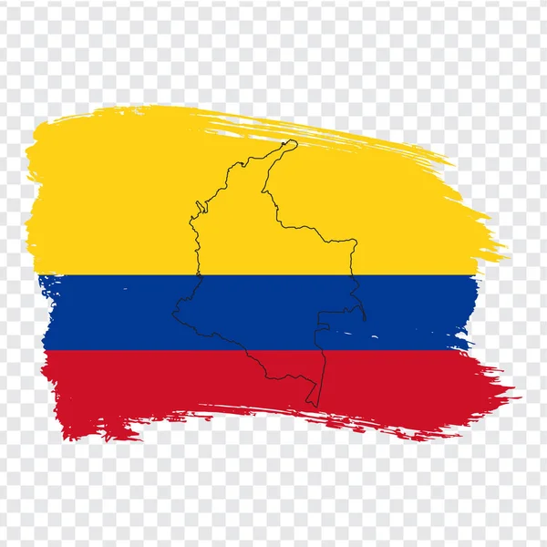
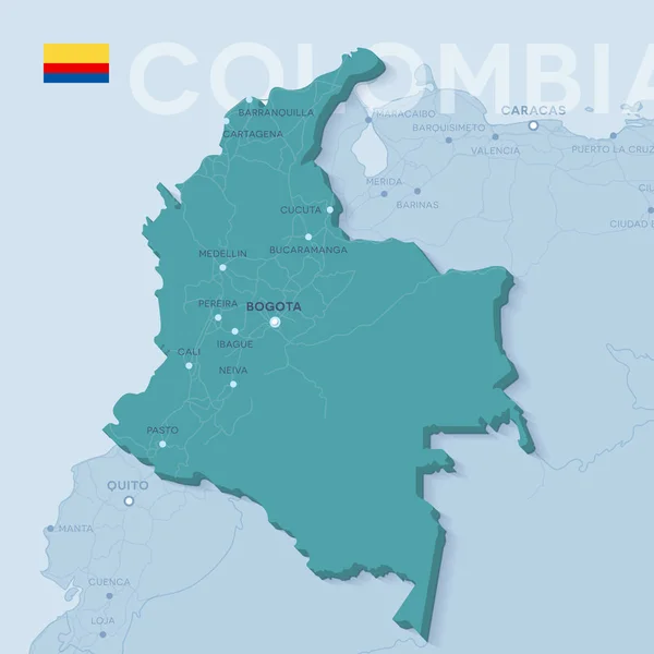
Flag Colombia From Brush Strokes And Blank Map Colombia. High Quality Map Of Colombia And Flag On Transparent Background. Stock Vector. Vector Illustration EPS10.

Vector, 3.5MB, 5000 × 5000 eps
stock image Aerial photo of comuna in Medellin, Colombia, Comuna 13. High quality photo

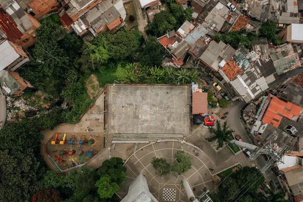
Aerial Photo Of Comuna In Medellin, Colombia, Comuna 13. High Quality Photo

Image, 9.35MB, 5464 × 3640 jpg
stock image Colombia travel concept. Columbian map with suitcases and signpo

Colombia Travel Concept. Columbian Map With Suitcases And Signpo

Image, 2.48MB, 6000 × 4000 jpg
stock vector Colombia - map and flag - Detailed Vector Illustration

Colombia - Map And Flag - Detailed Vector Illustration

Vector, 1.88MB, 5500 × 7051 eps
stock vector Map of Colombia - Highly Detailed Vector illustration

Map Of Colombia - Highly Detailed Vector Illustration

Vector, 7.34MB, 5563 × 6498 eps
stock vector Map of Medellin in Colombia in blue. Contains layered vector with roads water, parks, etc.

Map Of Medellin In Colombia In Blue. Contains Layered Vector With Roads Water, Parks, Etc.

Vector, 39.2MB, 2400 × 2400 eps
stock vector Costa Rica and Panama, political map, with the Isthmus of Panama and the Darien Gap. Narrow strip of land and region between the Caribbean Sea and the Pacific Ocean, linking North and South America.

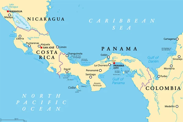
Costa Rica And Panama, Political Map, With The Isthmus Of Panama And The Darien Gap. Narrow Strip Of Land And Region Between The Caribbean Sea And The Pacific Ocean, Linking North And South America.

Vector, 4.22MB, 9000 × 5999 eps
stock vector Road map of Medellin in Colombia. Contains layered vector with roads water, parks, etc.

Road Map Of Medellin In Colombia. Contains Layered Vector With Roads Water, Parks, Etc.

Vector, 37.84MB, 2400 × 2400 eps
stock vector Darien Gap, political map. Geographical region in the Isthmus of Panama, connecting North and South America with Central America. The gap is in the Pan-American Highway of which a part were not built.

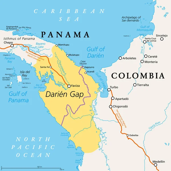
Darien Gap, Political Map. Geographical Region In The Isthmus Of Panama, Connecting North And South America With Central America. The Gap Is In The Pan-American Highway Of Which A Part Were Not Built.

Vector, 3.19MB, 6000 × 6000 eps
stock vector Colombia car license plate patern, letters, numbers and symbols, vector illustration, south america

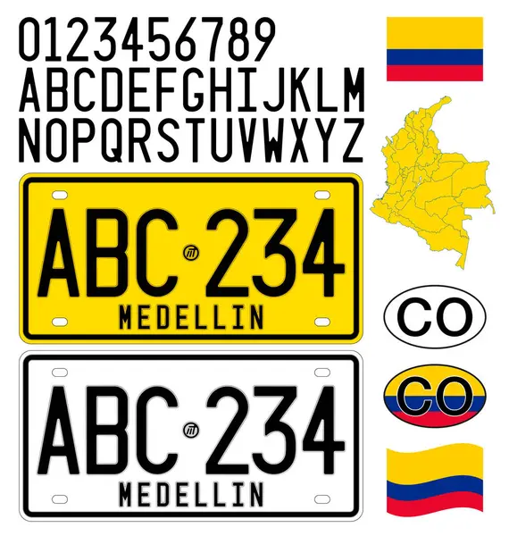
Colombia Car License Plate Patern, Letters, Numbers And Symbols, Vector Illustration, South America

Vector, 2.8MB, 7782 × 8192 ai
stock vector Costa Rica and Panama, gray political map, with the Isthmus of Panama and the Darien Gap. Narrow strip of land and region between the Caribbean Sea and Pacific Ocean, linking North and South America.

Costa Rica And Panama, Gray Political Map, With The Isthmus Of Panama And The Darien Gap. Narrow Strip Of Land And Region Between The Caribbean Sea And Pacific Ocean, Linking North And South America.

Vector, 2.74MB, 9000 × 5999 eps
stock vector Map of Colombia - Highly Detailed Vector illustration

Map Of Colombia - Highly Detailed Vector Illustration

Vector, 8.61MB, 5702 × 6637 eps
stock image Antioquia, department of Colombia. Colored elevation map with lakes and rivers

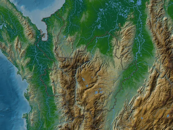
Antioquia, Department Of Colombia. Colored Elevation Map With Lakes And Rivers

Image, 10.05MB, 3840 × 2880 jpg
Page 1 >> Next