
Stock image Miller Cylindrical Projection

World Map In The Miller Cylindrical Projection Centered On 90 West Longitude. Bilevel Topographic Map - Raw Composite Of Raster With Graticule. 3D Illustration
Image, 3.31MB, 4000 × 2000 jpg

World Map In The Miller Cylindrical Projection Centered On 11 East Longitude. Mean Annual Temperature Map - Raw Composite Of Raster With Graticule. 3D Illustration
Image, 3.05MB, 4000 × 2000 jpg
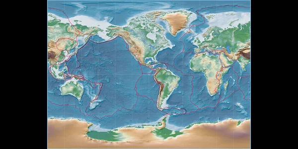
World Map In The Miller Cylindrical Projection Centered On 90 West Longitude. Colored Shader, Elevation Map - Composite Of Raster With Graticule And Tectonic Plates Borders. 3D Illustration
Image, 7.56MB, 4000 × 2000 jpg

World Map In The Miller Cylindrical Projection Centered On 11 East Longitude. Bilevel Topographic Map - Composite Of Raster With Graticule And Tectonic Plates Borders. 3D Illustration
Image, 3.38MB, 4000 × 2000 jpg

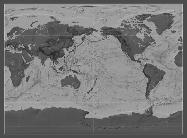
World Map In The Miller Cylindrical Projection Centered On 90 East Longitude. Main Physiographic Landscape Features - Composite Of Raster With Graticule And Tectonic Plates Borders. 3D Illustration
Image, 7.71MB, 4000 × 2000 jpg
Bilevel Map Of The World In The Miller Cylindrical Projection Centered On The Meridian 180 Longitude
Image, 6.09MB, 3877 × 2880 jpg
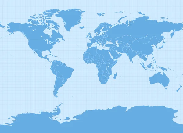
World Map In Miller Cylindrical Projection (EPSG:54003). Detailed Vector Earth Map With Countries Borders And 5-degree Grid.
Vector, 14.54MB, 13751 × 10001 eps
Page 1 >> Next