
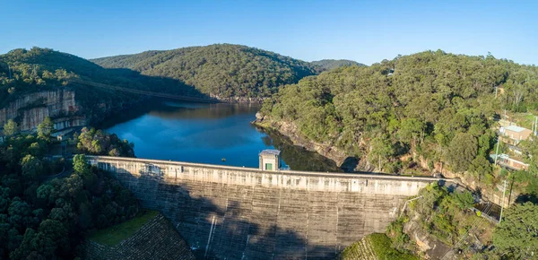
Stock image Nepean
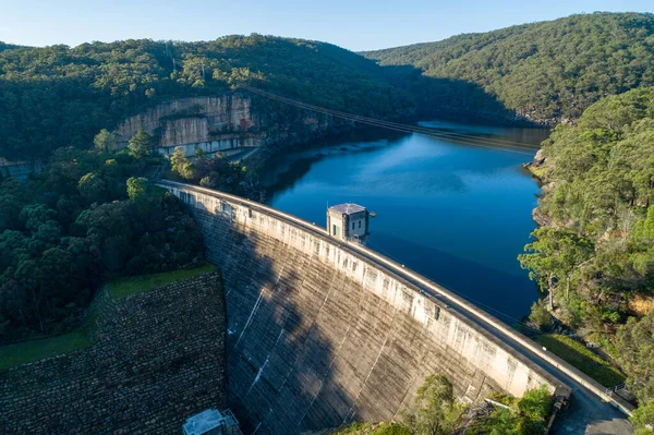
Aerial View Of Nepean Dam Wall At Sunrise. Bargo, New South Wales, Australia
Image, 3.74MB, 4918 × 3276 jpg
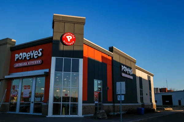
Ottawa, Ontario, Canada - November 18, 2020: A Popeyes Louisiana Kitchen Restaurant In The College Square Shopping Center.
Image, 6.53MB, 4734 × 3156 jpg


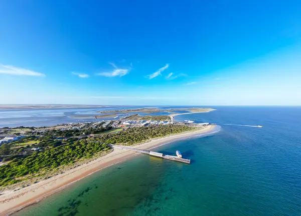
Aerial Panoramic View Of Sorrento Long Pier, Moored Passenger Ferry And Point Nepean Road At Dawn. Mornington Peninsula, Melbourne, Australia
Image, 2.78MB, 5863 × 2346 jpg

Penrith, NSW, Australia - 9 May 2021. Aerial View Of The Nepean Belle Paddlewheeler On The Nepean River At Penrith. The 'Belle' Has Been Cruising These Waters Since 1982 And Was Inspired By Mississippi Sternwheelers.
Image, 12.9MB, 5464 × 3640 jpg

Ottawa, Canada - May 22, 2022: Power Lines And Traffic Lights Down On Merivale Road, A Busy Street In The West End Of Ottawa After A Severe Storm Known As A Derecho Passed Through The Area Causing A Lot Of Damage And Power Outages The Day Before.
Image, 6.72MB, 4748 × 3170 jpg
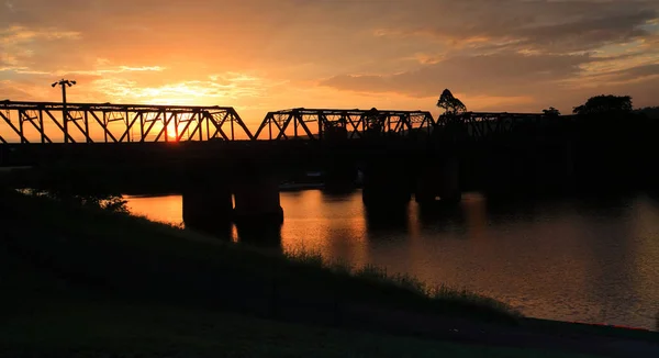
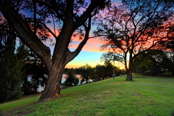
Sunset And Silhouettes At Nepean River Penrith With Views To The Historic Wrought Iron Box Plate Girder Victoria Bridge
Image, 0MB, 4800 × 2617 jpg
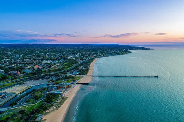
Aerial Views Of Queenscliff Pier And Sorrento Ferry Area At Dusk On A Summers Day On The Bellarine Peninsula, Victoria, Australia
Image, 6.82MB, 5892 × 4242 jpg
Aerial Panorama Of Nepean Dam Wall And Lake Nepean At Sunrise. Bargo, New South Wales, Australia
Image, 4.37MB, 6198 × 2998 jpg
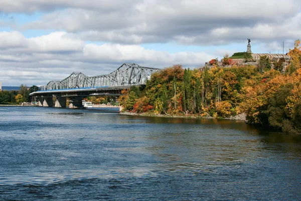

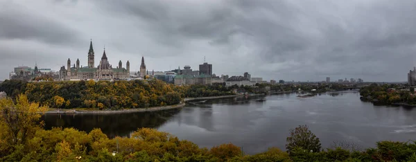
Panoramic View Of Downtown Ottawa And The Parliament Of Canada. Taken From Nepean Point, Ontario, Canada.
Image, 10.99MB, 7934 × 3595 jpg


Ottawa, Ontario, Canada - September 30, 2018: Panoramic View Of Downtown Ottawa And The Parliament Of Canada.
Image, 11.49MB, 8732 × 3578 jpg


Beach Huts On Ranelagh Beach At Mount Eliza, Victoria, Australia - Aerial View
Image, 4.44MB, 4899 × 3264 jpg
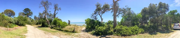
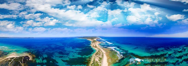
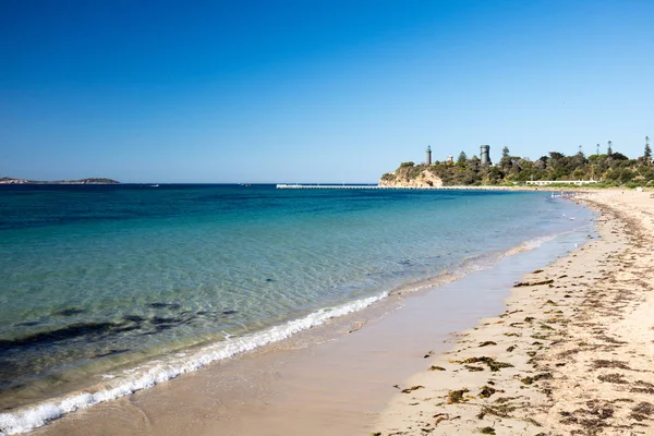
Aerial View Of Point Nepean National Park Coastline On Bright Sunny Day. Mornington, Victoria, Australia
Image, 1.61MB, 3593 × 2693 jpg

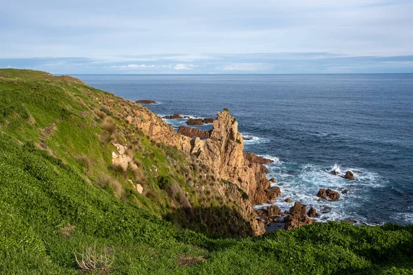
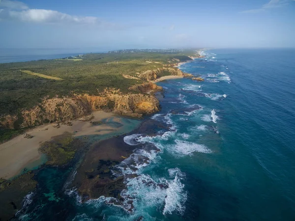
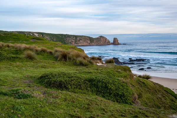
Rocky Outcrops On Rugged Coastline Of Mornington Peninsula In Melbourne, Australia
Image, 5.75MB, 5918 × 3945 jpg
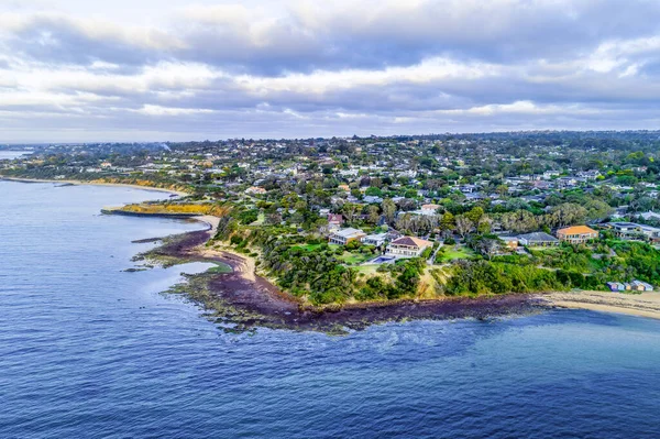
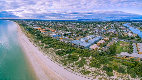
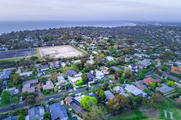
Oliver's Hill - Luxury Residential Area On Mornington Peninsula Coastline
Image, 2.96MB, 4918 × 3276 jpg
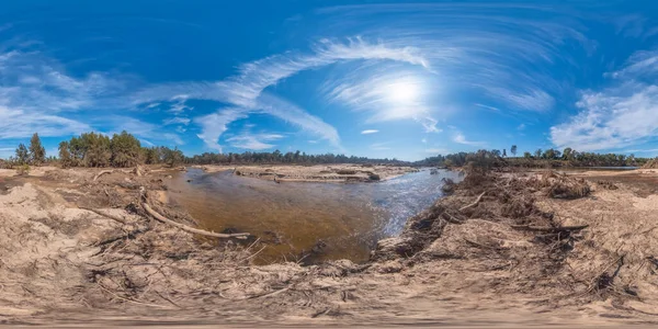
Spherical Panoramic Photograph Of A Large Livestock Centre In Regional New South Wales In Australia
Image, 9.9MB, 7296 × 3648 jpg

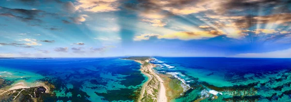
Aerial View Of The Tip Of Mornington Peninsula On A Bright Sunny Day. Melbourne, Victoria, Australia
Image, 1.54MB, 3593 × 2693 jpg
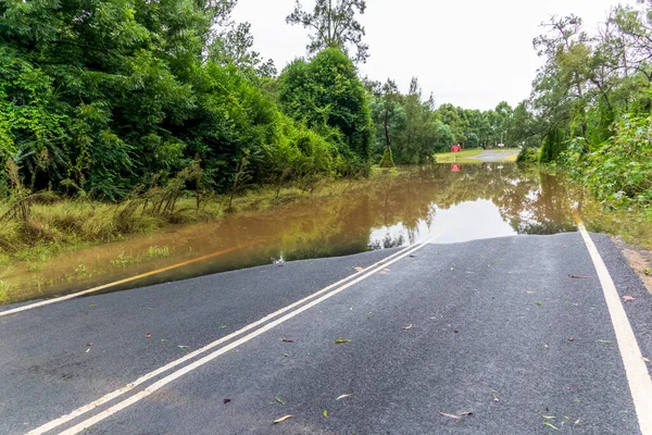
Photograph Of Water Across A Road Due To Severe Flooding In The Hawkesbury Nepean River System In The Hawkesbury Region Of New South Wales In Australia.
Image, 17.62MB, 5884 × 3923 jpg

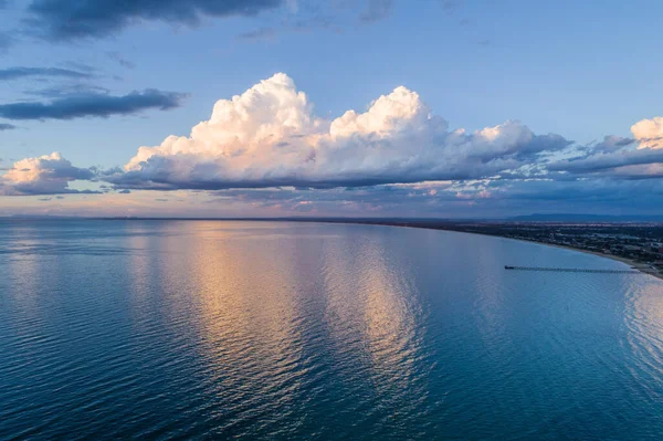
Aerial View Of Frankston Waterfront And Mornington Peninsula Coastline At Dusk In Melbourne, Australia
Image, 4.52MB, 5172 × 3446 jpg
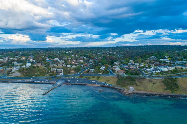
Aerial View Of Mount Eliza Coastline At Dusk. Mornington Peninsula, Melbourne, Australia
Image, 4.87MB, 4899 × 3264 jpg

Beautiful Sunset At Emu Plains By The Nepean River, Penrith Bracketed Exposure With Nd Filter
Image, 0MB, 5616 × 3744 jpg

Sackville, NSW, Australia - 9 March 2022. Aerial View Of The Hawkesbury River In Flood Over Roads And Farmland In Outer Rural Sydney.
Image, 10.59MB, 5464 × 3640 jpg


Panoramic View Of Downtown Ottawa And The Parliament Of Canada. Taken From Nepean Point, Ontario, Canada.
Image, 12.04MB, 9177 × 3593 jpg


Page 1 >> Next