
Stock image Norte De Chile

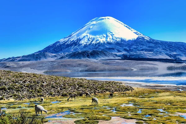
Alpaca's (Vicugna Pacos) Grazing On The Shore Of Lake Chungara At The Base Of Parinacota Volcano, In The Northern Chile.
Image, 9.28MB, 3900 × 2613 jpg

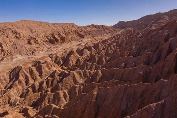
San Pedro De Atacama, Antofagasta - Chile. Desert. Andes Range & Route 23 - Miscanti Lagoon & Red Rock
Image, 11.13MB, 5464 × 3640 jpg


Aerial Road Of Andes Range And Route 23 - Miscanti Lagoon And Red Rock
Image, 18.86MB, 5464 × 3640 jpg

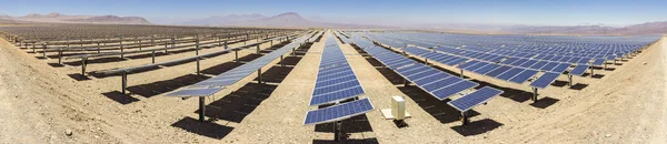
Solar Energy, Clean Technology To Reduce CO2 Emissions. The Best Place For Solar Energy Is Atacama Desert At North Chile. Generating Clean Energy With Renewable Resources Like The Sun For Solar Energy
Image, 6.99MB, 7038 × 1780 jpg

Aerial Road Of Andes Range And Route 23 - Miscanti Lagoon And Red Rock
Image, 18.89MB, 5464 × 3640 jpg


Aerial Road Of Andes Range And Route 23 - Miscanti Lagoon And Red Rock
Image, 15.84MB, 5464 × 3640 jpg

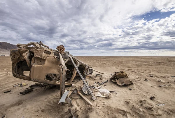
Still Visible The Effects Of The 2015 Flooding In North Chile At Chaaral Beach. A Car Remains Abandoned Above The Ground, Rusty By The Aggressive Environment In The Outdoors At Atacama Desert, Chile
Image, 7.83MB, 6267 × 4217 jpg

Solar Energy, Clean Technology To Reduce CO2 Emissions. The Best Place For Solar Energy Is Atacama Desert At North Chile. Generating Clean Energy With Renewable Resources Like The Sun For Solar Energy
Image, 28.62MB, 11488 × 4228 jpg

Aerial Road Of Andes Range And Route 23 - Miscanti Lagoon And Red Rock
Image, 18.81MB, 5464 × 3640 jpg

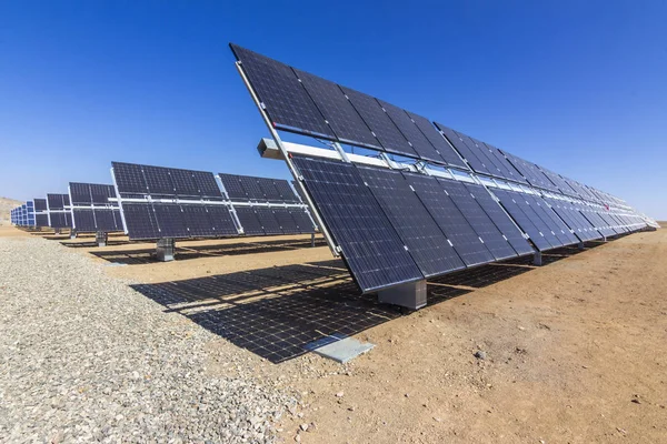
Solar Energy, Clean Technology To Reduce CO2 Emissions. The Best Place For Solar Energy Is Atacama Desert At North Chile. Generating Clean Energy With Renewable Resources Like The Sun For Solar Energy
Image, 5.62MB, 5184 × 3456 jpg
Solar Energy, Clean Technology To Reduce CO2 Emissions. The Best Place For Solar Energy Is Atacama Desert At North Chile. Generating Clean Energy With Renewable Resources Like The Sun For Solar Energy
Image, 13.2MB, 13613 × 2954 jpg

Solar Energy, Clean Technology To Reduce CO2 Emissions. The Best Place For Solar Energy Is Atacama Desert At North Chile. Generating Clean Energy With Renewable Resources Like The Sun For Solar Energy
Image, 5.32MB, 5184 × 3456 jpg
Solar Energy, Clean Technology To Reduce CO2 Emissions. The Best Place For Solar Energy Is Atacama Desert At North Chile. Generating Clean Energy With Renewable Resources Like The Sun For Solar Energy
Image, 7.18MB, 5184 × 3456 jpg


Alpaca's (Vicugna Pacos) Grazing On The Shore Of Lake Chungara At The Base Of Parinacota Volcano, In The Northern Chile.
Image, 9.14MB, 2613 × 3900 jpg


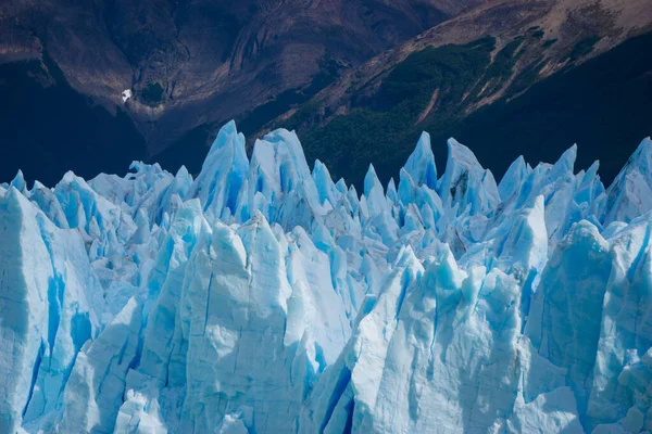
Glacier Perito Moreno, National Park Los Glasyares, Patagonia, Argentina
Image, 15.86MB, 6000 × 4000 jpg

Organization Of American States, Oas, Flag Isolated On The White Background
Vector, 2.71MB, 5000 × 3533 ai
Page 1 >> Next