photo free
Home Images Vectors Videos

Stock image Pulaski County

stock image Hawkinsville, Georgia, USA - April 19, 2022: Plaque tells the history of the Pulaski County

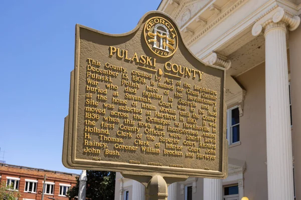
Hawkinsville, Georgia, USA - April 19, 2022: Plaque Tells The History Of The Pulaski County

Image, 26MB, 8192 × 5464 jpg
stock image Pinnacle Mountain in Arkansas

Pinnacle Mountain In Arkansas

Image, 10.98MB, 3264 × 4928 jpg
stock vector Vector illustration of the Welcome to Little Rock Arkansas Capital City road sign

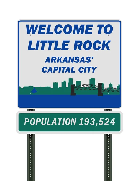
Vector Illustration Of The Welcome To Little Rock Arkansas Capital City Road Sign

Vector, 0.74MB, 6507 × 8500 ai
stock image A scenic shot of Pinnacle Mountain in Pulaski County, Arkansas at pinky sunset

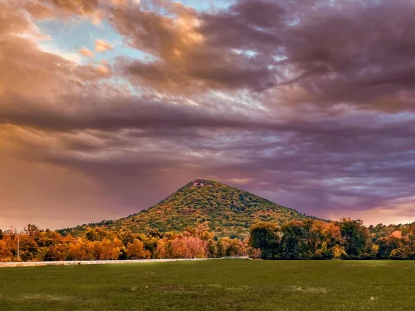
A Scenic Shot Of Pinnacle Mountain In Pulaski County, Arkansas At Pinky Sunset

Image, 3.2MB, 8000 × 6000 jpg
stock image Little Rock, Arkansas, USA skyline on the Arkansas River at dusk.

Little Rock, Arkansas, USA Skyline On The Arkansas River At Dusk.

Image, 15.58MB, 6600 × 4405 jpg
stock image Little Rock, Arkansas, USA skyline on the Arkansas River at dusk.

Little Rock, Arkansas, USA Skyline On The Arkansas River At Dusk.

Image, 22.11MB, 6600 × 4405 jpg
stock image Little Rock, Arkansas, USA skyline on the Arkansas River at dusk.

Little Rock, Arkansas, USA Skyline On The Arkansas River At Dusk.

Image, 26.42MB, 7360 × 4912 jpg
stock image Map of Pulaski County in Illinois state on white background. single County map highlighted by black colour on Illinois map. UNITED STATES, US

Map Of Pulaski County In Illinois State On White Background. Single County Map Highlighted By Black Colour On Illinois Map. UNITED STATES, US

Image, 5.19MB, 8000 × 8000 jpg
stock vector Arkansas, U.S. state, political map with borders and county names. State in the West South Central region of the Southern United States, subdivided into 75 counties, nicknamed The Natural State.

Arkansas, U.S. State, Political Map With Borders And County Names. State In The West South Central Region Of The Southern United States, Subdivided Into 75 Counties, Nicknamed The Natural State.

Vector, 3.42MB, 6000 × 6000 eps
stock image Map of Pulaski County in Virginia state on white background. single County map highlighted by black colour on Virginia map. UNITED STATES, US

Map Of Pulaski County In Virginia State On White Background. Single County Map Highlighted By Black Colour On Virginia Map. UNITED STATES, US

Image, 4.45MB, 8000 × 5334 jpg
stock image Map of Pulaski County in Georgia state on white background. single County map highlighted by black colour on Georgia map. UNITED STATES, US

Map Of Pulaski County In Georgia State On White Background. Single County Map Highlighted By Black Colour On Georgia Map. UNITED STATES, US

Image, 6.56MB, 8000 × 8000 jpg
stock vector Arkansas, U.S. state, gray political map with borders and county names. State in the West South Central region of the Southern United States, subdivided into 75 counties. Nicknamed The Natural State.

Arkansas, U.S. State, Gray Political Map With Borders And County Names. State In The West South Central Region Of The Southern United States, Subdivided Into 75 Counties. Nicknamed The Natural State.

Vector, 3.14MB, 6623 × 6000 eps
stock vector Arkansas, U.S. state, subdivided into 75 counties, multi colored political map with capital Little Rock, borders and county names. State in the West South Central region of the Southern United States.

Arkansas, U.S. State, Subdivided Into 75 Counties, Multi Colored Political Map With Capital Little Rock, Borders And County Names. State In The West South Central Region Of The Southern United States.

Vector, 3.16MB, 6623 × 6000 eps
stock image Little Rock, Arkansas, USA skyline on the Arkansas River at dusk.

Little Rock, Arkansas, USA Skyline On The Arkansas River At Dusk.

Image, 28.78MB, 7360 × 4912 jpg
Page 1 >> Next