photo free
Home Images Vectors Videos

Stock image Rankin Silhouette Map

stock vector The Mississippi State County Map with labels

The Mississippi State County Map With Labels

Vector, 9.48MB, 3504 × 5004 eps
stock vector Mississippi, U.S. state, gray political map with borders and county names. State in the Southeastern region of United States, subdivided into 82 counties. Nicknamed The Magnolia and Hospitality State.

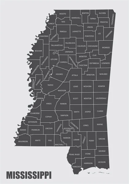
Mississippi, U.S. State, Gray Political Map With Borders And County Names. State In The Southeastern Region Of United States, Subdivided Into 82 Counties. Nicknamed The Magnolia And Hospitality State.

Vector, 2.09MB, 5952 × 9000 eps
stock vector Mississippi, U.S. state, subdivided into 82 counties, multi colored political map with capital Jackson, borders and county names. State in the Southeastern region of USA, nicknamed The Magnolia State.

Mississippi, U.S. State, Subdivided Into 82 Counties, Multi Colored Political Map With Capital Jackson, Borders And County Names. State In The Southeastern Region Of USA, Nicknamed The Magnolia State.

Vector, 2.11MB, 5952 × 9000 eps
Page 1 >> Next