
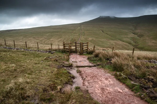
Stock image Summit Boundary


Toronto, Ontario, Canada - 06/25/2010 : Police Used Bicycles To Control Thousands Of Activists Marching Along University Avenue In A Protest Ahead Of The G20 Summit
Image, 13.77MB, 4288 × 2848 jpg

Toronto, Ontario, Canada - 06/25/2010 : Police Used Bicycles To Control Thousands Of Activists Marching Along University Avenue In A Protest Ahead Of The G20 Summit
Image, 11.98MB, 4288 × 2848 jpg
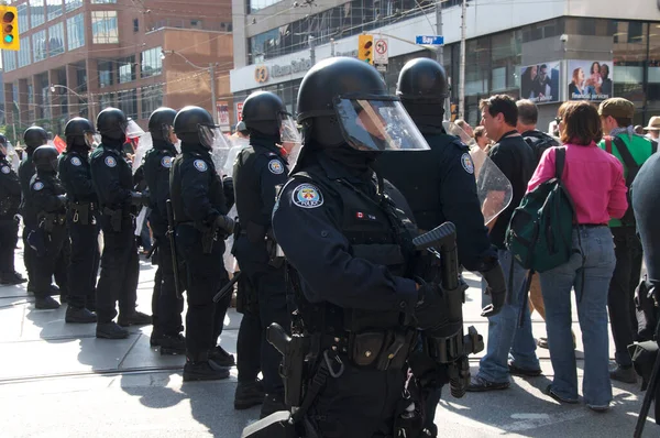
Toronto, Ontario, Canada - 06/25/2010 : Deploy Of Riot Polices Along The College Street Of Downtown Toronto With Participating In A Protest Ahead Of The G20 Summit
Image, 10.47MB, 4288 × 2848 jpg

Toronto, Ontario, Canada - 06/25/2010 : Polices Horses With Visors In Downtown Toronto For The G20 Summit.
Image, 11.23MB, 4288 × 2848 jpg

Toronto, Ontario, Canada - 06/25/2010 : Riot Police In Full Gear At Toronto Police Station (52 Division)
Image, 10.97MB, 4288 × 2848 jpg

Toronto, Ontario, Canada - 06/25/2010 : Police Used Bicycles To Control Thousands Of Activists Marching Along University Avenue In A Protest Ahead Of The G20 Summit
Image, 9.73MB, 3844 × 2563 jpg

Toronto, Ontario, Canada - 06/25/2010 : Deploy Of Riot Polices Along The College Street Of Downtown Toronto With Participating In A Protest Ahead Of The G20 Summit
Image, 10.13MB, 4288 × 2848 jpg

Map Of Summit County In Ohio State On White Background. Single County Map Highlighted By Black Colour On Ohio Map. UNITED STATES, US
Image, 5.59MB, 8000 × 8000 jpg
Ohio Counties, Political Map With Borders And County Names. State In The Midwestern Region Of The United States, Subdivided Into 88 Counties. Nicknamed Buckeye State, And Heart Of It All. Illustration
Vector, 2.9MB, 6000 × 7059 eps

Ohio Counties, Gray Political Map With Borders And County Names. State In The Midwestern Region Of The United States, Subdivided Into 88 Counties. Nicknamed Buckeye State, And Heart Of It All.
Vector, 2.28MB, 6000 × 6525 eps

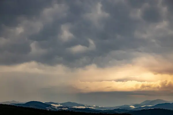
The Most Beautiful Landscape With Peaks In The Background, Sky With Clouds At Sunset.
Image, 12.14MB, 6720 × 4480 jpg
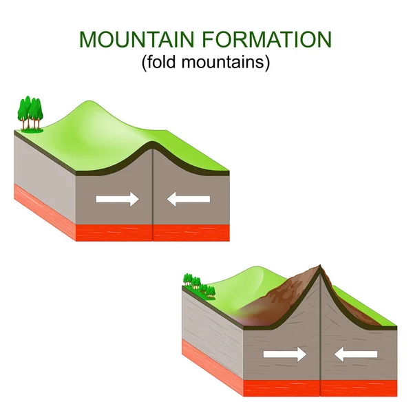
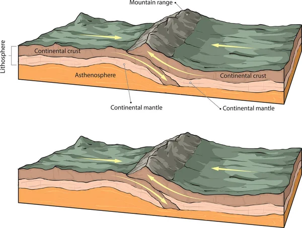
Mountain Formation. Tectonic Plates Collide, Buckle And Fold, Forming Mountains. Vector Illustration
Vector, 5.37MB, 4444 × 4444 eps

The Most Beautiful Landscape With Peaks In The Background, Sky With Clouds At Sunset.
Image, 13.6MB, 6720 × 4480 jpg
The Most Beautiful Landscape With Peaks In The Background, Sky With Clouds At Sunset.
Image, 11.6MB, 6720 × 4480 jpg

The Most Beautiful Landscape With Peaks In The Background, Sky With Clouds At Sunset.
Image, 10.9MB, 6720 × 4480 jpg

Group Of Seven G7, United Kingdom, Germany, Italy, Canada, United States Of America, France And Japan Vector Maps
Vector, 2.44MB, 6000 × 4000 eps

Majestic Landscape Of Giffre Valley Of Mountain Range With Cascade And Foggy In The Evening At Sixt Fer A Cheval, French Alps, France
Image, 29.94MB, 7008 × 4672 jpg

The Most Beautiful Landscape With Peaks In The Background, Sky With Clouds At Sunset.
Image, 10.44MB, 6384 × 4256 jpg

Lees Summit City, Missouri (United States Cities, United States Of America, Us, Usa City) Map Vector Illustration, Scribble Sketch City Of Lee's Summit Map
Vector, 1.42MB, 7087 × 4726 eps


The Most Beautiful Landscape With Peaks In The Background, Sky With Clouds At Sunset.
Image, 10.84MB, 6720 × 4480 jpg
Page 1 >> Next