photo free
Home Images Vectors Videos

Stock image Summit County Map

stock vector Colorado county map

Colorado County Map

Vector, 0.73MB, 5000 × 3692 ai
stock vector Ohio Counties Map

Ohio Counties Map

Vector, 9.69MB, 5000 × 5000 eps
stock vector Ohio Counties Map

Ohio Counties Map

Vector, 8.17MB, 5000 × 5000 eps
stock vector Corsica silhouette map

Corsica Silhouette Map

Vector, 8.15MB, 3000 × 5000 eps
stock vector Colorado County Map

Colorado County Map

Vector, 0.63MB, 5000 × 3692 ai
stock image Female hiker checking her GPS

Female Hiker Checking Her GPS

Image, 17.06MB, 6000 × 4002 jpg
stock image Map of summit County in Ohio state on white background. single County map highlighted by black colour on Ohio map. UNITED STATES, US

Map Of Summit County In Ohio State On White Background. Single County Map Highlighted By Black Colour On Ohio Map. UNITED STATES, US

Image, 5.59MB, 8000 × 8000 jpg
stock vector Ohio counties, political map with borders and county names. State in the Midwestern region of the United States, subdivided into 88 counties. Nicknamed Buckeye State, and Heart Of It All. Illustration

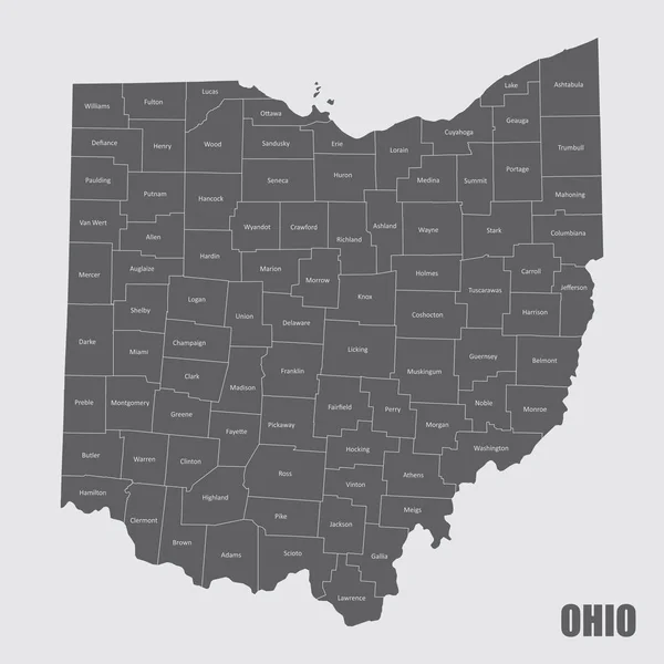
Ohio Counties, Political Map With Borders And County Names. State In The Midwestern Region Of The United States, Subdivided Into 88 Counties. Nicknamed Buckeye State, And Heart Of It All. Illustration

Vector, 2.9MB, 6000 × 7059 eps
stock vector Ohio counties, gray political map with borders and county names. State in the Midwestern region of the United States, subdivided into 88 counties. Nicknamed Buckeye State, and Heart Of It All.

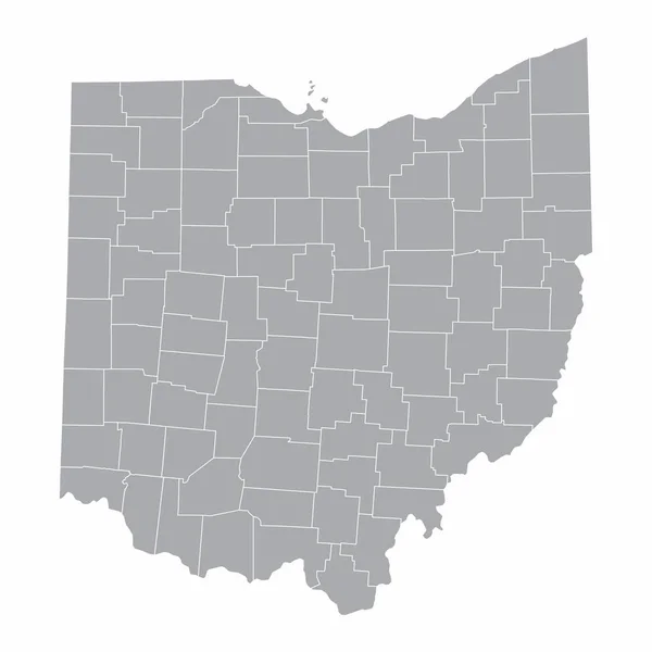
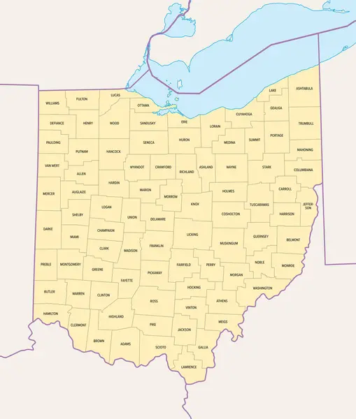
Ohio Counties, Gray Political Map With Borders And County Names. State In The Midwestern Region Of The United States, Subdivided Into 88 Counties. Nicknamed Buckeye State, And Heart Of It All.

Vector, 2.28MB, 6000 × 6525 eps
stock vector Lees Summit City, Missouri (United States cities, United States of America, us, usa city) map vector illustration, scribble sketch City of Lee's Summit map

Lees Summit City, Missouri (United States Cities, United States Of America, Us, Usa City) Map Vector Illustration, Scribble Sketch City Of Lee's Summit Map

Vector, 1.42MB, 7087 × 4726 eps
stock image Map of summit County in Colorado state on white background. single County map highlighted by black colour on Colorado map. UNITED STATES, US

Map Of Summit County In Colorado State On White Background. Single County Map Highlighted By Black Colour On Colorado Map. UNITED STATES, US

Image, 4.34MB, 8000 × 6266 jpg
Page 1 >> Next