
Stock image Wise Boundary Map


Virginia Administrative Map. Counties Map Of Virginia With Color, Blank Map, Empty Map Of Virginia
Image, 2.86MB, 8000 × 4000 jpg

Virginia Administrative Map, Virginia Outline And Counties State Map Set - Illustration Version
Image, 2.95MB, 8000 × 2667 jpg

Virginia Administrative Map. Counties Map Of Virginia With Color, Blank Map, Empty Map Of Virginia
Image, 3.11MB, 8000 × 4000 jpg

Virginia Administrative Map. Counties Map Of Virginia With Color, Blank Map, Empty Map Of Virginia
Image, 3.22MB, 8000 × 4000 jpg

Virginia Administrative Map. Counties Map Of Virginia With Color, Blank Map, Empty Map Of Virginia
Image, 2.55MB, 8000 × 4000 jpg

Virginia Administrative Map. Counties Map Of Virginia With Color, Blank Map, Empty Map Of Virginia
Image, 2.61MB, 8000 × 4000 jpg

Virginia Administrative Map. Counties Map Of Virginia With Color, Blank Map, Empty Map Of Virginia
Image, 2.84MB, 8000 × 4000 jpg

Virginia Administrative Map. Counties Map Of Virginia With Color, Blank Map, Empty Map Of Virginia
Image, 3.3MB, 8000 × 4000 jpg


Michigan Administrative Map. Counties Map Of Michigan, Blank Map, Empty Map Of Michigan
Image, 4.17MB, 8000 × 5334 jpg

Michigan Administrative Map. Counties Map Of Michigan, Blank Map, Empty Map Of Michigan
Image, 3.78MB, 8000 × 5334 jpg

Massachusetts Administrative Map. Counties Map Of Massachusetts, Blank Map, Empty Map Of Massachusetts
Image, 2.59MB, 8000 × 4000 jpg

Massachusetts Administrative Map. Counties Map Of Massachusetts, Blank Map, Empty Map Of Massachusetts
Image, 2.34MB, 8000 × 4000 jpg

Massachusetts Administrative Map. Counties Map Of Massachusetts, Blank Map, Empty Map Of Massachusetts
Image, 2.8MB, 8000 × 4000 jpg

Massachusetts Administrative Map, Massachusetts Outline And Counties State Map Set - Illustration Version
Image, 1.95MB, 8000 × 2667 jpg

Massachusetts Administrative Map, Massachusetts Outline And Counties State Map Set - Illustration Version
Image, 1.75MB, 8000 × 2667 jpg

Massachusetts Administrative Map. Counties Map Of Massachusetts, Blank Map, Empty Map Of Massachusetts
Image, 2.93MB, 8000 × 4000 jpg

Massachusetts Administrative Map. Counties Map Of Massachusetts, Blank Map, Empty Map Of Massachusetts
Image, 2.8MB, 8000 × 4000 jpg

Massachusetts Administrative Map, Massachusetts Outline And Counties State Map Set - Illustration Version
Image, 5.79MB, 8000 × 8000 jpg

Map Of Guernsey County In Ohio State On White Background. Single County Map Highlighted By Black Colour On Ohio Map. UNITED STATES, US
Image, 5.59MB, 8000 × 8000 jpg

Map Of Fairfield County In Ohio State On White Background. Single County Map Highlighted By Black Colour On Ohio Map. UNITED STATES, US
Image, 5.59MB, 8000 × 8000 jpg

Map Of Wyandot County In Ohio State On White Background. Single County Map Highlighted By Black Colour On Ohio Map. UNITED STATES, US
Image, 5.59MB, 8000 × 8000 jpg


Map Of Highland County In Ohio State On White Background. Single County Map Highlighted By Black Colour On Ohio Map. UNITED STATES, US
Image, 5.59MB, 8000 × 8000 jpg

Map Of Tuscarawas County In Ohio State On White Background. Single County Map Highlighted By Black Colour On Ohio Map. UNITED STATES, US
Image, 5.59MB, 8000 × 8000 jpg

Map Of Summit County In Ohio State On White Background. Single County Map Highlighted By Black Colour On Ohio Map. UNITED STATES, US
Image, 5.59MB, 8000 × 8000 jpg

Map Of Geauga County In Ohio State On White Background. Single County Map Highlighted By Black Colour On Ohio Map. UNITED STATES, US
Image, 5.59MB, 8000 × 8000 jpg

Map Of Crawford County In Ohio State On White Background. Single County Map Highlighted By Black Colour On Ohio Map. UNITED STATES, US
Image, 5.59MB, 8000 × 8000 jpg

Map Of Monroe County In Ohio State On White Background. Single County Map Highlighted By Black Colour On Ohio Map. UNITED STATES, US
Image, 5.59MB, 8000 × 8000 jpg

Map Of Peoria County In Illinois State On White Background. Single County Map Highlighted By Black Colour On Illinois Map. UNITED STATES, US
Image, 5.19MB, 8000 × 8000 jpg

Map Of Johnson County In Illinois State On White Background. Single County Map Highlighted By Black Colour On Illinois Map. UNITED STATES, US
Image, 5.2MB, 8000 × 8000 jpg

Map Of Crawford County In Illinois State On White Background. Single County Map Highlighted By Black Colour On Illinois Map. UNITED STATES, US
Image, 5.19MB, 8000 × 8000 jpg

Map Of Morgan County In Illinois State On White Background. Single County Map Highlighted By Black Colour On Illinois Map. UNITED STATES, US
Image, 5.19MB, 8000 × 8000 jpg

Map Of Carroll County In Illinois State On White Background. Single County Map Highlighted By Black Colour On Illinois Map. UNITED STATES, US
Image, 5.2MB, 8000 × 8000 jpg

Map Of Pulaski County In Illinois State On White Background. Single County Map Highlighted By Black Colour On Illinois Map. UNITED STATES, US
Image, 5.19MB, 8000 × 8000 jpg

Map Of Jasper County In Illinois State On White Background. Single County Map Highlighted By Black Colour On Illinois Map. UNITED STATES, US
Image, 5.19MB, 8000 × 8000 jpg

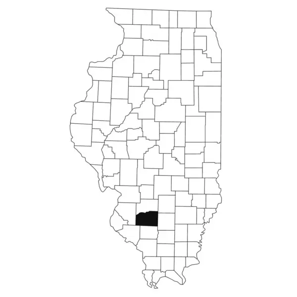
Map Of Shelby County In Illinois State On White Background. Single County Map Highlighted By Black Colour On Illinois Map. UNITED STATES, US
Image, 5.19MB, 8000 × 8000 jpg
Map Of Washington County In Illinois State On White Background. Single County Map Highlighted By Black Colour On Illinois Map. UNITED STATES, US
Image, 5.19MB, 8000 × 8000 jpg

Map Of Henderson County In Illinois State On White Background. Single County Map Highlighted By Black Colour On Illinois Map. UNITED STATES, US
Image, 5.19MB, 8000 × 8000 jpg

Map Of Effingham County In Illinois State On White Background. Single County Map Highlighted By Black Colour On Illinois Map. UNITED STATES, US
Image, 5.19MB, 8000 × 8000 jpg

Georgia Administrative Map, Georgia Outline And Counties State Map Set - Illustration Version
Image, 2.86MB, 8000 × 2667 jpg

Map Of Lawrence County In Illinois State On White Background. Single County Map Highlighted By Black Colour On Illinois Map. UNITED STATES, US
Image, 5.19MB, 8000 × 8000 jpg

Map Of Shelby County In Ohio State On White Background. Single County Map Highlighted By Black Colour On Ohio Map. UNITED STATES, US
Image, 5.59MB, 8000 × 8000 jpg

Map Of Portage County In Ohio State On White Background. Single County Map Highlighted By Black Colour On Ohio Map. UNITED STATES, US
Image, 5.59MB, 8000 × 8000 jpg


Map Of Knox County In Illinois State On White Background. Single County Map Highlighted By Black Colour On Illinois Map. UNITED STATES, US
Image, 5.2MB, 8000 × 8000 jpg

Map Of Jersey County In Illinois State On White Background. Single County Map Highlighted By Black Colour On Illinois Map. UNITED STATES, US
Image, 5.19MB, 8000 × 8000 jpg

Map Of Alexander County In Illinois State On White Background. Single County Map Highlighted By Black Colour On Illinois Map. UNITED STATES, US
Image, 5.19MB, 8000 × 8000 jpg
Page 1 >> Next