
Stock image Worcester County

Wild Horses Gallup Along The Side Of The Road In Assateague Island National Seashore In Maryland
Image, 10.38MB, 4928 × 3264 jpg

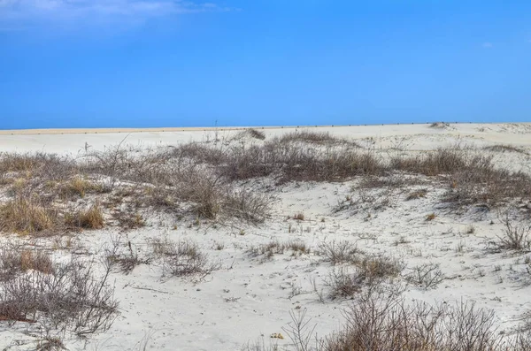
Beautiful Marsh Scenery Of Assateague Island National Seashore In Maryland, Along A Barrier Island In The Atlantic Ocean
Image, 4.52MB, 4928 × 3264 jpg

Wild Horses Gallup Along The Side Of The Road In Assateague Island National Seashore In Maryland
Image, 4.65MB, 4041 × 2677 jpg
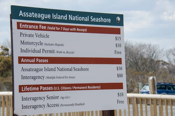
March 30 2018 - Ocean City, Maryland: Assateague Island National Seashore Entrance Fees Sign Shows The Amount For Visitors Need To Pay
Image, 5.83MB, 4928 × 3264 jpg

Blonde Woman Tempting Fate By Getting Too Close To Wildlife, A Wild Horse On Assateague Island, Attempting To Get A Photo
Image, 6.91MB, 4928 × 3264 jpg

Wild Horse - Assateague Island National Seashore, A Barrier Island In Maryland
Image, 10.27MB, 4928 × 3264 jpg

Wild Horse Eats Grass Along Side Of The Road - Assateague Island National Seashore In Maryland
Image, 10.19MB, 4928 × 3264 jpg


Fun Fisheye View Of Young Woman Enjoying The Beach At Assateague Island National Seashore On A Sunny Spring Day
Image, 7.43MB, 4928 × 3264 jpg

Wild Horses Grazing - Assateague Island National Seashore, A Barrier Island In Maryland
Image, 7.06MB, 4307 × 2853 jpg


Fitchburg District Court And Monument Park Aerial View On Main Street In Downtown Fitchburg, Massachusetts MA, USA.
Image, 8.79MB, 3992 × 2992 jpg


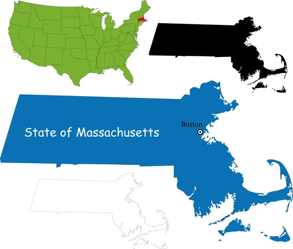
Map Of Worcester County In Massachusetts State On White Background. Single County Map Highlighted By Black Colour On Massachusetts Map. UNITED STATES, US
Image, 4.12MB, 8000 × 6667 jpg

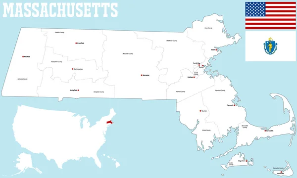
Massachusetts Counties, Gray Political Map. Commonwealth Of Massachusetts, State In The New England Region Of Northeastern United States, Subdivided Into 14 Counties. With Boundaries And County Names.
Vector, 2.12MB, 9000 × 5555 eps

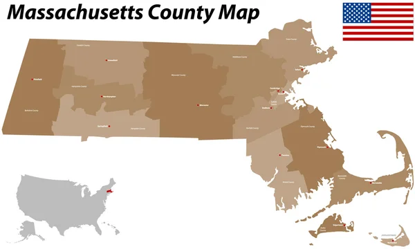
Massachusetts, U.S. State, Multi Colored Political Map With Borders, County Names And Capital Boston. State In The New England Region Of The Northeastern United States, Subdivided Into 14 Counties.
Vector, 2.14MB, 9000 × 5580 eps

Massachusetts Counties, Political Map. Commonwealth Of Massachusetts, A State In The New England Region Of Northeastern United States, Subdivided Into 14 Counties. With Boundaries And County Names.
Vector, 3.69MB, 9000 × 5555 eps

Map Of Worcester County In Massachusetts State On White Background. Single County Map Highlighted By Black Colour On Massachusetts Map. UNITED STATES, US
Image, 4.39MB, 8000 × 6667 jpg
Page 1 >> Next