
Stock image Zemlya
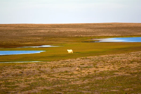
Unusual Picture: Polar Bear On Land In The Polar Day Period. Novaya Zemlya Archipelago, South Island
Image, 7.05MB, 3873 × 2582 jpg


Severny Island In The Kara Sea On A Topographic, OSM Humanitarian Style Map
Image, 0.53MB, 2880 × 1620 jpg

Severny Island In The Kara Sea - Belonging To Russia. Described Location Diagram With Yellow Shape Of The Island And Sample Maps Of Its Surroundings
Image, 1.96MB, 3840 × 2160 jpg

Pioneer Island In The Kara Sea - Belonging To Russia. Described Location Diagram With Yellow Shape Of The Island And Sample Maps Of Its Surroundings
Image, 2.37MB, 3840 × 2160 jpg


October Revolution Island In The Kara Sea, Belonging To Russia, Isolated On A Bilevel Elevation Map, With Distance Scale
Image, 0.74MB, 2160 × 2160 jpg

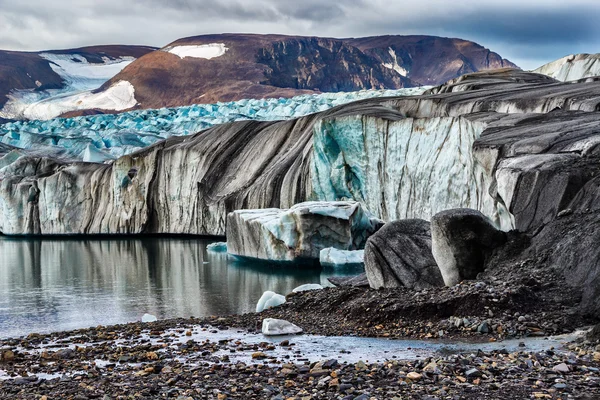
Aerial View Of The Rocks With Mudflow And Snow High In The Alpine Mountains.
Image, 5.49MB, 3000 × 1686 jpg

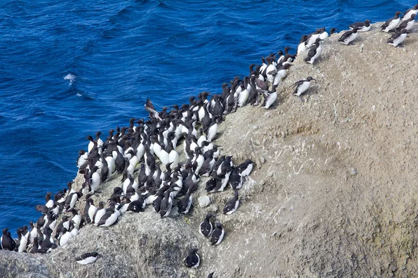
Planar Colony Of Brunnich's Guillemots And Common Guillemots On The Novaya Zemlya Archipelago, Barents Sea
Image, 7.05MB, 3465 × 2310 jpg

Komsomolets Island In The Kara Sea, Belonging To Russia, Isolated On A Bilevel Elevation Map, With Distance Scale
Image, 0.39MB, 2160 × 2160 jpg


Bolshevik Island In The Kara Sea On A Topographic, OSM Humanitarian Style Map
Image, 0.81MB, 2880 × 1620 jpg


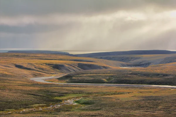
Scarce Landscape Of Cold Arctic Desert. Novaya Zemlya Archipelago. Nuclear Testing Range 3
Image, 7.52MB, 4245 × 2828 jpg
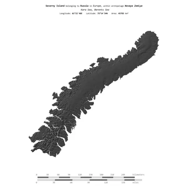
Severny Island In The Kara Sea, Belonging To Russia, Isolated On A Bilevel Elevation Map, With Distance Scale
Image, 0.54MB, 2160 × 2160 jpg

Novaya Zemlya Island In The Kara Sea - Belonging To Russia. Described Location Diagram With Yellow Shape Of The Island And Sample Maps Of Its Surroundings
Image, 2.55MB, 3840 × 2160 jpg

Komsomolets Island In The Kara Sea On A Satellite Image Taken In December 31, 2014
Image, 1.61MB, 2880 × 1620 jpg


Komsomolets Island In The Kara Sea On A Topographic, OSM Humanitarian Style Map
Image, 0.69MB, 2880 × 1620 jpg

Novaya Zemlya Island In The Kara Sea, Belonging To Russia, Isolated On A Bilevel Elevation Map, With Distance Scale
Image, 0.42MB, 2160 × 2160 jpg

Severny Island In The Kara Sea On A Satellite Image Taken In December 31, 2014
Image, 1.6MB, 2880 × 1620 jpg


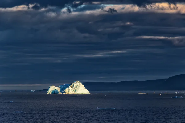
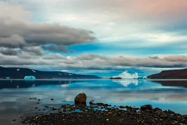
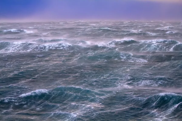
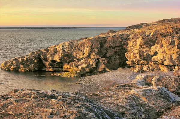
Kara Sea (basin Of Arctic Ocean) In High Arctic (Novaya Zemlya Archipelago). Old Name Of Kara Sea - Ice Cellar, But Now No Ice
Image, 8.09MB, 3873 × 2582 jpg
Scarce Landscape Of Cold Arctic Desert. Novaya Zemlya Archipelago. Nuclear Testing Range 1
Image, 14.1MB, 3875 × 2581 jpg


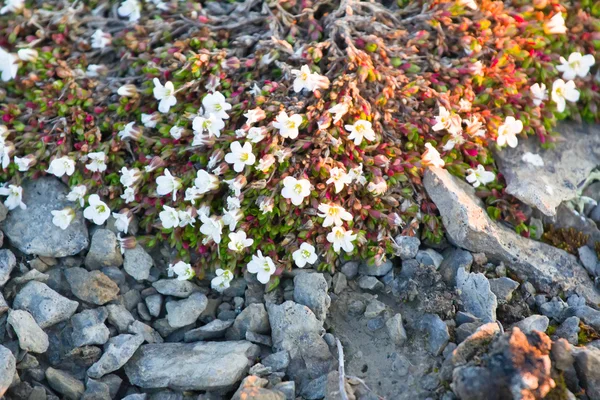
Modest Polar Desert Vegetation: Curtin Mouse-ear Chickweed (Cerastium Regelii). Novaya Zemlya Archipelago. Russia
Image, 10.15MB, 4244 × 2829 jpg
Scarce Landscape Of Cold Arctic Desert. Novaya Zemlya Archipelago. Nuclear Testing Range 3
Image, 17.52MB, 5202 × 3465 jpg


Yuzhny Island In The Kara Sea, Belonging To Russia, Isolated On A Bilevel Elevation Map, With Distance Scale
Image, 0.64MB, 2160 × 2160 jpg

October Revolution Island In The Kara Sea, Belonging To Russia, Isolated On A Topographic, OSM Humanitarian Style Map, With Distance Scale
Image, 0.72MB, 2160 × 2160 jpg

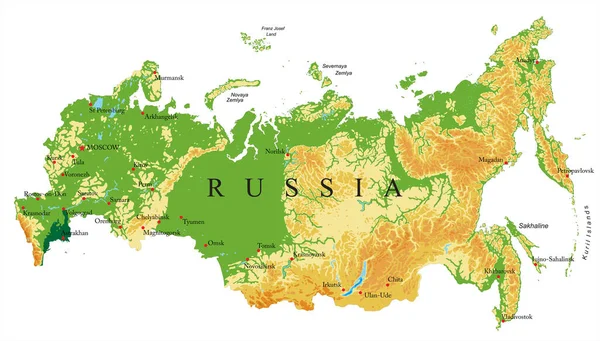
Highly Detailed Physical Map Of Russia,in Vector Format,with All The Relief Forms,regions And Big Cities.
Vector, 4.14MB, 6000 × 3411 eps

Yuzhny Island In The Kara Sea - Belonging To Russia. Described Location Diagram With Yellow Shape Of The Island And Sample Maps Of Its Surroundings
Image, 2MB, 3840 × 2160 jpg
Page 1 >> Next