
Stock image Aitutaki Map

Aitutaki Vector Map Grunge Rubber Stamp With The Name And Map Of Island Vector Illustration Can
Vector, 3.3MB, 8350 × 8350 eps
Aitutaki Flag Badge Vintage Travel Stamp With Circular Text Stars And Island Flag Inside It
Vector, 6.08MB, 8333 × 8333 eps

Aitutaki Geometric Map. Stencil Shape Of Aitutaki In Low Poly Style. Authentic Island Vector Illustration.
Vector, 0.88MB, 4845 × 6233 eps

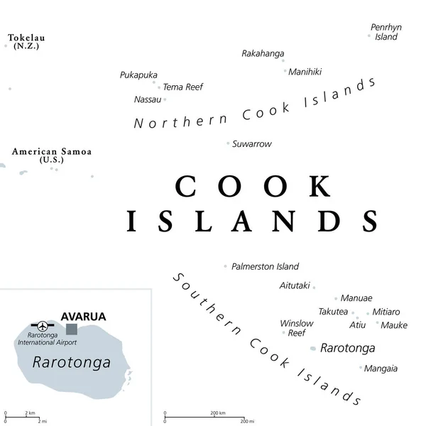
Cook Islands Political Map With Capital Avarua. Self-governing Island Country In South Pacific Ocean In Free Association With New Zealand, Comprising 15 Islands. English Labeling. Illustration. Vector
Vector, 1.66MB, 6000 × 6000 eps
Cook Islands, Gray Political Map With Capital Avarua. Self-governing Island Country In South Pacific Ocean In Free Association With New Zealand, Comprising 15 Islands. English. Illustration. Vector.
Vector, 1.57MB, 6000 × 6000 eps
Page 1 >> Next