
Stock image Alegranza Map
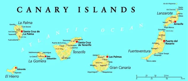
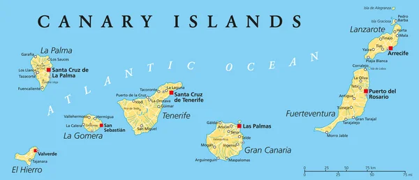
Canary Islands Political Map With Lanzarote, Fuerteventura, Gran Canaria, Tenerife, La Gomera, La Palma And El Hierro. English Labeling And Scaling. Illustration.
Vector, 0MB, 7176 × 3096 zip
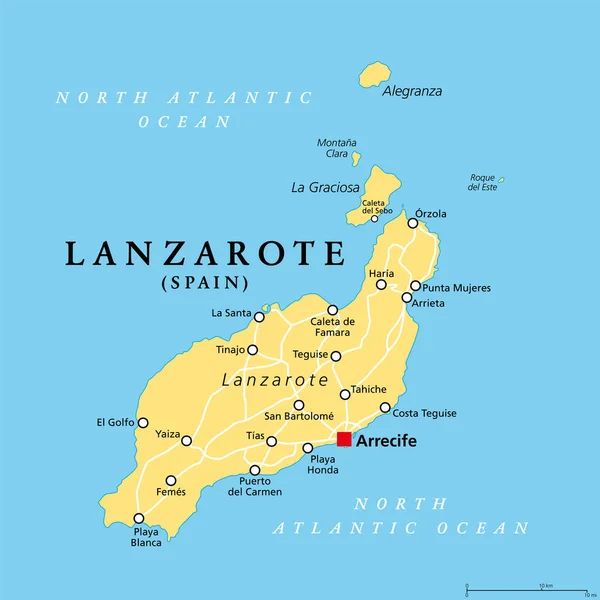
Lanzarote, Political Map, With Capital Arrecife. Northernmost And Easternmost Island Of Canary Islands, An Archipelago And Autonomous Community Of Spain, In The Atlantic Ocean Off The Coast Of Africa.
Vector, 2.31MB, 6000 × 6000 eps
Page 1 >> Next