photo free
Home Images Vectors Videos

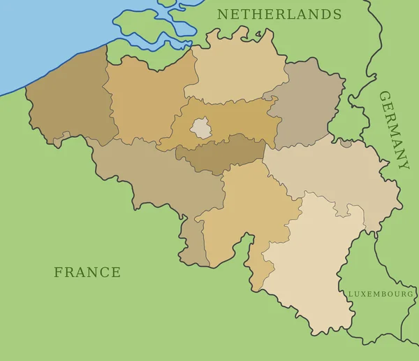
Stock image Belgium Regions

stock vector Belgium region map grey outline on white background Detailed map of Belgium regions Vector

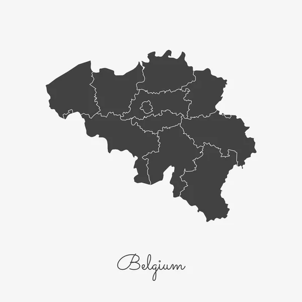
Belgium Region Map Grey Outline On White Background Detailed Map Of Belgium Regions Vector

Vector, 0.34MB, 8333 × 8333 eps
stock image Belgium map, individual regions, provinces of Belgium,  isolated on white background blank

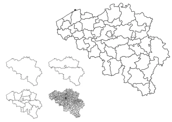
Belgium Map, Individual Regions, Provinces Of Belgium, Isolated On White Background Blank

Image, 1.03MB, 5137 × 3800 jpg
stock vector Detailed map of Belgium with administrative divisions of the country, color vector illustration

Detailed Map Of Belgium With Administrative Divisions Of The Country, Color Vector Illustration

Vector, 2.71MB, 7677 × 4224 eps
stock vector Brussels map Bruxelles Brussel administrative districts regions vector template with map of Belgium grey on white background. Contour line city map for infographic and web.

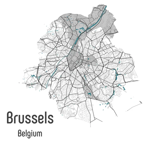
Brussels Map Bruxelles Brussel Administrative Districts Regions Vector Template With Map Of Belgium Grey On White Background. Contour Line City Map For Infographic And Web.

Vector, 19.95MB, 4075 × 4075 eps
stock vector Belgium vector maps with administrative regions, municipalities, departments, borders

Belgium Vector Maps With Administrative Regions, Municipalities, Departments, Borders

Vector, 10.25MB, 12151 × 6930 eps
stock vector Five detailed vector maps of Belgium administrative regions and areas in white color

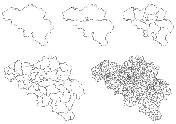
Five Detailed Vector Maps Of Belgium Administrative Regions And Areas In White Color

Vector, 9MB, 4472 × 3170 eps
stock vector Map of Belgium

Map Of Belgium

Vector, 0.46MB, 6000 × 5160 eps
stock vector Belgium outline map vector with administrative borders, regions, municipalities, departments in black white colors

Belgium Outline Map Vector With Administrative Borders, Regions, Municipalities, Departments In Black White Colors

Vector, 8.26MB, 4932 × 3496 eps
stock vector Belgium region map retro style brown outline on old paper background Detailed map of Belgium

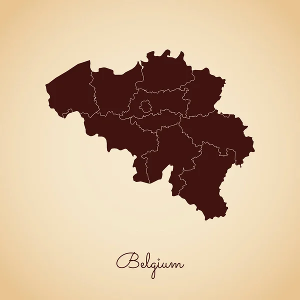
Belgium Region Map Retro Style Brown Outline On Old Paper Background Detailed Map Of Belgium

Vector, 0.34MB, 8333 × 8333 eps
stock vector Belgium region map golden gradient outline on dark background Detailed map of Belgium regions

Belgium Region Map Golden Gradient Outline On Dark Background Detailed Map Of Belgium Regions

Vector, 0.44MB, 8333 × 8333 eps
stock vector Belgium Regions Map Vector

Belgium Regions Map Vector

Vector, 0.96MB, 5200 × 5200 eps
stock vector Belgium region map colorful with white outline Detailed map of Belgium regions Vector

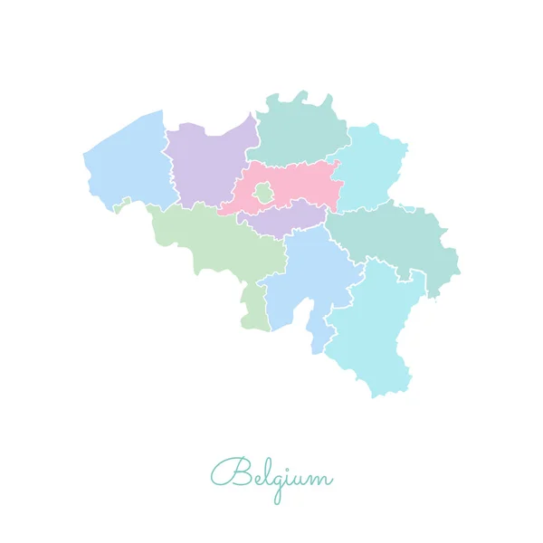
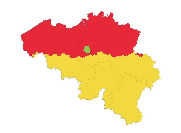
Belgium Region Map Colorful With White Outline Detailed Map Of Belgium Regions Vector

Vector, 0.73MB, 8333 × 8333 eps
stock vector Belgium Detailed Map With States

Belgium Detailed Map With States

Vector, 1.05MB, 2401 × 2401 eps
stock vector Doodle Map of Belgium With States

Doodle Map Of Belgium With States

Vector, 2.41MB, 2401 × 2401 eps
stock vector Belgium vector set.

Belgium Vector Set.

Vector, 0.34MB, 6000 × 6000 eps
stock image France map with flag

France Map With Flag

Image, 2.67MB, 3200 × 2900 jpg
stock vector all Flags of regions of Belgium. Vector illustraion

All Flags Of Regions Of Belgium. Vector Illustraion

Vector, 6.79MB, 5647 × 4000 eps
stock image Paris Triumph Arc in Mini Europe park

Paris Triumph Arc In Mini Europe Park

Image, 4.41MB, 3888 × 2592 jpg
stock image three-dimensional map of Europe.

Three-dimensional Map Of Europe.

Image, 5.92MB, 5600 × 4200 jpg
stock vector Europe map and country contours - Illustration.

Europe Map And Country Contours - Illustration.

Vector, 6.4MB, 5400 × 4561 eps
stock vector Europe map and navigation icons - Illustration

Europe Map And Navigation Icons - Illustration

Vector, 2.61MB, 5432 × 7478 eps
stock vector 3 dimensional infographics political map of Belgium, with every province easy selectable and editable in one click. Content labeled in Layers panel.

3 Dimensional Infographics Political Map Of Belgium, With Every Province Easy Selectable And Editable In One Click. Content Labeled In Layers Panel.

Vector, 13.86MB, 6400 × 4800 eps
stock image The European Union.

The European Union.

Image, 5.41MB, 5600 × 4200 jpg
stock vector Amsterdam map with roads and rivers, city municipality administrative borders, art design with grey and blue on white background

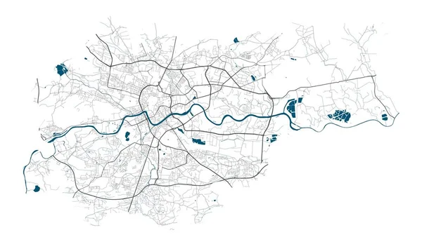
Amsterdam Map With Roads And Rivers, City Municipality Administrative Borders, Art Design With Grey And Blue On White Background

Vector, 29.23MB, 4941 × 3627 eps
stock image The European Union.

The European Union.

Image, 4.86MB, 5000 × 4200 jpg
stock image The European Union.

The European Union.

Image, 4.29MB, 4300 × 4300 jpg
stock vector Flag of Flemish Region in Belgium

Flag Of Flemish Region In Belgium

Vector, 5.99MB, 8334 × 5534 eps
stock image BRUSSELS

BRUSSELS

Image, 6.94MB, 2592 × 3888 jpg
stock vector Belgium

Belgium

Vector, 0.41MB, 6000 × 5160 eps
stock image The European Union.

The European Union.

Image, 4.62MB, 5000 × 4200 jpg
stock vector Country shape outlined and filled with the flag of Belgium isolated on blue background

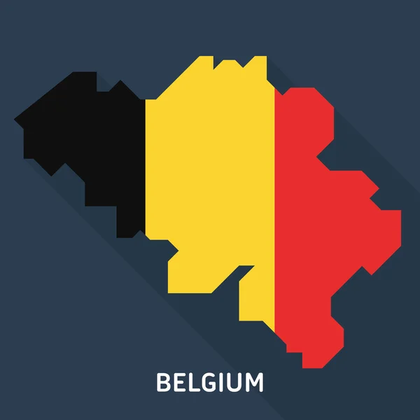
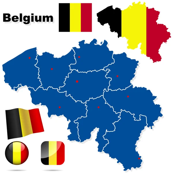
Country Shape Outlined And Filled With The Flag Of Belgium Isolated On Blue Background

Vector, 0.23MB, 6000 × 6000 eps
stock image Map of Belgium.

Map Of Belgium.

Image, 4.19MB, 5600 × 4200 jpg
stock vector Map pointer with namur map

Map Pointer With Namur Map

Vector, 1.59MB, 4472 × 4472 eps
stock vector Antwerpen Antwerp, Belgium administrative green map  rivers, water, roads and highways on black background

Antwerpen Antwerp, Belgium Administrative Green Map Rivers, Water, Roads And Highways On Black Background

Vector, 16.36MB, 4084 × 4173 eps
stock image three-dimensional map of Europe.

Three-dimensional Map Of Europe.

Image, 4.03MB, 5600 × 4200 jpg
stock vector Krakow map with roads and rivers, city municipality administrative borders, art design with grey and blue on white background

Krakow Map With Roads And Rivers, City Municipality Administrative Borders, Art Design With Grey And Blue On White Background

Vector, 10.78MB, 5306 × 3081 eps
stock vector Accurate map of Belgium

Accurate Map Of Belgium

Vector, 0.68MB, 5000 × 4000 eps
stock vector Europe Map - Color Detailed Vector Illustration

Europe Map - Color Detailed Vector Illustration

Vector, 14.86MB, 6265 × 4588 eps
stock vector Abstract background with europe map

Abstract Background With Europe Map

Vector, 5.96MB, 5000 × 5000 eps
stock vector Europe Map - Vintage Vector Illustration

Europe Map - Vintage Vector Illustration

Vector, 6.58MB, 5500 × 7066 eps
stock vector Belgium map, administrative division, separate individual regions with names, color map isolated on white background vector

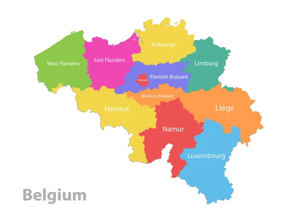
Belgium Map, Administrative Division, Separate Individual Regions With Names, Color Map Isolated On White Background Vector

Vector, 11.65MB, 5094 × 3800 eps
stock image Map of Europe and Estonia.

Map Of Europe And Estonia.

Image, 2.4MB, 5600 × 4200 jpg
stock vector Europe - map and navigation icons - illustration

Europe - Map And Navigation Icons - Illustration

Vector, 4.99MB, 5400 × 7461 eps
stock image three-dimensional map of Europe.

Three-dimensional Map Of Europe.

Image, 4.2MB, 5600 × 4200 jpg
stock image Map of Europe and Belarus.

Map Of Europe And Belarus.

Image, 2.44MB, 5600 × 4200 jpg
stock vector Europe - map, navigation icons - illustration.

Europe - Map, Navigation Icons - Illustration.

Vector, 5.62MB, 5400 × 7419 eps
stock image three-dimensional map of Europe.

Three-dimensional Map Of Europe.

Image, 4.9MB, 5600 × 4200 jpg
stock image three-dimensional map of Europe.

Three-dimensional Map Of Europe.

Image, 4.25MB, 5600 × 4200 jpg
stock image Map of France and Belgium.

Map Of France And Belgium.

Image, 2.78MB, 5600 × 4200 jpg
stock vector Belgium map with regions and pointer marks

Belgium Map With Regions And Pointer Marks

Vector, 1.95MB, 5000 × 3571 eps
Page 1 >> Next