photo free
Home Images Vectors Videos

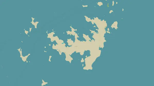
Stock image Calamian Group Of Islands

stock image Linapacan Island in the Sulu Sea on a topographic, OSM Humanitarian style map

Linapacan Island In The Sulu Sea On A Topographic, OSM Humanitarian Style Map

Image, 0.58MB, 2880 × 1620 jpg
stock image Calauit Island in the Sulu Sea, belonging to Philippines, isolated on a satellite image taken in December 28, 2023, with distance scale

Calauit Island In The Sulu Sea, Belonging To Philippines, Isolated On A Satellite Image Taken In December 28, 2023, With Distance Scale

Image, 1.56MB, 2160 × 2160 jpg
stock image Coron Island in the Sulu Sea, belonging to Philippines, isolated on a satellite image taken in December 28, 2023, with distance scale

Coron Island In The Sulu Sea, Belonging To Philippines, Isolated On A Satellite Image Taken In December 28, 2023, With Distance Scale

Image, 0.91MB, 2160 × 2160 jpg
stock image Culion Island in the Sulu Sea on a satellite image taken in May 17, 2021

Culion Island In The Sulu Sea On A Satellite Image Taken In May 17, 2021

Image, 4.46MB, 2880 × 1620 jpg
stock image Culion Island in the Sulu Sea - belonging to Philippines. Described location diagram with yellow shape of the island and sample maps of its surroundings

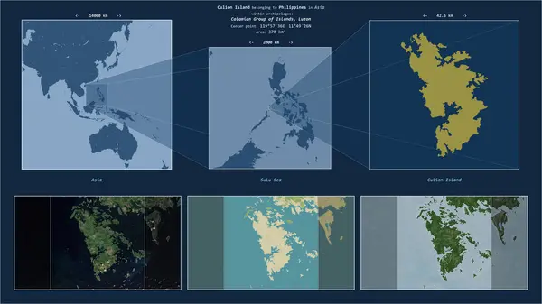
Culion Island In The Sulu Sea - Belonging To Philippines. Described Location Diagram With Yellow Shape Of The Island And Sample Maps Of Its Surroundings

Image, 2.57MB, 3840 × 2160 jpg
stock image Linapacan Island in the Sulu Sea, belonging to Philippines, isolated on a bilevel elevation map, with distance scale

Linapacan Island In The Sulu Sea, Belonging To Philippines, Isolated On A Bilevel Elevation Map, With Distance Scale

Image, 0.46MB, 2160 × 2160 jpg
stock image Linapacan Island in the Sulu Sea on a satellite image taken in March 23, 2020

Linapacan Island In The Sulu Sea On A Satellite Image Taken In March 23, 2020

Image, 5.25MB, 2880 × 1620 jpg
stock image Culion Island in the Sulu Sea, belonging to Philippines, isolated on a satellite image taken in January 8, 2019, with distance scale

Culion Island In The Sulu Sea, Belonging To Philippines, Isolated On A Satellite Image Taken In January 8, 2019, With Distance Scale

Image, 1.3MB, 2160 × 2160 jpg
stock image Coron Island in the Sulu Sea, belonging to Philippines, isolated on a bilevel elevation map, with distance scale

Coron Island In The Sulu Sea, Belonging To Philippines, Isolated On A Bilevel Elevation Map, With Distance Scale

Image, 0.31MB, 2160 × 2160 jpg
stock image Busuanga Island in the Sulu Sea on a colored elevation map

Busuanga Island In The Sulu Sea On A Colored Elevation Map

Image, 1.95MB, 2880 × 1620 jpg
stock image Coron Island in the Sulu Sea, belonging to Philippines, isolated on a topographic, OSM Humanitarian style map, with distance scale

Coron Island In The Sulu Sea, Belonging To Philippines, Isolated On A Topographic, OSM Humanitarian Style Map, With Distance Scale

Image, 0.37MB, 2160 × 2160 jpg
stock image Culion Island in the Sulu Sea, belonging to Philippines, isolated on a topographic, OSM Humanitarian style map, with distance scale

Culion Island In The Sulu Sea, Belonging To Philippines, Isolated On A Topographic, OSM Humanitarian Style Map, With Distance Scale

Image, 0.6MB, 2160 × 2160 jpg
stock image Culion Island in the Sulu Sea, belonging to Philippines, isolated on a bilevel elevation map, with distance scale

Culion Island In The Sulu Sea, Belonging To Philippines, Isolated On A Bilevel Elevation Map, With Distance Scale

Image, 0.54MB, 2160 × 2160 jpg
stock image Linapacan Island in the Sulu Sea, belonging to Philippines, isolated on a satellite image taken in March 3, 2021, with distance scale

Linapacan Island In The Sulu Sea, Belonging To Philippines, Isolated On A Satellite Image Taken In March 3, 2021, With Distance Scale

Image, 1.37MB, 2160 × 2160 jpg
stock image Linapacan Island in the Sulu Sea on a colored elevation map

Linapacan Island In The Sulu Sea On A Colored Elevation Map

Image, 1.08MB, 2880 × 1620 jpg
stock image Calauit Island in the Sulu Sea on a topographic, OSM Humanitarian style map

Calauit Island In The Sulu Sea On A Topographic, OSM Humanitarian Style Map

Image, 0.87MB, 2880 × 1620 jpg
stock image Culion Island in the Sulu Sea on a colored elevation map

Culion Island In The Sulu Sea On A Colored Elevation Map

Image, 1.77MB, 2880 × 1620 jpg
stock image Busuanga Island in the Sulu Sea - belonging to Philippines. Described location diagram with yellow shape of the island and sample maps of its surroundings

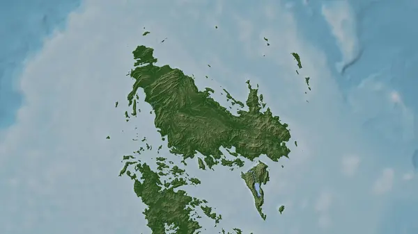
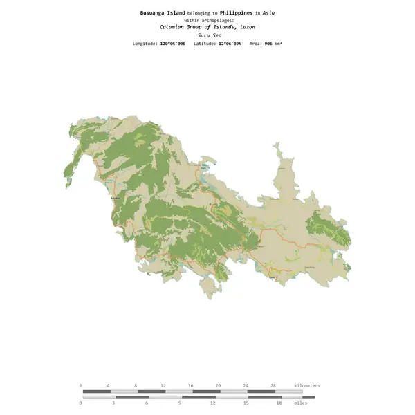
Busuanga Island In The Sulu Sea - Belonging To Philippines. Described Location Diagram With Yellow Shape Of The Island And Sample Maps Of Its Surroundings

Image, 2.5MB, 3840 × 2160 jpg
stock image Calauit Island in the Sulu Sea, belonging to Philippines, isolated on a bilevel elevation map, with distance scale

Calauit Island In The Sulu Sea, Belonging To Philippines, Isolated On A Bilevel Elevation Map, With Distance Scale

Image, 0.38MB, 2160 × 2160 jpg
stock image Coron Island in the Sulu Sea on a topographic, OSM Humanitarian style map

Coron Island In The Sulu Sea On A Topographic, OSM Humanitarian Style Map

Image, 1.12MB, 2880 × 1620 jpg
stock image Calauit Island in the Sulu Sea on a satellite image taken in April 21, 2024

Calauit Island In The Sulu Sea On A Satellite Image Taken In April 21, 2024

Image, 5.19MB, 2880 × 1620 jpg
stock image Calauit Island in the Sulu Sea, belonging to Philippines, isolated on a topographic, OSM Humanitarian style map, with distance scale

Calauit Island In The Sulu Sea, Belonging To Philippines, Isolated On A Topographic, OSM Humanitarian Style Map, With Distance Scale

Image, 0.76MB, 2160 × 2160 jpg
stock image Coron Island in the Sulu Sea - belonging to Philippines. Described location diagram with yellow shape of the island and sample maps of its surroundings

Coron Island In The Sulu Sea - Belonging To Philippines. Described Location Diagram With Yellow Shape Of The Island And Sample Maps Of Its Surroundings

Image, 2.51MB, 3840 × 2160 jpg
stock image Busuanga Island in the Sulu Sea, belonging to Philippines, isolated on a satellite image taken in February 26, 2024, with distance scale

Busuanga Island In The Sulu Sea, Belonging To Philippines, Isolated On A Satellite Image Taken In February 26, 2024, With Distance Scale

Image, 1.46MB, 2160 × 2160 jpg
stock image Busuanga Island in the Sulu Sea on a topographic, OSM Humanitarian style map

Busuanga Island In The Sulu Sea On A Topographic, OSM Humanitarian Style Map

Image, 1.15MB, 2880 × 1620 jpg
stock image Calauit Island in the Sulu Sea on a colored elevation map

Calauit Island In The Sulu Sea On A Colored Elevation Map

Image, 0.91MB, 2880 × 1620 jpg
stock image Busuanga Island in the Sulu Sea on a satellite image taken in December 29, 2019

Busuanga Island In The Sulu Sea On A Satellite Image Taken In December 29, 2019

Image, 4.81MB, 2880 × 1620 jpg
stock image Coron Island in the Sulu Sea on a satellite image taken in March 7, 2024

Coron Island In The Sulu Sea On A Satellite Image Taken In March 7, 2024

Image, 5.61MB, 2880 × 1620 jpg
stock image Culion Island in the Sulu Sea on a topographic, OSM Humanitarian style map

Culion Island In The Sulu Sea On A Topographic, OSM Humanitarian Style Map

Image, 1.23MB, 2880 × 1620 jpg
stock image Busuanga Island in the Sulu Sea, belonging to Philippines, isolated on a topographic, OSM Humanitarian style map, with distance scale

Busuanga Island In The Sulu Sea, Belonging To Philippines, Isolated On A Topographic, OSM Humanitarian Style Map, With Distance Scale

Image, 0.87MB, 2160 × 2160 jpg
stock image Linapacan Island in the Sulu Sea, belonging to Philippines, isolated on a topographic, OSM Humanitarian style map, with distance scale

Linapacan Island In The Sulu Sea, Belonging To Philippines, Isolated On A Topographic, OSM Humanitarian Style Map, With Distance Scale

Image, 0.5MB, 2160 × 2160 jpg
stock image Calauit Island in the Sulu Sea - belonging to Philippines. Described location diagram with yellow shape of the island and sample maps of its surroundings

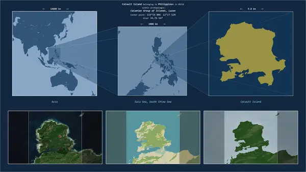
Calauit Island In The Sulu Sea - Belonging To Philippines. Described Location Diagram With Yellow Shape Of The Island And Sample Maps Of Its Surroundings

Image, 2.35MB, 3840 × 2160 jpg
stock image Busuanga Island in the Sulu Sea, belonging to Philippines, isolated on a bilevel elevation map, with distance scale

Busuanga Island In The Sulu Sea, Belonging To Philippines, Isolated On A Bilevel Elevation Map, With Distance Scale

Image, 0.63MB, 2160 × 2160 jpg
stock image Linapacan Island in the Sulu Sea - belonging to Philippines. Described location diagram with yellow shape of the island and sample maps of its surroundings

Linapacan Island In The Sulu Sea - Belonging To Philippines. Described Location Diagram With Yellow Shape Of The Island And Sample Maps Of Its Surroundings

Image, 2.26MB, 3840 × 2160 jpg
stock image Coron Island in the Sulu Sea on a colored elevation map

Coron Island In The Sulu Sea On A Colored Elevation Map

Image, 1.5MB, 2880 × 1620 jpg
Page 1 >> Next