
Stock image Central Highlands Vietnam


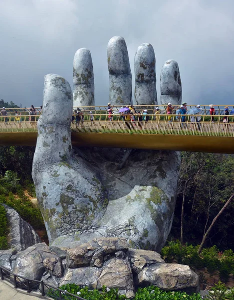
Ba Na, Vietnam - June 06, 2019; The Golden Hand Bridge At Ba Na In The Central Highlands Of Vietnam.
Image, 19.01MB, 5231 × 6677 jpg

Cattle Cross In Front Of The Building Housing The Vietnam-Laos International Border Gate At Bo Y, Ngoc Hoi District, Kontum Province, In The Central Highlands Of Vietnam
Image, 10.15MB, 6674 × 3946 jpg

The Catholic Phuong Nghia Parish Church, In Kontum Ion The Central Highlands Of Vietnam.
Image, 33.59MB, 7688 × 5084 jpg

A Large Motorcycle Parked Near A Blue Road Sign On QL40 Road Pointing To The Cambodia And Laos Borders In Bo Y Commune, Ngoc Hoi District, In The Central Highlands In Vietnam
Image, 25.9MB, 7786 × 5148 jpg

Public Health Information Posters Highlighting The Impartance Of Vaccination And Washing Hads In The Fight Against COVID-19, The Global Pandemic.
Image, 17.6MB, 5949 × 4088 jpg

A Blue Road Sign Pointing To The Cambodia And Laos Borders In Bo Y Commune, Ngoc Hoi District, In The Central Highlands In Vietnam
Image, 26.25MB, 7864 × 5200 jpg

Cattle Cross In Front Of The Building Housing The Vietnam-Laos International Border Gate At Bo Y, Ngoc Hoi District, Kontum Province, In The Central Highlands Of Vietnam
Image, 17.65MB, 7714 × 5101 jpg

A Cow Crosses In Front Of The Building Housing The Vietnam-Laos International Border Gate At Bo Y, Ngoc Hoi District, Kontum Province, In The Central Highlands Of Vietnam
Image, 11.02MB, 6087 × 4195 jpg

Intricately Carved Wooden Doors On The Front Of The Catholic Phuong Nghia Parish Church, In Kontum Ion The Central Highlands Of Vietnam.
Image, 17.47MB, 6593 × 4473 jpg

The Front Of The Colonial-era Catholic Bishop's House, Or Bishop's Palace, In Kontum In The Central Highlands Of Vietnam
Image, 24.91MB, 7864 × 5200 jpg

The Name Sign Concrete And Painted For The Catholic Ro Koi Parish Church In Sa Thay District, Kontum Province, Vietnam
Image, 21.39MB, 7628 × 4752 jpg

Topiary Bushes Next To The Building Housing The Vietnam-Laos International Border Gate At Bo Y, Ngoc Hoi District, Kontum Province, In The Central Highlands Of Vietnam
Image, 22.39MB, 7640 × 5029 jpg

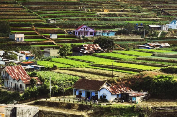
Aerial View Of Dalat City. The City Is Located On The Langbian Plateau In The Southern Parts Of The Central Highlands Region Of Vietnam
Image, 17.06MB, 6000 × 3687 jpg

A Blue Road Sign On QL40 Road Pointing To The Cambodia And Laos Borders In Bo Y Commune, Ngoc Hoi District, In The Central Highlands In Vietnam
Image, 23.5MB, 7078 × 4572 jpg

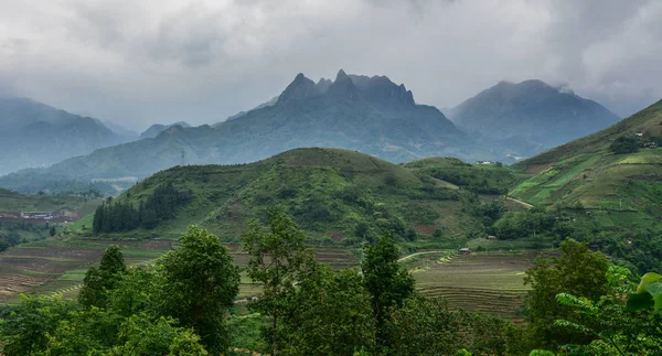
Mountain Scene In Sapa, Northern Vietnam. Sapa Is Located About 350 Km Northwest Of Hanoi, Close To The Chinese Border.
Image, 9.8MB, 5450 × 2935 jpg
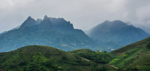
Mountain Scene In Sapa, Northern Vietnam. Sapa Is Located About 350 Km Northwest Of Hanoi, Close To The Chinese Border.
Image, 8.16MB, 5798 × 2758 jpg


Aerial View From The Drone To Dalat City. Located On The Langbian Plateau In The Southern Parts Of The Central Highlands Region Of Vietnam
Image, 5.83MB, 3992 × 2242 jpg

Aerial View From The Drone To Dalat City. Located On The Langbian Plateau In The Southern Parts Of The Central Highlands Region Of Vietnam
Image, 6.79MB, 3992 × 2242 jpg

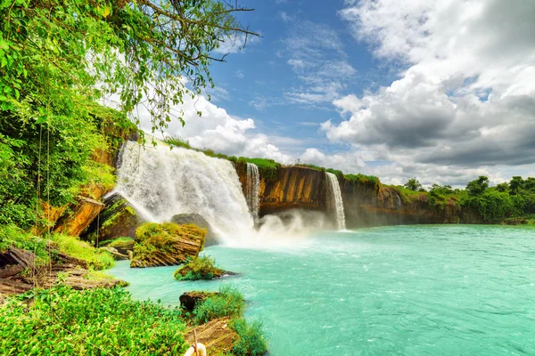
Amazing Pongour Waterfall Is Famous And Most Beautiful Of Fall In Vietnam. Not Far From Dalat City Estimate 45 Km. Dalat, Vietnam
Image, 16.56MB, 5900 × 3933 jpg

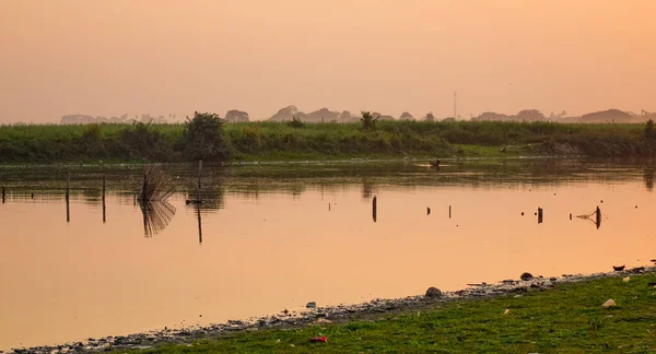
Fisherman's Hut On The Bank Of The Tuyen Lam Lake, Dalat, Central Highlands, Vietnam, Asia
Image, 1.68MB, 5132 × 3409 jpg


Mikhailowo, Poland, 08.18. 2024. Central City Park, Fountain, Town Hall. High Quality Photo
Image, 7.94MB, 4016 × 5622 jpg

Mikhailowo, Poland, 08.18. 2024. Central City Park, Fountain, Town Hall. High Quality Photo
Image, 9.66MB, 4016 × 6016 jpg

Vector Illustrated Blank Map Of Vietnam With Regions And Administrative Divisions, And Neighbouring Countries And Territories. Editable And Clearly Labeled Layers.
Vector, 2.92MB, 3500 × 5200 eps

Vector Blank Map Of Vietnam With Regions Or Territories And Administrative Divisions. Editable And Clearly Labeled Layers.
Vector, 1.76MB, 3500 × 5200 eps

Mikhailowo, Poland, 08.18. 2024. Central City Park, Fountain, Town Hall. High Quality Photo
Image, 6.37MB, 3841 × 5377 jpg

Vector Illustrated Map Of Vietnam With Regions And Administrative Divisions, And Neighbouring Countries And Territories. Editable And Clearly Labeled Layers.
Vector, 3.41MB, 3500 × 5200 eps

Mikhailowo, Poland, 08.18. 2024. Central City Park, Fountain, Town Hall. High Quality Photo
Image, 5.64MB, 3948 × 5527 jpg
Page 1 >> Next