
Stock image Columbia Point


North Carolina, NC, Political Map. With The Capital Raleigh And Largest Cities. State In The Southeastern Region Of The United States Of America. Old North State. Tar Heel State. Illustration. Vector.
Vector, 5.04MB, 9000 × 5331 eps
Aerial View From An Airplane Of Stanley Park, Coal Harbour And The Downtown City. Taken In Vancouver, British Columbia, Canada.
Image, 9.41MB, 5472 × 3648 jpg
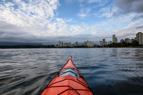
Sea Kayaking During A Dramatic Sunrise With City Skyline In The Background. Taken In Vancouver, British Columbia, Canada.
Image, 8.75MB, 5443 × 3629 jpg

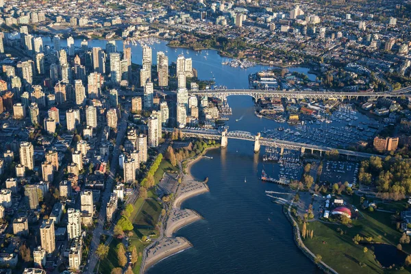
Beautiful Aerial View Of Vancouver Downtown, British Columbia, Canada, During A Bright Spring Sunset.
Image, 15.87MB, 5389 × 3593 jpg

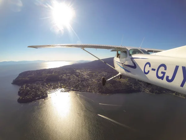
Tofino, Vancouver Island, British Columbia, Canada - June 29, 2017 - Small Cessna 172 Airplane Flying Around The City On Pacific Coast During A Bright Sun
Image, 4.77MB, 4000 × 3000 jpg
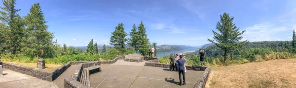
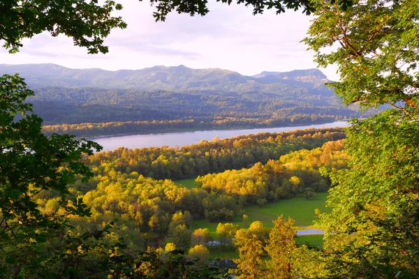
PORTLAND, OR - AUGUST 19, 2017: Tourists Enjoy Panoramic View Of Columbia River Gorge. It Is A Famous Attraction In Oregon.
Image, 21.68MB, 12964 × 3896 jpg

North Carolina, NC, Gray Political Map. With Capital Raleigh And Largest Cities. State In The Southeastern Region Of The United States Of America. Old North State. Tar Heel State. Illustration. Vector
Vector, 2.31MB, 9000 × 4674 eps


Beautiful Panoramic View Of Osoyoos Lake In British Columbia, Canada. Taken During A Cloudy Summer Day.
Image, 19.57MB, 11529 × 3520 jpg

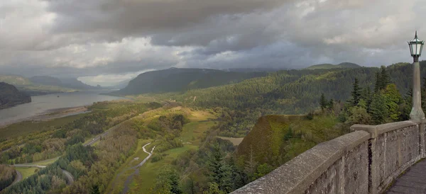

Panoramic View Of Columbia River Gorge From Crown Point Vista House - Oregon, USA
Image, 14.23MB, 5184 × 3888 jpg

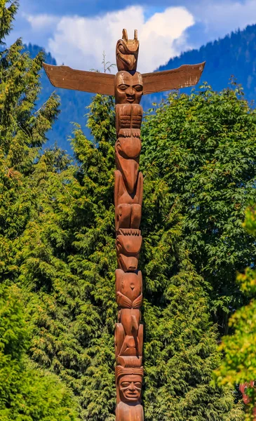
First Nations American Indian Totem Poles At Brockton Point In Stanley Park In Vancouver, Canada
Image, 10.75MB, 2716 × 4452 jpg

Tofino, Vancouver Island, British Columbia, Canada - June 29, 2017 - Small Cessna 172 Airplane Flying Around The City On Pacific Coast During A Bright Sun
Image, 3.31MB, 4000 × 3000 jpg


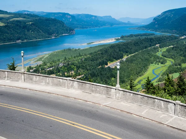
Overlook View Of The Columbia River Gorge From The Vista House, Oregon, USA.
Image, 13.92MB, 5370 × 3580 jpg
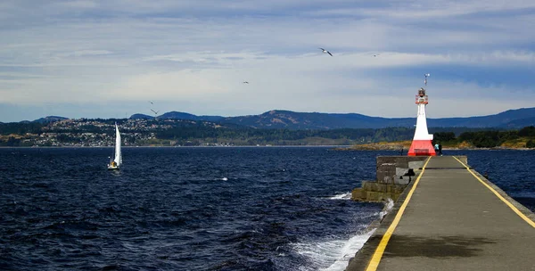
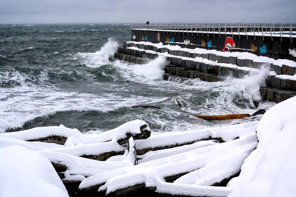
Wild Sea At Lighthouse And Breakwater At Ogden Point In Victoria, British Columbia, Canada
Image, 9.64MB, 5184 × 2627 jpg

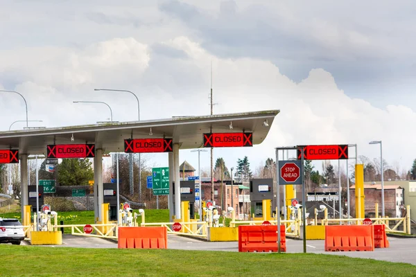
Surrey, Canada - Mar 29, 2020: Closed USA Border During Covid-19 Pandemic
Image, 10.76MB, 5929 × 3953 jpg

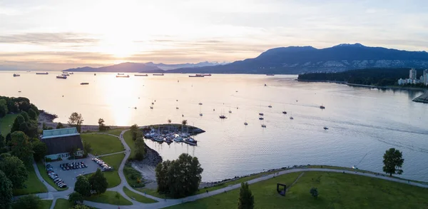
Beautiful Sunset Viewed From An Aerial Perspective Of Burrard Inlet From Kits Point, Vancouver, BC, Canada.
Image, 4.99MB, 4537 × 2217 jpg
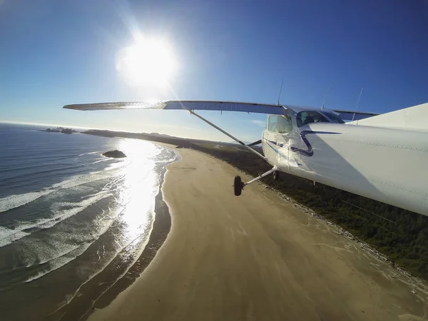
Small Airplane On Final Approach To Land At An Airport Near A Sandy Beach. Taken In Tofino, Vancouver Island, British Columbia, Canada.
Image, 4.61MB, 4000 × 3000 jpg

First Nations American Indian Totem Poles At Brockton Point In Stanley Park In Vancouver, Canada
Image, 9.46MB, 2848 × 4249 jpg

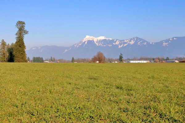
The Fraser Valley In Southern British Columbia, Canada And The Cascade Mountain Range With Mount Cheam Bordering In The Distant Background On A Sunny Spring Day.
Image, 16.85MB, 5200 × 3467 jpg
VICTORI, CANADA - Dec 07, 2020: Ogden Poiint Breakwater, Victoria, Vancouver Island, BC Canada
Image, 19.18MB, 5970 × 3972 jpg

Adventurous Girl Pointing Finger On Top Of A Rugged Rocky Mountain During A Cloudy Summer Morning. Taken On Crown Mountain, North Vancouver, BC, Canada.
Image, 8.05MB, 5472 × 3648 jpg
Page 1 >> Next