photo free
Home Images Vectors Videos

Stock image Como Outline

stock vector Satellite map of province of Como, towns and roads, buildings and connecting roads of surrounding areas. Lombardy, Italy. Map roads, ring roads

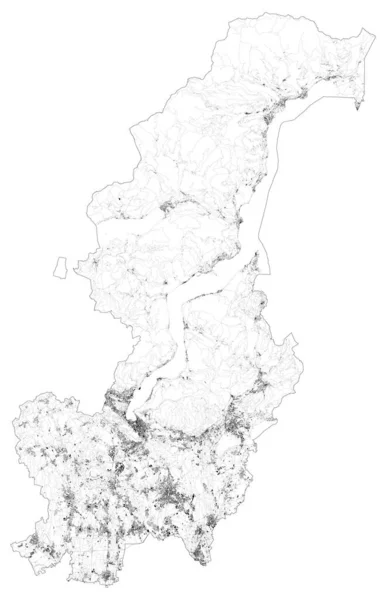
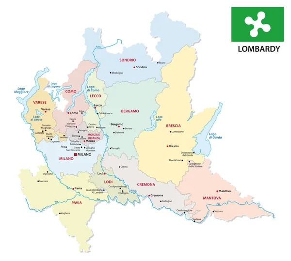
Satellite Map Of Province Of Como, Towns And Roads, Buildings And Connecting Roads Of Surrounding Areas. Lombardy, Italy. Map Roads, Ring Roads

Vector, 32.11MB, 5677 × 8811 eps
stock vector Italy, Como flat landmarks vector illustration. Italy, Como line city with famous travel sights, skyline, design.

Italy, Como Flat Landmarks Vector Illustration. Italy, Como Line City With Famous Travel Sights, Skyline, Design.

Vector, 3.14MB, 6000 × 3000 eps
stock image Outline Siena, Como and Milan Italy City Skylines with Blue Buildings and Reflections. Business Travel and Tourism Concept with Historic Architecture. Cityscapes with Landmarks.

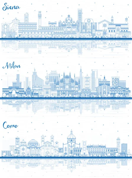
Outline Siena, Como And Milan Italy City Skylines With Blue Buildings And Reflections. Business Travel And Tourism Concept With Historic Architecture. Cityscapes With Landmarks.

Image, 16.42MB, 5969 × 8000 jpg
stock vector Italy vector map with city names

Italy Vector Map With City Names

Vector, 8.06MB, 3969 × 3969 eps
stock vector Italy vector map with city names

Italy Vector Map With City Names

Vector, 7.78MB, 3969 × 3969 eps
stock vector Italy, Como line skyline vector illustration. Italy, Como linear cityscape with famous landmarks, city sights, vector landscape.

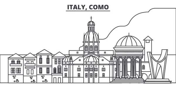
Italy, Como Line Skyline Vector Illustration. Italy, Como Linear Cityscape With Famous Landmarks, City Sights, Vector Landscape.

Vector, 1.63MB, 6000 × 3000 eps
stock vector Italy map and words cloud with larger cities

Italy Map And Words Cloud With Larger Cities

Vector, 0.62MB, 4233 × 4904 eps
stock vector small outline map of the upper Italian Lake Como, Italy.

Small Outline Map Of The Upper Italian Lake Como, Italy.

Vector, 0.9MB, 3100 × 4362 eps
stock vector Italy vector map with city names

Italy Vector Map With City Names

Vector, 8.02MB, 3969 × 3969 eps
stock vector Italy vector map with city names

Italy Vector Map With City Names

Vector, 7.14MB, 3969 × 3969 eps
stock vector map of the northern Italian lakes

Map Of The Northern Italian Lakes

Vector, 2.23MB, 6065 × 3100 eps
stock vector Italy vector map with city names

Italy Vector Map With City Names

Vector, 7.81MB, 3969 × 3969 eps
stock vector Restaurant by the lake

Restaurant By The Lake

Vector, 0.27MB, 5031 × 5031 eps
stock vector lombardy administrative and political map with flag

Lombardy Administrative And Political Map With Flag

Vector, 1.48MB, 3446 × 3100 eps
stock vector Italy vector map with city names

Italy Vector Map With City Names

Vector, 7.17MB, 3969 × 3969 eps
stock vector Italy vector map with city names

Italy Vector Map With City Names

Vector, 7.69MB, 3969 × 3969 eps
stock vector The grays map of Lombardy region with labels

The Grays Map Of Lombardy Region With Labels

Vector, 8.4MB, 5000 × 4500 eps
stock vector Cap template

Cap Template

Vector, 0.43MB, 5000 × 3152 eps
stock image Ilha de Como in the North Atlantic Ocean, belonging to Guinea-Bissau, isolated on a satellite image taken in October 31, 2023, with distance scale

Ilha De Como In The North Atlantic Ocean, Belonging To Guinea-Bissau, Isolated On A Satellite Image Taken In October 31, 2023, With Distance Scale

Image, 1.61MB, 2160 × 2160 jpg
stock vector Symbol Map of the Province Como (Italy) showing the state/province with a pattern of black squares like a chessboard

Symbol Map Of The Province Como (Italy) Showing The State/province With A Pattern Of Black Squares Like A Chessboard

Vector, 0.59MB, 4003 × 6000 eps
stock vector Mountain landscape with lake, sea. Hand drawn vector illustration. Panoramic calm sea view sketch, marine motive. The images are created without the use of any artificial intelligence software

Mountain Landscape With Lake, Sea. Hand Drawn Vector Illustration. Panoramic Calm Sea View Sketch, Marine Motive. The Images Are Created Without The Use Of Any Artificial Intelligence Software

Vector, 0.92MB, 5000 × 2500 eps
stock image Ilha de Como in the North Atlantic Ocean on a colored elevation map

Ilha De Como In The North Atlantic Ocean On A Colored Elevation Map

Image, 1.3MB, 2880 × 1620 jpg
stock image Ilha de Como in the North Atlantic Ocean on a satellite image taken in April 3, 2024

Ilha De Como In The North Atlantic Ocean On A Satellite Image Taken In April 3, 2024

Image, 6.61MB, 2880 × 1620 jpg
stock vector Symbol Map of the Province Como (Italy) showing the state/province with a pattern of randomly distributed colorful squares of different sizes

Symbol Map Of The Province Como (Italy) Showing The State/province With A Pattern Of Randomly Distributed Colorful Squares Of Different Sizes

Vector, 0.84MB, 4003 × 6000 eps
stock vector Lake Como (Italian Republic, Italy) map vector illustration, scribble sketch Lago di Como map

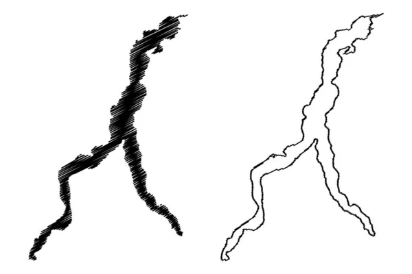
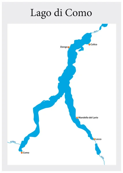
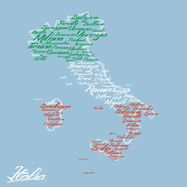
Lake Como (Italian Republic, Italy) Map Vector Illustration, Scribble Sketch Lago Di Como Map

Vector, 0.84MB, 7087 × 4726 eps
stock image Ilha de Como in the North Atlantic Ocean, belonging to Guinea-Bissau, isolated on a topographic, OSM Humanitarian style map, with distance scale

Ilha De Como In The North Atlantic Ocean, Belonging To Guinea-Bissau, Isolated On A Topographic, OSM Humanitarian Style Map, With Distance Scale

Image, 0.79MB, 2160 × 2160 jpg
stock image Ilha de Como in the North Atlantic Ocean - belonging to Guinea-Bissau. Described location diagram with yellow shape of the island and sample maps of its surroundings

Ilha De Como In The North Atlantic Ocean - Belonging To Guinea-Bissau. Described Location Diagram With Yellow Shape Of The Island And Sample Maps Of Its Surroundings

Image, 2.91MB, 3840 × 2160 jpg
stock vector Symbol Map of the Province Como (Italy) showing the contour of the state/province buffered inside in rainbow colors

Symbol Map Of The Province Como (Italy) Showing The Contour Of The State/province Buffered Inside In Rainbow Colors

Vector, 0.71MB, 4003 × 6000 eps
stock image Ilha de Como in the North Atlantic Ocean on a topographic, OSM Humanitarian style map

Ilha De Como In The North Atlantic Ocean On A Topographic, OSM Humanitarian Style Map

Image, 2.36MB, 2880 × 1620 jpg
Page 1 >> Next