photo free
Home Images Vectors Videos

Stock image Comoros Border

stock vector Comoros blank outline map set

Comoros Blank Outline Map Set

Vector, 1.75MB, 6000 × 3000 eps
stock vector Comoros islands highly detailed physical map

Comoros Islands Highly Detailed Physical Map

Vector, 2.13MB, 7500 × 6122 eps
stock vector Frame made of African countries flags

Frame Made Of African Countries Flags

Vector, 5.93MB, 5950 × 4200 eps
stock vector Vertical  frame and border with Comoros flag, template elements for your certificate and diploma. Vector.

Vertical Frame And Border With Comoros Flag, Template Elements For Your Certificate And Diploma. Vector.

Vector, 14.92MB, 3534 × 5000 eps
stock vector Vintage sticker in form of Comoros

Vintage Sticker In Form Of Comoros

Vector, 1.81MB, 5500 × 5500 eps
stock vector Stickers in form of Comoros Islands

Stickers In Form Of Comoros Islands

Vector, 0.58MB, 5500 × 5500 eps
stock vector Location Map of Comoros on map Africa. 3d Comoros flag map marker location pin. High quality map Union of the Comoros. Africa. EPS10.

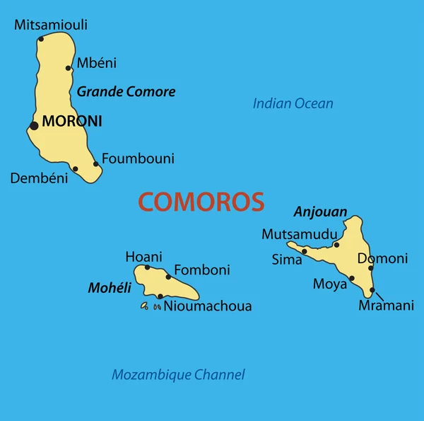
Location Map Of Comoros On Map Africa. 3d Comoros Flag Map Marker Location Pin. High Quality Map Union Of The Comoros. Africa. EPS10.

Vector, 7.73MB, 6960 × 6669 eps
stock vector Waving ribbon or banner with flag of Comoros. Template for poster design

Waving Ribbon Or Banner With Flag Of Comoros. Template For Poster Design

Vector, 2.95MB, 6000 × 4000 eps
stock vector Union of the Comoros - vector map

Union Of The Comoros - Vector Map

Vector, 0.18MB, 4234 × 4203 eps
stock vector Highly detailed physical map of Africa,in vector format,with all the relief forms,countries and big cities.

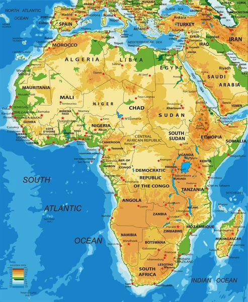
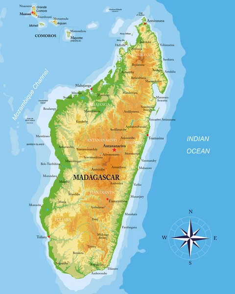
Highly Detailed Physical Map Of Africa,in Vector Format,with All The Relief Forms,countries And Big Cities.

Vector, 5.72MB, 4118 × 5000 eps
stock vector Union of the Comoros location on Africa map

Union Of The Comoros Location On Africa Map

Vector, 5.27MB, 6201 × 7001 eps
stock vector Stamp with map of Comoros

Stamp With Map Of Comoros

Vector, 3.24MB, 5669 × 5669 eps
stock vector Shiny icon in form of Comoros

Shiny Icon In Form Of Comoros

Vector, 1.06MB, 5500 × 5500 eps
stock vector Southern africa - vector maps of territories

Southern Africa - Vector Maps Of Territories

Vector, 0.44MB, 5424 × 4533 eps
stock vector World flag glass icons

World Flag Glass Icons

Vector, 8.51MB, 4167 × 4167 eps
stock vector Comoros

Comoros

Vector, 0.2MB, 2932 × 5101 eps
stock vector east africa map with flags

East Africa Map With Flags

Vector, 1.41MB, 4348 × 4108 eps
stock vector Arab League flag and text illustration

Arab League Flag And Text Illustration

Vector, 6.95MB, 5000 × 3125 eps
stock image Against the background of the flag of Comoros is a passport.

Against The Background Of The Flag Of Comoros Is A Passport.

Image, 12.56MB, 5000 × 3338 jpg
stock vector Madagascar highly detailed physical map

Madagascar Highly Detailed Physical Map

Vector, 9.73MB, 6009 × 7500 eps
stock vector Elongated Hexagon with the Flag of Comoros

Elongated Hexagon With The Flag Of Comoros

Vector, 1.15MB, 3750 × 2500 eps
stock image Comoros flag on the fabric texture

Comoros Flag On The Fabric Texture

Image, 10MB, 5448 × 3065 jpg
stock vector 3d isometric colored map of Comoros with borders of regions

3d Isometric Colored Map Of Comoros With Borders Of Regions

Vector, 2.81MB, 4000 × 4000 eps
stock image Grande Comore Island in the Mozambique Channel on a satellite image taken in June 13, 2023

Grande Comore Island In The Mozambique Channel On A Satellite Image Taken In June 13, 2023

Image, 1.28MB, 2880 × 1620 jpg
stock image Anjouan Island in the Mozambique Channel, belonging to Comoros, isolated on a topographic, OSM Humanitarian style map, with distance scale

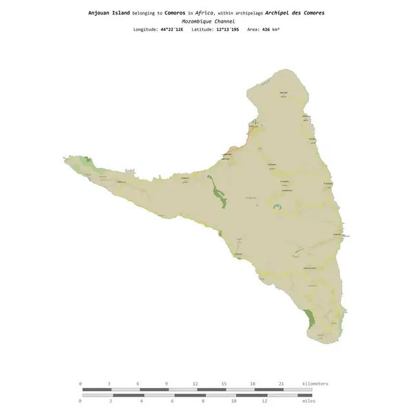
Anjouan Island In The Mozambique Channel, Belonging To Comoros, Isolated On A Topographic, OSM Humanitarian Style Map, With Distance Scale

Image, 0.58MB, 2160 × 2160 jpg
stock image Anjouan Island in the Mozambique Channel on a topographic, OSM Humanitarian style map

Anjouan Island In The Mozambique Channel On A Topographic, OSM Humanitarian Style Map

Image, 0.39MB, 2880 × 1620 jpg
stock image Grande Comore Island in the Mozambique Channel, belonging to Comoros, isolated on a topographic, OSM Humanitarian style map, with distance scale

Grande Comore Island In The Mozambique Channel, Belonging To Comoros, Isolated On A Topographic, OSM Humanitarian Style Map, With Distance Scale

Image, 0.58MB, 2160 × 2160 jpg
stock image Grande Comore Island in the Mozambique Channel, belonging to Comoros, isolated on a bilevel elevation map, with distance scale

Grande Comore Island In The Mozambique Channel, Belonging To Comoros, Isolated On A Bilevel Elevation Map, With Distance Scale

Image, 0.49MB, 2160 × 2160 jpg
stock image Moheli Island in the Mozambique Channel, belonging to Comoros, isolated on a bilevel elevation map, with distance scale

Moheli Island In The Mozambique Channel, Belonging To Comoros, Isolated On A Bilevel Elevation Map, With Distance Scale

Image, 0.45MB, 2160 × 2160 jpg
stock vector Creative Comoros Flag Circle Badge

Creative Comoros Flag Circle Badge

Vector, 2.41MB, 2401 × 2401 eps
stock vector Waving ribbon with flag of Comoros. Template for independence day poster design

Waving Ribbon With Flag Of Comoros. Template For Independence Day Poster Design

Vector, 5.4MB, 6000 × 4000 eps
stock image Anjouan Island in the Mozambique Channel, belonging to Comoros, isolated on a bilevel elevation map, with distance scale

Anjouan Island In The Mozambique Channel, Belonging To Comoros, Isolated On A Bilevel Elevation Map, With Distance Scale

Image, 0.56MB, 2160 × 2160 jpg
stock image Map of Comoros.

Map Of Comoros.

Image, 2.05MB, 4800 × 3600 jpg
stock vector Comoros map icon illustration element design

Comoros Map Icon Illustration Element Design

Vector, 1.17MB, 8333 × 8333 eps
stock image Anjouan Island in the Mozambique Channel on a satellite image taken in September 19, 2018

Anjouan Island In The Mozambique Channel On A Satellite Image Taken In September 19, 2018

Image, 4.08MB, 2880 × 1620 jpg
stock vector Waving ribbon or banner with flag of Comoros. Template for independence day poster design

Waving Ribbon Or Banner With Flag Of Comoros. Template For Independence Day Poster Design

Vector, 3.5MB, 6000 × 4000 eps
stock image Waving Comoros Flag

Waving Comoros Flag

Image, 15.98MB, 5184 × 3456 jpg
stock vector Comoros National Day poster vector illustration. Waving Comoros flag frame vector. Abstract Comoros flag symbol. Template for background, banner, card. July 6 every year. Important day

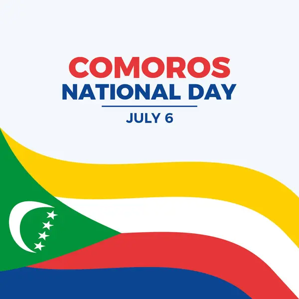
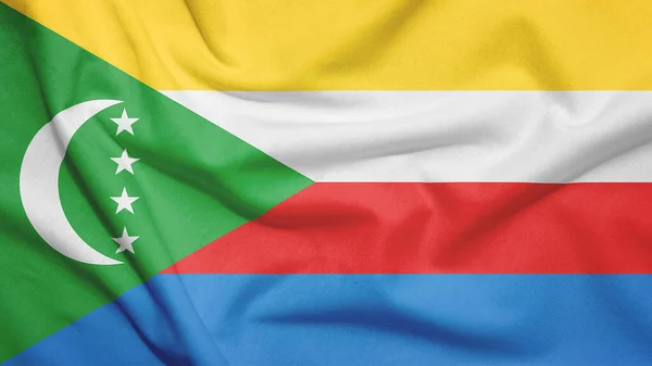
Comoros National Day Poster Vector Illustration. Waving Comoros Flag Frame Vector. Abstract Comoros Flag Symbol. Template For Background, Banner, Card. July 6 Every Year. Important Day

Vector, 5.4MB, 8334 × 8334 eps
stock image Grande Comore Island in the Mozambique Channel, belonging to Comoros, isolated on a satellite image taken in December 28, 2018, with distance scale

Grande Comore Island In The Mozambique Channel, Belonging To Comoros, Isolated On A Satellite Image Taken In December 28, 2018, With Distance Scale

Image, 1.09MB, 2160 × 2160 jpg
stock vector Comoros map icon illustration element design

Comoros Map Icon Illustration Element Design

Vector, 0.95MB, 8333 × 8333 eps
stock image Moheli Island in the Mozambique Channel - belonging to Comoros. Described location diagram with yellow shape of the island and sample maps of its surroundings

Moheli Island In The Mozambique Channel - Belonging To Comoros. Described Location Diagram With Yellow Shape Of The Island And Sample Maps Of Its Surroundings

Image, 1.87MB, 3840 × 2160 jpg
stock image Grande Comore Island in the Mozambique Channel - belonging to Comoros. Described location diagram with yellow shape of the island and sample maps of its surroundings

Grande Comore Island In The Mozambique Channel - Belonging To Comoros. Described Location Diagram With Yellow Shape Of The Island And Sample Maps Of Its Surroundings

Image, 1.54MB, 3840 × 2160 jpg
stock vector Comoros country simplified map.Thin triple pencil sketch outline isolated on white background. Simple vector icon

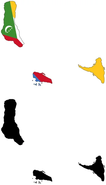
Comoros Country Simplified Map.Thin Triple Pencil Sketch Outline Isolated On White Background. Simple Vector Icon

Vector, 0.25MB, 8000 × 8000 eps
stock vector Comoros map icon illustration element design

Comoros Map Icon Illustration Element Design

Vector, 0.95MB, 8333 × 8333 eps
stock image Grande Comore Island in the Mozambique Channel on a topographic, OSM Humanitarian style map

Grande Comore Island In The Mozambique Channel On A Topographic, OSM Humanitarian Style Map

Image, 0.46MB, 2880 × 1620 jpg
stock image Moheli Island in the Mozambique Channel on a colored elevation map

Moheli Island In The Mozambique Channel On A Colored Elevation Map

Image, 0.94MB, 2880 × 1620 jpg
stock image Anjouan Island in the Mozambique Channel on a colored elevation map

Anjouan Island In The Mozambique Channel On A Colored Elevation Map

Image, 1.15MB, 2880 × 1620 jpg
stock vector Comoros map icon illustration element design

Comoros Map Icon Illustration Element Design

Vector, 0.92MB, 8333 × 8333 eps
stock image Grande Comore Island in the Mozambique Channel on a colored elevation map

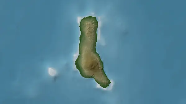
Grande Comore Island In The Mozambique Channel On A Colored Elevation Map

Image, 0.99MB, 2880 × 1620 jpg
stock image Moheli Island in the Mozambique Channel on a satellite image taken in March 6, 2024

Moheli Island In The Mozambique Channel On A Satellite Image Taken In March 6, 2024

Image, 3.46MB, 2880 × 1620 jpg
Page 1 >> Next