
Stock image Connecticut Map
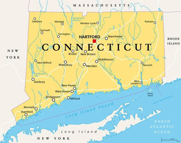
Connecticut, Political Map With Capital Hartford. State Of Connecticut, CT, The Southernmost State In The New England Region Of The Northeastern United States Of America. English. Illustration. Vector
Vector, 3.45MB, 7581 × 6000 eps
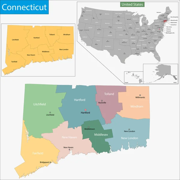

Illustrated Map Of The State Of Connecticut In United States With Cities And Landmarks. Editable Vector Illustration
Vector, 1.04MB, 3000 × 1997 eps
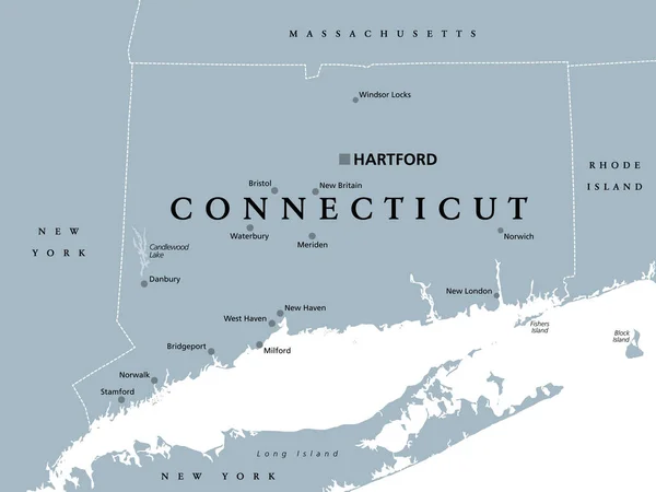
Connecticut, Political Map With Capital Hartford. State Of Connecticut, CT, Southernmost State In New England Region Of Northeastern United States Of America. Gray Illustration, Over White. Vector.
Vector, 2.66MB, 7986 × 6000 eps

Map Of Connecticut, Polygonal Mesh Line Map, Blue Map On Dark Background
Image, 20.92MB, 7500 × 5000 jpg

Massachusetts, Connecticut, Rhode Island Retro State Facts Illustrations
Vector, 2.79MB, 5000 × 5000 eps


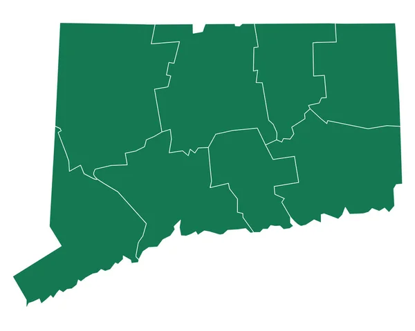
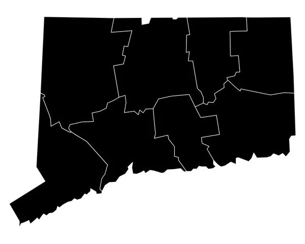
Connecticut, State Of USA - Solid Black Silhouette Map Of Country Area. Simple Flat Vector Illustration
Vector, 0.23MB, 6000 × 6000 eps


Set Of Vector Maps Of Connecticut Vibrant Waves Design Bright Map Of Us State In Geometric Smooth
Vector, 2.2MB, 5121 × 5889 eps


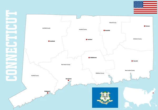
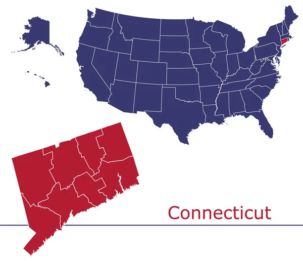
Connecticut Map Blank Vector Map Of The Us State With Counties Borders Of Connecticut For Your
Vector, 0.26MB, 6107 × 4941 eps

Polygonal Mesh Connecticut State Map With Coronavirus Centers. Abstract Network Lines, Triangles And Covid Viruses Form Connecticut State Map.
Vector, 1.14MB, 4788 × 3342 eps

Connecticut Map Poster With Map Of The Us State In Retro Color Palette Shape Of Connecticut With
Vector, 0.25MB, 5528 × 5468 eps

Abstract Image Connecticut Map From Point Blue And Glowing Stars On A Dark Background. Vector Illustration.
Vector, 2.5MB, 6000 × 4000 eps


Connecticut Black Silhouette Vector Map. Editable High Quality Illustration Of The American State Of Connecticut Simple Map
Vector, 0.04MB, 3500 × 3500 eps


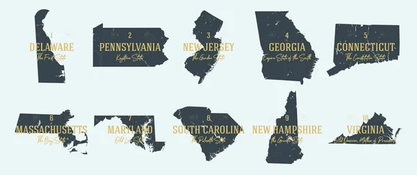
5 Of 50 Sets, US State Posters With Name And Information In 3 Design Styles, Detailed Vector Art Print Connecticut Map
Vector, 1.79MB, 8896 × 4168 eps

Connecticut State Map Vector Silhouette Illustration. United States Of America Flag Over Connecticut Map. USA, American National Symbol Of Pride And Patriotism. Vote Election Campaign Banner.
Vector, 0.38MB, 5234 × 4920 eps

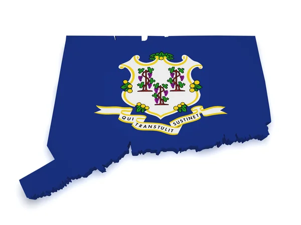
High Detailed Flag Of Connecticut. Connecticut State Flag, National Connecticut Flag. Flag Of State Connecticut. USA. America. 3D Illustration
Image, 8.11MB, 3840 × 2160 jpg

Connecticut Is Magnified Over A World Map, Illustration With Airplane, Passport, Boarding Pass, Compass And Eyeglasses.
Vector, 5.17MB, 8000 × 4000 eps

Connecticut And American Flag Together. High Detailed Waving Flag Of Connecticut And USA. Connecticut State Flag. USA. 3D Illustration.
Image, 7.37MB, 3840 × 2160 jpg

Connecticut And American Flag Together. High Detailed Waving Flag Of Connecticut And USA. Connecticut State Flag. USA. 3D Illustration.
Image, 1.77MB, 3840 × 2160 jpg

Two Versions Of An Connecticut Folded Map, One With A Pinned Country Flag And One With A Flag In The Map Contour. Template For Both Print And Online Design.
Vector, 2.26MB, 6500 × 2500 eps

High Detailed Flag Of Connecticut. Connecticut State Flag, National Connecticut Flag. Flag Of State Connecticut. USA. America. 3D Illustration
Image, 7.46MB, 3840 × 2160 jpg

High Detailed Flag Of Connecticut. Connecticut State Flag, National Connecticut Flag. Flag Of State Connecticut. USA. America. 3D Illustration
Image, 1.17MB, 3840 × 2160 jpg


Connecticut Icon Round Logo With Us State Map And Title Stylish Connecticut Badge With Map Vector
Vector, 0.2MB, 5121 × 5889 eps

Page 1 >> Next