
Stock image Continental Divide Trail page 2

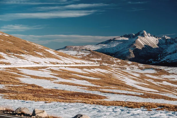
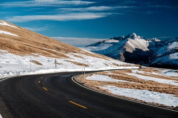
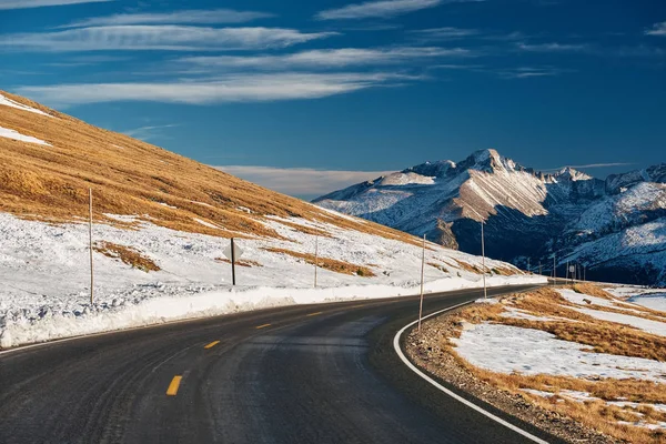
Trail Ridge Road, The Highest (12,183 Feet) Continuous Highway In The USA In High Alpine Tundra With Rocks And Mountains At Autumn. Rocky Mountain National Park In Colorado, USA.
Image, 23.3MB, 6000 × 6000 jpg


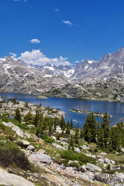
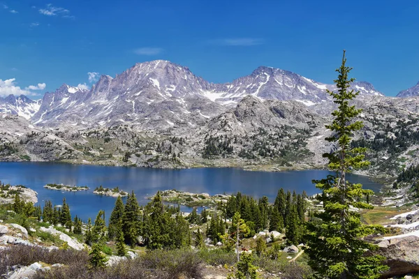
Upper And Lower Jean Lake In The Titcomb Basin Along The Wind River Range, Rocky Mountains, Wyoming, Views From Backpacking Hiking Trail To Titcomb Basin From Elkhart Park Trailhead Going Past Hobbs, Seneca, And Island Lakes As Well As Photographers
Image, 13.64MB, 10568 × 3532 jpg
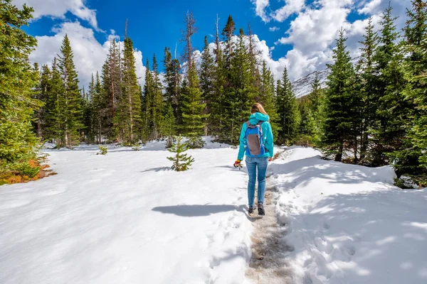
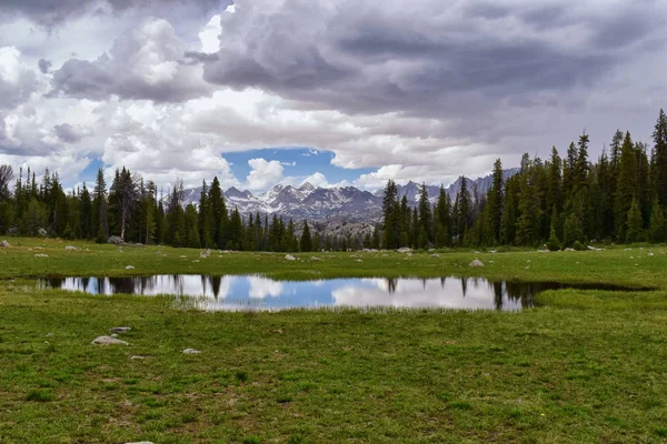
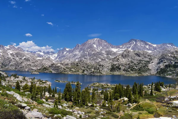
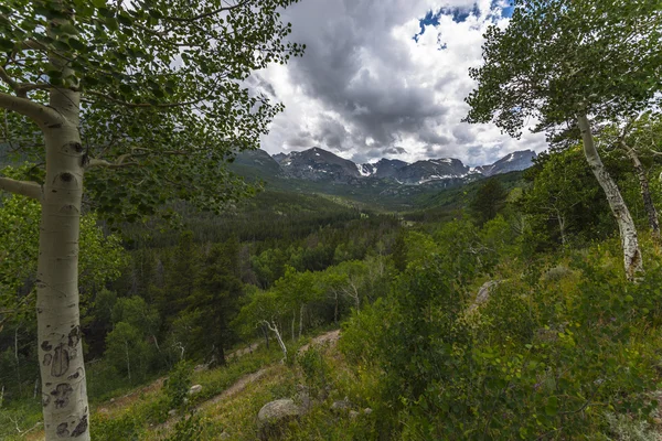
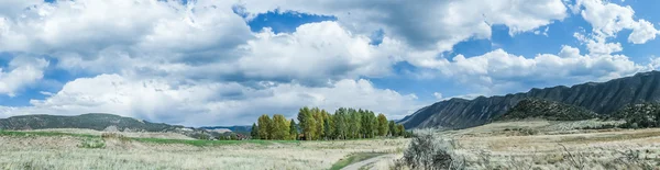
Wind River Range, Rocky Mountains, Wyoming, Views From Backpacking Hiking Trail To Titcomb Basin From Elkhart Park Trailhead Going Past Hobbs, Seneca, Island, Upper And Lower Jean Lakes As Well As Photographers Point.
Image, 13.01MB, 6000 × 4000 jpg

Wind River Range, Rocky Mountains, Wyoming, Views From Backpacking Hiking Trail To Titcomb Basin From Elkhart Park Trailhead Going Past Hobbs, Seneca, Island, Upper And Lower Jean Lakes As Well As Photographers Point.
Image, 12.47MB, 3936 × 5848 jpg

Trail Ridge Road, The Highest (12,183 Feet) Continuous Highway In USA In High Alpine Tundra With Rocks And Mountains In Autumn. Rocky Mountains National Park In Colorado, USA.
Image, 19.24MB, 6000 × 4000 jpg
Trail Ridge Road, The Highest (12,183 Feet) Continuous Highway In USA In High Alpine Tundra With Rocks And Mountains In Autumn. Rocky Mountains National Park In Colorado, USA.
Image, 17.28MB, 6000 × 4000 jpg

Wind River Range, Rocky Mountains, Wyoming, Views From Backpacking Hiking Trail To Titcomb Basin From Elkhart Park Trailhead Going Past Hobbs, Seneca, Island, Upper And Lower Jean Lakes As Well As Photographers Point.
Image, 12.78MB, 11243 × 3932 jpg

Wind River Range, Rocky Mountains, Wyoming, Views From Backpacking Hiking Trail To Titcomb Basin From Elkhart Park Trailhead Going Past Hobbs, Seneca, Island, Upper And Lower Jean Lakes As Well As Photographers Point.
Image, 14.5MB, 6000 × 4000 jpg

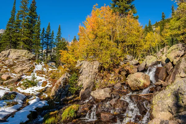
Season Changing, First Snow And Autumn Aspen Trees In Rocky Mountain National Park, Colorado, USA.
Image, 18.14MB, 5000 × 3333 jpg

Continental Divide Trail Sign Post In Wind Rivers Range Wyoming Along Continental Divide Trail No. 094, Fremont Crossing, Seneca Lake, Lester Pass, Island Lake And Indian Lake Which Is Part Of The Rocky Mountains In The United States.Signage, Sign,
Image, 12.99MB, 6000 × 4000 jpg


Wind River Range, Rocky Mountains, Wyoming, Views From Backpacking Hiking Trail To Titcomb Basin From Elkhart Park Trailhead Going Past Hobbs, Seneca, Island, Upper And Lower Jean Lakes As Well As Photographers Point.
Image, 12.91MB, 4000 × 6000 jpg
Trail Ridge Road, The Highest (12,183 Feet) Continuous Highway In USA In High Alpine Tundra With Rocks And Mountains In Autumn. Rocky Mountains National Park In Colorado, USA.
Image, 14.42MB, 6000 × 4000 jpg

Wind River Range, Rocky Mountains, Wyoming, Views From Backpacking Hiking Trail To Titcomb Basin From Elkhart Park Trailhead Going Past Hobbs, Seneca, Island, Upper And Lower Jean Lakes As Well As Photographers Point.
Image, 18.69MB, 28343 × 3577 jpg

Wind River Range, Rocky Mountains, Wyoming, Views From Backpacking Hiking Trail To Titcomb Basin From Elkhart Park Trailhead Going Past Hobbs, Seneca, Island, Upper And Lower Jean Lakes As Well As Photographers Point.
Image, 12.77MB, 6000 × 4000 jpg
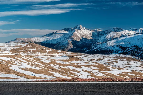
Trail Ridge Road, The Highest (12,183 Feet) Continuous Highway In The USA In High Alpine Tundra With Rocks And Mountains At Autumn. Rocky Mountain National Park In Colorado, USA.
Image, 15.79MB, 5917 × 3945 jpg
Wind River Range, Rocky Mountains, Wyoming, Views From Backpacking Hiking Trail To Titcomb Basin From Elkhart Park Trailhead Going Past Hobbs, Seneca, Island, Upper And Lower Jean Lakes As Well As Photographers Point.
Image, 12.04MB, 6000 × 4000 jpg
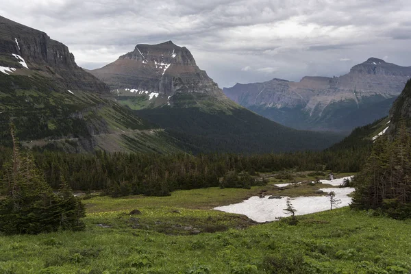
Scenic View Of Mountain Range Against Cloudy Sky, Logan Pass, Glacier National Park, Glacier County, Montana, USA
Image, 20.11MB, 7360 × 4912 jpg

Dream Lake In Rocky Mountain National Park, Colorado. Mountain And Lake Nature Landscape
Image, 21.5MB, 5184 × 3456 jpg
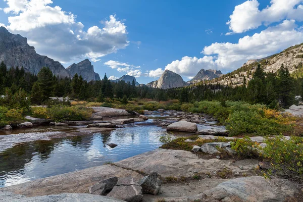
The East Fork River In The Wind River Range Of Wyoming. Left To Right, Ambush Peak, Raid Peak And Midsummer Dome Are Seen To The North.
Image, 11.69MB, 5494 × 3663 jpg

Island Lake In The Wind River Range, Rocky Mountains, Wyoming, Views From Backpacking Hiking Trail To Titcomb Basin From Elkhart Park Trailhead Going Past Hobbs, Seneca, Upper And Lower Jean Lakes As Well As Photographers Point.
Image, 14.5MB, 9067 × 3940 jpg

Wind River Range, Rocky Mountains, Wyoming, Views From Backpacking Hiking Trail To Titcomb Basin From Elkhart Park Trailhead Going Past Hobbs, Seneca, Island, Upper And Lower Jean Lakes As Well As Photographers Point.
Image, 11.53MB, 8363 × 3615 jpg
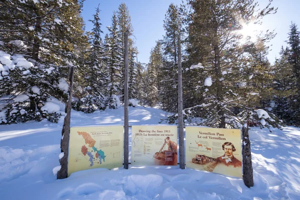
Continental Divide On Border Of Banff And Kootenay National Parks, Vermilion Pass, Alberta, British Columbia, Canada
Image, 16.5MB, 6000 × 4000 jpg

Wind River Range, Rocky Mountains, Wyoming, Views From Backpacking Hiking Trail To Titcomb Basin From Elkhart Park Trailhead Going Past Hobbs, Seneca, Island, Upper And Lower Jean Lakes As Well As Photographers Point.
Image, 12.37MB, 9418 × 3981 jpg
Wind River Range, Rocky Mountains, Wyoming, Views From Backpacking Hiking Trail To Titcomb Basin From Elkhart Park Trailhead Going Past Hobbs, Seneca, Island, Upper And Lower Jean Lakes As Well As Photographers Point.
Image, 12.86MB, 4000 × 6000 jpg

Seneca Lake In The Wind River Range, Rocky Mountains, Wyoming, Views From Backpacking Hiking Trail To Titcomb Basin From Elkhart Park Trailhead Going Past Hobbs, Island, Upper And Lower Jean Lakes As Well As Photographers Point.
Image, 11.38MB, 5271 × 16360 jpg
Wind River Range, Rocky Mountains, Wyoming, Views From Backpacking Hiking Trail To Titcomb Basin From Elkhart Park Trailhead Going Past Hobbs, Seneca, Island, Upper And Lower Jean Lakes As Well As Photographers Point.
Image, 12.74MB, 6000 × 4000 jpg

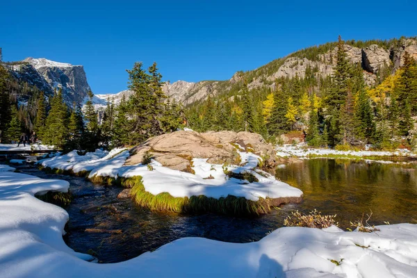
View On Hallett Peak And Flattop Mountain In Snow At Autumn. Trail To Emerald Lake. Rocky Mountain National Park In Colorado, USA.
Image, 15.28MB, 5000 × 4738 jpg

Seneca Lake In The Wind River Range, Rocky Mountains, Wyoming, Views From Backpacking Hiking Trail To Titcomb Basin From Elkhart Park Trailhead Going Past Hobbs, Island, Upper And Lower Jean Lakes As Well As Photographers Point.
Image, 11.72MB, 8476 × 11919 jpg

Wind River Range, Rocky Mountains, Wyoming, Views From Backpacking Hiking Trail To Titcomb Basin From Elkhart Park Trailhead Going Past Hobbs, Seneca, Island, Upper And Lower Jean Lakes As Well As Photographers Point.
Image, 14.24MB, 6000 × 4000 jpg

Island Lake In The Wind River Range, Rocky Mountains, Wyoming, Views From Backpacking Hiking Trail To Titcomb Basin From Elkhart Park Trailhead Going Past Hobbs, Seneca, Upper And Lower Jean Lakes As Well As Photographers Point.
Image, 13.66MB, 10982 × 3956 jpg


Water Falling From Rocks In A Forest, St Mary Falls, Glacier National Park, Glacier County, Montana, USA
Image, 14.51MB, 6868 × 4584 jpg
Island Lake In The Wind River Range, Rocky Mountains, Wyoming, Views From Backpacking Hiking Trail To Titcomb Basin From Elkhart Park Trailhead Going Past Hobbs, Seneca, Upper And Lower Jean Lakes As Well As Photographers Point.
Image, 13.39MB, 6000 × 4000 jpg


Previous << Page 2 >> Next