photo free
Home Images Vectors Videos

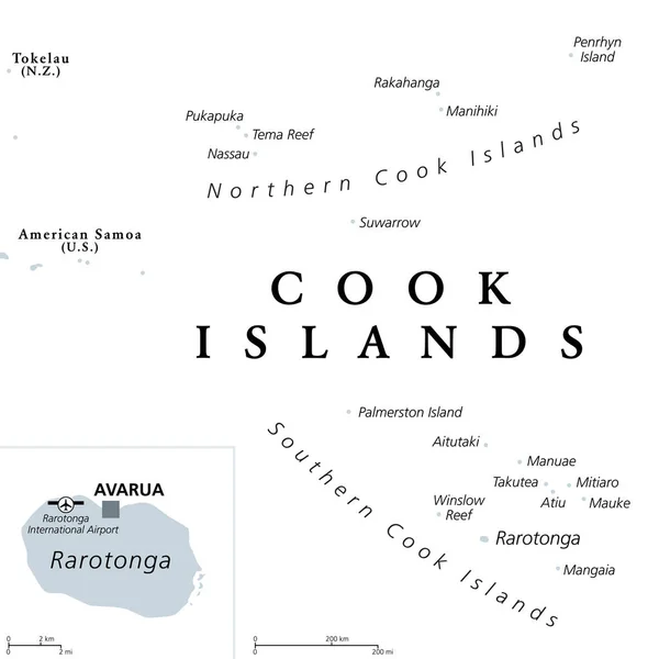
Stock image Cook Islands Map

stock vector Cook Islands political map with capital Avarua. Self-governing island country in South Pacific Ocean in free association with New Zealand, comprising 15 islands. English labeling. Illustration. Vector

Cook Islands Political Map With Capital Avarua. Self-governing Island Country In South Pacific Ocean In Free Association With New Zealand, Comprising 15 Islands. English Labeling. Illustration. Vector

Vector, 1.66MB, 6000 × 6000 eps
stock vector Cook Islands, gray political map with capital Avarua. Self-governing island country in South Pacific Ocean in free association with New Zealand, comprising 15 islands. English. Illustration. Vector.

Cook Islands, Gray Political Map With Capital Avarua. Self-governing Island Country In South Pacific Ocean In Free Association With New Zealand, Comprising 15 Islands. English. Illustration. Vector.

Vector, 1.57MB, 6000 × 6000 eps
stock vector Pinned countries flags on map of Oceania

Pinned Countries Flags On Map Of Oceania

Vector, 0.53MB, 5156 × 2950 ai
stock vector OCEANI Countries - Part Three

OCEANI Countries - Part Three

Vector, 2.34MB, 5512 × 5512 eps
stock vector Marker from paper with flag for map - set sixteen

Marker From Paper With Flag For Map - Set Sixteen

Vector, 0.95MB, 5000 × 5000 eps
stock vector Asian, Australia and Oceania countries maps

Asian, Australia And Oceania Countries Maps

Vector, 13.28MB, 7292 × 7292 eps
stock vector OCEANI Countries - Part Two

OCEANI Countries - Part Two

Vector, 2.39MB, 5512 × 5512 eps
stock vector Map marker with flag-set sixteen

Map Marker With Flag-set Sixteen

Vector, 7.31MB, 5000 × 5000 eps
stock vector Oceania flags collection. Big set of blue pin icon with flags.

Oceania Flags Collection. Big Set Of Blue Pin Icon With Flags.

Vector, 1.16MB, 8000 × 4000 eps
stock vector Polynesia, subregion of Oceania, political map.  A region, made up of more than 1000 islands scattered over the central and southern Pacific Ocean. English. Illustration on white background. Vector.

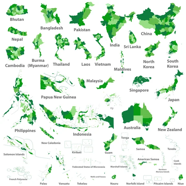
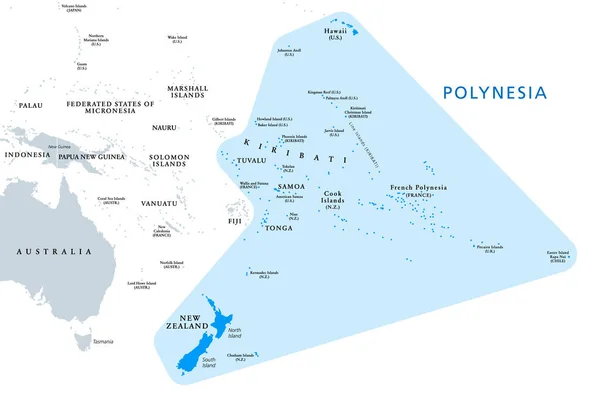
Polynesia, Subregion Of Oceania, Political Map. A Region, Made Up Of More Than 1000 Islands Scattered Over The Central And Southern Pacific Ocean. English. Illustration On White Background. Vector.

Vector, 3.07MB, 9000 × 5999 eps
stock vector national flags of the world

National Flags Of The World

Vector, 1.75MB, 7000 × 4666 eps
stock vector Flag of Cook Islands from brush strokes. Flag Cook Islands on transparent background for your web site design, app, UI.  Oceania. New Zealand. Stock vector.  EPS10.

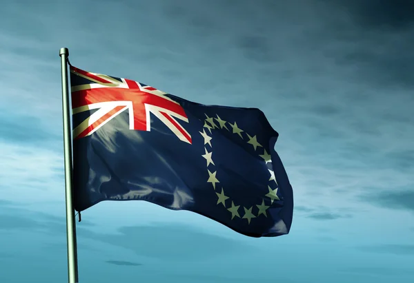
Flag Of Cook Islands From Brush Strokes. Flag Cook Islands On Transparent Background For Your Web Site Design, App, UI. Oceania. New Zealand. Stock Vector. EPS10.

Vector, 7.21MB, 5000 × 5000 eps
stock image Enuamanu Island in the South Pacific Ocean on a topographic, OSM Humanitarian style map

Enuamanu Island In The South Pacific Ocean On A Topographic, OSM Humanitarian Style Map

Image, 0.38MB, 2880 × 1620 jpg
stock image Rarotonga Island in the South Pacific Ocean on a satellite image taken in May 31, 2021

Rarotonga Island In The South Pacific Ocean On A Satellite Image Taken In May 31, 2021

Image, 4.16MB, 2880 × 1620 jpg
stock vector Locator map showing the location of the country Cook Islands in Oceania. The country is highlighted with a red polygon. No labels at all. Made with Natural Earth.

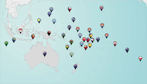
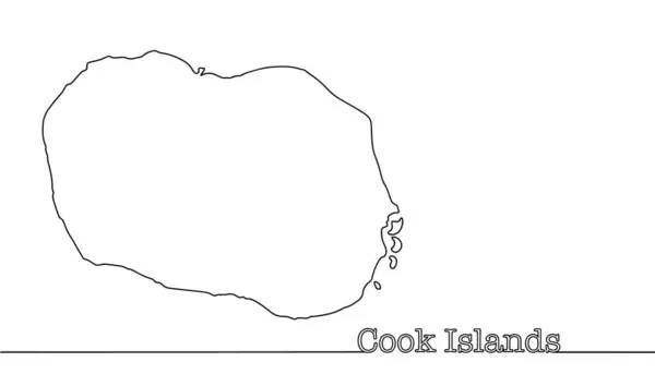
Locator Map Showing The Location Of The Country Cook Islands In Oceania. The Country Is Highlighted With A Red Polygon. No Labels At All. Made With Natural Earth.

Vector, 2.83MB, 5887 × 3537 eps
stock image Rarotonga Island in the South Pacific Ocean, belonging to Cook Islands, isolated on a topographic, OSM Humanitarian style map, with distance scale

Rarotonga Island In The South Pacific Ocean, Belonging To Cook Islands, Isolated On A Topographic, OSM Humanitarian Style Map, With Distance Scale

Image, 1.28MB, 2160 × 2160 jpg
stock image Rarotonga Island in the South Pacific Ocean - belonging to Cook Islands. Described location diagram with yellow shape of the island and sample maps of its surroundings

Rarotonga Island In The South Pacific Ocean - Belonging To Cook Islands. Described Location Diagram With Yellow Shape Of The Island And Sample Maps Of Its Surroundings

Image, 2.11MB, 3840 × 2160 jpg
stock image Enuamanu Island in the South Pacific Ocean, belonging to Cook Islands, isolated on a topographic, OSM Humanitarian style map, with distance scale

Enuamanu Island In The South Pacific Ocean, Belonging To Cook Islands, Isolated On A Topographic, OSM Humanitarian Style Map, With Distance Scale

Image, 0.6MB, 2160 × 2160 jpg
stock image Enuamanu Island in the South Pacific Ocean - belonging to Cook Islands. Described location diagram with yellow shape of the island and sample maps of its surroundings

Enuamanu Island In The South Pacific Ocean - Belonging To Cook Islands. Described Location Diagram With Yellow Shape Of The Island And Sample Maps Of Its Surroundings

Image, 1.59MB, 3840 × 2160 jpg
stock image Enuamanu Island in the South Pacific Ocean, belonging to Cook Islands, isolated on a satellite image taken in June 30, 2023, with distance scale

Enuamanu Island In The South Pacific Ocean, Belonging To Cook Islands, Isolated On A Satellite Image Taken In June 30, 2023, With Distance Scale

Image, 2.24MB, 2160 × 2160 jpg
stock image Rarotonga Island in the South Pacific Ocean on a topographic, OSM Humanitarian style map

Rarotonga Island In The South Pacific Ocean On A Topographic, OSM Humanitarian Style Map

Image, 0.9MB, 2880 × 1620 jpg
stock image Rarotonga Island in the South Pacific Ocean on a colored elevation map

Rarotonga Island In The South Pacific Ocean On A Colored Elevation Map

Image, 1.06MB, 2880 × 1620 jpg
stock image Rarotonga Island in the South Pacific Ocean, belonging to Cook Islands, isolated on a satellite image taken in August 4, 2021, with distance scale

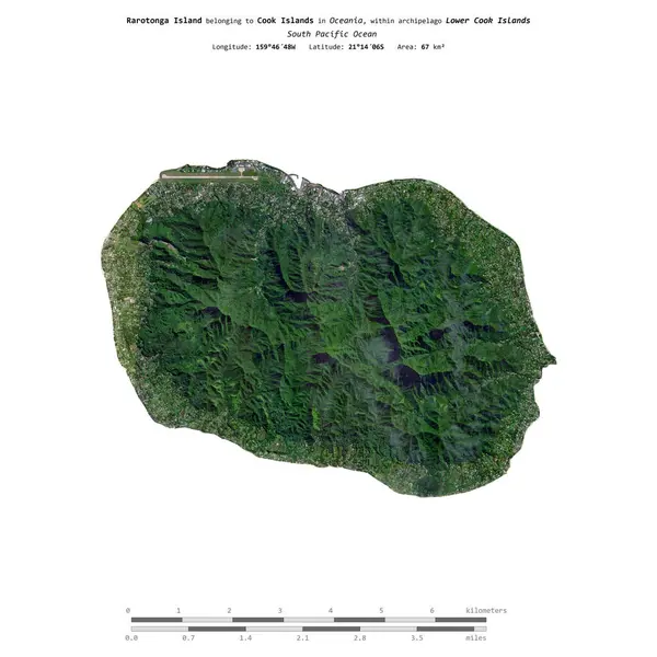
Rarotonga Island In The South Pacific Ocean, Belonging To Cook Islands, Isolated On A Satellite Image Taken In August 4, 2021, With Distance Scale

Image, 2.25MB, 2160 × 2160 jpg
stock image Rarotonga Island in the South Pacific Ocean, belonging to Cook Islands, isolated on a bilevel elevation map, with distance scale

Rarotonga Island In The South Pacific Ocean, Belonging To Cook Islands, Isolated On A Bilevel Elevation Map, With Distance Scale

Image, 0.36MB, 2160 × 2160 jpg
stock image Enuamanu Island in the South Pacific Ocean on a satellite image taken in August 24, 2023

Enuamanu Island In The South Pacific Ocean On A Satellite Image Taken In August 24, 2023

Image, 4.18MB, 2880 × 1620 jpg
stock vector Tonga map

Tonga Map

Vector, 0.84MB, 6040 × 6367 eps
stock vector Hawaii Islands Political Map

Hawaii Islands Political Map

Vector, 0.67MB, 9000 × 5868 eps
stock vector Aitutaki geometric map. Stencil shape of Aitutaki in low poly style. Authentic island vector illustration.

Aitutaki Geometric Map. Stencil Shape Of Aitutaki In Low Poly Style. Authentic Island Vector Illustration.

Vector, 0.88MB, 4845 × 6233 eps
stock image Young woman traveling by convertible car in a Pacific Island

Young Woman Traveling By Convertible Car In A Pacific Island

Image, 13.52MB, 4928 × 3264 jpg
stock vector Rarotonga round logo Vintage travel badge with the circular name and map of island vector

Rarotonga Round Logo Vintage Travel Badge With The Circular Name And Map Of Island Vector

Vector, 0.25MB, 5488 × 5488 eps
stock image Cook Islands flag waving on the wind

Cook Islands Flag Waving On The Wind

Image, 6.7MB, 5052 × 3465 jpg
stock vector Cook Islands country big text with flag inside map suitable for a logo icon design

Cook Islands Country Big Text With Flag Inside Map Suitable For A Logo Icon Design

Vector, 3.44MB, 5793 × 3720 eps
stock vector Rarotonga map stamp Retro distressed insignia Hipster round badge with text banner Island vector

Rarotonga Map Stamp Retro Distressed Insignia Hipster Round Badge With Text Banner Island Vector

Vector, 6.4MB, 8333 × 8333 eps
stock vector Aitutaki vector map Grunge rubber stamp with the name and map of island vector illustration Can

Aitutaki Vector Map Grunge Rubber Stamp With The Name And Map Of Island Vector Illustration Can

Vector, 3.3MB, 8350 × 8350 eps
stock vector Aitutaki flag badge Vintage travel stamp with circular text stars and island flag inside it

Aitutaki Flag Badge Vintage Travel Stamp With Circular Text Stars And Island Flag Inside It

Vector, 6.08MB, 8333 × 8333 eps
stock vector Hand drawn map of the Cook Islands. A self-governing territory in free association with New Zealand. Vector illustration.

Hand Drawn Map Of The Cook Islands. A Self-governing Territory In Free Association With New Zealand. Vector Illustration.

Vector, 0.29MB, 5705 × 3265 eps
stock vector Heart shaped national flags set vector illustration design. country flags collection.

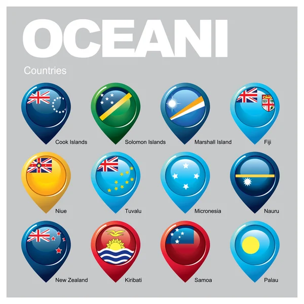
Heart Shaped National Flags Set Vector Illustration Design. Country Flags Collection.

Vector, 5.5MB, 8000 × 4500 eps
Page 1 >> Next