
Stock image Coquihalla Highway
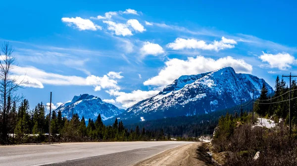
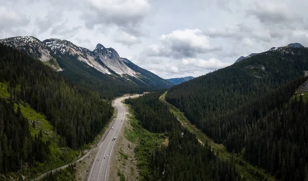
The Summit Of The Four Lane Coquihalla Highway Between Hope And Merritt, As It Winds Through The Coast Mountains In British Columbia, Canada
Image, 9.18MB, 5281 × 2971 jpg
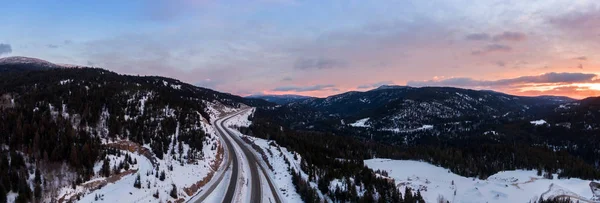
Aerial Panoramic View Of A Scenic Highway Passing In The Canadian Mountain Landscape During A Colorful Winter Sunrise. Taken Near Hope And Merritt, British Columbia, Canada.
Image, 10.34MB, 8536 × 2895 jpg

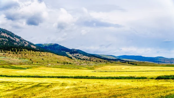
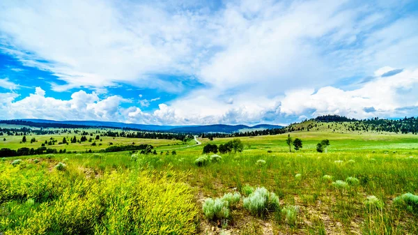
Ranch Land In The Nicola Valley Along Highway 5A Between Merritt And Kamloops, British Columbia, Canada
Image, 19.71MB, 5895 × 3316 jpg
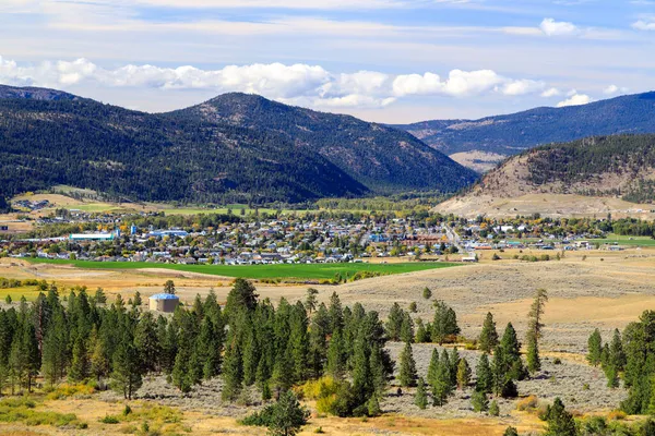
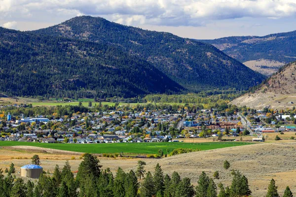
Merritt Is A City In The Nicola Valley Of The South-central Interior Of British Columbia, Canada.
Image, 19.13MB, 5775 × 3850 jpg
Ranch Land In The Nicola Valley Along Highway 5A Between Merritt And Kamloops, British Columbia, Canada
Image, 16.73MB, 6000 × 3375 jpg
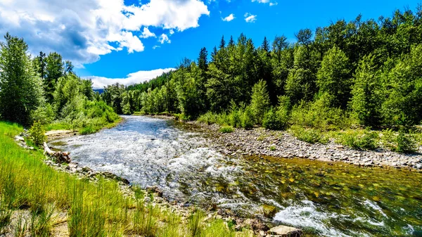
The Fast Flowing Water Of The Coldwater River Near The Intersection Between The Coldwater Road And The Coquihalla Highway Between Hope And Merritt In British Columbia, Canada
Image, 17.44MB, 6000 × 3375 jpg
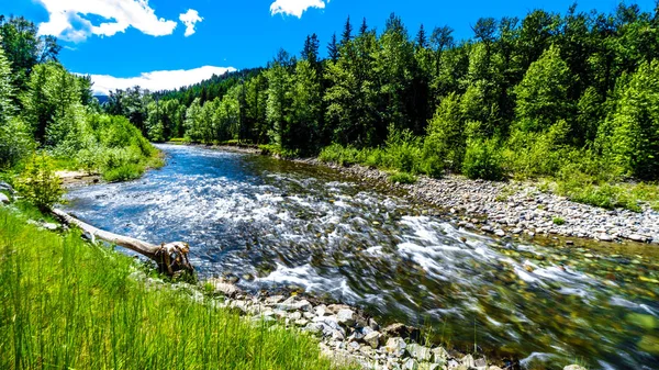
The Fast Flowing Water Of The Coldwater River Near The Intersection Between The Coldwater Road And The Coquihalla Highway Between Hope And Merritt In British Columbia, Canada
Image, 18.25MB, 6000 × 3375 jpg
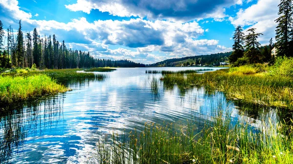
Sky Reflecting In Lac Le Jeune - West Lake Near Kamloops, British Columbia, Canada
Image, 22.76MB, 6000 × 3375 jpg
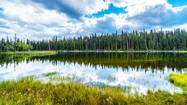
Dawn Glow Pond Along The Meadow Creek Road Near Lac Le Jeune Near Kamloops, British Columbia, Canada
Image, 18.59MB, 6000 × 3375 jpg
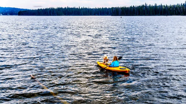
Dog Sitting On The Front Of A Kayak Steered By A Woman On Lac Le Jeune Lake Near Kamloops In British Columbia, Canada
Image, 15.79MB, 5584 × 3141 jpg
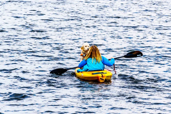
Dog Sitting On The Front Of A Kayak Steered By A Woman On Lac Le Jeune Lake Near Kamloops In British Columbia, Canada
Image, 12.29MB, 5450 × 3633 jpg
Merritt Is A City In The Nicola Valley Of The South-central Interior Of British Columbia, Canada.
Image, 19.52MB, 5775 × 3850 jpg
Aerial View Of The Scenic Route Passing In The Valley Between The Mountains. Taken In Coquihalla Hwy Northeast From Hope, British Columbia, Canada.
Image, 5.11MB, 4231 × 2485 jpg

Dark Clouds Hanging Over The Fertile Farmland And Rolling Hills Along Highway 5A Near Nicola Lake, Between Kamloops And Merritt In The Okanagen Region Of British Columbia, Canada
Image, 15.5MB, 5961 × 3353 jpg

Avalanche Area Sign On Trans-Canada Highway In British Columbia Near Kamloops. "You Are In Avalanche Country" Sign With Mountains In The Background.
Image, 13.38MB, 5871 × 3766 jpg

Tin Roofed Barns In The Wide Open Grass Lands Of The Nicola Valley, Along Highway 5A Between Merritt And Kamloops, British Columbia, Canada, Under Dark Threatening Sky
Image, 13.81MB, 5596 × 3148 jpg
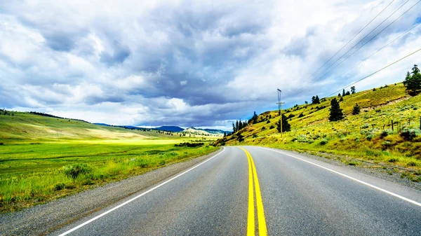
Highway 5A Winding Through The Wide Open Grass Lands Of The Nicola Valley, Between Merritt And Kamloops, British Columbia, Canada, Under Partly Cloudy Sky
Image, 17.89MB, 5973 × 3360 jpg
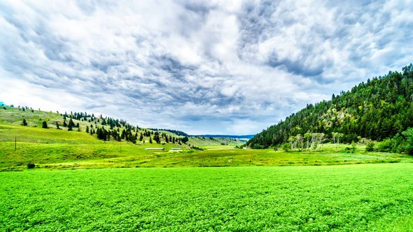
The Fertile Farmland Among The Rolling Hills Along Highway 5A Between Kamloops And Merritt In The Okanagen Region Of British Columbia, Canada
Image, 20.15MB, 6000 × 3375 jpg

Aerial Panoramic View Of A Scenic Highway Passing In The Canadian Landscape
Image, 13.73MB, 8758 × 4000 jpg

Dark Clouds Hanging Over The Fertile Farmland And Rolling Hills Along Highway 5A Near Nicola Lake, Between Kamloops And Merritt In The Okanagen Region Of British Columbia, Canada
Image, 16.92MB, 6000 × 3375 jpg

Dark Clouds Hanging Over Lodgepole Pine Trees On The Rolling Hills In A Dry Region Of The Okanagen Along Highway 5A Between Kamloops And Merritt In British Columbia, Canada
Image, 15.58MB, 5995 × 3372 jpg
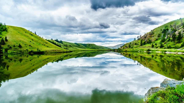
Dark Clouds And Surrounding Mountains Reflecting On The Smooth Water Surface Of Trapp Lake, Located Along Highway 5A Between Kamloops And Merritt In British Columbia, Canada
Image, 16.44MB, 6000 × 3375 jpg

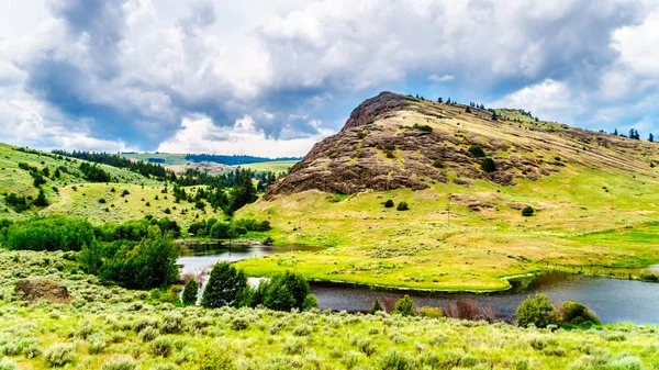
Rocky Mountain Among The Rolling Hills In The Nicola Valley Along Highway 5A Between Merritt And Kamloops, British Columbia, Canada Under Dark Cloudy Skies
Image, 15.48MB, 6000 × 3375 jpg
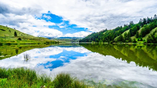
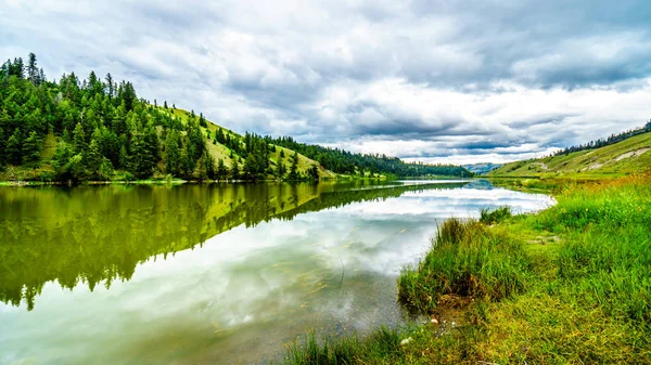
Blue Sky, Clouds And Surrounding Mountains Reflecting On The Smooth Water Surface Of Trapp Lake, Located Along Highway 5A Between Kamloops And Merritt In British Columbia, Canada
Image, 14.21MB, 5966 × 3356 jpg
Dark Clouds And Surrounding Mountains Reflecting On The Smooth Water Surface Of Trapp Lake, Located Along Highway 5A Between Kamloops And Merritt In British Columbia, Canada
Image, 14.13MB, 6000 × 3375 jpg
Rocky Mountain Among The Rolling Hills In The Nicola Valley Along Highway 5A Between Merritt And Kamloops, British Columbia, Canada Under Dark Cloudy Skies
Image, 17.78MB, 6000 × 3375 jpg
Page 1 >> Next