
Stock image Deboyne

Panaeati Island In The Solomon Sea, Belonging To Papua New Guinea, Isolated On A Topographic, OSM Humanitarian Style Map, With Distance Scale
Image, 0.26MB, 2160 × 2160 jpg
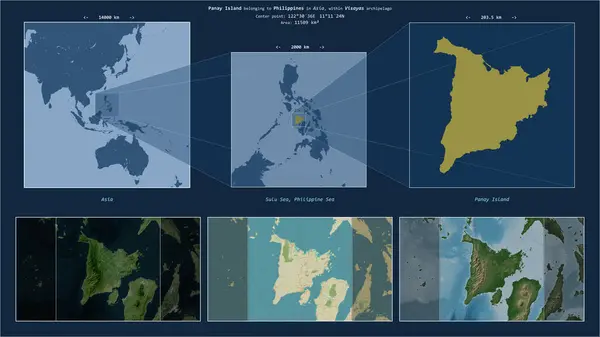
Panay Island In The Sulu Sea - Belonging To Philippines. Described Location Diagram With Yellow Shape Of The Island And Sample Maps Of Its Surroundings
Image, 2.85MB, 3840 × 2160 jpg

Panay Island In The Sulu Sea, Belonging To Philippines, Isolated On A Bilevel Elevation Map, With Distance Scale
Image, 0.85MB, 2160 × 2160 jpg


Panay Island In The Sulu Sea, Belonging To Philippines, Isolated On A Topographic, OSM Humanitarian Style Map, With Distance Scale
Image, 1.52MB, 2160 × 2160 jpg

Panaeati Island In The Solomon Sea On A Topographic, OSM Humanitarian Style Map
Image, 0.16MB, 2880 × 1620 jpg

Panaon Island In The Philippine Sea, Belonging To Philippines, Isolated On A Topographic, OSM Humanitarian Style Map, With Distance Scale
Image, 0.45MB, 2160 × 2160 jpg

Pulau Panaitan In The Java Sea, Belonging To Indonesia, Isolated On A Topographic, OSM Humanitarian Style Map, With Distance Scale
Image, 0.34MB, 2160 × 2160 jpg

Panaeati Island In The Solomon Sea, Belonging To Papua New Guinea, Isolated On A Bilevel Elevation Map, With Distance Scale
Image, 0.29MB, 2160 × 2160 jpg
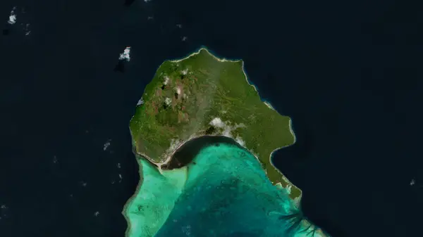
Panaeati Island In The Solomon Sea On A Satellite Image Taken In June 12, 2019
Image, 4.12MB, 2880 × 1620 jpg

Panaon Island In The Philippine Sea, Belonging To Philippines, Isolated On A Bilevel Elevation Map, With Distance Scale
Image, 0.42MB, 2160 × 2160 jpg

Panaeati Island In The Solomon Sea, Belonging To Papua New Guinea, Isolated On A Satellite Image Taken In August 31, 2019, With Distance Scale
Image, 1.84MB, 2160 × 2160 jpg

Panaeati Island In The Solomon Sea - Belonging To Papua New Guinea. Described Location Diagram With Yellow Shape Of The Island And Sample Maps Of Its Surroundings
Image, 1.9MB, 3840 × 2160 jpg

Pulau Panaitan In The Java Sea, Belonging To Indonesia, Isolated On A Bilevel Elevation Map, With Distance Scale
Image, 0.42MB, 2160 × 2160 jpg
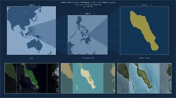
Panaon Island In The Philippine Sea - Belonging To Philippines. Described Location Diagram With Yellow Shape Of The Island And Sample Maps Of Its Surroundings
Image, 2.29MB, 3840 × 2160 jpg
Page 1 >> Next