photo free
Home Images Vectors Videos

Stock image Drone Boston

stock image Boston at night view

Boston At Night View

Image, 8.07MB, 4200 × 2798 jpg
stock image Downtown Boston at night

Downtown Boston At Night

Image, 7.58MB, 4000 × 2665 jpg
stock image  Fenway Park view

Fenway Park View

Image, 8.24MB, 4200 × 2798 jpg
stock image Billerica town common and Boston Road aerial view in summer in historic town center of Billerica, Massachusetts MA, USA.

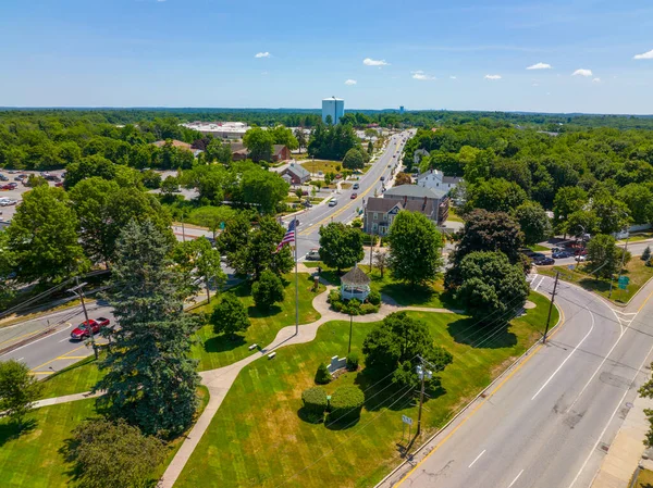
Billerica Town Common And Boston Road Aerial View In Summer In Historic Town Center Of Billerica, Massachusetts MA, USA.

Image, 15.73MB, 5280 × 3956 jpg
stock image Boston Back Bay modern city skyline including John Hancock Tower, Prudential Tower, and Four Season Hotel at One Dalton Street in Boston, Massachusetts MA, USA.

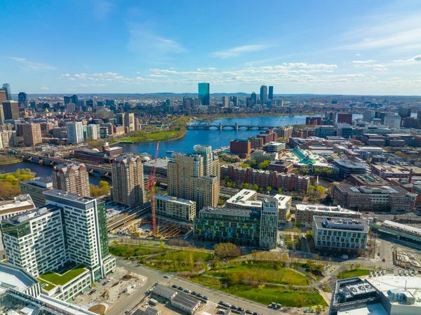
Boston Back Bay Modern City Skyline Including John Hancock Tower, Prudential Tower, And Four Season Hotel At One Dalton Street In Boston, Massachusetts MA, USA.

Image, 14.34MB, 5280 × 3956 jpg
stock image Waltham historic city center aerial view with Boston city skyline at the background, Waltham, Massachusetts MA, USA.

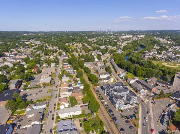
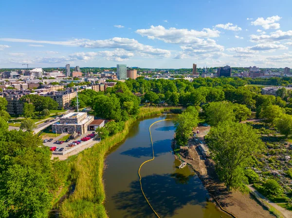
Waltham Historic City Center Aerial View With Boston City Skyline At The Background, Waltham, Massachusetts MA, USA.

Image, 8.7MB, 3992 × 2992 jpg
stock image Hingham Harbor panorama aerial view in Hingham near Boston, Massachusetts MA, USA.

Hingham Harbor Panorama Aerial View In Hingham Near Boston, Massachusetts MA, USA.

Image, 10.63MB, 7530 × 2400 jpg
stock image Wayland historic town center aerial view in summer at Boston Post Road and MA Route 27, including First Parish Church and Town Hall, Wayland, Massachusetts MA, USA.

Wayland Historic Town Center Aerial View In Summer At Boston Post Road And MA Route 27, Including First Parish Church And Town Hall, Wayland, Massachusetts MA, USA.

Image, 8.49MB, 3992 × 2992 jpg
stock image Boston, Massachusetts Skyline from above by Drone during Summer Time

Boston, Massachusetts Skyline From Above By Drone During Summer Time

Image, 5.81MB, 4862 × 3646 jpg
stock image Arlington historic town center aerial view on Massachusetts Avenue at Mystic Street and Broadway with Boston at the background, Arlington, Massachusetts MA, USA.

Arlington Historic Town Center Aerial View On Massachusetts Avenue At Mystic Street And Broadway With Boston At The Background, Arlington, Massachusetts MA, USA.

Image, 8.8MB, 3992 × 2992 jpg
stock image Arlington Heights suburban landscape aerial view in spring in historic town of Arlington, Massachusetts MA, USA.

Arlington Heights Suburban Landscape Aerial View In Spring In Historic Town Of Arlington, Massachusetts MA, USA.

Image, 15.67MB, 5280 × 3956 jpg
stock image Hingham Harbor panorama aerial view in Hingham near Boston, Massachusetts MA, USA.

Hingham Harbor Panorama Aerial View In Hingham Near Boston, Massachusetts MA, USA.

Image, 10.57MB, 7127 × 2400 jpg
stock image  Harvard University view

Harvard University View

Image, 8.47MB, 4200 × 2798 jpg
stock image Boston Common USA

Boston Common USA

Image, 7.92MB, 4200 × 2798 jpg
stock image Boston Common park aerial image

Boston Common Park Aerial Image

Image, 9.04MB, 4200 × 2798 jpg
stock image Boston Massachusetts USA

Boston Massachusetts USA

Image, 8.5MB, 4200 × 2798 jpg
stock image Aerial view of Amtrak Downeaster line between Boston Massachusetts and Brunswick Maine in Lawrence train station, Lawrence, Massachusetts MA, USA.

Aerial View Of Amtrak Downeaster Line Between Boston Massachusetts And Brunswick Maine In Lawrence Train Station, Lawrence, Massachusetts MA, USA.

Image, 8.11MB, 3992 × 2992 jpg
stock image Boston, Massachusetts Skyline from above by Drone during Summer Time

Boston, Massachusetts Skyline From Above By Drone During Summer Time

Image, 6.71MB, 4790 × 3592 jpg
stock image Cambridge Harvard University

Cambridge Harvard University

Image, 8.41MB, 4200 × 2798 jpg
stock image Waltham city center at Main Street near Waltham city hall aerial view in downtown Waltham, Massachusetts, MA, USA.

Waltham City Center At Main Street Near Waltham City Hall Aerial View In Downtown Waltham, Massachusetts, MA, USA.

Image, 8.05MB, 3992 × 2992 jpg
stock image Waltham city center at Main Street near Waltham city hall aerial view in downtown Waltham, Massachusetts, MA, USA.

Waltham City Center At Main Street Near Waltham City Hall Aerial View In Downtown Waltham, Massachusetts, MA, USA.

Image, 8.84MB, 3992 × 2992 jpg
stock image Boston Charles River and Back Bay skyline including John Hancock Tower, Prudential Center and One Dalton Street building, Boston, Massachusetts MA, USA.

Boston Charles River And Back Bay Skyline Including John Hancock Tower, Prudential Center And One Dalton Street Building, Boston, Massachusetts MA, USA.

Image, 14.55MB, 5280 × 3956 jpg
stock image Malden city aerial view on Centre Street in downtown Malden, Massachusetts MA, USA.

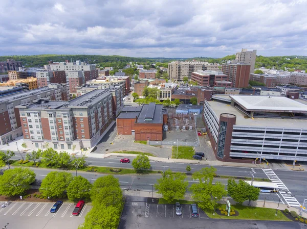
Malden City Aerial View On Centre Street In Downtown Malden, Massachusetts MA, USA.

Image, 7.99MB, 3992 × 2992 jpg
stock image Longfellow Bridge aerial view that connects city of Boston (left) and Cambridge (right) over Charles River, Boston, Massachusetts MA, USA. The bridge is a steel rib arch bridge built in 1906.

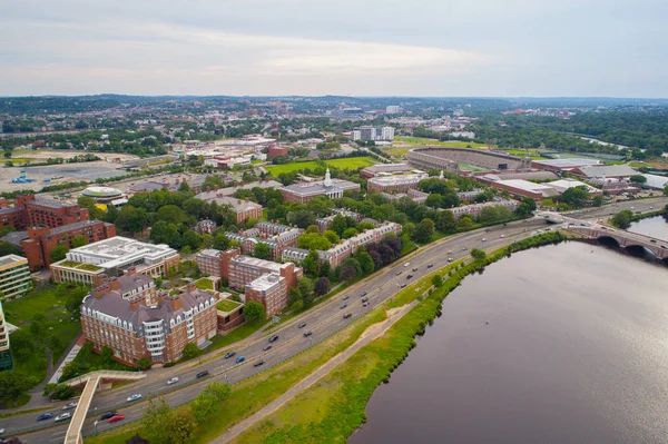
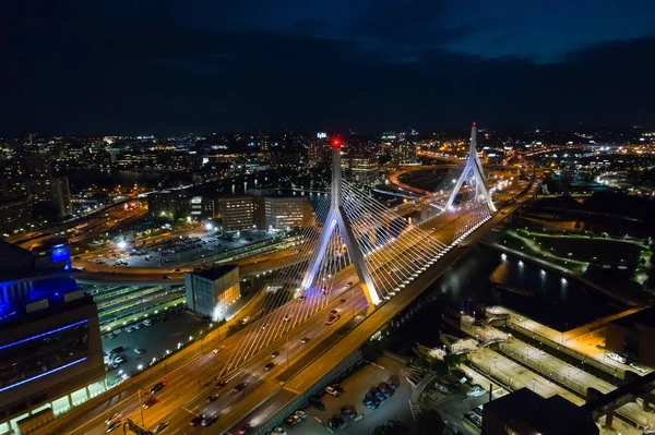
Longfellow Bridge Aerial View That Connects City Of Boston (left) And Cambridge (right) Over Charles River, Boston, Massachusetts MA, USA. The Bridge Is A Steel Rib Arch Bridge Built In 1906.

Image, 11.6MB, 5280 × 3956 jpg
stock image Fenway Park aerial view in Fenway and Interstate Highway 90 in Kenmore district in Boston, Massachusetts MA, USA.

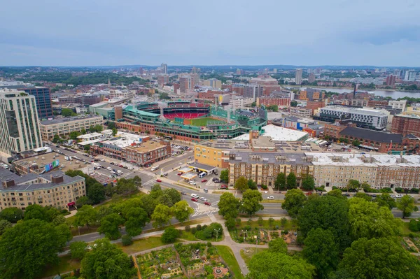
Fenway Park Aerial View In Fenway And Interstate Highway 90 In Kenmore District In Boston, Massachusetts MA, USA.

Image, 13.88MB, 5280 × 3956 jpg
stock image Longfellow Bridge aerial view that connects city of Cambridge (left) and Boston (right) over Charles River, Boston, Massachusetts MA, USA. The bridge is a steel rib arch bridge built in 1906.

Longfellow Bridge Aerial View That Connects City Of Cambridge (left) And Boston (right) Over Charles River, Boston, Massachusetts MA, USA. The Bridge Is A Steel Rib Arch Bridge Built In 1906.

Image, 12.72MB, 5280 × 3956 jpg
stock image Cheverus School aerial view on Centre Street in downtown Malden, Massachusetts MA, USA.

Cheverus School Aerial View On Centre Street In Downtown Malden, Massachusetts MA, USA.

Image, 7.69MB, 3992 × 2882 jpg
stock image Back Bay Fens aerial view in summer near Charles River in Back Bay, Boston, Massachusetts MA, USA. Back Bay Fens was designed by Frederick Law Olmsted in 1879.

Back Bay Fens Aerial View In Summer Near Charles River In Back Bay, Boston, Massachusetts MA, USA. Back Bay Fens Was Designed By Frederick Law Olmsted In 1879.

Image, 15.23MB, 5280 × 3956 jpg
stock image Leonard P Zakim Bunker Hill Memorial Bridge

Leonard P Zakim Bunker Hill Memorial Bridge

Image, 7.73MB, 4200 × 2798 jpg
stock image Historic Boston Beacon Hill aerial view, Boston, Massachusetts MA, USA.

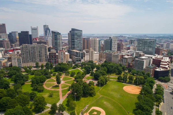
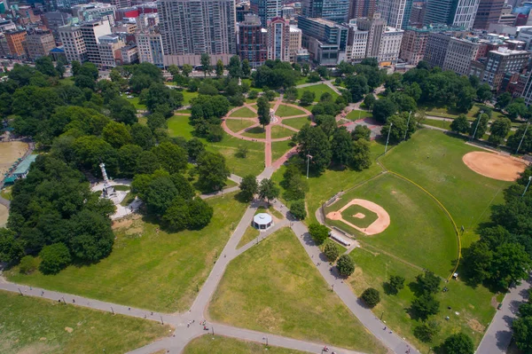
Historic Boston Beacon Hill Aerial View, Boston, Massachusetts MA, USA.

Image, 37.54MB, 8000 × 6000 jpg
stock image Panorama Bangkok city aerial view with river curved and sunset sky

Panorama Bangkok City Aerial View With River Curved And Sunset Sky

Image, 4.86MB, 3500 × 1969 jpg
stock image Nantasket Beach aerial view in town of Hull in south of Boston, Massachusetts MA, USA.

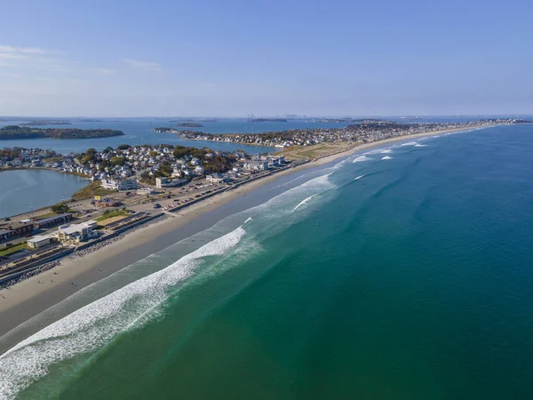
Nantasket Beach Aerial View In Town Of Hull In South Of Boston, Massachusetts MA, USA.

Image, 7.97MB, 4000 × 3000 jpg
stock image Aerial Drone View of Kartal Istanbul City Seaside. Cityscape

Aerial Drone View Of Kartal Istanbul City Seaside. Cityscape

Image, 9.16MB, 4048 × 3032 jpg
stock image Yachts at pier aerial view in Hingham Harbor near Boston, Massachusetts MA, USA.

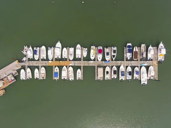
Yachts At Pier Aerial View In Hingham Harbor Near Boston, Massachusetts MA, USA.

Image, 7.12MB, 3992 × 2992 jpg
stock image Fenway Park Stadium Red Socks

Fenway Park Stadium Red Socks

Image, 8.28MB, 4200 × 2798 jpg
stock image Beacon Hill Boston

Beacon Hill Boston

Image, 10.12MB, 4200 × 2798 jpg
stock image Aerial Drone View of Kartal Istanbul City Seaside with Garbage Scow Vessel Old Ship. City Life.

Aerial Drone View Of Kartal Istanbul City Seaside With Garbage Scow Vessel Old Ship. City Life.

Image, 9.45MB, 4048 × 3032 jpg
stock image City downtown aerial view over river curved skyline with sunset

City Downtown Aerial View Over River Curved Skyline With Sunset

Image, 4.46MB, 3500 × 2333 jpg
stock image Boston Lighthouse on Little Brewster Island in Boston Harbor, Boston, Massachusetts, USA.

Boston Lighthouse On Little Brewster Island In Boston Harbor, Boston, Massachusetts, USA.

Image, 8.32MB, 3992 × 2992 jpg
stock image Boston Lighthouse on Little Brewster Island in Boston Harbor, Boston, Massachusetts, USA.

Boston Lighthouse On Little Brewster Island In Boston Harbor, Boston, Massachusetts, USA.

Image, 7.58MB, 3992 × 2992 jpg
stock image  Leonard P Zakim Bunker Hill Bridge at night

Leonard P Zakim Bunker Hill Bridge At Night

Image, 7.4MB, 4000 × 2665 jpg
stock image  Harvard football stadium

Harvard Football Stadium

Image, 7.55MB, 4200 × 2798 jpg
stock image Aerial drone photo of a typical housing estate in the village of Boston Spa in Leeds West Yorkshire showing the St John's Catholic School for the Deaf with farmers fields in the background

Aerial Drone Photo Of A Typical Housing Estate In The Village Of Boston Spa In Leeds West Yorkshire Showing The St John's Catholic School For The Deaf With Farmers Fields In The Background

Image, 14.48MB, 5464 × 3640 jpg
stock image Aerial 360 drone photo Beacon Hill Downtown Boston Massachusetts. Equirectangular spherical stock image

Aerial 360 Drone Photo Beacon Hill Downtown Boston Massachusetts. Equirectangular Spherical Stock Image

Image, 36MB, 12000 × 6000 jpg
stock image Boston Back Bay and Financial District skyline and Boston Harbor panoramic aerial view including Moon Island and Thompson Island from Quincy Bay, Boston, Massachusetts MA, USA.

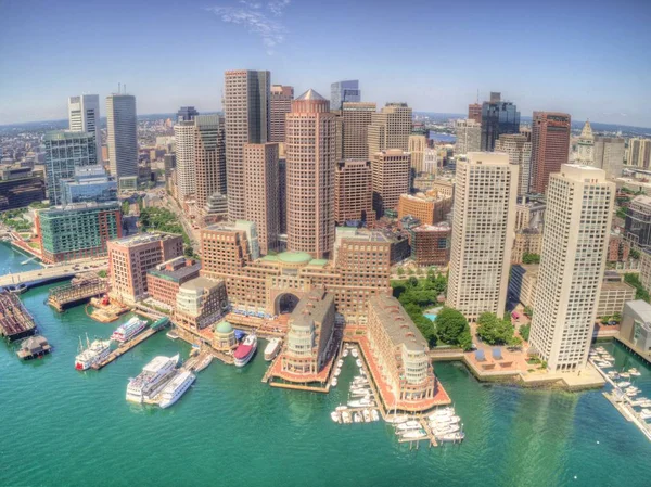
Boston Back Bay And Financial District Skyline And Boston Harbor Panoramic Aerial View Including Moon Island And Thompson Island From Quincy Bay, Boston, Massachusetts MA, USA.

Image, 21.61MB, 12780 × 2860 jpg
stock image Boston aerial drone stock image 2024. Equirectangular 360 virtual tour photo

Boston Aerial Drone Stock Image 2024. Equirectangular 360 Virtual Tour Photo

Image, 36.69MB, 12000 × 6000 jpg
stock image Aerial photo of a typical housing estate in the village of Boston Spa in Leeds West Yorkshire showing a typical British housing estate with the roads around the houses in the summer time from above

Aerial Photo Of A Typical Housing Estate In The Village Of Boston Spa In Leeds West Yorkshire Showing A Typical British Housing Estate With The Roads Around The Houses In The Summer Time From Above

Image, 14.63MB, 5464 × 3640 jpg
stock image Museum of Fine Arts main entrance aerial view at 465 Huntington Avenue in Fenway district, Boston, Massachusetts MA, USA.

Museum Of Fine Arts Main Entrance Aerial View At 465 Huntington Avenue In Fenway District, Boston, Massachusetts MA, USA.

Image, 6.57MB, 3736 × 2800 jpg
stock image Aerial photo of a typical housing estate in the village of Boston Spa in Leeds West Yorkshire showing gardens of typical British homes in the summer

Aerial Photo Of A Typical Housing Estate In The Village Of Boston Spa In Leeds West Yorkshire Showing Gardens Of Typical British Homes In The Summer

Image, 14.9MB, 5464 × 3640 jpg
stock image Aerial drone photo of a typical housing estate in the village of Boston Spa in Leeds West Yorkshire showing the St John's Catholic School for the Deaf with farmers fields in the background

Aerial Drone Photo Of A Typical Housing Estate In The Village Of Boston Spa In Leeds West Yorkshire Showing The St John's Catholic School For The Deaf With Farmers Fields In The Background

Image, 14.24MB, 5464 × 3640 jpg
Page 1 >> Next