photo free
Home Images Vectors Videos

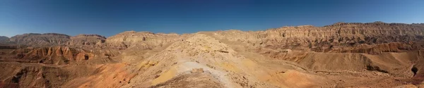
Stock image Dune Rim

stock image Early morning light over chains of barchans-moving sand dunes covering the surface of the Taklamakan Desert some of them reaching up to 300 ms.high. Qiemo Cherchen county-Xinjiang Uyghur region-China.

Early Morning Light Over Chains Of Barchans-moving Sand Dunes Covering The Surface Of The Taklamakan Desert Some Of Them Reaching Up To 300 Ms.high. Qiemo Cherchen County-Xinjiang Uyghur Region-China.

Image, 8.09MB, 5100 × 3400 jpg
stock image Diffused light of morning over chains of moving sand dunes covering the surface of the Taklamakan Desert some of them reaching up to 300 ms.high. Qiemo Cherchen county-Xinjiang Uyghur region-China.

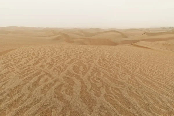
Diffused Light Of Morning Over Chains Of Moving Sand Dunes Covering The Surface Of The Taklamakan Desert Some Of Them Reaching Up To 300 Ms.high. Qiemo Cherchen County-Xinjiang Uyghur Region-China.

Image, 16.87MB, 5100 × 3400 jpg
stock image Lonely desert poplar-Populus euphratica deciduous tree with bent-forked double stem growing on the slope of a sand dune in the Taklamakan desert. Keriya county-Xinjiang Uyghur Autonomous region-China.

Lonely Desert Poplar-Populus Euphratica Deciduous Tree With Bent-forked Double Stem Growing On The Slope Of A Sand Dune In The Taklamakan Desert. Keriya County-Xinjiang Uyghur Autonomous Region-China.

Image, 13.32MB, 5100 × 3400 jpg
stock image Moving sand dunes cover the surface of the Taklamakan Desert forming chains of these eolian topographic forms-some of them reaching up to 300 ms.high. Yutian Keriya county-Xinjiang Uyghur region-China

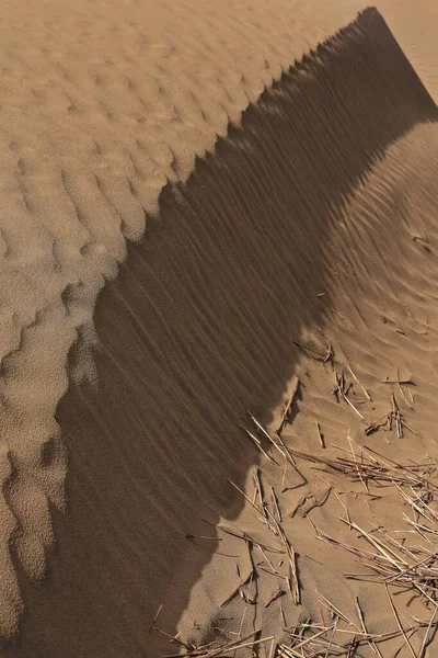
Moving Sand Dunes Cover The Surface Of The Taklamakan Desert Forming Chains Of These Eolian Topographic Forms-some Of Them Reaching Up To 300 Ms.high. Yutian Keriya County-Xinjiang Uyghur Region-China

Image, 13.63MB, 3400 × 5100 jpg
stock image Keriya River supplies several oases-flows N.into the TaklaMakan desert to an endorheic delta where it gets lost in the sand-off road vehicles running along. Yutian County-Xinjiang Uyghur Region-China.

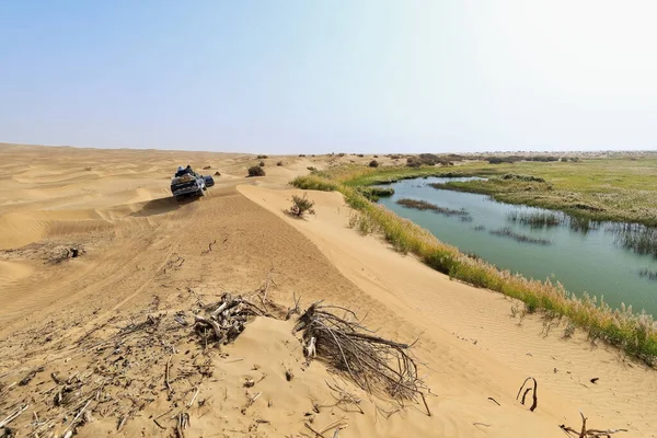
Keriya River Supplies Several Oases-flows N.into The TaklaMakan Desert To An Endorheic Delta Where It Gets Lost In The Sand-off Road Vehicles Running Along. Yutian County-Xinjiang Uyghur Region-China.

Image, 12.73MB, 5100 × 3400 jpg
stock image View from the rim of the volcanoe Waw an Namus, Libya, Africa

View From The Rim Of The Volcanoe Waw An Namus, Libya, Africa

Image, 2.91MB, 5450 × 3562 jpg
stock image The Large Crater (Makhtesh Gadol) in Negev desert

The Large Crater (Makhtesh Gadol) In Negev Desert

Image, 5.92MB, 6635 × 3433 jpg
stock image Scenic desert landscape in Makhtesh Katan in Israel

Scenic Desert Landscape In Makhtesh Katan In Israel

Image, 2.81MB, 7381 × 1549 jpg
stock image Charyn canyon in the Kazakhstan

Charyn Canyon In The Kazakhstan

Image, 8.88MB, 5433 × 3622 jpg
stock image Beautiful mature woman walking on sand dune

Beautiful Mature Woman Walking On Sand Dune

Image, 3.79MB, 4092 × 2722 jpg
stock image Desert flowers and Ant hills near White Rim Road Moab Utah

Desert Flowers And Ant Hills Near White Rim Road Moab Utah

Image, 9.13MB, 4096 × 2734 jpg
stock image Desert flowers and Ant hills near White Rim Road Moab Utah

Desert Flowers And Ant Hills Near White Rim Road Moab Utah

Image, 5.8MB, 3906 × 2607 jpg
stock image Beautiful mature woman balancing on sand dune

Beautiful Mature Woman Balancing On Sand Dune

Image, 3.67MB, 3989 × 2655 jpg
stock image Ocean shore in Pacific Rim National park, Canada

Ocean Shore In Pacific Rim National Park, Canada

Image, 17.83MB, 6048 × 4032 jpg
stock image A view of the Grand Canyon from the south rim.

A View Of The Grand Canyon From The South Rim.

Image, 19.43MB, 7835 × 5226 jpg
Page 1 >> Next