photo free
Home Images Vectors Videos

Stock image Fauro Island

stock image Fauro Island in the Solomon Sea on a topographic, OSM Humanitarian style map

Fauro Island In The Solomon Sea On A Topographic, OSM Humanitarian Style Map

Image, 0.48MB, 2880 × 1620 jpg
stock image Fauro Island in the Solomon Sea, belonging to Solomon Islands, isolated on a topographic, OSM Humanitarian style map, with distance scale

Fauro Island In The Solomon Sea, Belonging To Solomon Islands, Isolated On A Topographic, OSM Humanitarian Style Map, With Distance Scale

Image, 0.35MB, 2160 × 2160 jpg
stock image Fauro Island in the Solomon Sea, belonging to Solomon Islands, isolated on a bilevel elevation map, with distance scale

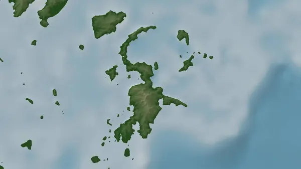
Fauro Island In The Solomon Sea, Belonging To Solomon Islands, Isolated On A Bilevel Elevation Map, With Distance Scale

Image, 0.3MB, 2160 × 2160 jpg
stock image Fauro Island in the Solomon Sea, belonging to Solomon Islands, isolated on a satellite image taken in June 12, 2021, with distance scale

Fauro Island In The Solomon Sea, Belonging To Solomon Islands, Isolated On A Satellite Image Taken In June 12, 2021, With Distance Scale

Image, 0.8MB, 2160 × 2160 jpg
stock image Fauro Island in the Solomon Sea - belonging to Solomon Islands. Described location diagram with yellow shape of the island and sample maps of its surroundings

Fauro Island In The Solomon Sea - Belonging To Solomon Islands. Described Location Diagram With Yellow Shape Of The Island And Sample Maps Of Its Surroundings

Image, 2.03MB, 3840 × 2160 jpg
stock image Fauro Island in the Solomon Sea on a colored elevation map

Fauro Island In The Solomon Sea On A Colored Elevation Map

Image, 1.16MB, 2880 × 1620 jpg
stock image Fauro Island in the Solomon Sea on a satellite image taken in December 29, 2022

Fauro Island In The Solomon Sea On A Satellite Image Taken In December 29, 2022

Image, 3.9MB, 2880 × 1620 jpg
Page 1 >> Next