photo free
Home Images Vectors Videos

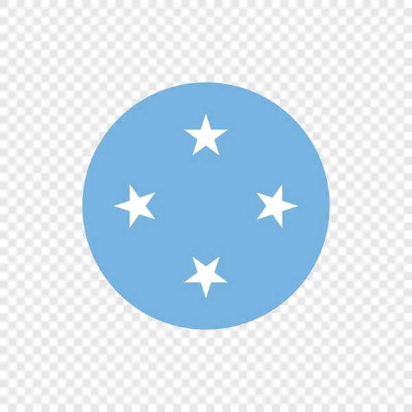
Stock image Federated States Micronesia page 2

stock vector Federated States of Micronesia

Federated States Of Micronesia

Vector, 0.09MB, 6400 × 6400 ai
stock vector Federated States of Micronesia - Vector Circle Flag

Federated States Of Micronesia - Vector Circle Flag

Vector, 0.96MB, 5000 × 5000 eps
stock vector Micronesia,Federated States flag Golden badge design vector

Micronesia,Federated States Flag Golden Badge Design Vector

Vector, 1.02MB, 5000 × 5000 eps
stock image Wa'ab Island in the Philippine Sea, belonging to Federated States of Micronesia, isolated on a bilevel elevation map, with distance scale

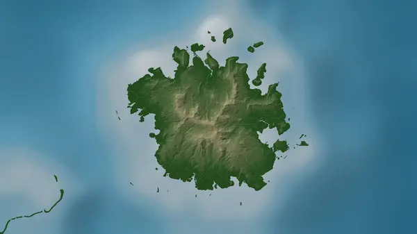
Wa'ab Island In The Philippine Sea, Belonging To Federated States Of Micronesia, Isolated On A Bilevel Elevation Map, With Distance Scale

Image, 0.29MB, 2160 × 2160 jpg
stock image Wa'ab Island in the Philippine Sea on a satellite image taken in March 31, 2024

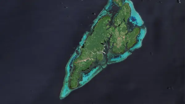
Wa'ab Island In The Philippine Sea On A Satellite Image Taken In March 31, 2024

Image, 5.98MB, 2880 × 1620 jpg
stock image World Flag Set 15

World Flag Set 15

Image, 2.17MB, 4839 × 2694 jpg
stock image Micronesia Federated States Flags Night Clouds

Micronesia Federated States Flags Night Clouds

Image, 5.09MB, 9000 × 6000 jpg
stock image Flag of Federated States of Micronesia. Fabric textured Federated States of Micronesia. flag isolated on dark background. 3D illustration

Flag Of Federated States Of Micronesia. Fabric Textured Federated States Of Micronesia. Flag Isolated On Dark Background. 3D Illustration

Image, 10.97MB, 7500 × 3000 jpg
stock image Kosrae Island in the North Pacific Ocean, belonging to Federated States of Micronesia, isolated on a bilevel elevation map, with distance scale

Kosrae Island In The North Pacific Ocean, Belonging To Federated States Of Micronesia, Isolated On A Bilevel Elevation Map, With Distance Scale

Image, 0.43MB, 2160 × 2160 jpg
stock image Ponape Island in the North Pacific Ocean - belonging to Federated States of Micronesia. Described location diagram with yellow shape of the island and sample maps of its surroundings

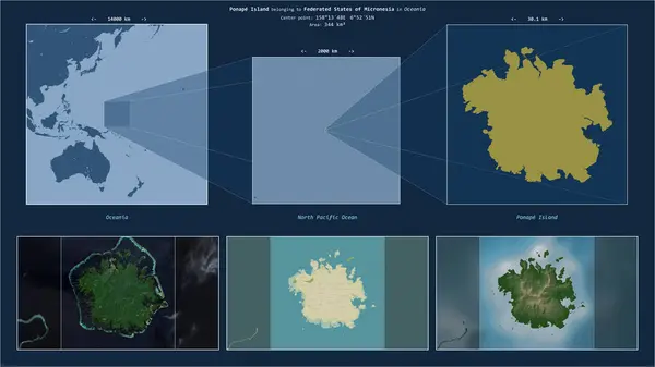
Ponape Island In The North Pacific Ocean - Belonging To Federated States Of Micronesia. Described Location Diagram With Yellow Shape Of The Island And Sample Maps Of Its Surroundings

Image, 2.36MB, 3840 × 2160 jpg
stock image Kosrae Island in the North Pacific Ocean on a satellite image taken in August 18, 2020

Kosrae Island In The North Pacific Ocean On A Satellite Image Taken In August 18, 2020

Image, 6.1MB, 2880 × 1620 jpg
stock vector Map of Guam a non incorporated territory of the United States

Map Of Guam A Non Incorporated Territory Of The United States

Vector, 1.02MB, 3113 × 3288 eps
stock image 3D illustration of new year 2025 balloons on Federated States of Micronesia flag color, isolated on black background

3D Illustration Of New Year 2025 Balloons On Federated States Of Micronesia Flag Color, Isolated On Black Background

Image, 2.18MB, 4000 × 4000 jpg
stock image Ponape Island in the North Pacific Ocean, belonging to Federated States of Micronesia, isolated on a topographic, OSM Humanitarian style map, with distance scale

Ponape Island In The North Pacific Ocean, Belonging To Federated States Of Micronesia, Isolated On A Topographic, OSM Humanitarian Style Map, With Distance Scale

Image, 0.91MB, 2160 × 2160 jpg
stock image Kosrae Island in the North Pacific Ocean - belonging to Federated States of Micronesia. Described location diagram with yellow shape of the island and sample maps of its surroundings

Kosrae Island In The North Pacific Ocean - Belonging To Federated States Of Micronesia. Described Location Diagram With Yellow Shape Of The Island And Sample Maps Of Its Surroundings

Image, 2.13MB, 3840 × 2160 jpg
stock image Kosrae Island in the North Pacific Ocean, belonging to Federated States of Micronesia, isolated on a satellite image taken in December 31, 2021, with distance scale

Kosrae Island In The North Pacific Ocean, Belonging To Federated States Of Micronesia, Isolated On A Satellite Image Taken In December 31, 2021, With Distance Scale

Image, 1.77MB, 2160 × 2160 jpg
stock vector Micronesia- flag pin for map. Vector illustration.

Micronesia- Flag Pin For Map. Vector Illustration.

Vector, 1.05MB, 6477 × 7656 eps
stock image Wa'ab Island in the Philippine Sea, belonging to Federated States of Micronesia, isolated on a satellite image taken in July 26, 2018, with distance scale

Wa'ab Island In The Philippine Sea, Belonging To Federated States Of Micronesia, Isolated On A Satellite Image Taken In July 26, 2018, With Distance Scale

Image, 0.94MB, 2160 × 2160 jpg
stock image colorful waving national flag of Federated States of Micronesia on a euro money banknotes background. finance concept

Colorful Waving National Flag Of Federated States Of Micronesia On A Euro Money Banknotes Background. Finance Concept

Image, 10.96MB, 5500 × 3670 jpg
stock image Wa'ab Island in the Philippine Sea, belonging to Federated States of Micronesia, isolated on a topographic, OSM Humanitarian style map, with distance scale

Wa'ab Island In The Philippine Sea, Belonging To Federated States Of Micronesia, Isolated On A Topographic, OSM Humanitarian Style Map, With Distance Scale

Image, 0.59MB, 2160 × 2160 jpg
stock image Kosrae Island in the North Pacific Ocean, belonging to Federated States of Micronesia, isolated on a topographic, OSM Humanitarian style map, with distance scale

Kosrae Island In The North Pacific Ocean, Belonging To Federated States Of Micronesia, Isolated On A Topographic, OSM Humanitarian Style Map, With Distance Scale

Image, 0.53MB, 2160 × 2160 jpg
stock image Kosrae Island in the North Pacific Ocean on a colored elevation map

Kosrae Island In The North Pacific Ocean On A Colored Elevation Map

Image, 1.23MB, 2880 × 1620 jpg
stock image Wa'ab Island in the Philippine Sea on a colored elevation map

Wa'ab Island In The Philippine Sea On A Colored Elevation Map

Image, 1.13MB, 2880 × 1620 jpg
stock image Micronesia, Federated States of Micronesia national flag cloth fabric waving on beautiful sky blue Background.

Micronesia, Federated States Of Micronesia National Flag Cloth Fabric Waving On Beautiful Sky Blue Background.

Image, 1.12MB, 2551 × 2053 jpg
stock image Micronesia, Federated States of Micronesia national flag cloth fabric waving on beautiful White Square Background.

Micronesia, Federated States Of Micronesia National Flag Cloth Fabric Waving On Beautiful White Square Background.

Image, 4.58MB, 5320 × 2667 jpg
stock image Ponape Island in the North Pacific Ocean, belonging to Federated States of Micronesia, isolated on a bilevel elevation map, with distance scale

Ponape Island In The North Pacific Ocean, Belonging To Federated States Of Micronesia, Isolated On A Bilevel Elevation Map, With Distance Scale

Image, 0.69MB, 2160 × 2160 jpg
stock image Wa'ab Island in the Philippine Sea - belonging to Federated States of Micronesia. Described location diagram with yellow shape of the island and sample maps of its surroundings

Wa'ab Island In The Philippine Sea - Belonging To Federated States Of Micronesia. Described Location Diagram With Yellow Shape Of The Island And Sample Maps Of Its Surroundings

Image, 2.36MB, 3840 × 2160 jpg
stock image Ponape Island in the North Pacific Ocean on a colored elevation map

Ponape Island In The North Pacific Ocean On A Colored Elevation Map

Image, 1.49MB, 2880 × 1620 jpg
stock image Flag of Federated States of Micronesia. Fabric textured Federated States of Micronesia. flag isolated on dark background. 3D illustration

Flag Of Federated States Of Micronesia. Fabric Textured Federated States Of Micronesia. Flag Isolated On Dark Background. 3D Illustration

Image, 9.96MB, 7500 × 3000 jpg
stock image Ponape Island in the North Pacific Ocean on a topographic, OSM Humanitarian style map

Ponape Island In The North Pacific Ocean On A Topographic, OSM Humanitarian Style Map

Image, 0.77MB, 2880 × 1620 jpg
stock image Ponape Island in the North Pacific Ocean, belonging to Federated States of Micronesia, isolated on a satellite image taken in January 27, 2021, with distance scale

Ponape Island In The North Pacific Ocean, Belonging To Federated States Of Micronesia, Isolated On A Satellite Image Taken In January 27, 2021, With Distance Scale

Image, 2.02MB, 2160 × 2160 jpg
stock image Flag of the Federated States of Micronesia, intergration of a multicultural group of young people

Flag Of The Federated States Of Micronesia, Intergration Of A Multicultural Group Of Young People

Image, 7.73MB, 5456 × 3632 jpg
stock image Flags of the world for school, Country Federated States of Micronesia.

Flags Of The World For School, Country Federated States Of Micronesia.

Image, 0.15MB, 3371 × 2385 jpg
stock vector Locator map showing the location of the country Federated States Of Micronesia in Oceania. The country is highlighted with a red polygon. No labels at all. Made with Natural Earth.

Locator Map Showing The Location Of The Country Federated States Of Micronesia In Oceania. The Country Is Highlighted With A Red Polygon. No Labels At All. Made With Natural Earth.

Vector, 2.84MB, 5887 × 3537 eps
stock image Ponape Island in the North Pacific Ocean on a satellite image taken in January 3, 2018

Ponape Island In The North Pacific Ocean On A Satellite Image Taken In January 3, 2018

Image, 6.22MB, 2880 × 1620 jpg
stock image Wa'ab Island in the Philippine Sea on a topographic, OSM Humanitarian style map

Wa'ab Island In The Philippine Sea On A Topographic, OSM Humanitarian Style Map

Image, 0.78MB, 2880 × 1620 jpg
stock image Kosrae Island in the North Pacific Ocean on a topographic, OSM Humanitarian style map

Kosrae Island In The North Pacific Ocean On A Topographic, OSM Humanitarian Style Map

Image, 0.42MB, 2880 × 1620 jpg
Previous << Page 2 >> Next