photo free
Home Images Vectors Videos

Stock image French Polynesia Map

stock vector french polynesia map, vector illustration

French Polynesia Map, Vector Illustration

Vector, 0MB, 5248 × 4432 zip
stock vector French Polynesia

French Polynesia

Vector, 1.67MB, 6049 × 5788 eps
stock vector Australia and Oceania - map and navigation labels - illustration.

Australia And Oceania - Map And Navigation Labels - Illustration.

Vector, 4.32MB, 7400 × 5626 eps
stock vector Australia and Oceania - map and navigation labels - illustration.

Australia And Oceania - Map And Navigation Labels - Illustration.

Vector, 3.86MB, 7400 × 5359 eps
stock vector French Polynesia, gray political map with capital Papeete, on the island of Tahiti. Overseas collectivity of France, and sole overseas country, in the South Pacific Ocean, with 121 islands and atolls.

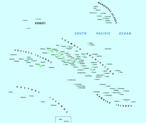
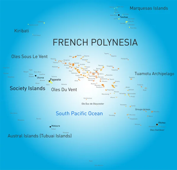
French Polynesia, Gray Political Map With Capital Papeete, On The Island Of Tahiti. Overseas Collectivity Of France, And Sole Overseas Country, In The South Pacific Ocean, With 121 Islands And Atolls.

Vector, 5.54MB, 6000 × 6000 eps
stock vector Australia and Oceania detailed political map and navigation icon

Australia And Oceania Detailed Political Map And Navigation Icon

Vector, 7.94MB, 8192 × 6142 eps
stock vector pacific islands map

Pacific Islands Map

Vector, 3.5MB, 5880 × 3856 eps
stock vector Australia and Oceania - map and navigation icons - illustration.

Australia And Oceania - Map And Navigation Icons - Illustration.

Vector, 4.18MB, 6400 × 4774 eps
stock vector Australia and Oceania - map - illustration.

Australia And Oceania - Map - Illustration.

Vector, 3.28MB, 6400 × 4253 eps
stock vector Australia and Oceania - map, navigation icons - illustration.

Australia And Oceania - Map, Navigation Icons - Illustration.

Vector, 3.88MB, 7400 × 5312 eps
stock vector Australia and Oceania - map - illustration.

Australia And Oceania - Map - Illustration.

Vector, 3.8MB, 6400 × 4253 eps
stock vector Australia and Oceania - map - illustration.

Australia And Oceania - Map - Illustration.

Vector, 3.83MB, 6400 × 4253 eps
stock vector Australia and Oceania - map - illustration.

Australia And Oceania - Map - Illustration.

Vector, 4.55MB, 6400 × 4254 eps
stock vector Map markers with flags - Oceania. Original colors.

Map Markers With Flags - Oceania. Original Colors.

Vector, 5.12MB, 4000 × 7091 eps
stock vector Vector map of the Marquesas Islands, French Polynesia

Vector Map Of The Marquesas Islands, French Polynesia

Vector, 1.31MB, 3274 × 3100 eps
stock vector Blank map Leeward Islands in gray. Every Island map is with titles. High quality map of  Leeward Islands with districts on transparent background for your  design. Bora Bora.  French Polynesia. EPS10.

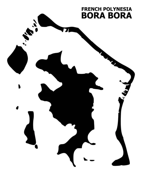
Blank Map Leeward Islands In Gray. Every Island Map Is With Titles. High Quality Map Of Leeward Islands With Districts On Transparent Background For Your Design. Bora Bora. French Polynesia. EPS10.

Vector, 3.86MB, 7500 × 3750 eps
stock vector Australia and Oceania map and navigation icons - Illustration.

Australia And Oceania Map And Navigation Icons - Illustration.

Vector, 1.19MB, 6400 × 4640 eps
stock vector Fifteen Flags of Australia and Oceania countries - alphabetical order with name.  Set of 2d geolocation signs like national flags of Australia and Oceania. Fifteen geolocation signs. EPS10.

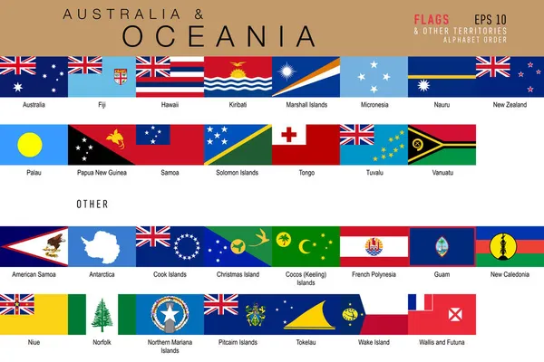
Fifteen Flags Of Australia And Oceania Countries - Alphabetical Order With Name. Set Of 2d Geolocation Signs Like National Flags Of Australia And Oceania. Fifteen Geolocation Signs. EPS10.

Vector, 7.12MB, 5000 × 5000 eps
stock vector Bora bora map

Bora Bora Map

Vector, 12.13MB, 7021 × 4160 eps
stock vector Pixelated Mosaic Map of Tahiti Island

Pixelated Mosaic Map Of Tahiti Island

Vector, 0.42MB, 6282 × 3000 eps
stock vector French Polynesia infographics, statistical data, sights

French Polynesia Infographics, Statistical Data, Sights

Vector, 1.59MB, 5000 × 5000 eps
stock vector vector map of Moruroa (Mururoa, Mururura) atoll, which belongs to French Polynesia

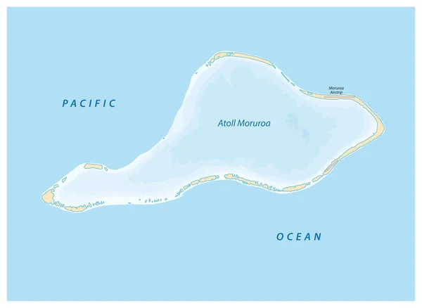
Vector Map Of Moruroa (Mururoa, Mururura) Atoll, Which Belongs To French Polynesia

Vector, 0.65MB, 4241 × 3100 eps
stock vector Topographic map of Moorea, Society Islands, French Polynesia, Pacific Ocean. Vector detailed elevation map of island. Geographic elegant landscape outline poster

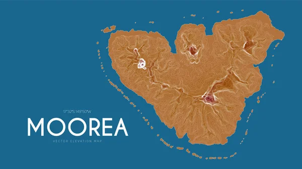
Topographic Map Of Moorea, Society Islands, French Polynesia, Pacific Ocean. Vector Detailed Elevation Map Of Island. Geographic Elegant Landscape Outline Poster

Vector, 5.89MB, 6000 × 3375 eps
stock vector Asian, Australia and Oceania countries maps

Asian, Australia And Oceania Countries Maps

Vector, 13.28MB, 7292 × 7292 eps
stock vector Map of the French Polynesian Archipelago Leeward Islands (Society Islands), France

Map Of The French Polynesian Archipelago Leeward Islands (Society Islands), France

Vector, 0.8MB, 4378 × 3100 eps
stock vector Bora Bora

Bora Bora

Vector, 0.7MB, 5665 × 6858 eps
stock vector Vector map of the Leeward Islands belonging to the French Society Islands

Vector Map Of The Leeward Islands Belonging To The French Society Islands

Vector, 1.79MB, 5426 × 3100 eps
stock vector Australia and Oceania - map and navigation icons - illustration.

Australia And Oceania - Map And Navigation Icons - Illustration.

Vector, 3.99MB, 6400 × 4774 eps
stock vector vector maps and flags of oceania countries with administrative divisions (regions borders)

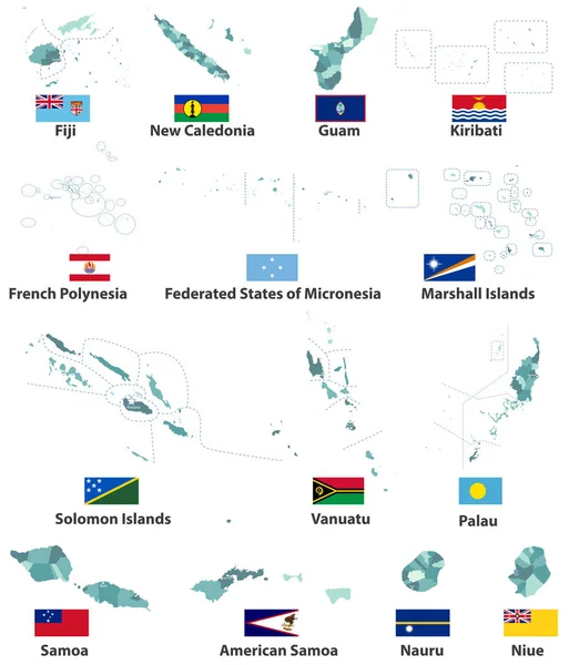
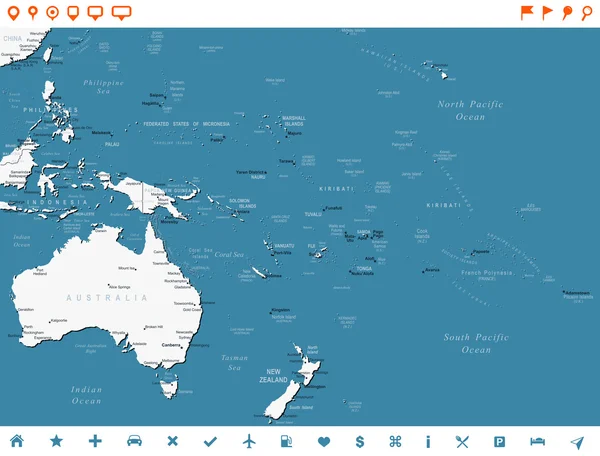
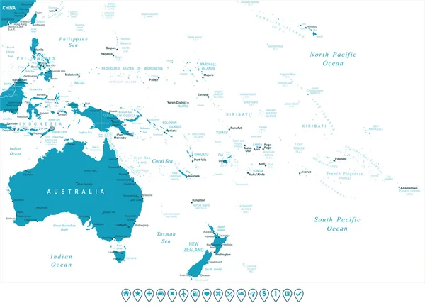
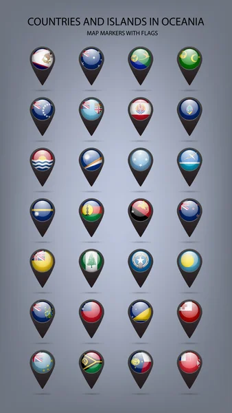
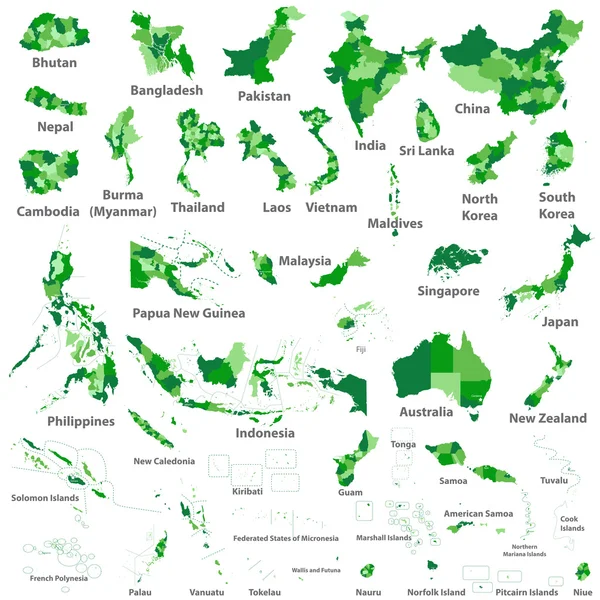
Vector Maps And Flags Of Oceania Countries With Administrative Divisions (regions Borders)

Vector, 7.89MB, 7139 × 8334 eps
stock vector Composition of Tahiti Island Map Symbol Mosaic and Scratched No Nuts Stamp

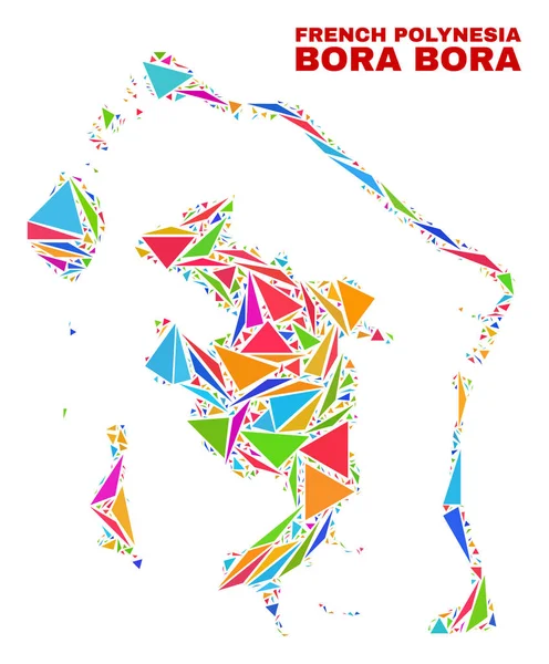
Composition Of Tahiti Island Map Symbol Mosaic And Scratched No Nuts Stamp

Vector, 1.88MB, 5687 × 2813 eps
stock vector French Polynesia flag button

French Polynesia Flag Button

Vector, 3.2MB, 1961 × 2550 eps
stock vector French Polynesia flag button

French Polynesia Flag Button

Vector, 3.2MB, 1961 × 2550 eps
stock vector Flag French Polynesia from brush strokes. Flag French Polynesia on transparent background for your web site design, logo, app, UI. Oceania. Stock vector.  EPS10.

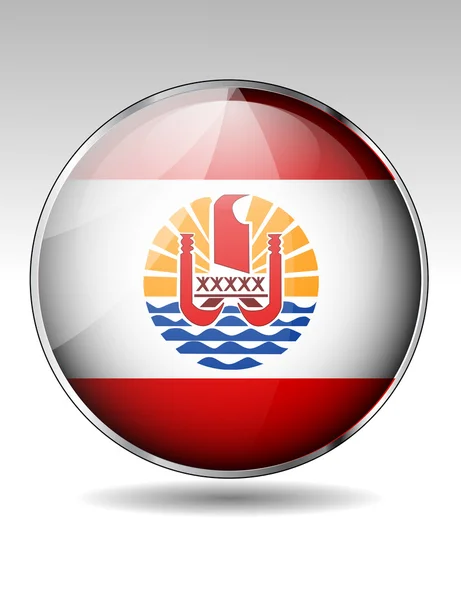
Flag French Polynesia From Brush Strokes. Flag French Polynesia On Transparent Background For Your Web Site Design, Logo, App, UI. Oceania. Stock Vector. EPS10.

Vector, 6.89MB, 5000 × 5000 eps
stock vector vector map of the Austral Islands in the southern Pacific Ocean, French Polynesia, France

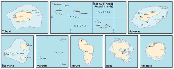
Vector Map Of The Austral Islands In The Southern Pacific Ocean, French Polynesia, France

Vector, 0.89MB, 7727 × 3100 eps
stock vector Country Flag Bages

Country Flag Bages

Vector, 8.87MB, 5145 × 3880 eps
stock vector Australia and Oceania - map and navigation icons - illustration.

Australia And Oceania - Map And Navigation Icons - Illustration.

Vector, 3.99MB, 6400 × 4640 eps
stock vector Vector Flat Map of Bora-Bora with Name

Vector Flat Map Of Bora-Bora With Name

Vector, 0.09MB, 3617 × 4425 eps
stock vector French Polynesia infographics, statistical data, sights

French Polynesia Infographics, Statistical Data, Sights

Vector, 1.36MB, 5000 × 5000 eps
stock vector Polynesia, subregion of Oceania, political map.  A region, made up of more than 1000 islands scattered over the central and southern Pacific Ocean. English. Illustration on white background. Vector.

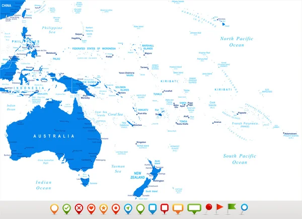
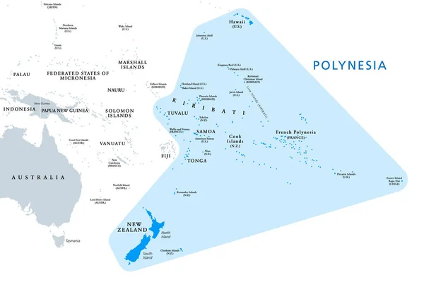
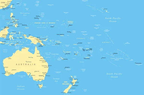
Polynesia, Subregion Of Oceania, Political Map. A Region, Made Up Of More Than 1000 Islands Scattered Over The Central And Southern Pacific Ocean. English. Illustration On White Background. Vector.

Vector, 3.07MB, 9000 × 5999 eps
stock vector Tahiti

Tahiti

Vector, 0.69MB, 6896 × 4144 eps
stock vector Bora Bora icon Shape of the island with Bora Bora flag Round sign with flag colors gradient ring

Bora Bora Icon Shape Of The Island With Bora Bora Flag Round Sign With Flag Colors Gradient Ring

Vector, 0.39MB, 5488 × 5488 eps
stock vector national flags of the world

National Flags Of The World

Vector, 1.75MB, 7000 × 4666 eps
stock vector Bora-Bora Map - Mosaic of Color Triangles

Bora-Bora Map - Mosaic Of Color Triangles

Vector, 0.44MB, 3742 × 4517 eps
stock vector Vector Halftone Pattern and Solid Map of Bora-Bora

Vector Halftone Pattern And Solid Map Of Bora-Bora

Vector, 1.79MB, 5928 × 3830 eps
stock vector Moorea map Blank vector map of the Island Borders of Moorea for your infographic Vector

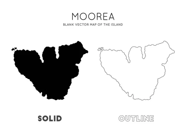
Moorea Map Blank Vector Map Of The Island Borders Of Moorea For Your Infographic Vector

Vector, 0.24MB, 6468 × 4660 eps
stock vector French Polynesia infographics, statistical data, sights

French Polynesia Infographics, Statistical Data, Sights

Vector, 3.09MB, 5000 × 5000 eps
stock vector Development Mosaic Bora-Bora Map and Made in Distress Stamp Seal

Development Mosaic Bora-Bora Map And Made In Distress Stamp Seal

Vector, 11.27MB, 6053 × 3000 eps
stock image the coast of the city of Teahupoo of the island of Tahiti French Polynesia in 2019

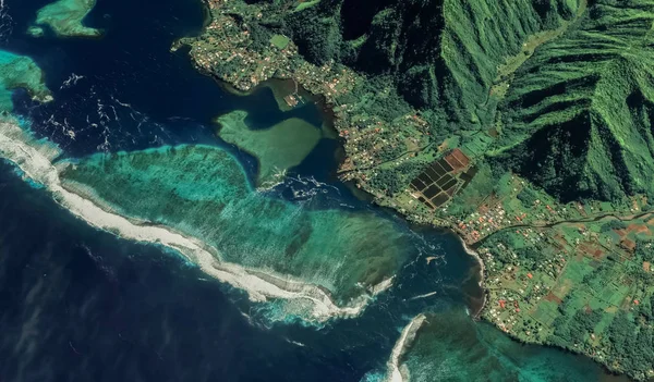
The Coast Of The City Of Teahupoo Of The Island Of Tahiti French Polynesia In 2019

Image, 4.15MB, 3230 × 1894 jpg
stock vector Coronavirus Mosaic Tahiti Island Map with Distress Biohazard Seals

Coronavirus Mosaic Tahiti Island Map With Distress Biohazard Seals

Vector, 2.77MB, 5826 × 3000 eps
stock vector Society Islands, political map. Group of volcanic islands, in French Polynesia, an overseas collectivity of France, in the South Pacific Ocean. Archipelago, divided into Leeward and Windward Islands.

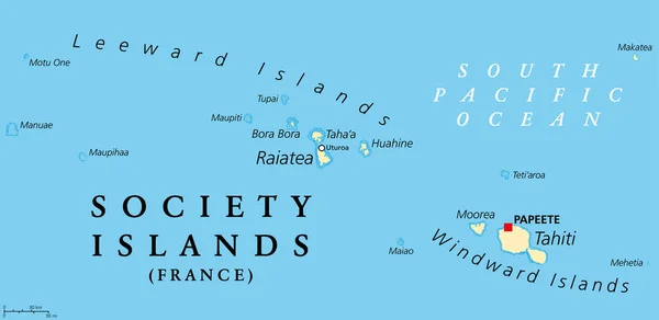
Society Islands, Political Map. Group Of Volcanic Islands, In French Polynesia, An Overseas Collectivity Of France, In The South Pacific Ocean. Archipelago, Divided Into Leeward And Windward Islands.

Vector, 2.25MB, 9000 × 4391 eps
Page 1 >> Next