
Stock image Garhwal

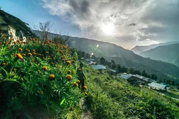
A Little Glimpse Of The Place Chopta In Uttarakhand With Snow Covered Mountains & Roads With Beautiful Sunsets In The Evening.
Image, 13.01MB, 4000 × 6000 jpg


Female Asian Elephant With Cub Crossing Ram Ganga River In Jim Corbett National Park At Dhikala Zone, Nainital, Pauri Garhwal Uttarakhand, India
Image, 9.74MB, 4841 × 2909 jpg

Gangotri, Uttrakhand, India - October 8, 2018 : Gangotri Temple Hindu Pilgrim Town -
Image, 2.69MB, 3024 × 2016 jpg
White Clouds Over Distant Himalayan Mountains, Monsoon Landscape Of Himalays,Garhwal, Uttarakhand, India. Climate Change Effect On Himalays Bringing Landslide,untimely Rain,destruction Of Environment.
Image, 5.64MB, 3000 × 2000 jpg
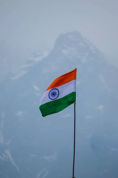
Tricolor Indian Flag In Himalayan Mountains Waving In Air By The Pressure Of Wind
Image, 9.53MB, 4000 × 6000 jpg
Vishnuprayag Is One Of The Panch Prayag, Five Confluences, Of Alaknanda River, And Lies At The Confluence Of Alaknanda River And Dhauliganga River, Chamoli District In Uttarakhand India
Image, 7.6MB, 3730 × 2488 jpg

White Chrysanthemums, Sometimes Called Mums Or Chrysanths, Are Flowering Plants Of The Genus Chrysanthemum In The Family Asteraceae. Chandramallika In Bengali, Popular Flower, India.
Image, 10.41MB, 3900 × 2600 jpg

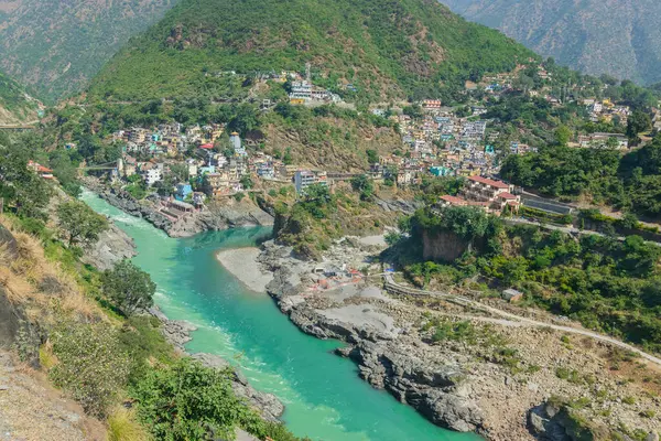
Bhagirathi River From Left Side And Alakananda River With Turquoise Blue Colour From Right Side Converge At Devprayag,Holy Conflunece And Form River Holy Ganges Thereafter.Garhwal, Uttarakhand, India.
Image, 12.04MB, 3900 × 2600 jpg

Cloudy Sky And Curve Of Himalayan Road, Monsoon Landscape Of Garhwal, Uttarakhand, India. Climate Change Effect On Himalays Bringing Landslide, Untimely Rain And Destruction Of Mountain Environment.
Image, 5.6MB, 3000 × 2000 jpg

Bhagirathi River From Left Side And Alakananda River With Turquoise Blue Colour From Right Side Converge At Devprayag,Holy Conflunece And Form River Holy Ganges Thereafter.Garhwal, Uttarakhand, India.
Image, 11.94MB, 3900 × 2600 jpg
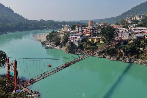
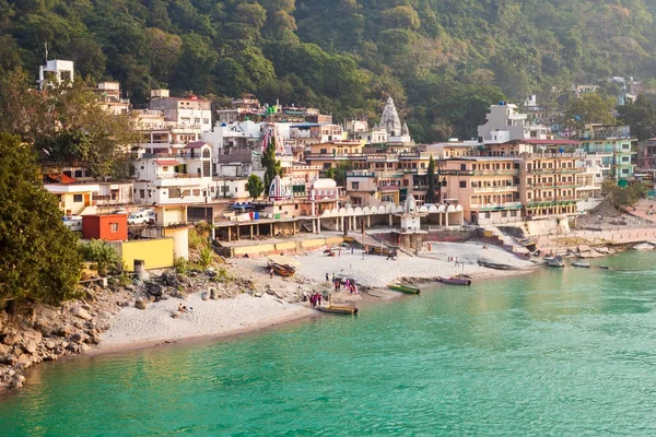
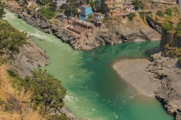
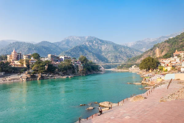
Rishikesh, India - November, 5th, 2017. View Of Ganga River Embankment And Lakshman Jhula Bridge In Rishikesh
Image, 2.75MB, 3731 × 2493 jpg

Black-necked Stork Fishing At Ram Ganga River At Dhikala Zone, Nainital, Pauri Garhwal Uttarakhand, India
Image, 2.5MB, 2537 × 1648 jpg
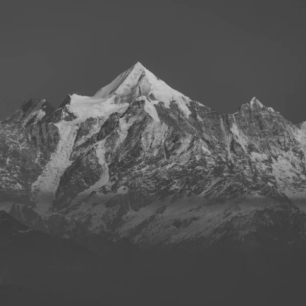
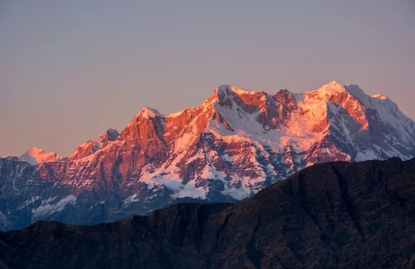
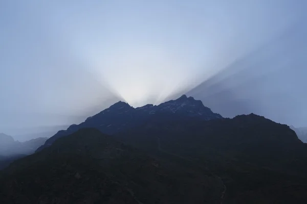
A Close Up View Of Nanda Devi Peak And Glacier In The Kumaun Himalayan Range In Monochrome
Image, 7.05MB, 4480 × 4480 jpg

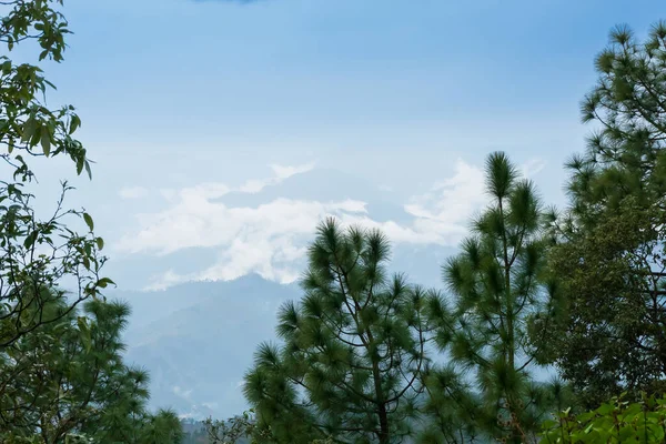
View From Khaliya Top - Landscape Of Himalayas, Khaliya Top, Munsiyari, Uttarakhand, India -
Image, 2.63MB, 3023 × 2017 jpg


Bhagirathi River From Left Side And Alakananda River With Turquoise Blue Colour From Right Side Converge At Devprayag,Holy Conflunece And Form River Holy Ganges Thereafter.Garhwal, Uttarakhand, India.
Image, 9.48MB, 3900 × 2600 jpg
Bhagirathi River From Left Side And Alakananda River With Turquoise Blue Colour From Right Side Converge At Devprayag,Holy Conflunece And Form River Holy Ganges Thereafter.Garhwal, Uttarakhand, India.
Image, 9.63MB, 3900 × 2600 jpg

Cloudy Sky And Curve Of Himalayan Road, Monsoon Landscape Of Garhwal, Uttarakhand, India. Climate Change Effect On Himalays Bringing Landslide, Untimely Rain And Destruction Of Mountain Environment.
Image, 5.78MB, 3000 × 2000 jpg


Asian Elephant Crossing Ram Ganga River In Jim Corbett National Park At Dhikala Zone, Nainital, Pauri Garhwal Uttarakhand, India
Image, 9.45MB, 4685 × 3087 jpg

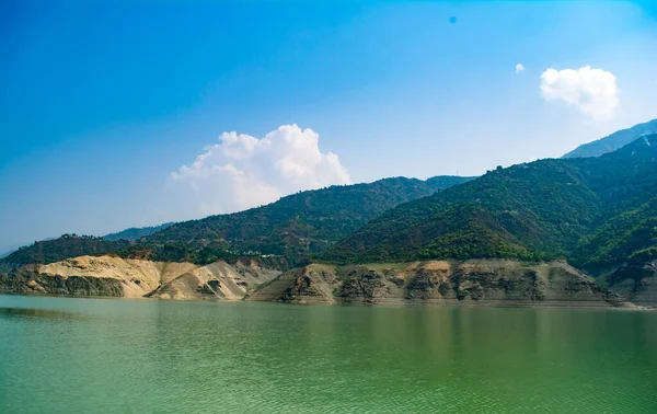
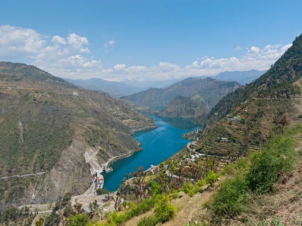
Tehri Lake In Uttarakhand, India, Tehri Lake Is An Artificial Dam Reservoir. Tehri Dam, The Tallest Dam In India And Tehri Dam Is Asia's Largest Man-made Lake.
Image, 13.33MB, 6000 × 3786 jpg

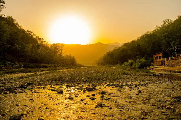
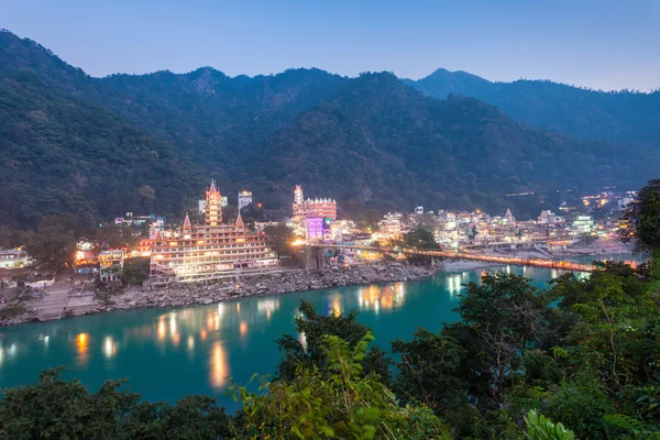
Ganga River At Rishikesh, Located In The Foothills Of The Himalayas In Northern India,
Image, 22.11MB, 6000 × 4000 jpg


Curvy Road At Devprayag, Godly Confluence,Garhwal,Uttarakhand, India. Here Alaknanda Meets The Bhagirathi River And Both Rivers Thereafter Flow On As The Holy Ganges River Or Ganga.
Image, 6.88MB, 2000 × 3000 jpg


Devprayag, Godly Confluence,Garhwal,Uttarakhand, India. Here Alaknanda Meets The Bhagirathi River And Both Rivers Thereafter Flow On As The Holy Ganges River Or Ganga. Sacred Place For Hindu Devotees.
Image, 11.45MB, 3900 × 2600 jpg

Cloudy Sky And Curve Of Himalayan Road, Monsoon Landscape Of Garhwal, Uttarakhand, India. Climate Change Effect On Himalays Bringing Landslide, Untimely Rain And Destruction Of Mountain Environment.
Image, 4.09MB, 3000 × 2000 jpg


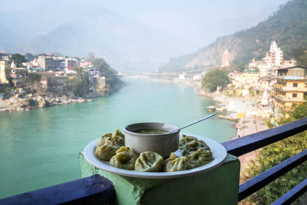
A Large Plate With The Tibetan Momo And Hot Soup On The Background Of The River Ganges. Rishikesh India., Yoga City India, Gange River Ganga Ram Jhoola Jula
Image, 6.41MB, 4500 × 3000 jpg

Traditional Tibetan Momo On The Background Of A Beautiful Urban Landscape
Image, 8.81MB, 5000 × 3333 jpg
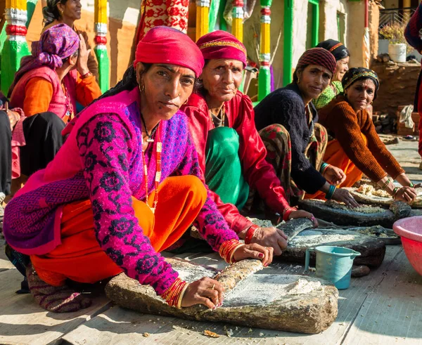
31st January 2023, Tehri Garhwal, Uttarakhand, India. Women Preparing Traditional Cuisine In Groups During A Marriage Ceremony. District Jaunsar-Jaunpur
Image, 13.65MB, 4458 × 3648 jpg
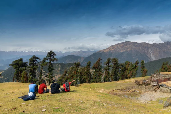
Tunganath, Uttarakhand, India - November 1st 2018 : Trekkers Enjoying View Of Bugyals, Alpine Lands, Or Meadows, In Higher Elevation Range Of Himalayas In Uttarakhand, Called Nature's Own Gardens.
Image, 6.94MB, 4000 × 2667 jpg
Page 1 >> Next