
Stock image Geospatial page 2
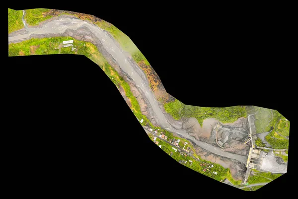
High Resolution Orthorectified, Orthorectification Aerial Map Used For Photogrammetry In Banos Ecuador
Image, 2.87MB, 5000 × 3350 jpg


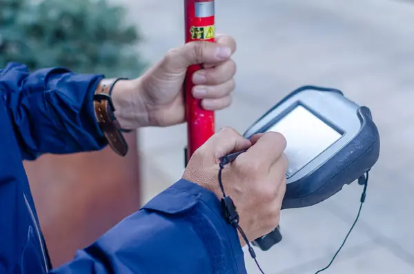
Professional Male Land Surveyor Measures Ground Control Point Using A GPS Rover. Green Field On A Background
Image, 13.07MB, 5760 × 3840 jpg

Professional Male Land Surveyor Measures Ground Control Point Using A GPS Rover. Green Field On A Backgroun
Image, 13MB, 5760 × 3431 jpg

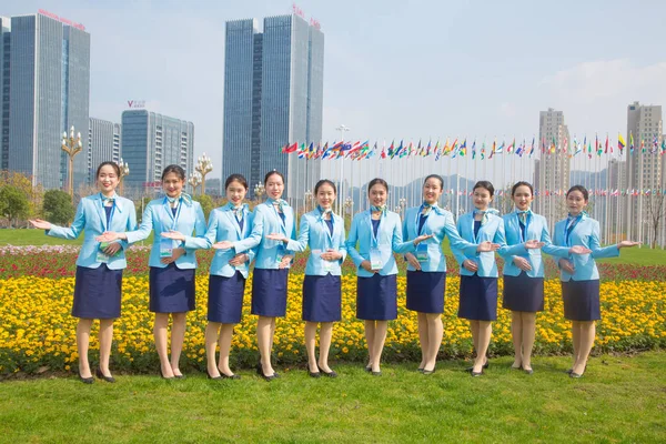
Chinese Volunteers Attend The Launching Ceremony For The Upcoming United Nations World Geospatial Information Congress (UNWGIC) In Deqing County, Huzhou City, East China's Zhejiang Province, 13 November 2018. *** Local Caption ***
Image, 5.11MB, 5000 × 3333 jpg

Chinese Volunteers Attend The Launching Ceremony For The Upcoming United Nations World Geospatial Information Congress (UNWGIC) In Deqing County, Huzhou City, East China's Zhejiang Province, 13 November 2018. *** Local Caption ***
Image, 6.62MB, 5000 × 3333 jpg

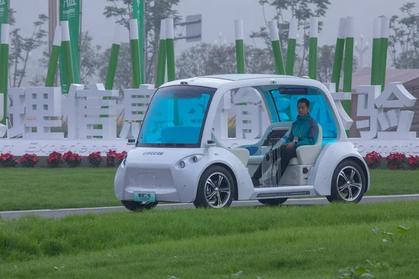
Chinese Volunteers Take An UISEE Self-driving Vehicle At The Intelligence Experience Zone For The Upcoming United Nations World Geospatial Information Congress (UNWGIC) In Deqing County, Huzhou City, East China's Zhejiang Province, 20 November 2018.
Image, 3.28MB, 4500 × 3000 jpg

Chinese Volunteers Take An UISEE Self-driving Vehicle At The Intelligence Experience Zone For The Upcoming United Nations World Geospatial Information Congress (UNWGIC) In Deqing County, Huzhou City, East China's Zhejiang Province, 20 November 2018.
Image, 4.68MB, 4500 × 3000 jpg

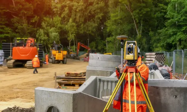
Site Engineer In Hi-viz Installing Surveying Instrument On Construction Site
Image, 12.08MB, 6000 × 3999 jpg

Professional Male Land Surveyor Measures Ground Control Point Using A GPS Rover. Green Field On A Backgroun
Image, 11.97MB, 5594 × 3730 jpg

Professional Male Land Surveyor Measures Ground Control Point Using A GPS Rover. Green Field On A Background
Image, 12.26MB, 5760 × 3840 jpg

Surveyor Builder Site Engineer With Theodolite Total Station At Construction Site Outdoors During Surveying Work
Image, 9.38MB, 6000 × 3909 jpg
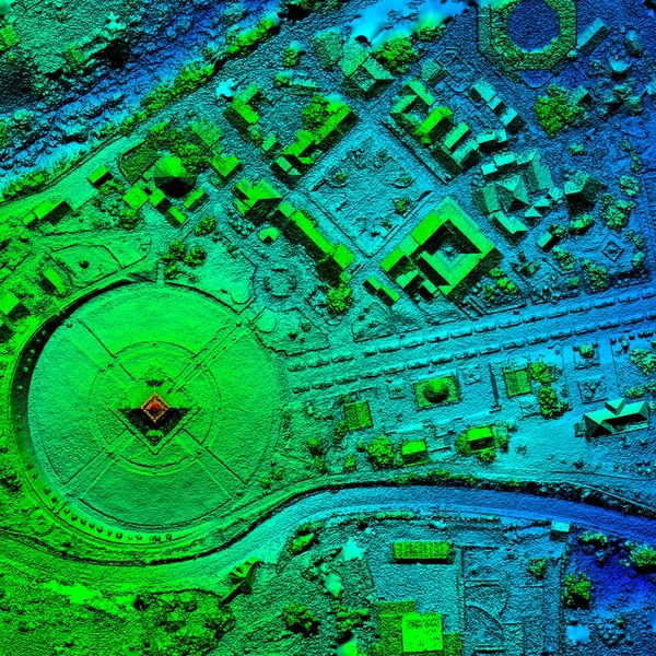
Digital Elevation Model Of Water Dam And Hydrologic Area High Tech Technology For Assessing Smart Engineering
Image, 9.83MB, 5000 × 3279 jpg
Chinese Volunteers Take An UISEE Self-driving Vehicle At The Intelligence Experience Zone For The Upcoming United Nations World Geospatial Information Congress (UNWGIC) In Deqing County, Huzhou City, East China's Zhejiang Province, 20 November 2018.
Image, 3.19MB, 4500 × 3000 jpg

Chinese Volunteers Attend The Launching Ceremony For The Upcoming United Nations World Geospatial Information Congress (UNWGIC) In Deqing County, Huzhou City, East China's Zhejiang Province, 13 November 2018. *** Local Caption ***
Image, 5.23MB, 5000 × 3333 jpg


Location Intelligence Written On Blue Key Of Metallic Keyboard. Finger Pressing Key.
Image, 7.29MB, 5242 × 3744 jpg

Chinese Volunteers Attend The Launching Ceremony For The Upcoming United Nations World Geospatial Information Congress (UNWGIC) In Deqing County, Huzhou City, East China's Zhejiang Province, 13 November 2018. *** Local Caption ***
Image, 6.87MB, 5000 × 3333 jpg
High Resolution Orthorectified, Orthorectification Aerial Map Used For Photogrammetry At Centre Of The World, Mitad Del Mundo In Quito Ecuador
Image, 28.76MB, 4000 × 4000 jpg

Surveyor Builder Site Engineer With Theodolite Total Station At Construction Site Outdoors During Surveying Work
Image, 10.76MB, 7270 × 4847 jpg

Surveyor Builder Site Engineer With Theodolite Total Station At Construction Site Outdoors During Surveying Work
Image, 9.19MB, 7212 × 4629 jpg

Surveyor Builder Site Engineer With Theodolite Total Station At Construction Site Outdoors During Surveying Work
Image, 19.03MB, 7952 × 5304 jpg

Chinese Volunteers Attend The Launching Ceremony For The Upcoming United Nations World Geospatial Information Congress (UNWGIC) In Deqing County, Huzhou City, East China's Zhejiang Province, 13 November 2018. *** Local Caption ***
Image, 6.62MB, 5000 × 3333 jpg

Chinese Volunteers Take An UISEE Self-driving Vehicle At The Intelligence Experience Zone For The Upcoming United Nations World Geospatial Information Congress (UNWGIC) In Deqing County, Huzhou City, East China's Zhejiang Province, 20 November 2018.
Image, 3.28MB, 4500 × 3000 jpg

Chinese Volunteers Take An UISEE Self-driving Vehicle At The Intelligence Experience Zone For The Upcoming United Nations World Geospatial Information Congress (UNWGIC) In Deqing County, Huzhou City, East China's Zhejiang Province, 20 November 2018.
Image, 4.59MB, 4500 × 3000 jpg

Drone Controller's Hands Clasp Holding His Control And Dro. Cartographic Engineering.
Image, 10.68MB, 4708 × 3141 jpg

Geodetic Engineer Surveyor In White Hard Hat Doing Measurements With GNSS Satellite Receiver During Road Construction Works.
Image, 5.86MB, 3000 × 2250 jpg
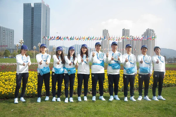
Chinese Volunteers Pose For Photos Ahead Of The Upcoming United Nations World Geospatial Information Congress (UNWGIC) In Deqing County, Huzhou City, East China's Zhejiang Province, 13 November 2018. *** Local Caption ***
Image, 5.3MB, 5000 × 3333 jpg

Surveyor Builder Site Engineer With Theodolite Total Station At Construction Site Outdoors During Surveying Work
Image, 7.86MB, 7629 × 4684 jpg
Surveyor Site Engineer With Total Positioning Station On The Construction Site Of The New Road Construction With Construction Machinery And Materials In The Background
Image, 13.32MB, 7500 × 4497 jpg

Two Location Pins Are Marking The Start And End Of A Route On A Folded Paper Map
Vector, 0.91MB, 5000 × 5000 eps
Digital Elevation Model Of Water Dam And Hydrologic Area High Tech Technology For Assessing Smart Engineering
Image, 8.54MB, 5000 × 3279 jpg

Chinese Volunteers Take An UISEE Self-driving Vehicle At The Intelligence Experience Zone For The Upcoming United Nations World Geospatial Information Congress (UNWGIC) In Deqing County, Huzhou City, East China's Zhejiang Province, 20 November 2018.
Image, 4.68MB, 4500 × 3000 jpg
Chinese Volunteers Pose For Photos Ahead Of The Upcoming United Nations World Geospatial Information Congress (UNWGIC) In Deqing County, Huzhou City, East China's Zhejiang Province, 13 November 2018. *** Local Caption ***
Image, 5.73MB, 5000 × 3333 jpg

A Visitor Experiments Augmented Reality (AR) Using HoloLens Glasses During The United Nations World Geospatial Information Congress (UNWGIC) In Deqing County, Huzhou City, East China's Zhejiang Province, 20 November 2018.
Image, 3.54MB, 4500 × 3000 jpg
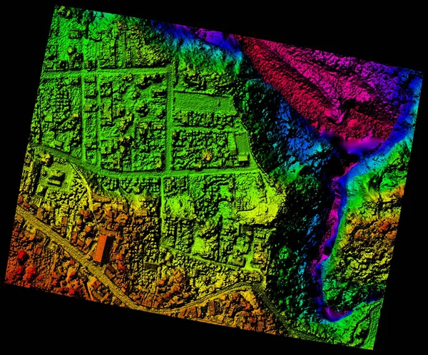
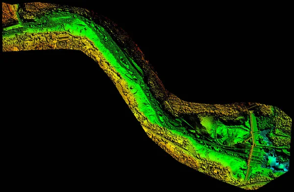
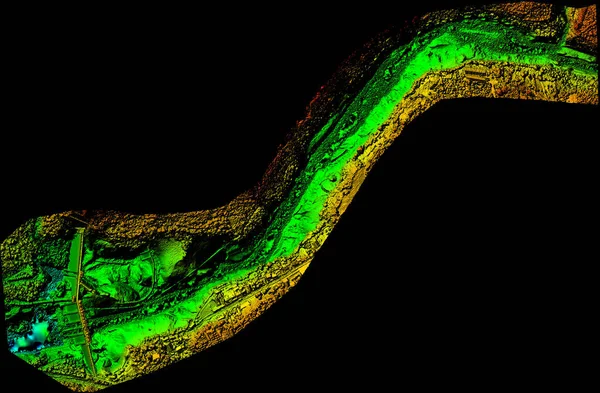
Aerial Orthorectified Orthorectification Digital Elevation Model Of Banos De Agua Santa San Martin Canyon Altitude Represented From Blue To Red
Image, 9.75MB, 4000 × 3319 jpg

Surveyor Builder Site Engineer With Theodolite Total Station At Construction Site Outdoors During Surveying Work
Image, 20.5MB, 7952 × 5304 jpg

Surveyor Site Engineer With Total Positioning Station On The Construction Site Of The New Road Construction With Construction Machinery And Materials In The Background
Image, 33.74MB, 7952 × 5304 jpg

Chinese Volunteer Operates An UISEE Self-driving Vehicle At The Intelligence Experience Zone For The Upcoming United Nations World Geospatial Information Congress (UNWGIC) In Deqing County, Huzhou City, East China's Zhejiang Province, 20 November 2
Image, 4.14MB, 4500 × 3000 jpg

Chinese Volunteers Take An UISEE Self-driving Vehicle At The Intelligence Experience Zone For The Upcoming United Nations World Geospatial Information Congress (UNWGIC) In Deqing County, Huzhou City, East China's Zhejiang Province, 20 November 2018.
Image, 4.8MB, 4500 × 3000 jpg

Chinese Volunteers Attend The Launching Ceremony For The Upcoming United Nations World Geospatial Information Congress (UNWGIC) In Deqing County, Huzhou City, East China's Zhejiang Province, 13 November 2018. *** Local Caption ***
Image, 6.42MB, 5000 × 3333 jpg

Chinese Volunteers Attend The Launching Ceremony For The Upcoming United Nations World Geospatial Information Congress (UNWGIC) In Deqing County, Huzhou City, East China's Zhejiang Province, 13 November 2018. *** Local Caption ***
Image, 5.11MB, 5000 × 3333 jpg

Professional Male Land Surveyor Measures Ground Control Point Using A GPS Rover. Green Field On A Background
Image, 12.63MB, 5760 × 3840 jpg
Surveyors Line Vector Icons And Signs. Mapping, Geologists, Survey, Measurement, Surveying, Geomatics, Civil, Cartography Vector Outline Illustration Set
Vector, 0.66MB, 4160 × 6000 eps

Chinese Volunteers Attend The Launching Ceremony For The Upcoming United Nations World Geospatial Information Congress (UNWGIC) In Deqing County, Huzhou City, East China's Zhejiang Province, 13 November 2018. *** Local Caption ***
Image, 6.42MB, 5000 × 3333 jpg

Chinese Volunteers Take An UISEE Self-driving Vehicle At The Intelligence Experience Zone For The Upcoming United Nations World Geospatial Information Congress (UNWGIC) In Deqing County, Huzhou City, East China's Zhejiang Province, 20 November 2018.
Image, 4.7MB, 4500 × 3000 jpg

Chinese Volunteers Attend The Launching Ceremony For The Upcoming United Nations World Geospatial Information Congress (UNWGIC) In Deqing County, Huzhou City, East China's Zhejiang Province, 13 November 2018. *** Local Caption ***
Image, 6.85MB, 5000 × 3333 jpg


Surveyor Builder Site Engineer With Theodolite Total Station At Construction Site Outdoors During Surveying Work
Image, 12.5MB, 7952 × 5304 jpg
Previous << Page 2 >> Next