photo free
Home Images Vectors Videos

Stock image Great Inagua

stock vector The Bahamas Political Map

The Bahamas Political Map

Vector, 1.79MB, 7902 × 6000 eps
stock image Gran Inagua Island in the North Atlantic Ocean, belonging to Bahamas, isolated on a bilevel elevation map, with distance scale

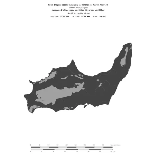
Gran Inagua Island In The North Atlantic Ocean, Belonging To Bahamas, Isolated On A Bilevel Elevation Map, With Distance Scale

Image, 0.39MB, 2160 × 2160 jpg
stock image Ilha Grande in the South Atlantic Ocean - belonging to Brazil. Described location diagram with yellow shape of the island and sample maps of its surroundings

Ilha Grande In The South Atlantic Ocean - Belonging To Brazil. Described Location Diagram With Yellow Shape Of The Island And Sample Maps Of Its Surroundings

Image, 2.23MB, 3840 × 2160 jpg
stock image Gran Inagua Island in the North Atlantic Ocean on a satellite image taken in August 29, 2023

Gran Inagua Island In The North Atlantic Ocean On A Satellite Image Taken In August 29, 2023

Image, 1.62MB, 2880 × 1620 jpg
stock image Gran Inagua Island in the North Atlantic Ocean, belonging to Bahamas, isolated on a satellite image taken in February 16, 2018, with distance scale

Gran Inagua Island In The North Atlantic Ocean, Belonging To Bahamas, Isolated On A Satellite Image Taken In February 16, 2018, With Distance Scale

Image, 1.27MB, 2160 × 2160 jpg
stock image Gran Inagua Island in the North Atlantic Ocean on a colored elevation map

Gran Inagua Island In The North Atlantic Ocean On A Colored Elevation Map

Image, 1.01MB, 2880 × 1620 jpg
stock image Concept of summer traveling with old suitcase and Bahamas with burning sun

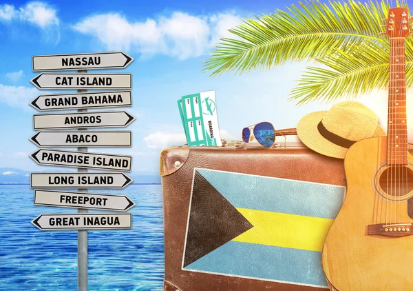
Concept Of Summer Traveling With Old Suitcase And Bahamas With Burning Sun

Image, 6.41MB, 4654 × 3280 jpg
stock image Gran Inagua Island in the North Atlantic Ocean, belonging to Bahamas, isolated on a topographic, OSM Humanitarian style map, with distance scale

Gran Inagua Island In The North Atlantic Ocean, Belonging To Bahamas, Isolated On A Topographic, OSM Humanitarian Style Map, With Distance Scale

Image, 0.43MB, 2160 × 2160 jpg
stock image Gran Inagua Island in the North Atlantic Ocean on a topographic, OSM Humanitarian style map

Gran Inagua Island In The North Atlantic Ocean On A Topographic, OSM Humanitarian Style Map

Image, 0.39MB, 2880 × 1620 jpg
stock image Gran Inagua Island in the North Atlantic Ocean - belonging to Bahamas. Described location diagram with yellow shape of the island and sample maps of its surroundings

Gran Inagua Island In The North Atlantic Ocean - Belonging To Bahamas. Described Location Diagram With Yellow Shape Of The Island And Sample Maps Of Its Surroundings

Image, 2.21MB, 3840 × 2160 jpg
stock image Grande-Terre Island in the Mozambique Channel - belonging to Mayotte. Described location diagram with yellow shape of the island and sample maps of its surroundings

Grande-Terre Island In The Mozambique Channel - Belonging To Mayotte. Described Location Diagram With Yellow Shape Of The Island And Sample Maps Of Its Surroundings

Image, 1.93MB, 3840 × 2160 jpg
stock image Great spotted woodpecker on a Canary Island pine.

Great Spotted Woodpecker On A Canary Island Pine.

Image, 6.44MB, 4288 × 2848 jpg
stock image Young great spotted woodpecker Dendrocopos major thanneri.

Young Great Spotted Woodpecker Dendrocopos Major Thanneri.

Image, 7.68MB, 4928 × 3264 jpg
Page 1 >> Next