photo free
Home Images Vectors Videos

Stock image Guadalcanal

stock image Views of Honiara from a cruise ship, Solomon Islands.

Views Of Honiara From A Cruise Ship, Solomon Islands.

Image, 2.27MB, 4896 × 3672 jpg
stock image Views of Honiara from a cruise ship, Solomon Islands.

Views Of Honiara From A Cruise Ship, Solomon Islands.

Image, 2.36MB, 4674 × 3372 jpg
stock image Guadalcanal Island in the Solomon Sea, belonging to Solomon Islands, isolated on a satellite image taken in July 19, 2021, with distance scale

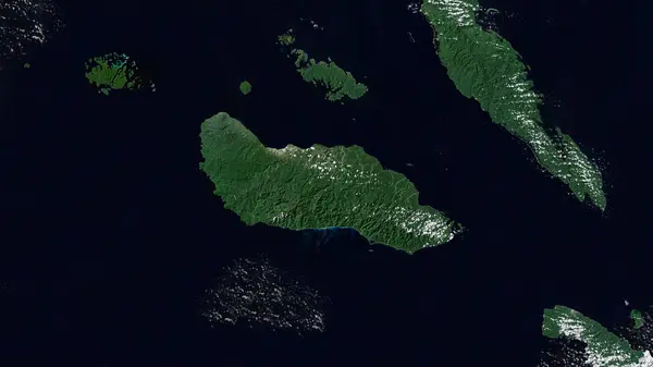
Guadalcanal Island In The Solomon Sea, Belonging To Solomon Islands, Isolated On A Satellite Image Taken In July 19, 2021, With Distance Scale

Image, 1.22MB, 2160 × 2160 jpg
stock image Rubbish and car wrecks piled up on the foreshore of Ranadi industrial area in Honiara, capital city of the Solomon Islands.

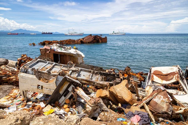
Rubbish And Car Wrecks Piled Up On The Foreshore Of Ranadi Industrial Area In Honiara, Capital City Of The Solomon Islands.

Image, 21.28MB, 5472 × 3648 jpg
stock image Fort Rosecrans National Cemetery at Point Loma in San Diego, Cal

Fort Rosecrans National Cemetery At Point Loma In San Diego, Cal

Image, 16.46MB, 4928 × 3264 jpg
stock image Views of Honiara from a cruise ship, Solomon Islands.

Views Of Honiara From A Cruise Ship, Solomon Islands.

Image, 2.93MB, 4584 × 3486 jpg
stock image Views of Honiara from a cruise ship, Solomon Islands.

Views Of Honiara From A Cruise Ship, Solomon Islands.

Image, 1.53MB, 3177 × 2361 jpg
stock image Eggplants and bananas laid out on banana leaves, for sale in the Honiara Central Market in the Solomon Islands.

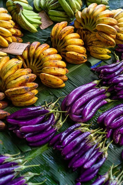
Eggplants And Bananas Laid Out On Banana Leaves, For Sale In The Honiara Central Market In The Solomon Islands.

Image, 2.34MB, 3323 × 4984 jpg
stock image Guadalcanal Island in the Solomon Sea on a colored elevation map

Guadalcanal Island In The Solomon Sea On A Colored Elevation Map

Image, 2.79MB, 2880 × 1620 jpg
stock vector Guadalcanal province map, administrative division of Solomon Islands. Vector illustration.

Guadalcanal Province Map, Administrative Division Of Solomon Islands. Vector Illustration.

Vector, 5.34MB, 8334 × 8334 eps
stock image Scenes of central Honiara, Solomon Islands.

Scenes Of Central Honiara, Solomon Islands.

Image, 1.25MB, 2661 × 2448 jpg
stock image Views of Honiara from a cruise ship, Solomon Islands.

Views Of Honiara From A Cruise Ship, Solomon Islands.

Image, 3.08MB, 4896 × 3672 jpg
stock image Views of Honiara from a cruise ship, Solomon Islands.

Views Of Honiara From A Cruise Ship, Solomon Islands.

Image, 2.14MB, 4896 × 3672 jpg
stock vector Guadalcanal province map, administrative division of Solomon Islands. Vector illustration.

Guadalcanal Province Map, Administrative Division Of Solomon Islands. Vector Illustration.

Vector, 5.66MB, 8334 × 8334 eps
stock image Guadalcanal Island in the Solomon Sea - belonging to Solomon Islands. Described location diagram with yellow shape of the island and sample maps of its surroundings

Guadalcanal Island In The Solomon Sea - Belonging To Solomon Islands. Described Location Diagram With Yellow Shape Of The Island And Sample Maps Of Its Surroundings

Image, 2.33MB, 3840 × 2160 jpg
stock image Fruits for sale in the Honiara Central Market in the Solomon Islands.

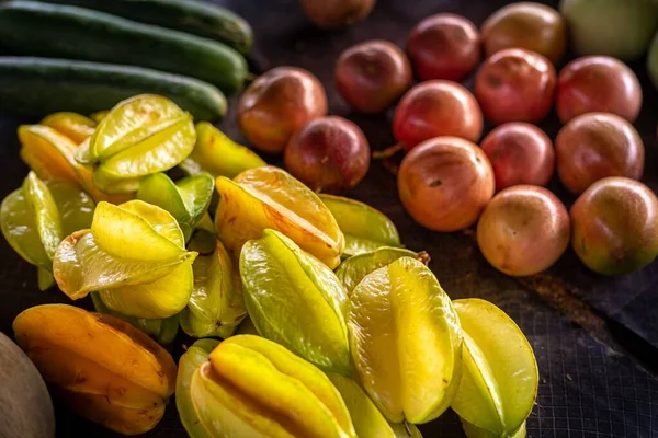
Fruits For Sale In The Honiara Central Market In The Solomon Islands.

Image, 1.89MB, 5472 × 3648 jpg
stock image Jungle on the beach

Jungle On The Beach

Image, 9.43MB, 3648 × 2736 jpg
stock image Guadalcanal Island in the Solomon Sea, belonging to Solomon Islands, isolated on a bilevel elevation map, with distance scale

Guadalcanal Island In The Solomon Sea, Belonging To Solomon Islands, Isolated On A Bilevel Elevation Map, With Distance Scale

Image, 0.68MB, 2160 × 2160 jpg
stock image Views of Honiara from a cruise ship, Solomon Islands.

Views Of Honiara From A Cruise Ship, Solomon Islands.

Image, 2.2MB, 4896 × 3672 jpg
stock vector Oceania highly detailed physical map

Oceania Highly Detailed Physical Map

Vector, 7.22MB, 8923 × 8398 eps
stock image Guadalcanal Island in the Solomon Sea on a topographic, OSM Humanitarian style map

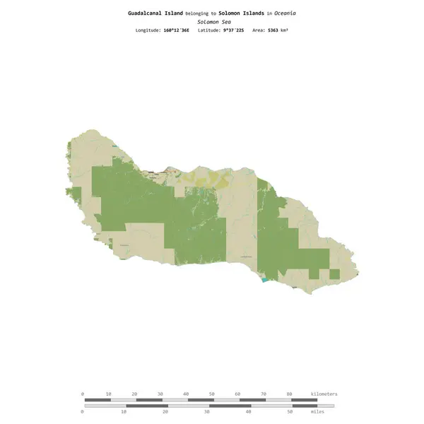
Guadalcanal Island In The Solomon Sea On A Topographic, OSM Humanitarian Style Map

Image, 0.97MB, 2880 × 1620 jpg
stock image Views of Honiara from a cruise ship, Solomon Islands.

Views Of Honiara From A Cruise Ship, Solomon Islands.

Image, 3.98MB, 4896 × 3672 jpg
stock image Views of Honiara from a cruise ship, Solomon Islands.

Views Of Honiara From A Cruise Ship, Solomon Islands.

Image, 3.05MB, 4896 × 3672 jpg
stock vector Guadalcanal province map, administrative division of Solomon Islands. Vector illustration.

Guadalcanal Province Map, Administrative Division Of Solomon Islands. Vector Illustration.

Vector, 5.34MB, 8334 × 8334 eps
stock image Guadalcanal Island in the Solomon Sea on a satellite image taken in November 21, 2022

Guadalcanal Island In The Solomon Sea On A Satellite Image Taken In November 21, 2022

Image, 3.28MB, 2880 × 1620 jpg
stock image Guadalcanal Island in the Solomon Sea, belonging to Solomon Islands, isolated on a topographic, OSM Humanitarian style map, with distance scale

Guadalcanal Island In The Solomon Sea, Belonging To Solomon Islands, Isolated On A Topographic, OSM Humanitarian Style Map, With Distance Scale

Image, 0.67MB, 2160 × 2160 jpg
Page 1 >> Next