photo free
Home Images Vectors Videos

Stock image Guimaras

stock image Windmill, San Lorenzo, Guimaras Island, Philippines

Windmill, San Lorenzo, Guimaras Island, Philippines

Image, 14.67MB, 5970 × 3982 jpg
stock image Overlooking Iloilo Straits, Philippines

Overlooking Iloilo Straits, Philippines

Image, 20.26MB, 5909 × 3917 jpg
stock image Just Before the Sun Sets, Iloilo Straits, from Guimaras Island,

Just Before The Sun Sets, Iloilo Straits, From Guimaras Island,

Image, 8.41MB, 5952 × 2625 jpg
stock vector Guimaras province outline map set

Guimaras Province Outline Map Set

Vector, 0.96MB, 6000 × 3000 eps
stock image Guimaras Island in the Sulu Sea, belonging to Philippines, isolated on a topographic, OSM Humanitarian style map, with distance scale

Guimaras Island In The Sulu Sea, Belonging To Philippines, Isolated On A Topographic, OSM Humanitarian Style Map, With Distance Scale

Image, 1.06MB, 2160 × 2160 jpg
stock image Guimaras Island in the Sulu Sea - belonging to Philippines. Described location diagram with yellow shape of the island and sample maps of its surroundings

Guimaras Island In The Sulu Sea - Belonging To Philippines. Described Location Diagram With Yellow Shape Of The Island And Sample Maps Of Its Surroundings

Image, 3.1MB, 3840 × 2160 jpg
stock image The Homes of Guimaras Island

The Homes Of Guimaras Island

Image, 14.87MB, 4270 × 2842 jpg
stock image Unloading the Boat, Jordan Wharf, Guimaras Island, Philippines

Unloading The Boat, Jordan Wharf, Guimaras Island, Philippines

Image, 27.46MB, 3957 × 5973 jpg
stock image Green heaven in Guimaras Philippines.

Green Heaven In Guimaras Philippines.

Image, 22.05MB, 5328 × 4000 jpg
stock image Iloilo in the Background, from Guimaras Island, Philippines

Iloilo In The Background, From Guimaras Island, Philippines

Image, 19.47MB, 5982 × 4006 jpg
stock image Guimaras Island in the Sulu Sea, belonging to Philippines, isolated on a bilevel elevation map, with distance scale

Guimaras Island In The Sulu Sea, Belonging To Philippines, Isolated On A Bilevel Elevation Map, With Distance Scale

Image, 0.6MB, 2160 × 2160 jpg
stock image Guimaras Island in the Sulu Sea, belonging to Philippines, isolated on a satellite image taken in March 16, 2019, with distance scale

Guimaras Island In The Sulu Sea, Belonging To Philippines, Isolated On A Satellite Image Taken In March 16, 2019, With Distance Scale

Image, 1.7MB, 2160 × 2160 jpg
stock image Inlet Near Magic Island, Guimaras Island, Philippines

Inlet Near Magic Island, Guimaras Island, Philippines

Image, 1.98MB, 4083 × 2706 jpg
stock image Guimaras Island in the Sulu Sea on a topographic, OSM Humanitarian style map

Guimaras Island In The Sulu Sea On A Topographic, OSM Humanitarian Style Map

Image, 3.18MB, 2880 × 1620 jpg
stock image Guimaras Island in the Sulu Sea on a satellite image taken in January 30, 2020

Guimaras Island In The Sulu Sea On A Satellite Image Taken In January 30, 2020

Image, 5.42MB, 2880 × 1620 jpg
stock image Farmers House and Rice Field, Guimaras Island, Philippines

Farmers House And Rice Field, Guimaras Island, Philippines

Image, 29.32MB, 5964 × 3566 jpg
stock image Guimaraes Castle

Guimaraes Castle

Image, 6.07MB, 3015 × 1958 jpg
stock image Guimaras Island in the Sulu Sea on a colored elevation map

Guimaras Island In The Sulu Sea On A Colored Elevation Map

Image, 2.66MB, 2880 × 1620 jpg
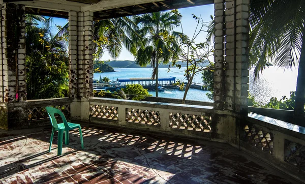
stock image A Porch With a View, Bueanavista, Guimaras Island, Philippines

A Porch With A View, Bueanavista, Guimaras Island, Philippines

Image, 17.72MB, 5958 × 3598 jpg
stock image Lopez House, Guimaras Island, Philippines

Lopez House, Guimaras Island, Philippines

Image, 10MB, 4266 × 2818 jpg
Page 1 >> Next