photo free
Home Images Vectors Videos

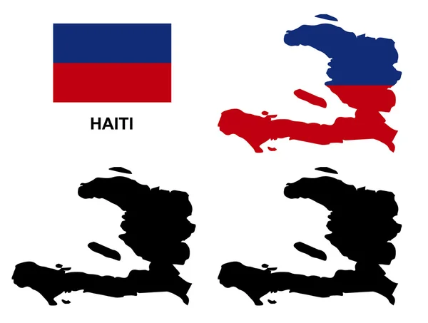
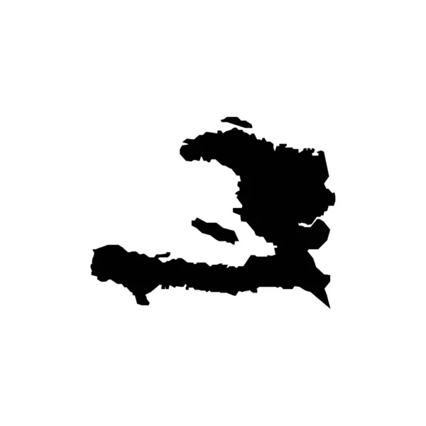
Stock image Haiti Territory

stock vector Haiti map vector, Haiti flag vector, isolated Haiti

Haiti Map Vector, Haiti Flag Vector, Isolated Haiti

Vector, 2.69MB, 5662 × 4283 eps
stock vector haiti

Haiti

Vector, 2.86MB, 5000 × 4000 eps
stock vector Flag of Haiti

Flag Of Haiti

Vector, 7.4MB, 5984 × 5984 eps
stock vector Flag of Haiti

Flag Of Haiti

Vector, 7.78MB, 9450 × 5544 eps
stock vector Republic of Haiti - vector map

Republic Of Haiti - Vector Map

Vector, 0.23MB, 3188 × 3473 eps
stock vector West Indies - vector maps of countries

West Indies - Vector Maps Of Countries

Vector, 0.53MB, 4665 × 4188 eps
stock vector Black location map of the Honduran Ocotepeque department inside gray map of Honduras

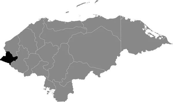
Black Location Map Of The Honduran Ocotepeque Department Inside Gray Map Of Honduras

Vector, 0.6MB, 6004 × 3533 eps
stock vector Black location map of the Honduran Francisco Morazn department inside gray map of Honduras

Black Location Map Of The Honduran Francisco Morazn Department Inside Gray Map Of Honduras

Vector, 0.6MB, 6004 × 3533 eps
stock vector Black location map of the Honduran Comayagua department inside gray map of Honduras

Black Location Map Of The Honduran Comayagua Department Inside Gray Map Of Honduras

Vector, 0.6MB, 6004 × 3533 eps
stock vector Black location map of the Honduran Yoro department inside gray map of Honduras

Black Location Map Of The Honduran Yoro Department Inside Gray Map Of Honduras

Vector, 0.6MB, 6004 × 3533 eps
stock vector Black location map of the Honduran Intibuc department inside gray map of Honduras

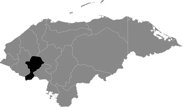
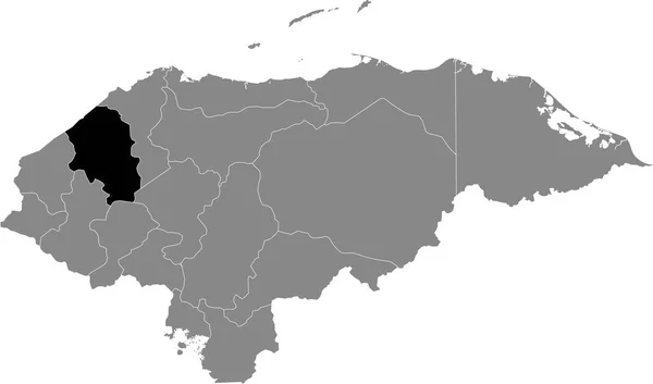
Black Location Map Of The Honduran Intibuc Department Inside Gray Map Of Honduras

Vector, 0.6MB, 6004 × 3533 eps
stock vector Black location map of the Honduran Choluteca department inside gray map of Honduras

Black Location Map Of The Honduran Choluteca Department Inside Gray Map Of Honduras

Vector, 0.6MB, 6004 × 3533 eps
stock vector Black location map of the Honduran Islas de la Baha department inside gray map of Honduras

Black Location Map Of The Honduran Islas De La Baha Department Inside Gray Map Of Honduras

Vector, 0.6MB, 6004 × 3533 eps
stock vector Black location map of the Honduran El Paraso department inside gray map of Honduras

Black Location Map Of The Honduran El Paraso Department Inside Gray Map Of Honduras

Vector, 0.6MB, 6004 × 3533 eps
stock vector Black location map of the Honduran Santa Brbara department inside gray map of Honduras

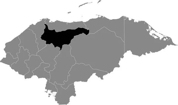
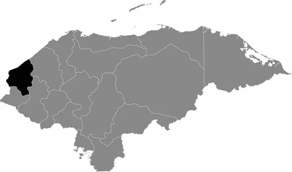
Black Location Map Of The Honduran Santa Brbara Department Inside Gray Map Of Honduras

Vector, 0.6MB, 6004 × 3533 eps
stock vector Black location map of the Honduran Olancho department inside gray map of Honduras

Black Location Map Of The Honduran Olancho Department Inside Gray Map Of Honduras

Vector, 0.6MB, 6004 × 3533 eps
stock vector Black location map of the Honduran Gracias a Dios department inside gray map of Honduras

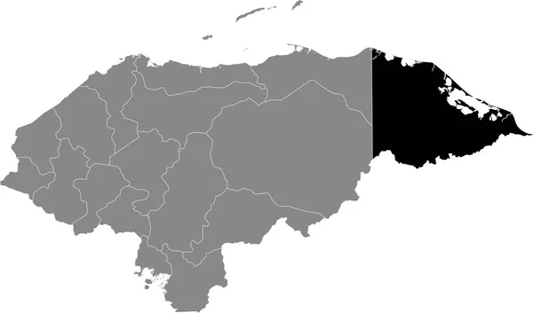
Black Location Map Of The Honduran Gracias A Dios Department Inside Gray Map Of Honduras

Vector, 0.6MB, 6004 × 3533 eps
stock vector Black location map of the Honduran Atlntida department inside gray map of Honduras

Black Location Map Of The Honduran Atlntida Department Inside Gray Map Of Honduras

Vector, 0.6MB, 6004 × 3533 eps
stock vector Black location map of the Honduran La Paz department inside gray map of Honduras

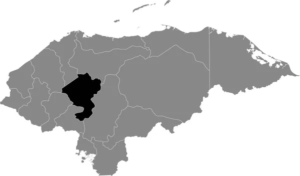
Black Location Map Of The Honduran La Paz Department Inside Gray Map Of Honduras

Vector, 0.6MB, 6004 × 3533 eps
stock vector Black location map of the Honduran Corts department inside gray map of Honduras

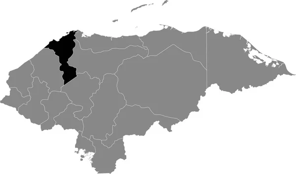
Black Location Map Of The Honduran Corts Department Inside Gray Map Of Honduras

Vector, 0.6MB, 6004 × 3533 eps
stock vector Black location map of the Honduran Valle department inside gray map of Honduras

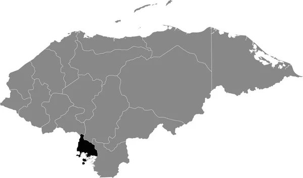
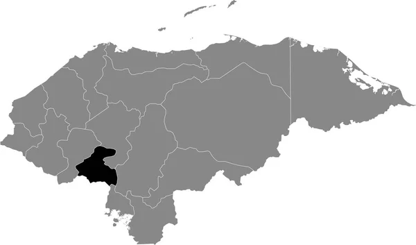
Black Location Map Of The Honduran Valle Department Inside Gray Map Of Honduras

Vector, 0.6MB, 6004 × 3533 eps
stock vector Black location map of the Honduran Lempira department inside gray map of Honduras

Black Location Map Of The Honduran Lempira Department Inside Gray Map Of Honduras

Vector, 0.6MB, 6004 × 3533 eps
stock vector North America countries

North America Countries

Vector, 1.58MB, 3543 × 4724 eps
stock vector North America

North America

Vector, 6.7MB, 3543 × 4724 eps
stock vector Haiti vector map with infographic elements, pointer marks. Editable template with regions, cities and capital Port-au-Prince.

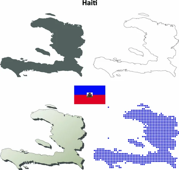
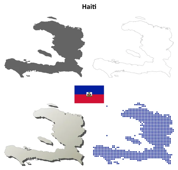
Haiti Vector Map With Infographic Elements, Pointer Marks. Editable Template With Regions, Cities And Capital Port-au-Prince.

Vector, 2.13MB, 4000 × 4000 eps
stock vector Black location map of the Honduran Coln department inside gray map of Honduras

Black Location Map Of The Honduran Coln Department Inside Gray Map Of Honduras

Vector, 0.6MB, 6004 × 3533 eps
stock vector Black location map of the Honduran Copn department inside gray map of Honduras

Black Location Map Of The Honduran Copn Department Inside Gray Map Of Honduras

Vector, 0.6MB, 6004 × 3533 eps
stock vector Haiti map on a white background sign eps ten

Haiti Map On A White Background Sign Eps Ten

Vector, 0.55MB, 8334 × 8334 eps
stock image waving colorful national flag of haiti on a gray world map background.

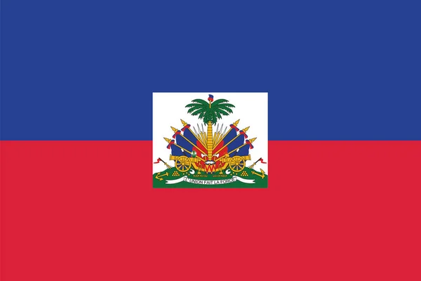
Waving Colorful National Flag Of Haiti On A Gray World Map Background.

Image, 9.22MB, 6558 × 4377 jpg
stock vector 3d map with borders of regions

3d Map With Borders Of Regions

Vector, 1.29MB, 4000 × 4000 eps
stock vector Haiti blank detailed outline map set

Haiti Blank Detailed Outline Map Set

Vector, 0MB, 5000 × 4772 zip
stock vector Flag of Haiti. Abstract concept

Flag Of Haiti. Abstract Concept

Vector, 2.42MB, 5000 × 4000 eps
stock image Costa Rica Map

Costa Rica Map

Image, 3.23MB, 6000 × 4000 jpg
stock vector Map of Haiti with flag

Map Of Haiti With Flag

Vector, 7.85MB, 5984 × 5984 eps
stock vector Flag of Jamaica cropped inside it's map

Flag Of Jamaica Cropped Inside It's Map

Vector, 0.43MB, 6000 × 2373 eps
stock vector Haiti blank detailed outline map set

Haiti Blank Detailed Outline Map Set

Vector, 3.04MB, 5037 × 4808 eps
stock vector collection of flags from all national countries of America

Collection Of Flags From All National Countries Of America

Vector, 3.86MB, 5079 × 5079 eps
stock vector ballotbox Haiti

Ballotbox Haiti

Vector, 3.29MB, 5906 × 4176 eps
stock vector Flag of Haiti with Coat of Arms. Vector Format

Flag Of Haiti With Coat Of Arms. Vector Format

Vector, 6.57MB, 8253 × 5500 eps
stock vector Gray Divided Map of Haiti

Gray Divided Map Of Haiti

Vector, 0.36MB, 3001 × 2001 eps
stock image Grande Cayemite Island in the Caribbean Sea on a colored elevation map

Grande Cayemite Island In The Caribbean Sea On A Colored Elevation Map

Image, 1.08MB, 2880 × 1620 jpg
stock image La Espanola Island in the Caribbean Sea, shared between: Haiti, Dominican Republic, isolated on a satellite image taken in March 18, 2018, with distance scale

La Espanola Island In The Caribbean Sea, Shared Between: Haiti, Dominican Republic, Isolated On A Satellite Image Taken In March 18, 2018, With Distance Scale

Image, 0.89MB, 2160 × 2160 jpg
stock image puzzle with the national flag of haiti and ecuador

Puzzle With The National Flag Of Haiti And Ecuador

Image, 7.94MB, 5400 × 3604 jpg
stock image Haiti 3d Golden Map

Haiti 3d Golden Map

Image, 0.72MB, 2650 × 2270 jpg
stock image Gonave Island in the Caribbean Sea on a colored elevation map

Gonave Island In The Caribbean Sea On A Colored Elevation Map

Image, 2.22MB, 2880 × 1620 jpg
stock image Ile-a-Vache in the Caribbean Sea, belonging to Haiti, isolated on a topographic, OSM Humanitarian style map, with distance scale

Ile-a-Vache In The Caribbean Sea, Belonging To Haiti, Isolated On A Topographic, OSM Humanitarian Style Map, With Distance Scale

Image, 0.6MB, 2160 × 2160 jpg
stock image Grande Cayemite Island in the Caribbean Sea, belonging to Haiti, isolated on a topographic, OSM Humanitarian style map, with distance scale

Grande Cayemite Island In The Caribbean Sea, Belonging To Haiti, Isolated On A Topographic, OSM Humanitarian Style Map, With Distance Scale

Image, 0.33MB, 2160 × 2160 jpg
stock image Gonave Island in the Caribbean Sea on a topographic, OSM Humanitarian style map

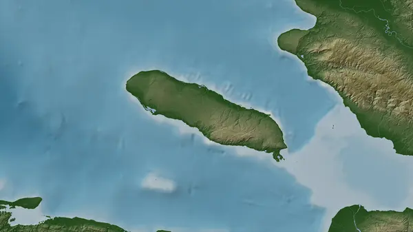
Gonave Island In The Caribbean Sea On A Topographic, OSM Humanitarian Style Map

Image, 0.82MB, 2880 × 1620 jpg
stock image Grande Cayemite Island in the Caribbean Sea on a topographic, OSM Humanitarian style map

Grande Cayemite Island In The Caribbean Sea On A Topographic, OSM Humanitarian Style Map

Image, 0.51MB, 2880 × 1620 jpg
stock image Gonave Island in the Caribbean Sea, belonging to Haiti, isolated on a satellite image taken in January 9, 2020, with distance scale

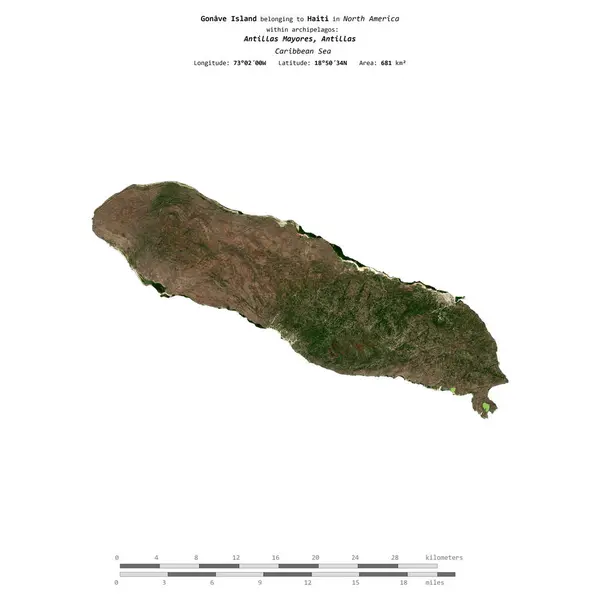
Gonave Island In The Caribbean Sea, Belonging To Haiti, Isolated On A Satellite Image Taken In January 9, 2020, With Distance Scale

Image, 1.09MB, 2160 × 2160 jpg
Page 1 >> Next