photo free
Home Images Vectors Videos

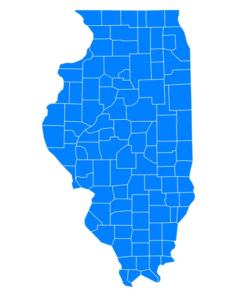
Stock image Illinois County

stock vector Illinois map

Illinois Map

Vector, 8.17MB, 7002 × 7002 eps
stock vector Accurate map of Illinois

Accurate Map Of Illinois

Vector, 0.68MB, 4000 × 5000 eps
stock vector Illinois county map

Illinois County Map

Vector, 0.82MB, 3332 × 5000 ai
stock vector Illinois County Map

Illinois County Map

Vector, 0.85MB, 3332 × 5000 ai
stock vector Accurate map of Illinois

Accurate Map Of Illinois

Vector, 0.66MB, 4000 × 5000 eps
stock vector Vector illustration of a county state with US united states flag

Vector Illustration Of A County State With US United States Flag

Vector, 3.43MB, 6047 × 3469 eps
stock image List of cities in Illinois USA state, map silhouette word cloud map concept

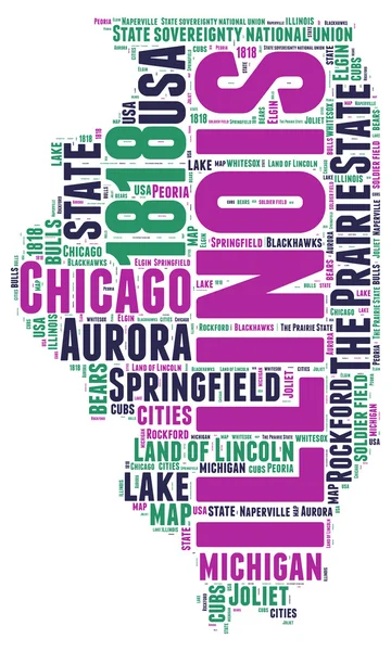
List Of Cities In Illinois USA State, Map Silhouette Word Cloud Map Concept

Image, 3.75MB, 5760 × 3840 jpg
stock image View on waterfront with autumn leaves, City of Chicago, Illinois, USA

View On Waterfront With Autumn Leaves, City Of Chicago, Illinois, USA

Image, 16.5MB, 5616 × 3744 jpg
stock image Illinois Map

Illinois Map

Image, 0.94MB, 2000 × 2000 jpg
stock vector Illinois accurate vector exact detailed State Map with Community Assistance and Activates Icons Original pastel Illustration. United States of Americ

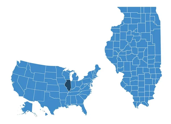
Illinois Accurate Vector Exact Detailed State Map With Community Assistance And Activates Icons Original Pastel Illustration. United States Of Americ

Vector, 0.52MB, 3470 × 5501 eps
stock vector Yellow map of Illinois with indication of largest cities

Yellow Map Of Illinois With Indication Of Largest Cities

Vector, 1.5MB, 3600 × 4500 eps
stock image Trails around Castle Rock state park.

Trails Around Castle Rock State Park.

Image, 28.56MB, 4000 × 6000 jpg
stock vector Illinois USA state map vector tag cloud illustration

Illinois USA State Map Vector Tag Cloud Illustration

Vector, 9.74MB, 6740 × 11220 eps
stock vector Accurate map of Illinois

Accurate Map Of Illinois

Vector, 0.67MB, 4000 × 5000 eps
stock vector Illinois map

Illinois Map

Vector, 4.04MB, 5302 × 4627 eps
stock vector Black map of Illinois

Black Map Of Illinois

Vector, 1.43MB, 3600 × 4500 eps
stock vector Grey map of Illinois

Grey Map Of Illinois

Vector, 1.42MB, 3600 × 4500 eps
stock image Starved Rock State Park - Illinois

Starved Rock State Park - Illinois

Image, 6.56MB, 4752 × 2376 jpg
stock vector Map of Illinois map

Map Of Illinois Map

Vector, 1.36MB, 6907 × 5018 eps
stock vector white abstract outline of Illinois map on grey background

White Abstract Outline Of Illinois Map On Grey Background

Vector, 1.43MB, 3600 × 4500 eps
stock vector High Quality map of Illinois is a state of United States of America with borders of the counties

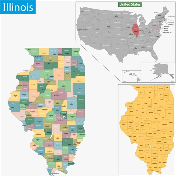
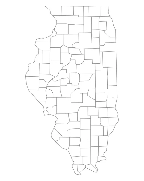
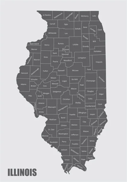
High Quality Map Of Illinois Is A State Of United States Of America With Borders Of The Counties

Vector, 1.23MB, 4000 × 4000 eps
stock vector USA map. United States of America poster with state names. Geographic american maps including Alaska and Hawaii vector illustration

USA Map. United States Of America Poster With State Names. Geographic American Maps Including Alaska And Hawaii Vector Illustration

Vector, 1.63MB, 9000 × 4500 eps
stock vector Doodle freehand drawing USA political map with major cities. Vector illustration.

Doodle Freehand Drawing USA Political Map With Major Cities. Vector Illustration.

Vector, 10.16MB, 8344 × 6282 eps
stock image Bridge across a river in a city, La Salle Street Bridge, Chicago

Bridge Across A River In A City, La Salle Street Bridge, Chicago

Image, 12.21MB, 5361 × 3657 jpg
stock image Skyscrapers at waterfront

Skyscrapers At Waterfront

Image, 12.27MB, 5616 × 3299 jpg
stock vector Large and detailed map of Alexander county in Illinois, USA.

Large And Detailed Map Of Alexander County In Illinois, USA.

Vector, 1.14MB, 3748 × 4506 ai
stock vector Illinois USA federal state map with Coronavirus warning illustration

Illinois USA Federal State Map With Coronavirus Warning Illustration

Vector, 7.7MB, 4500 × 7486 eps
stock vector Accurate map of Illinois

Accurate Map Of Illinois

Vector, 0.71MB, 4000 × 5000 eps
stock vector Illinois counties map

Illinois Counties Map

Vector, 8.16MB, 3504 × 5004 eps
stock vector Accurate map of Illinois

Accurate Map Of Illinois

Vector, 0.67MB, 4000 × 5000 eps
stock vector California state map silhouette in the United States

California State Map Silhouette In The United States

Vector, 0.03MB, 5000 × 3000 eps
stock image Skyscrapers at waterfront, La Salle Street Bridge, Wrigley Buildi

Skyscrapers At Waterfront, La Salle Street Bridge, Wrigley Buildi

Image, 10.85MB, 3507 × 5033 jpg
stock vector USA State counties emblem map

USA State Counties Emblem Map

Vector, 0MB, 5136 × 5168 zip
stock image Skyscrapers in a city

Skyscrapers In A City

Image, 8.69MB, 6922 × 3650 jpg
stock vector Accurate map of Illinois

Accurate Map Of Illinois

Vector, 0.71MB, 4000 × 5000 eps
stock image American state of Illinois, simple 3D map in white grey. 3D Rendering

American State Of Illinois, Simple 3D Map In White Grey. 3D Rendering

Image, 1.81MB, 4500 × 4500 jpg
stock vector Accurate map of Illinois

Accurate Map Of Illinois

Vector, 0.67MB, 4000 × 5000 eps
stock vector Illinois counties map

Illinois Counties Map

Vector, 9.9MB, 3504 × 5004 eps
stock vector Vector hand drawn stylized map of The United States of America. Travel illustration of USA states. Hand drawn lettering illustration. North America map element

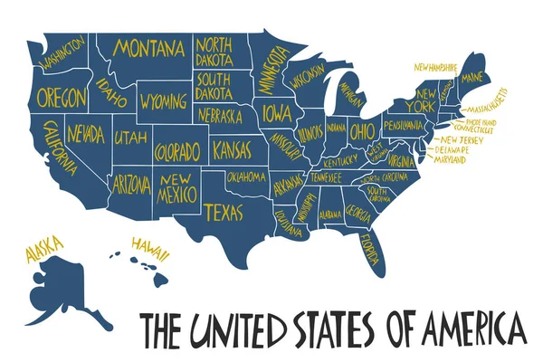
Vector Hand Drawn Stylized Map Of The United States Of America. Travel Illustration Of USA States. Hand Drawn Lettering Illustration. North America Map Element

Vector, 0.64MB, 6000 × 4000 eps
stock vector USA map with geographical state borders and state names. United States of America map. Colorful US map design with state names for infographic. Vector

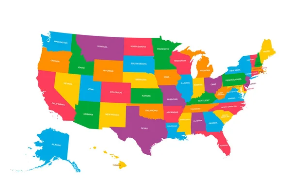
USA Map With Geographical State Borders And State Names. United States Of America Map. Colorful US Map Design With State Names For Infographic. Vector

Vector, 2.1MB, 6250 × 4167 eps
stock image Downtown Chicago

Downtown Chicago

Image, 11.26MB, 4288 × 2848 jpg
stock vector Accurate map of Illinois

Accurate Map Of Illinois

Vector, 0.71MB, 4000 × 5000 eps
stock vector USA map silhouette isolated on white. United States of America country. Vector illustration.

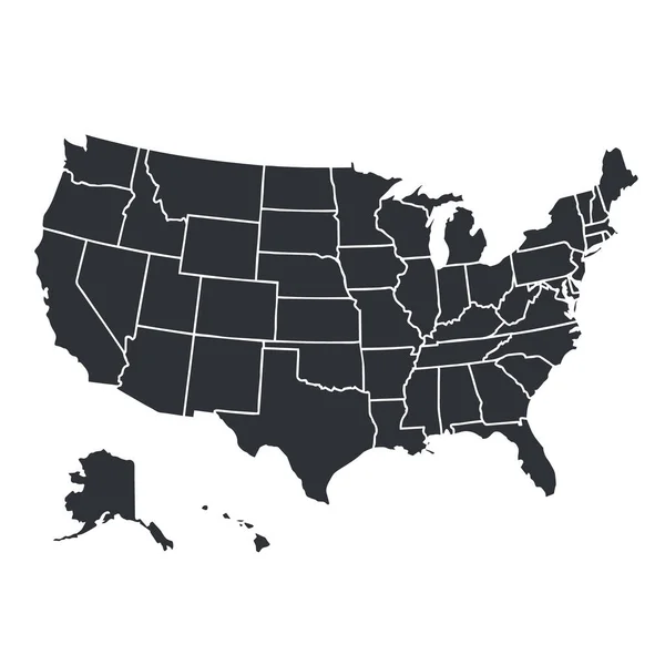
USA Map Silhouette Isolated On White. United States Of America Country. Vector Illustration.

Vector, 0.64MB, 4000 × 4000 eps
stock vector Map of Cook in Illinois

Map Of Cook In Illinois

Vector, 0.26MB, 4000 × 5000 eps
stock image View of City of Chicago from town park through flowerbed, Illinois, USA

View Of City Of Chicago From Town Park Through Flowerbed, Illinois, USA

Image, 15.07MB, 5616 × 3744 jpg
stock vector black outline of Illinois map- vector illustration

Black Outline Of Illinois Map- Vector Illustration

Vector, 6.44MB, 4000 × 4000 eps
stock image City of Chicago downtown bridges metro train and river, Illinois, USA

City Of Chicago Downtown Bridges Metro Train And River, Illinois, USA

Image, 15.45MB, 5354 × 3497 jpg
stock image Magnificent Mile in Chicago

Magnificent Mile In Chicago

Image, 9.88MB, 4758 × 3308 jpg
stock image Skyscrapers of Chicago

Skyscrapers Of Chicago

Image, 6.56MB, 5297 × 2852 jpg
stock image Chicago Buildings with Sears-Willis Tower

Chicago Buildings With Sears-Willis Tower

Image, 6.09MB, 2228 × 3355 jpg
Page 1 >> Next