
Stock image Irrigated Land
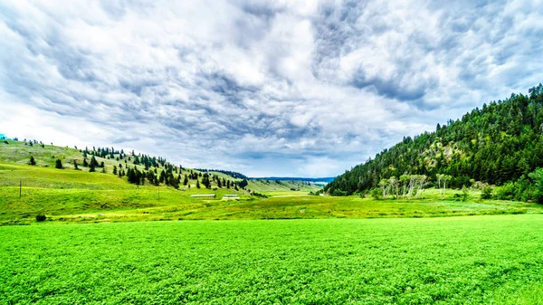
The Fertile Farmland Among The Rolling Hills Along Highway 5A Between Kamloops And Merritt In The Okanagen Region Of British Columbia, Canada
Image, 20.15MB, 6000 × 3375 jpg
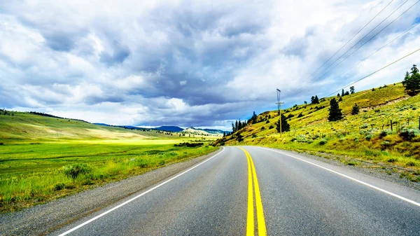
Highway 5A Winding Through The Wide Open Grass Lands Of The Nicola Valley, Between Merritt And Kamloops, British Columbia, Canada, Under Partly Cloudy Sky
Image, 17.89MB, 5973 × 3360 jpg

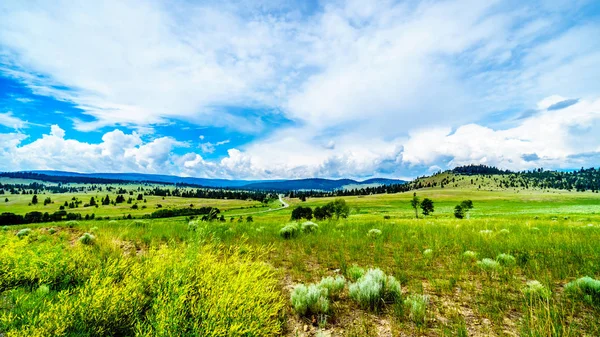
Ranch Land In The Nicola Valley Along Highway 5A Between Merritt And Kamloops, British Columbia, Canada
Image, 19.71MB, 5895 × 3316 jpg

View From Highway R62 Of The Lovely Town Of Barrydale, Nestled Between The Tradouw Valley And The Klein Karoo, In The Western Cape Province Of South Africa
Image, 13.1MB, 5955 × 3350 jpg

Dark Clouds Hanging Over Lodgepole Pine Trees On The Rolling Hills In A Dry Region Of The Okanagen Along Highway 5A Between Kamloops And Merritt In British Columbia, Canada
Image, 15.58MB, 5995 × 3372 jpg
Ranch Land In The Nicola Valley Along Highway 5A Between Merritt And Kamloops, British Columbia, Canada
Image, 16.73MB, 6000 × 3375 jpg

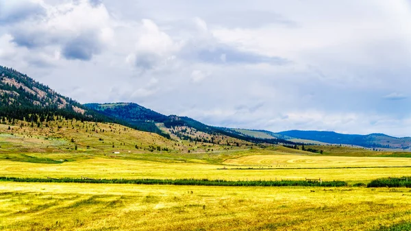
Dark Clouds Hanging Over The Fertile Farmland And Rolling Hills Along Highway 5A Near Nicola Lake, Between Kamloops And Merritt In The Okanagen Region Of British Columbia, Canada
Image, 16.92MB, 6000 × 3375 jpg
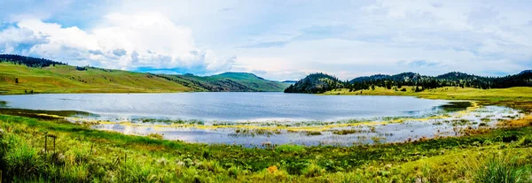
Panorama View Of Stump Lake Surrounded By The Rolling Hills And Wide Open Grass Lands Of The Nicola Valley Along Highway 5A, Between Merritt And Kamloops, British Columbia, Canada, Under Partly Cloudy Sky
Image, 15.99MB, 9349 × 3228 jpg
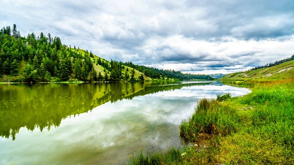
Dark Clouds And Surrounding Mountains Reflecting On The Smooth Water Surface Of Trapp Lake, Located Along Highway 5A Between Kamloops And Merritt In British Columbia, Canada
Image, 16.44MB, 6000 × 3375 jpg

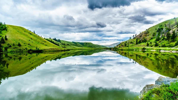
Dark Clouds And Surrounding Mountains Reflecting On The Smooth Water Surface Of Trapp Lake, Located Along Highway 5A Between Kamloops And Merritt In British Columbia, Canada
Image, 14.13MB, 6000 × 3375 jpg
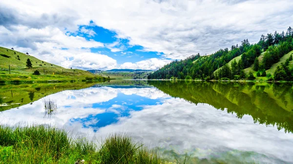
Blue Sky, Clouds And Surrounding Mountains Reflecting On The Smooth Water Surface Of Trapp Lake, Located Along Highway 5A Between Kamloops And Merritt In British Columbia, Canada
Image, 14.21MB, 5966 × 3356 jpg
Dark Clouds Hanging Over The Fertile Farmland And Rolling Hills Along Highway 5A Near Nicola Lake, Between Kamloops And Merritt In The Okanagen Region Of British Columbia, Canada
Image, 15.5MB, 5961 × 3353 jpg


Asian Farmer Cultivating Rice Field Paddy Plantation Agriculture Illustration
Vector, 1.18MB, 5000 × 3200 eps


Page 1 >> Next