photo free
Home Images Vectors Videos

Stock image Island Grand Bahama Map

stock vector Grand Bahama map Blank vector map of the Island Borders of Grand Bahama for your infographic

Grand Bahama Map Blank Vector Map Of The Island Borders Of Grand Bahama For Your Infographic

Vector, 0.38MB, 7478 × 4031 eps
stock vector Grand Bahama map Map of the island with beautiful geometric waves in red blue colors Vivid Grand

Grand Bahama Map Map Of The Island With Beautiful Geometric Waves In Red Blue Colors Vivid Grand

Vector, 0.43MB, 7729 × 3892 eps
stock vector The Bahamas Political Map

The Bahamas Political Map

Vector, 1.79MB, 7902 × 6000 eps
stock vector Grand Bahama Logo Map of Grand Bahama with island name and flag Creative vector illustration

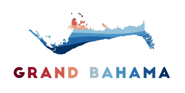
Grand Bahama Logo Map Of Grand Bahama With Island Name And Flag Creative Vector Illustration

Vector, 0.37MB, 6839 × 4391 eps
stock vector Grand Bahama Badge Round logo of island with triangular mesh map and radial rays EPS10 Vector

Grand Bahama Badge Round Logo Of Island With Triangular Mesh Map And Radial Rays EPS10 Vector

Vector, 0.63MB, 5488 × 5488 eps
stock vector Grand Bahama vector map Distressed travel stamp with text wrapped around a circle and stars Island

Grand Bahama Vector Map Distressed Travel Stamp With Text Wrapped Around A Circle And Stars Island

Vector, 3.04MB, 8333 × 8333 eps
stock vector North America with highlighted The Bahamas map.

North America With Highlighted The Bahamas Map.

Vector, 0.46MB, 5000 × 3500 eps
stock image Grand Bahama Island in the North Atlantic Ocean - belonging to Bahamas. Described location diagram with yellow shape of the island and sample maps of its surroundings

Grand Bahama Island In The North Atlantic Ocean - Belonging To Bahamas. Described Location Diagram With Yellow Shape Of The Island And Sample Maps Of Its Surroundings

Image, 2.31MB, 3840 × 2160 jpg
stock image Grand Bahama Island in the North Atlantic Ocean on a topographic, OSM Humanitarian style map

Grand Bahama Island In The North Atlantic Ocean On A Topographic, OSM Humanitarian Style Map

Image, 0.91MB, 2880 × 1620 jpg
stock image Grand Bahama Island in the North Atlantic Ocean on a satellite image taken in January 30, 2023

Grand Bahama Island In The North Atlantic Ocean On A Satellite Image Taken In January 30, 2023

Image, 4.13MB, 2880 × 1620 jpg
stock image Grand Bahama Island in the North Atlantic Ocean, belonging to Bahamas, isolated on a satellite image taken in March 20, 2024, with distance scale

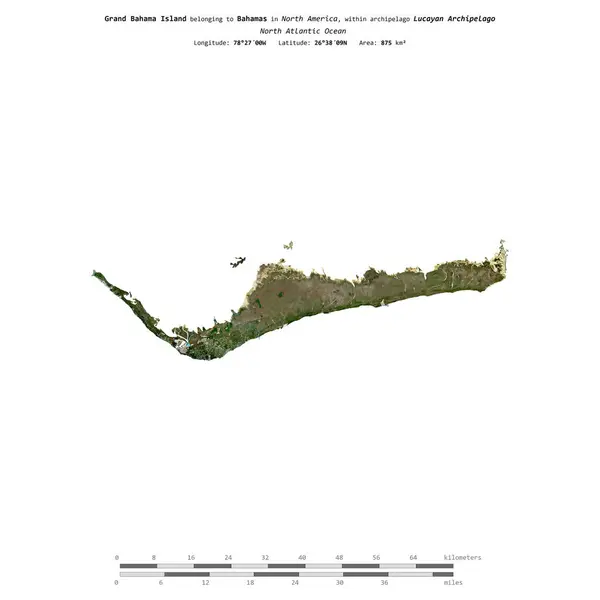
Grand Bahama Island In The North Atlantic Ocean, Belonging To Bahamas, Isolated On A Satellite Image Taken In March 20, 2024, With Distance Scale

Image, 0.52MB, 2160 × 2160 jpg
stock image Grand Bahama Island in the North Atlantic Ocean, belonging to Bahamas, isolated on a topographic, OSM Humanitarian style map, with distance scale

Grand Bahama Island In The North Atlantic Ocean, Belonging To Bahamas, Isolated On A Topographic, OSM Humanitarian Style Map, With Distance Scale

Image, 0.4MB, 2160 × 2160 jpg
stock image Grand Bahama Island in the North Atlantic Ocean, belonging to Bahamas, isolated on a bilevel elevation map, with distance scale

Grand Bahama Island In The North Atlantic Ocean, Belonging To Bahamas, Isolated On A Bilevel Elevation Map, With Distance Scale

Image, 0.26MB, 2160 × 2160 jpg
stock image Grand Bahama Island in the North Atlantic Ocean on a colored elevation map

Grand Bahama Island In The North Atlantic Ocean On A Colored Elevation Map

Image, 1.24MB, 2880 × 1620 jpg
Page 1 >> Next