photo free
Home Images Vectors Videos

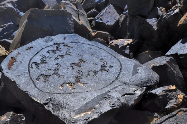
Stock image Jalal Abad

stock image Jalal-Abad - province of Kyrgyzstan zoomed and highlighted with capital. Main physical landscape features. 3D rendering

Jalal-Abad - Province Of Kyrgyzstan Zoomed And Highlighted With Capital. Main Physical Landscape Features. 3D Rendering

Image, 4.89MB, 2880 × 1620 jpg
stock image The Naryn River in the Tien Shan mountains, Kyrgyzstan.

The Naryn River In The Tien Shan Mountains, Kyrgyzstan.

Image, 9.07MB, 5387 × 3591 jpg
stock image snowy mountain peaks on the Ala Bel pass, Bishkek Osh Highway M41 in Kyrgyzstan

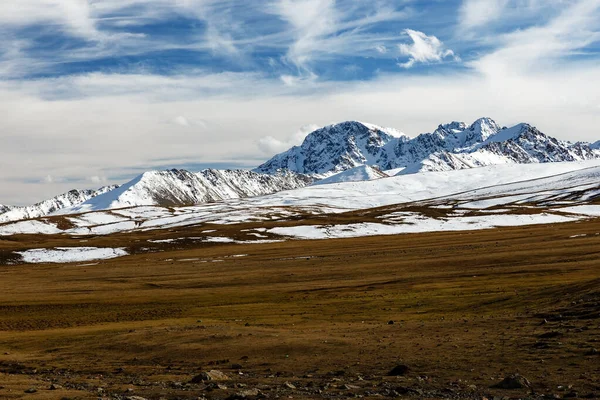
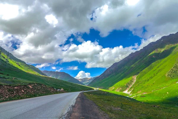
Snowy Mountain Peaks On The Ala Bel Pass, Bishkek Osh Highway M41 In Kyrgyzstan

Image, 8.81MB, 5328 × 3552 jpg
stock image Toktogul Reservoir in the territory of the Toktogul district of the Jalal-Abad region of Kyrgyzstan.

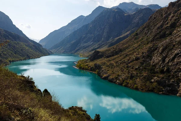
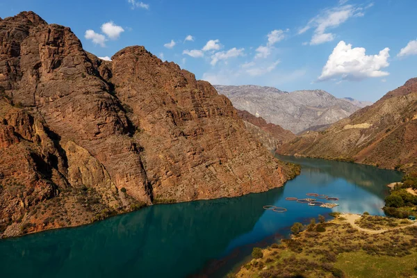
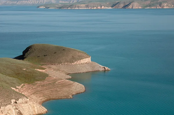
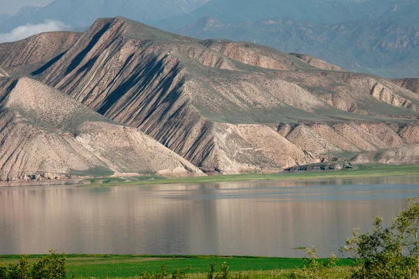
Toktogul Reservoir In The Territory Of The Toktogul District Of The Jalal-Abad Region Of Kyrgyzstan.

Image, 9.48MB, 5372 × 3581 jpg
stock image Toktogul highland mountain lake in Kyrgyzstan

Toktogul Highland Mountain Lake In Kyrgyzstan

Image, 18.99MB, 5628 × 3747 jpg
stock image Kyrgyzstan flag depicted on side wall of white delivery van close up. Shipping and local delivery concept

Kyrgyzstan Flag Depicted On Side Wall Of White Delivery Van Close Up. Shipping And Local Delivery Concept

Image, 2.71MB, 4928 × 3264 jpg
stock image Kyrgyzstan flag depicted on metal doors of shipping cargo container outdoors in docks area close up

Kyrgyzstan Flag Depicted On Metal Doors Of Shipping Cargo Container Outdoors In Docks Area Close Up

Image, 2.09MB, 4928 × 3264 jpg
stock image Kyrgyzstan flag depicted on metal doors of shipping cargo container outdoors in docks area close up

Kyrgyzstan Flag Depicted On Metal Doors Of Shipping Cargo Container Outdoors In Docks Area Close Up

Image, 3.4MB, 4928 × 3264 jpg
stock vector Vector blank map of Kyrgyzstan with regions and administrative divisions, and neighbouring countries and territories. Editable and clearly labeled layers.

Vector Blank Map Of Kyrgyzstan With Regions And Administrative Divisions, And Neighbouring Countries And Territories. Editable And Clearly Labeled Layers.

Vector, 1.95MB, 6000 × 4000 eps
stock image Kyrgyzstan flag depicted on folded wavy fabric of old cloth close up

Kyrgyzstan Flag Depicted On Folded Wavy Fabric Of Old Cloth Close Up

Image, 8MB, 4928 × 3264 jpg
stock image Kyrgyzstan flag and big stack of shipping cargo containers in docks with sky background close up

Kyrgyzstan Flag And Big Stack Of Shipping Cargo Containers In Docks With Sky Background Close Up

Image, 4.82MB, 4928 × 3264 jpg
stock vector Vector illustrated map of Kyrgyzstan with regions and administrative divisions, and neighbouring countries and territories. Editable and clearly labeled layers.

Vector Illustrated Map Of Kyrgyzstan With Regions And Administrative Divisions, And Neighbouring Countries And Territories. Editable And Clearly Labeled Layers.

Vector, 2.52MB, 6000 × 4000 eps
stock image Toktogul highland mountain lake in Kyrgyzstan

Toktogul Highland Mountain Lake In Kyrgyzstan

Image, 0.71MB, 2496 × 1664 jpg
stock image Kyrgyzstan flag depicted on folded wavy fabric of old cloth close up

Kyrgyzstan Flag Depicted On Folded Wavy Fabric Of Old Cloth Close Up

Image, 7.2MB, 4928 × 3264 jpg
stock vector Vector blank map of Kyrgyzstan with regions or territories and administrative divisions. Editable and clearly labeled layers.

Vector Blank Map Of Kyrgyzstan With Regions Or Territories And Administrative Divisions. Editable And Clearly Labeled Layers.

Vector, 1.48MB, 6000 × 4000 eps
stock image Kyrgyzstan flag depicted on folded wavy fabric of old cloth close up

Kyrgyzstan Flag Depicted On Folded Wavy Fabric Of Old Cloth Close Up

Image, 7.65MB, 4928 × 3264 jpg
stock image Kyrgyzstan flag and big stack of shipping cargo containers in docks with sky background close up

Kyrgyzstan Flag And Big Stack Of Shipping Cargo Containers In Docks With Sky Background Close Up

Image, 1.13MB, 4928 × 3264 jpg
stock vector Jalal Abad region map, administrative division of Kyrgyzstan. Vector illustration.

Jalal Abad Region Map, Administrative Division Of Kyrgyzstan. Vector Illustration.

Vector, 5.32MB, 8334 × 8334 eps
stock vector Vector map of Kyrgyzstan with regions and administrative divisions, and neighbouring countries and territories. Editable and clearly labeled layers.

Vector Map Of Kyrgyzstan With Regions And Administrative Divisions, And Neighbouring Countries And Territories. Editable And Clearly Labeled Layers.

Vector, 2.02MB, 6000 × 4000 eps
stock vector Vector blank map of Kyrgyzstan with regions and administrative divisions. Editable and clearly labeled layers.

Vector Blank Map Of Kyrgyzstan With Regions And Administrative Divisions. Editable And Clearly Labeled Layers.

Vector, 1.48MB, 6000 × 4000 eps
stock vector Vector illustrated blank map of Kyrgyzstan with regions and administrative divisions, and neighbouring countries and territories. Editable and clearly labeled layers.

Vector Illustrated Blank Map Of Kyrgyzstan With Regions And Administrative Divisions, And Neighbouring Countries And Territories. Editable And Clearly Labeled Layers.

Vector, 2.28MB, 6000 × 4000 eps
stock vector Vector map of Kyrgyzstan with regions and administrative divisions. Editable and clearly labeled layers.

Vector Map Of Kyrgyzstan With Regions And Administrative Divisions. Editable And Clearly Labeled Layers.

Vector, 1.52MB, 6000 × 4000 eps
stock image Kyrgyzstan flag depicted on side wall of white delivery van close up. Shipping and local delivery concept

Kyrgyzstan Flag Depicted On Side Wall Of White Delivery Van Close Up. Shipping And Local Delivery Concept

Image, 2.59MB, 4928 × 3264 jpg
stock image Kyrgyzstan flag and big stack of shipping cargo containers in docks with sky background close up

Kyrgyzstan Flag And Big Stack Of Shipping Cargo Containers In Docks With Sky Background Close Up

Image, 5.46MB, 4928 × 3264 jpg
stock vector Vector map of Kyrgyzstan with regions and administrative divisions. Editable and clearly labeled layers.

Vector Map Of Kyrgyzstan With Regions And Administrative Divisions. Editable And Clearly Labeled Layers.

Vector, 1.52MB, 6000 × 4000 eps
stock image Kyrgyzstan flag depicted on folded wavy fabric of old cloth close up

Kyrgyzstan Flag Depicted On Folded Wavy Fabric Of Old Cloth Close Up

Image, 7.32MB, 4928 × 3264 jpg
stock image Kyrgyzstan flag and big stack of shipping cargo containers in docks with sky background close up

Kyrgyzstan Flag And Big Stack Of Shipping Cargo Containers In Docks With Sky Background Close Up

Image, 5.65MB, 4928 × 3264 jpg
stock image Kyrgyzstan flag depicted on folded wavy fabric of old cloth close up

Kyrgyzstan Flag Depicted On Folded Wavy Fabric Of Old Cloth Close Up

Image, 5.71MB, 4928 × 3264 jpg
stock image Walnut trees in a walnut forest in Arslanbob in Kyrgyzstan.

Walnut Trees In A Walnut Forest In Arslanbob In Kyrgyzstan.

Image, 17.32MB, 8256 × 4644 jpg
stock image Ancient pictograms

Ancient Pictograms

Image, 7.54MB, 3012 × 2001 jpg
stock image Ancient pictograms

Ancient Pictograms

Image, 9.85MB, 3012 × 2001 jpg
stock image Ancient petroglyphs

Ancient Petroglyphs

Image, 8.64MB, 3012 × 2001 jpg
stock image Ancient pictograms

Ancient Pictograms

Image, 8.18MB, 3012 × 2001 jpg
stock image Money of Kyrgyzstan. Som  bills. KGS banknotes. 100 Kirghiz. Business, finance, news background. 3d illustration.

Money Of Kyrgyzstan. Som Bills. KGS Banknotes. 100 Kirghiz. Business, Finance, News Background. 3d Illustration.

Image, 11.95MB, 4000 × 3000 jpg
stock image Ancient pictogram

Ancient Pictogram

Image, 6.97MB, 3012 × 2001 jpg
stock image Naryn river from the bridge.

Naryn River From The Bridge.

Image, 8.06MB, 4032 × 3024 jpg
stock image Coat of arms of the city of Jalal-Abad. Kyrgyzstan

Coat Of Arms Of The City Of Jalal-Abad. Kyrgyzstan

Image, 4.11MB, 4000 × 4000 jpg
stock image Ancient pictograms

Ancient Pictograms

Image, 7.54MB, 3012 × 2001 jpg
stock image Ancient pictograms

Ancient Pictograms

Image, 7.54MB, 3012 × 2001 jpg
stock vector Kyrgyzstan physical map ,in vector format,with all the relief forms,regions and big cities.

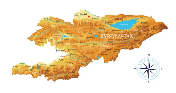
Kyrgyzstan Physical Map ,in Vector Format,with All The Relief Forms,regions And Big Cities.

Vector, 2.21MB, 6000 × 3163 eps
stock image The Naryn River, Kyrgyzstan

The Naryn River, Kyrgyzstan

Image, 9.96MB, 5472 × 3648 jpg
stock image Ancient pictograms

Ancient Pictograms

Image, 8.78MB, 3012 × 2001 jpg
stock image Suusamyr Too Snow Capped Mountain Range Grass Land Valley Landscape and Road View Point

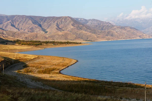
Suusamyr Too Snow Capped Mountain Range Grass Land Valley Landscape And Road View Point

Image, 3.99MB, 3000 × 2000 jpg
stock image Flag of Kyrgyzstan

Flag Of Kyrgyzstan

Image, 2.38MB, 3072 × 1920 jpg
stock vector Jalal-Abad region outline map set

Jalal-Abad Region Outline Map Set

Vector, 0.5MB, 6000 × 3000 eps
stock image Walnut trees in a walnut forest in Arslanbob in Kyrgyzstan.

Walnut Trees In A Walnut Forest In Arslanbob In Kyrgyzstan.

Image, 20.8MB, 8256 × 4644 jpg
stock image Suusamyr Too Mountain Range Landscape View Point Highway to Bishkek

Suusamyr Too Mountain Range Landscape View Point Highway To Bishkek

Image, 4.15MB, 3000 × 2000 jpg
stock image Toktogul highland mountain lake in Kyrgyzstan

Toktogul Highland Mountain Lake In Kyrgyzstan

Image, 19.01MB, 5628 × 3746 jpg
stock image Toktogul highland mountain lake in Kyrgyzstan

Toktogul Highland Mountain Lake In Kyrgyzstan

Image, 19.89MB, 5628 × 3747 jpg
stock image Toktogul highland mountain lake in Kyrgyzstan

Toktogul Highland Mountain Lake In Kyrgyzstan

Image, 18.47MB, 5628 × 3747 jpg
Page 1 >> Next