
Stock image Kanawha County
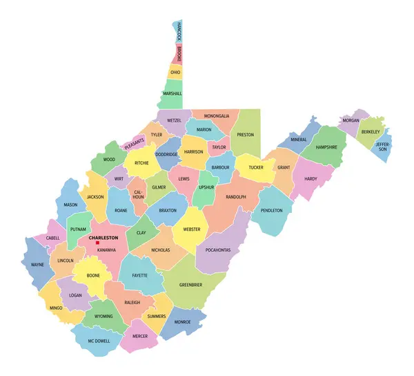
West Virginia, U.S. State, Subdivided Into 55 Counties, Multi Colored Political Map With Capital Charleston, Borders And County Names. State In The Southeastern And Mid-Atlantic Regions Of The USA.
Vector, 1.34MB, 6612 × 6000 eps

West Virginia Counties, Political Map With Borders And County Names. Landlocked State In The Southeastern And Mid-Atlantic Regions Of The United States, Subdivided Into 55 Counties. Illustration
Vector, 1.52MB, 6571 × 6000 eps

West Virginia Counties, Gray Political Map With Borders And County Names. Landlocked State In The Southeastern And Mid-Atlantic Regions Of The United States, Subdivided Into 55 Counties. Illustration
Vector, 1.32MB, 6612 × 6000 eps
Page 1 >> Next