
Stock image Kei Island

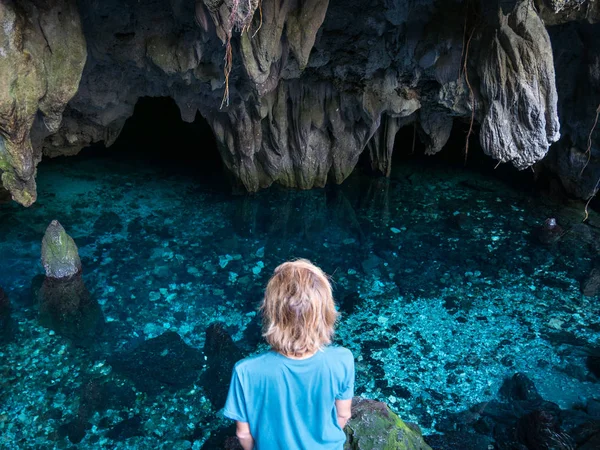
Woman Swimming In Natural Lake Inside Cave. Colorful Reflection, Turquoise Transparent Water, Summer Adventures. Tourist Destination, Kei Islands, Moluccas, Indonesia.
Image, 19.71MB, 5641 × 3766 jpg
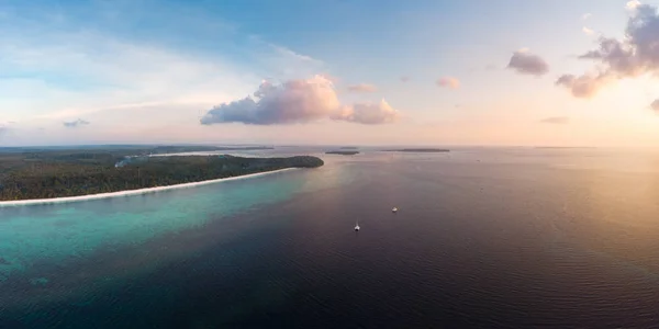
Aerial View Tropical Beach Island Reef Caribbean Sea At Sunset. Kei Island, Indonesia Moluccas Archipelago. Top Travel Destination, Best Diving Snorkeling, Stunning Panorama.
Image, 9.43MB, 5956 × 2978 jpg
Woman In Natural Lake Inside Cave. Colorful Reflection, Turquoise Transparent Water, Summer Adventures. Tourist Destination, Kei Islands, Moluccas, Indonesia.
Image, 8.09MB, 3673 × 2758 jpg

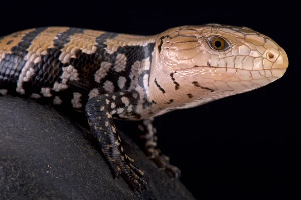
The Kei Island Blue-tongued Skink (Tiliqua Gigas Keyensis) Is Endemic To The Kei Islands, Part Of Indonesia.
Image, 12.33MB, 6512 × 4346 jpg

Aerial View Of The Madwaer Beach In The Kei Cecil Island, Maluku, Indonesia
Image, 6.95MB, 3992 × 2242 jpg

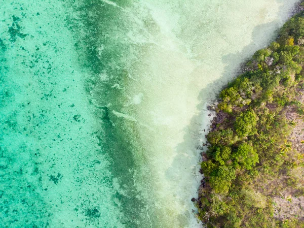
Coral Reef Tropical Caribbean Sea, Turquoise Blue Water. Indonesia Sulawesi Wakatobi National Park. Top Travel Tourist Destination, Best Diving Snorkeling.
Image, 21.29MB, 6016 × 4016 jpg
Aerial Top Down View Tropical Paradise Pristine Coast Line Rainforest At Bair Island. Indonesia Moluccas Archipelago, Kei Islands, Banda Sea. Top Travel Destination, Best Diving Snorkeling.
Image, 9.08MB, 3845 × 2880 jpg

Aerial: Tropical Paradise Pristine Coast Line Rainforest Blue Lake At Bair Island. Indonesia Moluccas Archipelago, Kei Islands, Banda Sea. Top Travel Destination, Best Diving Snorkeling.
Image, 18.09MB, 13692 × 4467 jpg
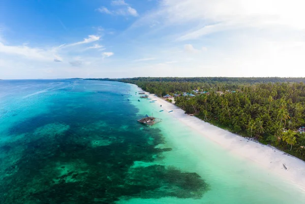
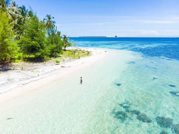
Aerial View Tropical Beach Island Reef Caribbean Sea. Indonesia Moluccas Archipelago, Kei Islands, Banda Sea. Top Travel Destination, Best Diving Snorkeling, Stunning Panorama.
Image, 18.5MB, 6884 × 4618 jpg

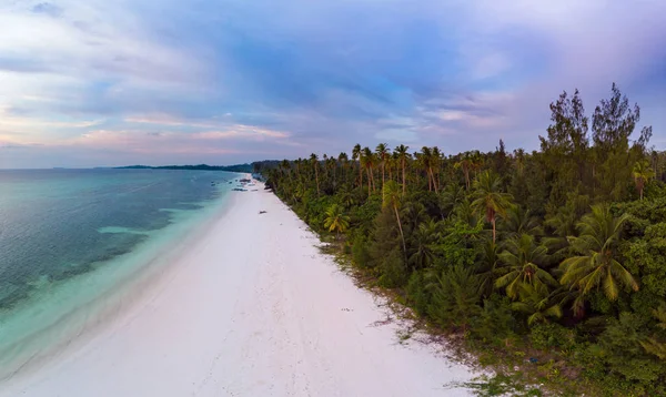
Aerial View Tropical Beach Island Reef Caribbean Sea. Indonesia Moluccas Archipelago, Kei Islands, Banda Sea. Top Travel Destination, Best Diving Snorkeling, Stunning Panorama.
Image, 20.87MB, 12127 × 4455 jpg

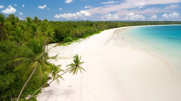
Aerial View Tropical Beach Island Reef Caribbean Sea. Indonesia Moluccas Archipelago, Kei Islands, Banda Sea. Top Travel Destination, Best Diving Snorkeling, Stunning Panorama.
Image, 20.76MB, 6852 × 4587 jpg
Aerial View Tropical Beach Island Reef Caribbean Sea. Indonesia Moluccas Archipelago, Kei Islands, Banda Sea. Top Travel Destination, Best Diving Snorkeling, Stunning Panorama.
Image, 13.57MB, 6296 × 3757 jpg
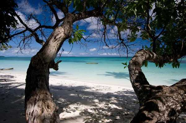
Aerial: Woman Getting Out Of Caribbean Sea Turquoise Water Tropical Coral Reef Walking On White Sand Beach. Banyak Islands Sumatra Indonesia Scenic Travel Destination
Image, 5.22MB, 3200 × 2397 jpg
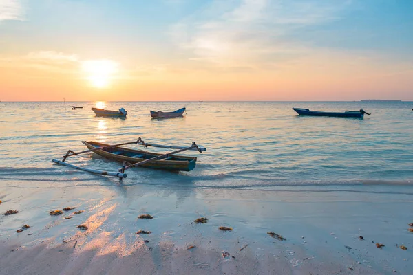
Sunset Tropical Beach Caribbean Sea Wooden Boats At Pasir Panjang. Indonesia Moluccas Archipelago, Kei Islands, Banda Sea. Top Travel Destination, Best Diving Snorkeling, Stunning Panorama.
Image, 10.27MB, 5715 × 3815 jpg
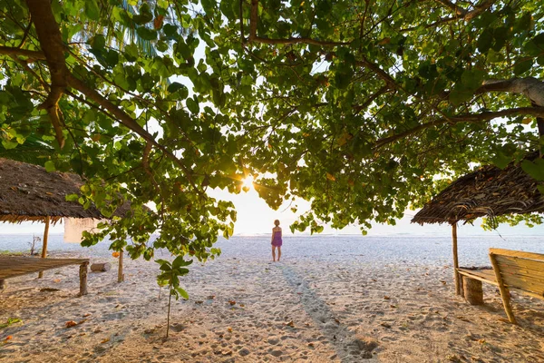
Woman Dancing On Sand Beach Romantic Sky At Sunset, Rear View, Golden Sunlight, Real People. Indonesia, Kei Islands, Moluccas Maluku
Image, 17.09MB, 5715 × 3815 jpg
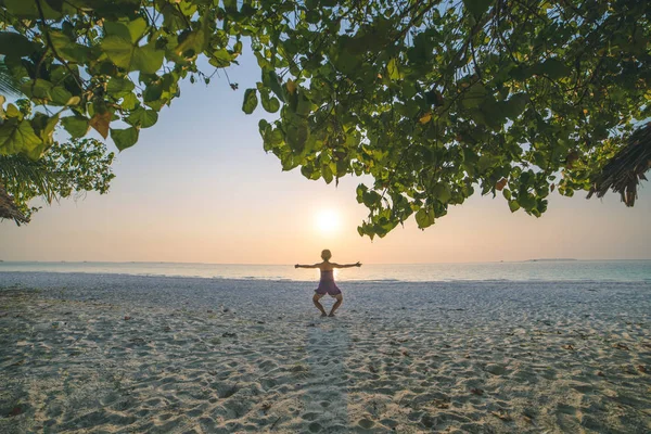
Woman Dancing On Sand Beach Romantic Sky At Sunset, Rear View, Golden Sunlight, Real People. Indonesia, Kei Islands, Moluccas Maluku
Image, 13.91MB, 5627 × 3756 jpg
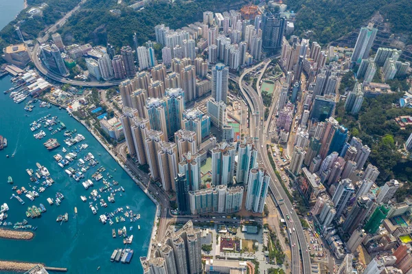
Shau Kei Wan, Hong Kong - 19 March, 2019: Top Down View Of Hong Kong City
Image, 11.98MB, 4500 × 2998 jpg


Hong Kong S.A.R. - July 13, 2017: Double Decker Tram Or Ding Ding On The Street In Causeway Bay Hong Kong. Hong Kong Tramways Is One Of The Earliest Forms Of Public Transport In The Metropolis
Image, 13.28MB, 5304 × 3536 jpg

Shau Kei Wan, Hong Kong - 19 March 2019: Top Down View Of Hong Kong City
Image, 9.9MB, 4500 × 2998 jpg


Hong Kong S.A.R. - July 13, 2017: View From Double Decker Tram Or Ding Ding In Causeway Bay Hong Kong. Hong Kong Tram Is One Of The Earliest Forms Of Public Transport In The Metropolis
Image, 12.99MB, 5472 × 3648 jpg


Pulau Kai Kecil In The Banda Sea On A Topographic, OSM Humanitarian Style Map
Image, 0.88MB, 2880 × 1620 jpg

Pulau Kai Besar In The Banda Sea - Belonging To Indonesia. Described Location Diagram With Yellow Shape Of The Island And Sample Maps Of Its Surroundings
Image, 2.08MB, 3840 × 2160 jpg

Pulau Kanyuran In The Makassar Strait, Belonging To Indonesia, Isolated On A Topographic, OSM Humanitarian Style Map, With Distance Scale
Image, 0.25MB, 2160 × 2160 jpg

Pulau Kai Kecil In The Banda Sea On A Satellite Image Taken In August 18, 2018
Image, 2.59MB, 2880 × 1620 jpg

Pulau Kai Besar In The Banda Sea, Belonging To Indonesia, Isolated On A Topographic, OSM Humanitarian Style Map, With Distance Scale
Image, 0.3MB, 2160 × 2160 jpg

Pulau Kai Kecil In The Banda Sea, Belonging To Indonesia, Isolated On A Topographic, OSM Humanitarian Style Map, With Distance Scale
Image, 0.55MB, 2160 × 2160 jpg

Kalymnos Island In The Aegean Sea, Belonging To Greece, Isolated On A Topographic, OSM Humanitarian Style Map, With Distance Scale
Image, 0.93MB, 2160 × 2160 jpg

Kala Kyun Island In The Andaman Or Burma Sea, Belonging To Myanmar, Isolated On A Topographic, OSM Humanitarian Style Map, With Distance Scale
Image, 0.29MB, 2160 × 2160 jpg

Kamishima Island In The Eastern China Sea - Belonging To Japan. Described Location Diagram With Yellow Shape Of The Island And Sample Maps Of Its Surroundings
Image, 3.53MB, 3840 × 2160 jpg

Pulau Kanyuran In The Makassar Strait - Belonging To Indonesia. Described Location Diagram With Yellow Shape Of The Island And Sample Maps Of Its Surroundings
Image, 2.15MB, 3840 × 2160 jpg
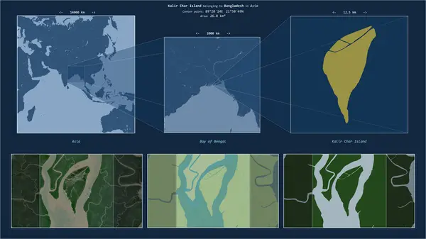
Kalir Char Island In The Bay Of Bengal - Belonging To Bangladesh. Described Location Diagram With Yellow Shape Of The Island And Sample Maps Of Its Surroundings
Image, 2.58MB, 3840 × 2160 jpg

Shau Kei Wan, Hong Kong - 19 March 2019: Top Down View Of Hong Kong City
Image, 9.73MB, 4500 × 2998 jpg
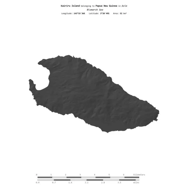
Kairiru Island In The Bismarck Sea, Belonging To Papua New Guinea, Isolated On A Bilevel Elevation Map, With Distance Scale
Image, 0.32MB, 2160 × 2160 jpg

Kalymnos Island In The Aegean Sea, Belonging To Greece, Isolated On A Bilevel Elevation Map, With Distance Scale
Image, 0.43MB, 2160 × 2160 jpg

Kalavria Island In The Aegean Sea, Belonging To Greece, Isolated On A Bilevel Elevation Map, With Distance Scale
Image, 0.29MB, 2160 × 2160 jpg
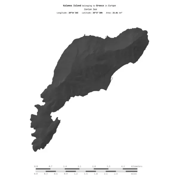
Kalamos Island In The Ionian Sea, Belonging To Greece, Isolated On A Bilevel Elevation Map, With Distance Scale
Image, 0.3MB, 2160 × 2160 jpg

Kamaran Island In The Red Sea - Belonging To Yemen. Described Location Diagram With Yellow Shape Of The Island And Sample Maps Of Its Surroundings
Image, 2.04MB, 3840 × 2160 jpg

Kaoh Sralau Island In The Gulf Of Thailand, Belonging To Cambodia, Isolated On A Topographic, OSM Humanitarian Style Map, With Distance Scale
Image, 0.5MB, 2160 × 2160 jpg
Page 1 >> Next