
Stock image Khyber
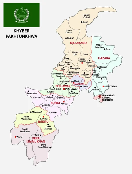
Administrative Vector Map Of Pakistani Province Of Khyber Pakhtunkhwa With Flag, Pakistan
Vector, 0MB, 3781 × 4000 zip

Coat Of Arms Of Khyber Pakhtunkhwa Is A Pakistan Region. Vector Heraldic Emblem
Vector, 0.94MB, 4000 × 4000 eps
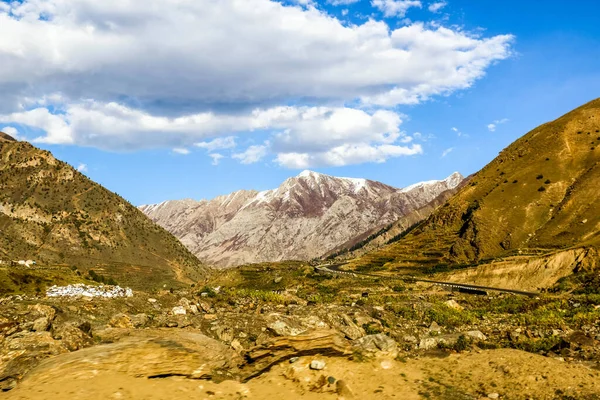
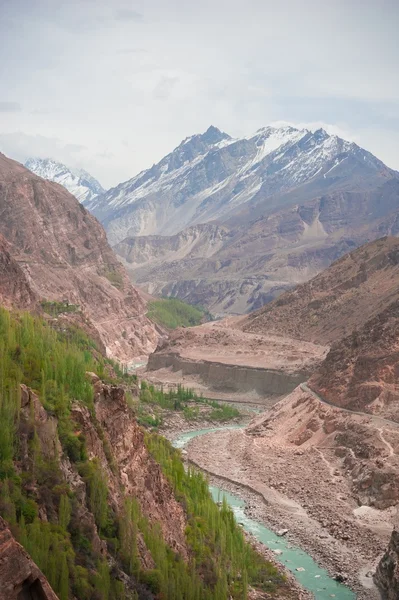
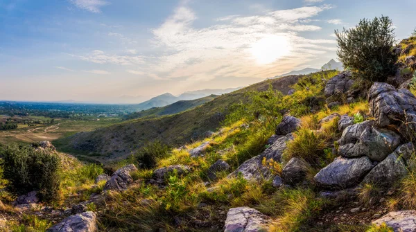
Geological Structure Of Snow Mountainous In Naran Valley, Mansehra District, Khyber-Pakhtunkhwa, Northern Areas Of Pakistan
Image, 4.96MB, 5472 × 3648 jpg


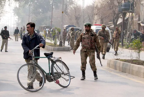
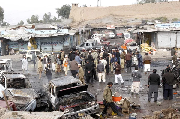
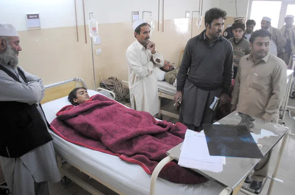
Security Officials Inspect The Site After Bombs Explosions At Political Agent Khyber Office In Peshawar
Image, 2.06MB, 3000 × 2039 jpg
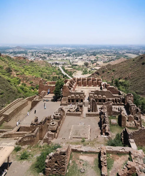
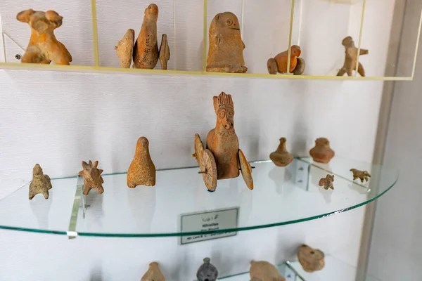
Takht-i-Bhai Parthian Archaeological Site And Buddhist Monastery Pakistan
Image, 7.93MB, 2908 × 3532 jpg
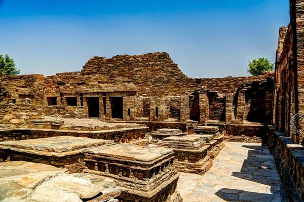
Takht-i-Bhai Parthian Archaeological Site And Buddhist Monastery Pakistan
Image, 9.43MB, 3877 × 2583 jpg

Hunza Valley, Pakistan : Pakistani Man In Traditional Clothes. Sheep Autumn Pasture Cattle Hunza Valley, Gilgit Baltistan, Pakistan Nothern Areas
Image, 10.42MB, 4867 × 3650 jpg
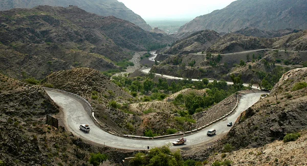
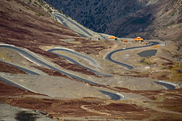
The Khyber Pass In Northern Pakistan. Vehicles Are Climbing The Khyber Pass On The Pakistan Side. The Khyber Pass Is A Vital Road Link From Peshawar, Pakistan To Landi Kotal And Torkham In Afghanistan
Image, 4.9MB, 3320 × 1801 jpg

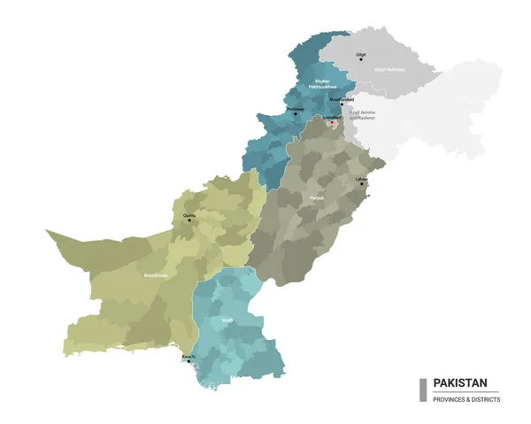
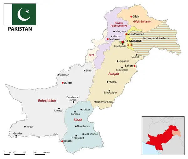
Vector Regional Blank Map Of Pakistan With Provinces And Territories And Administrative Divisions. Editable And Clearly Labeled Layers.
Vector, 1.45MB, 5000 × 4600 eps


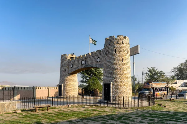
Bab-e-Khyber Is A Monument Which Stands At The Entrance Of The Khyber Pass In The Federally Administered Tribal Areas Of Pakistan.
Image, 12.87MB, 6016 × 4016 jpg
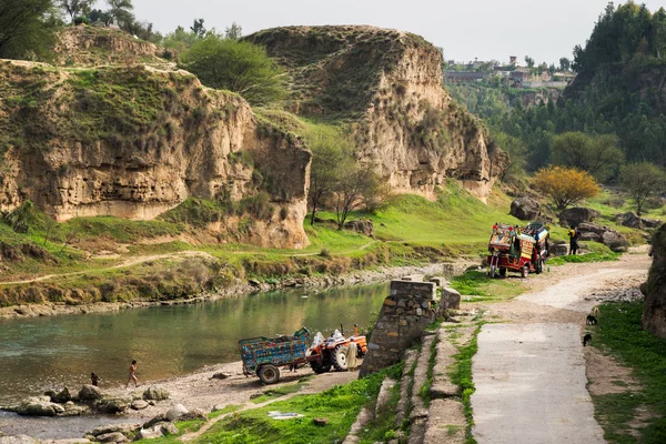
Villagers Enjoying Fresh Water Stream In Province Of Khyber Pukhtunkhwa, Pakistan.
Image, 22.03MB, 6016 × 4016 jpg

NEW DELHI, INDIA - AUGUST 4: Houses Being Bulldozed During A Demolition Drive At Khyber Pass Area, By Land And Development Office, On August 4, 2024 In New Delhi, India.
Image, 3.35MB, 6048 × 4024 jpg
Pakistan Higt Detailed Map With Subdivisions. Administrative Map Of Pakistan With Districts And Cities Name, Colored By States And Administrative Districts. Vector Illustration.
Vector, 1.86MB, 5000 × 4000 eps
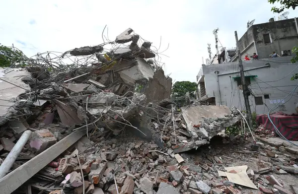
NEW DELHI, INDIA - AUGUST 4, 2024: Demolition Drive By The Land And Development Office At Khyber Pass Near Civil Lines, On August 4, 2024 In New Delhi, India.
Image, 2.86MB, 6048 × 3944 jpg


Geological Structure Of Snow Mountainous In Naran Valley, Mansehra District, Khyber-Pakhtunkhwa, Northern Areas Of Pakistan
Image, 5.8MB, 5472 × 3648 jpg
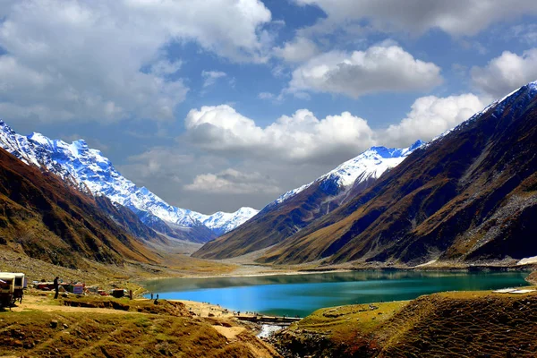
Beautiful View Of Mountainous Lake Saiful Muluk In Naran Valley, Mansehra District, Khyber-Pakhtunkhwa, Northern Areas Of Pakistan
Image, 15.96MB, 5472 × 3648 jpg

Geological Structure Of Snow Mountainous In Naran Valley, Mansehra District, Khyber-Pakhtunkhwa, Northern Areas Of Pakistan
Image, 6.96MB, 5472 × 3648 jpg
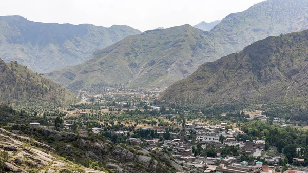
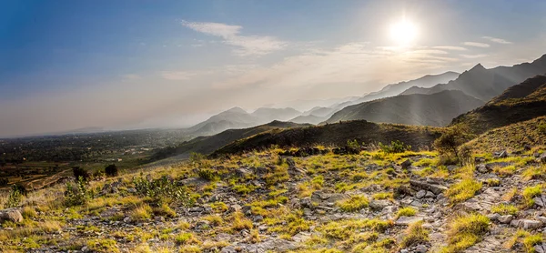
District Bunner Residential Area Wide Angle View From The Mountain Top.
Image, 12.8MB, 6054 × 3405 jpg

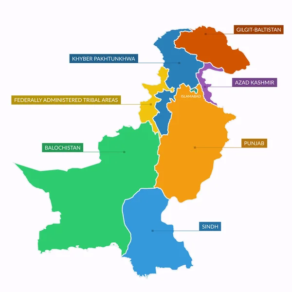
Vector Illustrated Regional Map Of Pakistan With Provinces And Territories And Administrative Divisions, And Neighbouring Countries And Territories. Editable And Clearly Labeled Layers.
Vector, 3.09MB, 5000 × 4600 eps
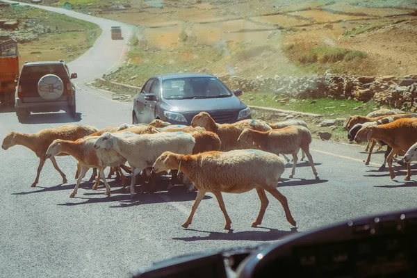
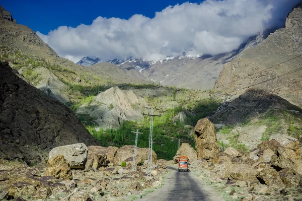
Cars Stop And Waiting For A Herd Of Local Sheep Crossing Road. Traffic In Naran, Khyber Pakhtunkhwa, Pakistan. View From The Windshield.
Image, 9.17MB, 4896 × 3264 jpg

Beautiful View Of Mountainous Lake Saiful Muluk In Naran Valley, Mansehra District, Khyber-Pakhtunkhwa, Northern Areas Of Pakistan
Image, 2.37MB, 3456 × 2304 jpg

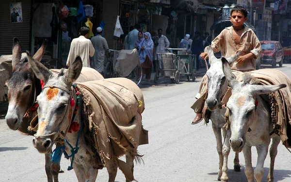
Peshawar In Khyber Pakhtunkhwa Province, Pakistan. Boy Riding A Donkey In Peshawar, Pakistan. He Is Herding Donkeys Along A Street In Peshawar. The Boy Is Riding A Donkey In Peshawar, Pakistan.
Image, 3.43MB, 2952 × 1856 jpg


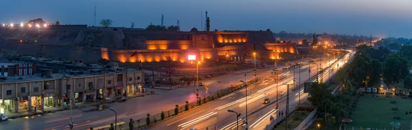
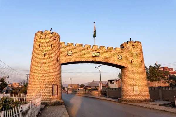
The Khyber Gate Was Built In 1964, At The Mouth Of The Khyber Pass, Where The Jamrud Fort Is Also Located Near Peshawar City In Pakistan
Image, 13.28MB, 5948 × 3971 jpg

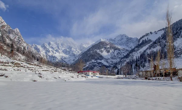
A Winter Landscapes Of Swat Valley With Snowy Mountains In Khyber Pakhtunkhwa Pakistan
Image, 18.12MB, 5293 × 3216 jpg
Page 1 >> Next