
Stock image Landlocked page 3

3d Flag Of Armenia 3d Wavy Shiny Armenia Ribbon Isolated On White Background 3d Illustration
Image, 2.7MB, 3600 × 2200 jpg


3d Flag Of Nepal 3d Shiny Waving Nepal Ribbon Flag On Grey Background 3d Illustration
Image, 1.44MB, 3600 × 2200 jpg

Botswana Map Made Of High Quality Premium Golden Metallic Copper Brass Pillars 3D Illustration
Image, 2.44MB, 2975 × 2100 jpg

Botswana Map Soil Land Geology Cross Section Green Grass And Rock Ground Texture 3d Illustration
Image, 3.22MB, 3000 × 2200 jpg

Illuminated Botswana Data Map Highlighting Geographical Features Neon Glow Light 3D Illustration
Image, 3.62MB, 3100 × 2200 jpg

Arizona Counties, Political Map. Landlocked State, Also Known As Grand Canyon State, In The Southwestern Region Of The United States, Subdivided Into 15 Counties. Map With Boundaries And County Names.
Vector, 2.6MB, 6000 × 6818 eps

Botswana Is Magnified Over A World Map, Illustration With Airplane, Passport, Boarding Pass, Compass And Eyeglasses.
Vector, 5MB, 8000 × 4000 eps

North Dakota, U.S. State, Subdivided Into 53 Counties, Political Map With Borders And County Names. State In The Upper Midwest Region Of The United States, Nicknamed Peace Garden And Roughrider State.
Vector, 2.1MB, 9000 × 5648 eps

South Dakota, U.S. State, Subdivided Into 66 Counties, Political Map With Borders And County Names. State In The North Central Region Of The United States, Nicknamed The Mount Rushmore State.
Vector, 2.24MB, 9000 × 6000 eps
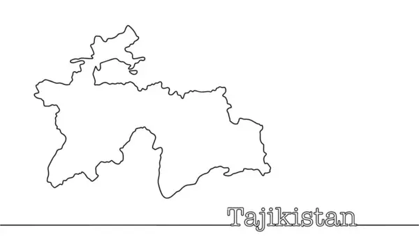
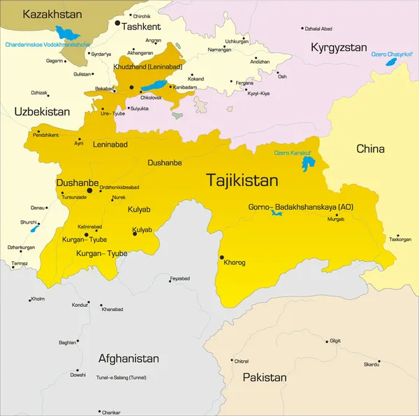
Silhouette Of The Borders Of A Central Asian Country. A Simple Map Of Tajikistan, Drawn On A White Background. Vector.
Vector, 0.35MB, 5683 × 3252 eps

3d Flag Of Nepal 3d Shiny Waving Nepal Ribbon Flag On Grey Background 3d Illustration
Image, 1.04MB, 3600 × 2200 jpg

3d Flag Of Kosovo 3d Wavy Shiny Kosovo Ribbon Flag Isolated On White Background 3d Illustration
Image, 3.18MB, 3600 × 2200 jpg

Illuminated Belarus Digital Data Map Pink And Blue Neon Glowing Particles 3D Illustration
Image, 2.47MB, 2975 × 2100 jpg

3d Flag Of Mali 3d Wavy Shiny Mali Ribbon Flag Isolated On White Background 3d Illustration
Image, 1.17MB, 3200 × 2200 jpg

3d Flag Of Austria 3d Shiny Waving Austria Ribbon Flag On White Background 3d Illustration
Image, 1.69MB, 3000 × 2200 jpg

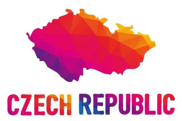
Low Polygonal Map Of The Czech Republic (Ceska Republika), Also Know Az Czechia (Cesko)
Vector, 1.67MB, 5250 × 3500 eps

Welcome Sign At Zimbabwe Border With Zambia - Entrance To The Village Of Victoria Falls
Image, 5.18MB, 3028 × 2013 jpg

Bay Of Navarino, Greek Ormos Navarinou , Small, Deep, And Almost Landlocked Bay Of The Ionian Sea In The Nomos Of Messenia, In The Southwestern Peloponnese, Greece.
Image, 29.65MB, 7713 × 3900 jpg


Flag Of Republic Of Belarus Is A Landlocked Country In Eastern Europe. Vector Illustration
Vector, 6.29MB, 6271 × 4167 eps

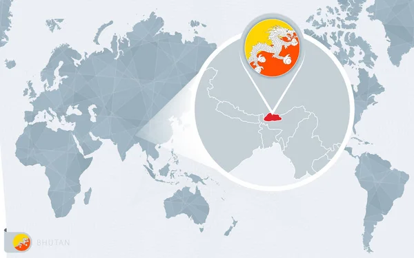
Pacific Centered World Map With Magnified Bhutan. Flag And Map Of Bhutan.
Vector, 1.29MB, 8000 × 5000 eps

A Grayscale Map Of Serbia With A Hanging Serbian Flag On One Side. Vector Map For Many Types Of News.
Vector, 3.58MB, 6000 × 4000 eps


3d Flag Of Hungary 3d Wavy Shiny Hungary Ribbon Isolated On White Background 3d Illustration
Image, 3.39MB, 4000 × 3000 jpg

Two Versions Of An Bhutan Folded Map, One With A Pinned Country Flag And One With A Flag In The Map Contour. Template For Both Print And Online Design.
Vector, 3.31MB, 6500 × 2500 eps

3d Flag Of Mauritania 3d Shiny Waving Mauritania Ribbon Flag On White Background 3d Illustration
Image, 1.93MB, 3600 × 2200 jpg

3d Flag Of Mauritania 3d Shiny Waving Mauritania Ribbon Flag On White Background 3d Illustration
Image, 2.67MB, 3600 × 2200 jpg

3d Flag Of Mongolia 3d Wavy Shiny Mongolia Ribbon Isolated On White Background 3d Illustration
Image, 2.72MB, 4230 × 2500 jpg

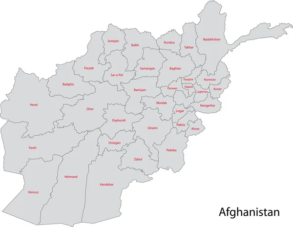
Afghanistan Map Monochromatic Shaded Relief Textured Map With Orange Neon Border 3D Illustration
Image, 3.55MB, 3400 × 2400 jpg

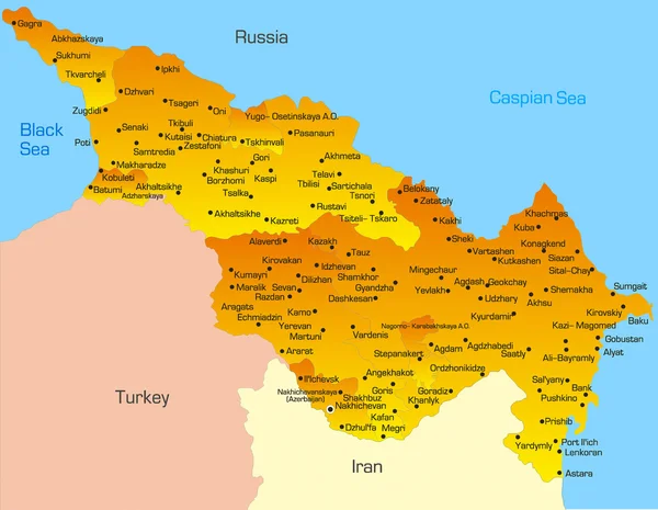
Armenia Map Monochromatic Shaded Relief Textured Map With Orange Neon Border 3D Illustration
Image, 4.13MB, 3400 × 2400 jpg

Bolivia Map Made Of High Quality Premium Golden Metallic Copper Brass Pillars 3D Illustration
Image, 2.38MB, 2975 × 2100 jpg

3d Flag Of Nepal Heart Shape Shiny Wavy Awareness Ribbon Flag On Grey Background 3d Illustration
Image, 0.84MB, 3600 × 2200 jpg

Iowa Counties, Political Map With Borders And County Names. Landlocked State In The Midwestern Region Of The United States, Subdivided Into 99 Counties. Nicknamed The Hawkeye State. Illustration
Vector, 2.29MB, 9000 × 6000 eps

Slovakia Is Magnified Over A World Map, Illustration With Airplane, Passport, Boarding Pass, Compass And Eyeglasses.
Vector, 5.06MB, 8000 × 4000 eps

Serbia Is Magnified Over A World Map, Illustration With Airplane, Passport, Boarding Pass, Compass And Eyeglasses.
Vector, 5.29MB, 8000 × 4000 eps
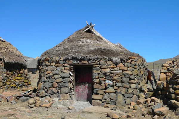
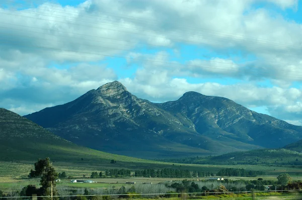
Traditional Style Of Housing In Lesotho At Sani Pass At Altitude Of 2 874m
Image, 5.16MB, 3776 × 2520 jpg


Previous << Page 3 >> Next