
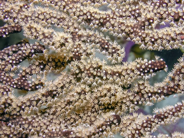
Stock image Lucayan Archipelago


Crooked Island In The North Atlantic Ocean, Belonging To Bahamas, Isolated On A Topographic, OSM Humanitarian Style Map, With Distance Scale
Image, 0.46MB, 2160 × 2160 jpg

Great Exuma Island In The North Atlantic Ocean On A Topographic, OSM Humanitarian Style Map
Image, 0.68MB, 2880 × 1620 jpg

Great Abaco Island In The North Atlantic Ocean On A Satellite Image Taken In November 26, 2021
Image, 5.09MB, 2880 × 1620 jpg
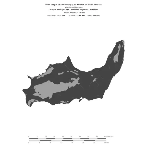
Gran Inagua Island In The North Atlantic Ocean, Belonging To Bahamas, Isolated On A Bilevel Elevation Map, With Distance Scale
Image, 0.39MB, 2160 × 2160 jpg

East Caicos Island In The North Atlantic Ocean - Belonging To Turks And Caicos Islands. Described Location Diagram With Yellow Shape Of The Island And Sample Maps Of Its Surroundings
Image, 2.08MB, 3840 × 2160 jpg

Crooked Island In The North Atlantic Ocean, Belonging To Bahamas, Isolated On A Satellite Image Taken In December 7, 2022, With Distance Scale
Image, 1.03MB, 2160 × 2160 jpg

East Caicos Island In The North Atlantic Ocean On A Satellite Image Taken In January 24, 2020
Image, 4.9MB, 2880 × 1620 jpg
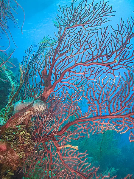
Coral Garden In Caribbean Red Deepwater Gorgonian.Diodogorgia Nodulifera
Image, 5.82MB, 2325 × 3100 jpg

Crooked Island In The North Atlantic Ocean - Belonging To Bahamas. Described Location Diagram With Yellow Shape Of The Island And Sample Maps Of Its Surroundings
Image, 2.27MB, 3840 × 2160 jpg

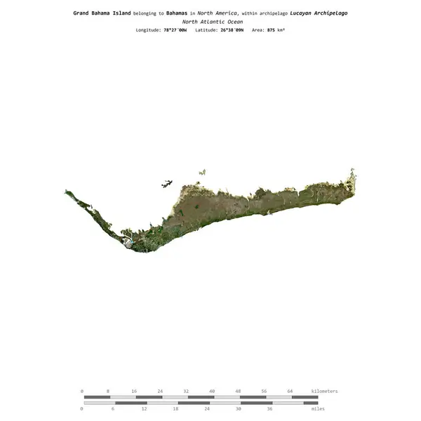
Grand Bahama Island In The North Atlantic Ocean - Belonging To Bahamas. Described Location Diagram With Yellow Shape Of The Island And Sample Maps Of Its Surroundings
Image, 2.31MB, 3840 × 2160 jpg
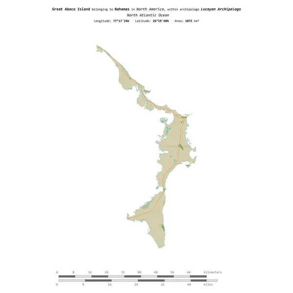
Great Abaco Island In The North Atlantic Ocean, Belonging To Bahamas, Isolated On A Topographic, OSM Humanitarian Style Map, With Distance Scale
Image, 0.38MB, 2160 × 2160 jpg

Big Wood Cay Island In The North Atlantic Ocean, Belonging To Bahamas, Isolated On A Satellite Image Taken In December 3, 2020, With Distance Scale
Image, 1.55MB, 2160 × 2160 jpg

Great Abaco Island In The North Atlantic Ocean On A Colored Elevation Map
Image, 1.31MB, 2880 × 1620 jpg

Grand Bahama Island In The North Atlantic Ocean On A Topographic, OSM Humanitarian Style Map
Image, 0.91MB, 2880 × 1620 jpg

Grand Bahama Island In The North Atlantic Ocean On A Satellite Image Taken In January 30, 2023
Image, 4.13MB, 2880 × 1620 jpg

Crooked Island In The North Atlantic Ocean On A Satellite Image Taken In April 5, 2024
Image, 4.54MB, 2880 × 1620 jpg

Great Exuma Island In The North Atlantic Ocean, Belonging To Bahamas, Isolated On A Topographic, OSM Humanitarian Style Map, With Distance Scale
Image, 0.46MB, 2160 × 2160 jpg

Big Wood Cay Island In The North Atlantic Ocean On A Colored Elevation Map
Image, 1.16MB, 2880 × 1620 jpg

Great Exuma Island In The North Atlantic Ocean - Belonging To Bahamas. Described Location Diagram With Yellow Shape Of The Island And Sample Maps Of Its Surroundings
Image, 2.15MB, 3840 × 2160 jpg

Gran Inagua Island In The North Atlantic Ocean On A Satellite Image Taken In August 29, 2023
Image, 1.62MB, 2880 × 1620 jpg

Great Exuma Island In The North Atlantic Ocean, Belonging To Bahamas, Isolated On A Bilevel Elevation Map, With Distance Scale
Image, 0.29MB, 2160 × 2160 jpg

Big Wood Cay Island In The North Atlantic Ocean - Belonging To Bahamas. Described Location Diagram With Yellow Shape Of The Island And Sample Maps Of Its Surroundings
Image, 2.47MB, 3840 × 2160 jpg
Grand Bahama Island In The North Atlantic Ocean, Belonging To Bahamas, Isolated On A Satellite Image Taken In March 20, 2024, With Distance Scale
Image, 0.52MB, 2160 × 2160 jpg

Gran Inagua Island In The North Atlantic Ocean, Belonging To Bahamas, Isolated On A Satellite Image Taken In February 16, 2018, With Distance Scale
Image, 1.27MB, 2160 × 2160 jpg

East Caicos Island In The North Atlantic Ocean, Belonging To Turks And Caicos Islands, Isolated On A Topographic, OSM Humanitarian Style Map, With Distance Scale
Image, 0.34MB, 2160 × 2160 jpg

Great Abaco Island In The North Atlantic Ocean - Belonging To Bahamas. Described Location Diagram With Yellow Shape Of The Island And Sample Maps Of Its Surroundings
Image, 2.26MB, 3840 × 2160 jpg

Big Wood Cay Island In The North Atlantic Ocean On A Topographic, OSM Humanitarian Style Map
Image, 0.7MB, 2880 × 1620 jpg


Stamp Postal Of Paradise Island. Map Silhouette Rubber Seal. Design Retro Travel. Seal Of Map Paradise Island Grunge For Your Design. The Bahamas. EPS10
Vector, 5.49MB, 5000 × 5000 eps

Gran Inagua Island In The North Atlantic Ocean On A Colored Elevation Map
Image, 1.01MB, 2880 × 1620 jpg

Crooked Island In The North Atlantic Ocean On A Topographic, OSM Humanitarian Style Map
Image, 0.56MB, 2880 × 1620 jpg

Acklins Island In The North Atlantic Ocean On A Satellite Image Taken In January 24, 2021
Image, 4.03MB, 2880 × 1620 jpg

Acklins Island In The North Atlantic Ocean, Belonging To Bahamas, Isolated On A Satellite Image Taken In January 20, 2020, With Distance Scale
Image, 0.68MB, 2160 × 2160 jpg

East Caicos Island In The North Atlantic Ocean, Belonging To Turks And Caicos Islands, Isolated On A Satellite Image Taken In February 27, 2023, With Distance Scale
Image, 1.11MB, 2160 × 2160 jpg

Acklins Island In The North Atlantic Ocean, Belonging To Bahamas, Isolated On A Topographic, OSM Humanitarian Style Map, With Distance Scale
Image, 0.34MB, 2160 × 2160 jpg

Big Wood Cay Island In The North Atlantic Ocean, Belonging To Bahamas, Isolated On A Bilevel Elevation Map, With Distance Scale
Image, 0.3MB, 2160 × 2160 jpg

Grand Bahama Island In The North Atlantic Ocean, Belonging To Bahamas, Isolated On A Topographic, OSM Humanitarian Style Map, With Distance Scale
Image, 0.4MB, 2160 × 2160 jpg
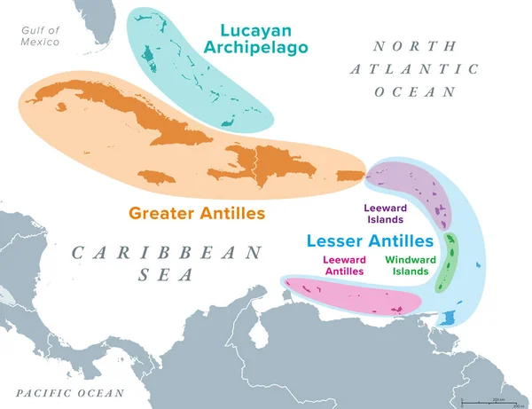
Island Groups Of The West Indies, Political Map. Subregion Of The Americas, Surrounded By North Atlantic Ocean And Caribbean Sea. Greater Antilles, Lesser Antilles, And Lucayan Archipelago.
Vector, 2.91MB, 7793 × 6000 eps

Great Abaco Island In The North Atlantic Ocean, Belonging To Bahamas, Isolated On A Bilevel Elevation Map, With Distance Scale
Image, 0.28MB, 2160 × 2160 jpg

Great Exuma Island In The North Atlantic Ocean On A Colored Elevation Map
Image, 1.09MB, 2880 × 1620 jpg
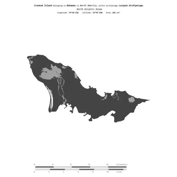
Crooked Island In The North Atlantic Ocean, Belonging To Bahamas, Isolated On A Bilevel Elevation Map, With Distance Scale
Image, 0.33MB, 2160 × 2160 jpg

Gran Inagua Island In The North Atlantic Ocean, Belonging To Bahamas, Isolated On A Topographic, OSM Humanitarian Style Map, With Distance Scale
Image, 0.43MB, 2160 × 2160 jpg

Crooked Island In The North Atlantic Ocean On A Colored Elevation Map
Image, 1.21MB, 2880 × 1620 jpg

Gran Inagua Island In The North Atlantic Ocean On A Topographic, OSM Humanitarian Style Map
Image, 0.39MB, 2880 × 1620 jpg

Big Wood Cay Island In The North Atlantic Ocean On A Satellite Image Taken In September 19, 2020
Image, 4.01MB, 2880 × 1620 jpg
Page 1 >> Next