photo free
Home Images Vectors Videos

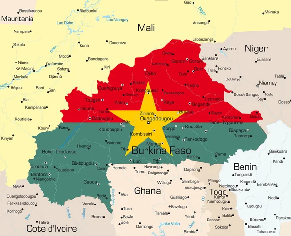
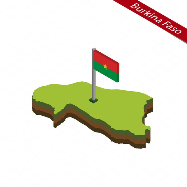
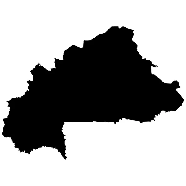
Stock image Map Burkina Faso

stock vector Burkina Faso country

Burkina Faso Country

Vector, 2.54MB, 4273 × 3474 eps
stock vector Burkina Faso Political Map

Burkina Faso Political Map

Vector, 3.17MB, 7504 × 6000 eps
stock vector Burkina Faso line travel skyline set. Burkina Faso outline city vector illustration, symbol, travel sights, landmarks.

Burkina Faso Line Travel Skyline Set. Burkina Faso Outline City Vector Illustration, Symbol, Travel Sights, Landmarks.

Vector, 3.27MB, 6000 × 3000 eps
stock vector Burkina Faso round grunge stamp with country map and country flag Vintage badge with circular text

Burkina Faso Round Grunge Stamp With Country Map And Country Flag Vintage Badge With Circular Text

Vector, 6.11MB, 5486 × 5487 eps
stock image Detailed Earth. West African countries on a moonlit night

Detailed Earth. West African Countries On A Moonlit Night

Image, 8.58MB, 5000 × 5000 jpg
stock image Modern map showing the countries that the prime Greenwich meridian passes through

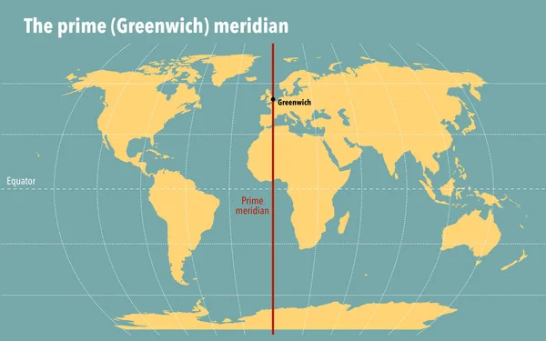
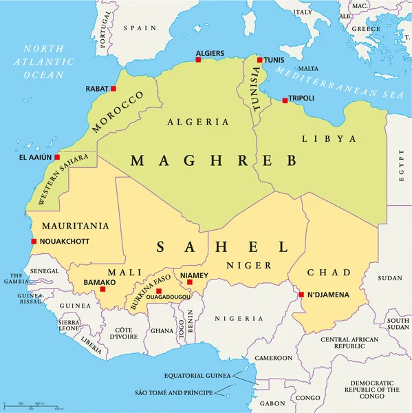
Modern Map Showing The Countries That The Prime Greenwich Meridian Passes Through

Image, 1.55MB, 3200 × 2000 jpg
stock vector Map markers with flags - Africa. Original colors.

Map Markers With Flags - Africa. Original Colors.

Vector, 3.53MB, 4000 × 4429 eps
stock vector Map of Burkina Faso. Vector illustration

Map Of Burkina Faso. Vector Illustration

Vector, 0.62MB, 6250 × 5000 eps
stock vector Burkina Faso communication network map. Vector image of a low poly global map with city lights.

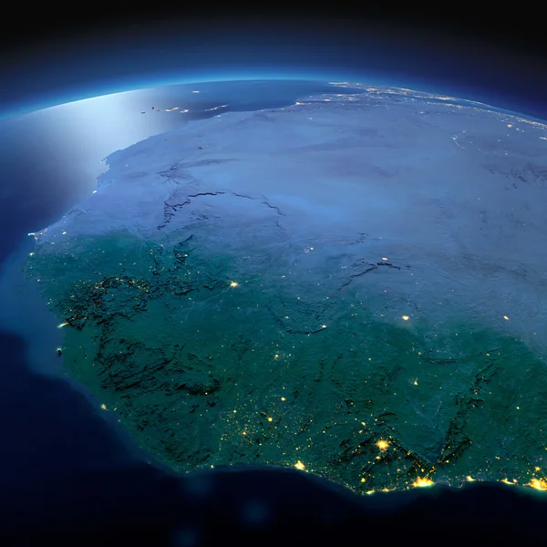
Burkina Faso Communication Network Map. Vector Image Of A Low Poly Global Map With City Lights.

Vector, 0.55MB, 8000 × 4500 eps
stock image Detailed Earth. West African countries on a moonlit night

Detailed Earth. West African Countries On A Moonlit Night

Image, 7.22MB, 5000 × 5000 jpg
stock image Detailed Earth. Countries of the Gulf of Guinea on a moonlit nig

Detailed Earth. Countries Of The Gulf Of Guinea On A Moonlit Nig

Image, 8.36MB, 5000 × 5000 jpg
stock vector Vector maps set.  High detailed 46 maps of African countries wit

Vector Maps Set. High Detailed 46 Maps Of African Countries Wit

Vector, 11.08MB, 6000 × 3600 eps
stock vector Map of Africa with all countries and their capitals

Map Of Africa With All Countries And Their Capitals

Vector, 2.38MB, 6000 × 6000 eps
stock vector Map of Africa with all countries

Map Of Africa With All Countries

Vector, 1.53MB, 6000 × 5481 eps
stock vector Blank map  of Burkina Faso. Provinces of Burkina Faso map. High detailed vector map Burkina Faso on transparent background for your web site design, logo, app, UI.  EPS10.

Blank Map Of Burkina Faso. Provinces Of Burkina Faso Map. High Detailed Vector Map Burkina Faso On Transparent Background For Your Web Site Design, Logo, App, UI. EPS10.

Vector, 3.51MB, 5000 × 5000 eps
stock vector Africa (Map with The Frontiers and Country Names)

Africa (Map With The Frontiers And Country Names)

Vector, 1.53MB, 3200 × 3200 ai
stock vector vector map of Africa continent colored by regions. All flags of African countries arranged in alphabetical order and singled out by regions

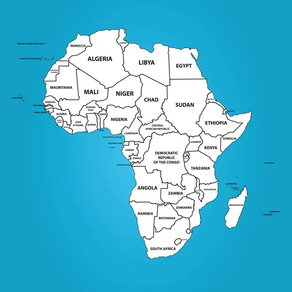
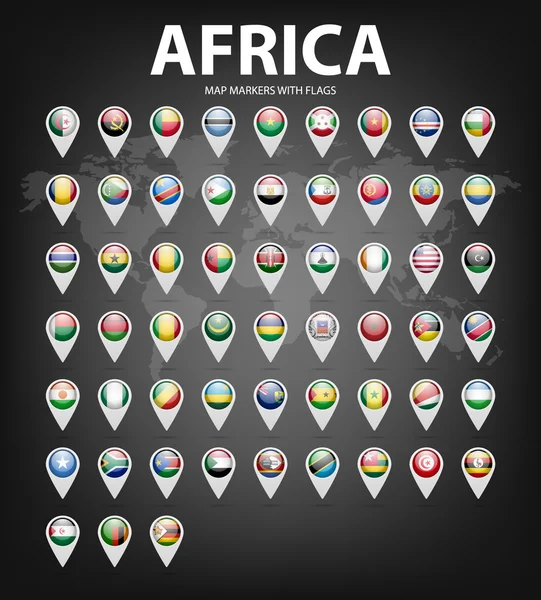
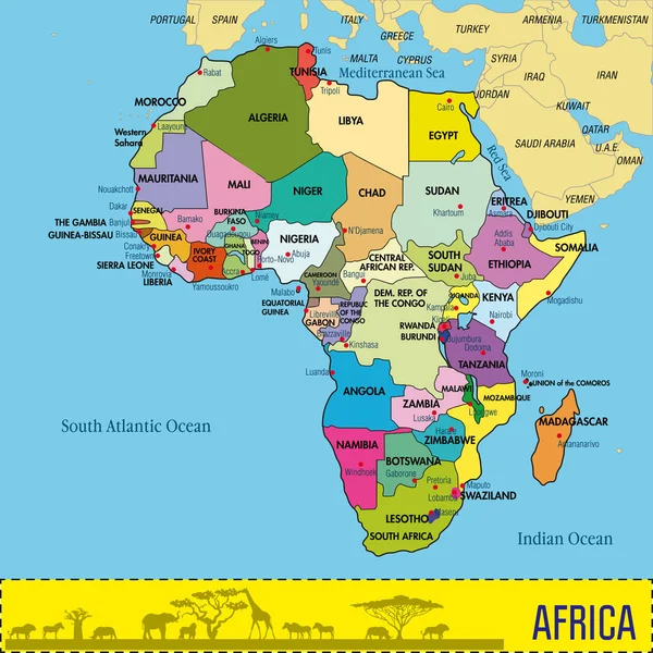
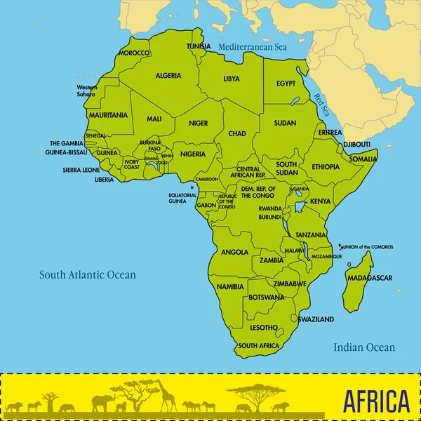
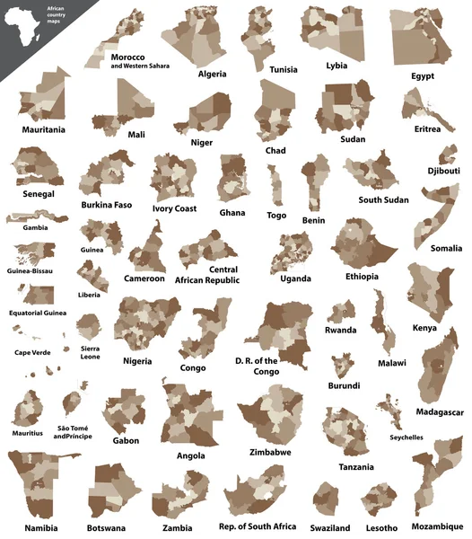
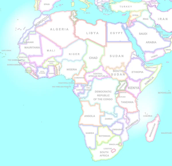
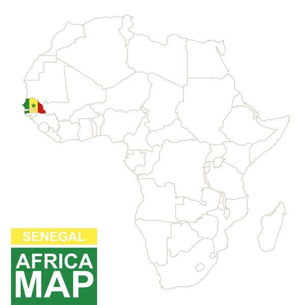
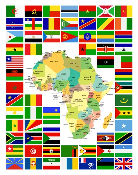
Vector Map Of Africa Continent Colored By Regions. All Flags Of African Countries Arranged In Alphabetical Order And Singled Out By Regions

Vector, 8.46MB, 8334 × 5379 eps
stock vector Map of Africa with all countries and their capitals

Map Of Africa With All Countries And Their Capitals

Vector, 1.8MB, 6000 × 6000 eps
stock vector vector political map of Africa with all country flags

Vector Political Map Of Africa With All Country Flags

Vector, 6.95MB, 8334 × 7884 eps
stock vector Blue-green detailed map of Niger administrative divisions with country flag and location on the globe. Vector illustration

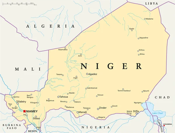
Blue-green Detailed Map Of Niger Administrative Divisions With Country Flag And Location On The Globe. Vector Illustration

Vector, 9.49MB, 5239 × 6288 eps
stock vector vector map of Africa mixed with countries flags. Collection of all African maps combined with flags isolated on white background

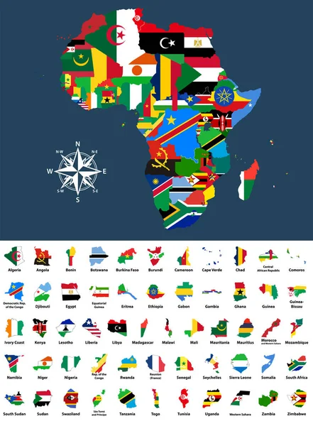
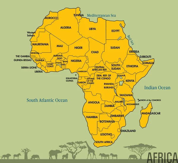
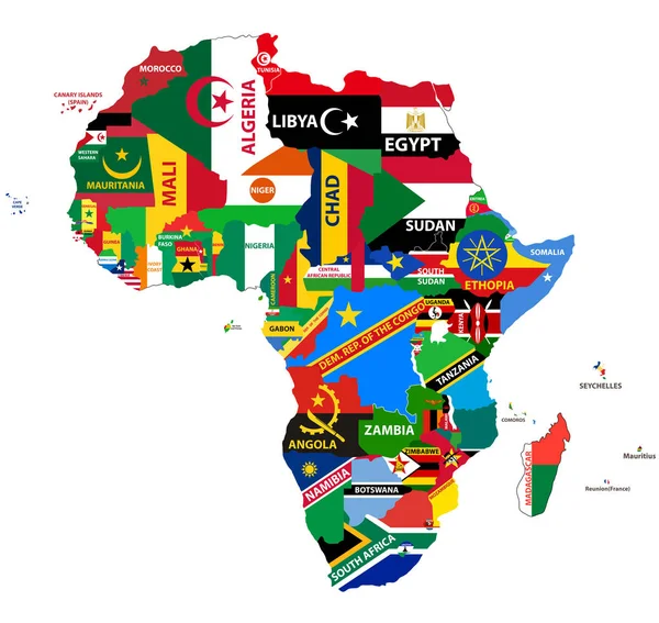
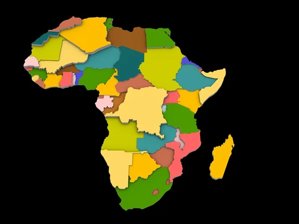
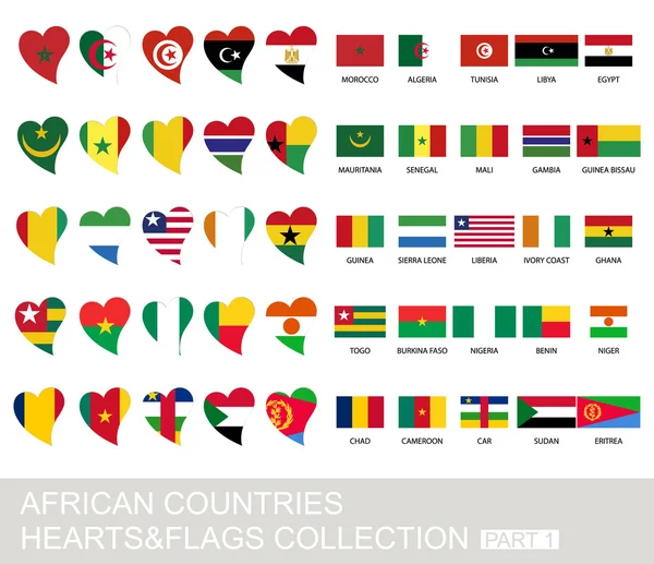
Vector Map Of Africa Mixed With Countries Flags. Collection Of All African Maps Combined With Flags Isolated On White Background

Vector, 10.1MB, 6125 × 8334 eps
stock vector African vector isolated country maps

African Vector Isolated Country Maps

Vector, 9.92MB, 6250 × 7119 eps
stock vector Africa map in vintage style

Africa Map In Vintage Style

Vector, 0.6MB, 4000 × 3877 ai
stock vector Vector Collage Map of Burkina Faso of Colored Marijuana Leaves and Solid Map

Vector Collage Map Of Burkina Faso Of Colored Marijuana Leaves And Solid Map

Vector, 67.28MB, 7049 × 3000 eps
stock vector Mali Political Map

Mali Political Map

Vector, 1.06MB, 8700 × 7898 eps
stock vector Stencil map of Burkina Faso. Simple and minimal transparent map of Burkina Faso. Black rectangle with cut shape of the country. Trendy vector illustration.

Stencil Map Of Burkina Faso. Simple And Minimal Transparent Map Of Burkina Faso. Black Rectangle With Cut Shape Of The Country. Trendy Vector Illustration.

Vector, 0.37MB, 6268 × 4825 eps
stock vector Burkina Faso higt detailed map with subdivisions. Administrative map of Burkina Faso with districts and cities name, colored by states and administrative districts. Vector illustration with editable and labelled layers.

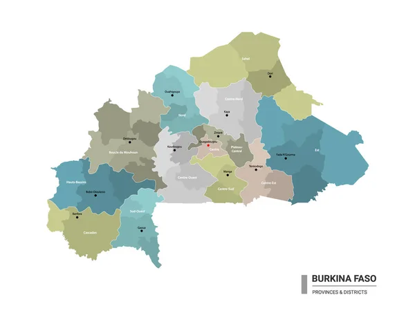
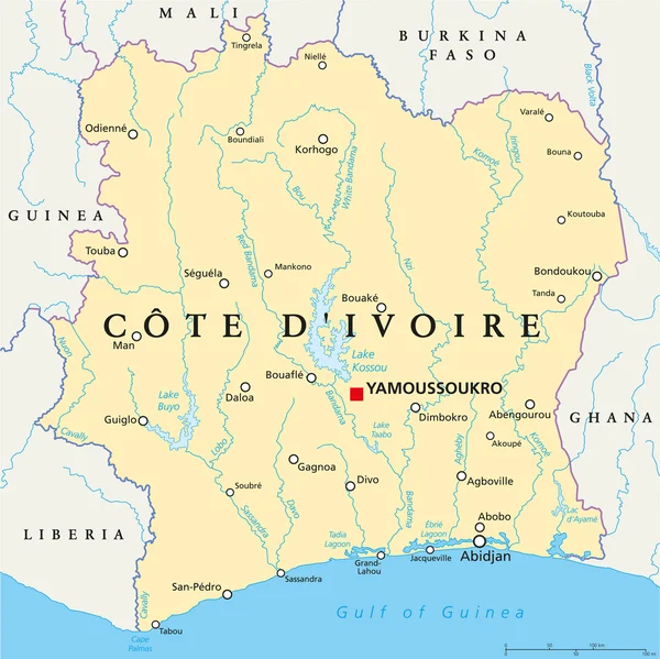
Burkina Faso Higt Detailed Map With Subdivisions. Administrative Map Of Burkina Faso With Districts And Cities Name, Colored By States And Administrative Districts. Vector Illustration With Editable And Labelled Layers.

Vector, 1.16MB, 4400 × 3300 eps
stock vector West Africa Map

West Africa Map

Vector, 0.97MB, 3915 × 4444 eps
stock image A illustration of the africa map and countries

A Illustration Of The Africa Map And Countries

Image, 0.63MB, 3076 × 2304 jpg
stock vector Energy industry and ecology of Burkina Faso

Energy Industry And Ecology Of Burkina Faso

Vector, 3.59MB, 6400 × 6400 eps
stock vector AFRICA Countries - Part FOUR

AFRICA Countries - Part FOUR

Vector, 0.5MB, 6201 × 6201 eps
stock vector West Africa Map - Vintage Vector Illustration

West Africa Map - Vintage Vector Illustration

Vector, 2.27MB, 7673 × 5500 eps
stock vector Niger Political Map

Niger Political Map

Vector, 4.02MB, 7882 × 6000 eps
stock vector Highly detailed vector map of Togo with administrative regions, main cities and roads.

Highly Detailed Vector Map Of Togo With Administrative Regions, Main Cities And Roads.

Vector, 2.33MB, 4062 × 5000 eps
stock vector Africa contoured map with highlighted Senegal.

Africa Contoured Map With Highlighted Senegal.

Vector, 1.26MB, 5000 × 5000 eps
stock vector Burkina Faso Isometric map and flag. Vector Illustration.

Burkina Faso Isometric Map And Flag. Vector Illustration.

Vector, 0.33MB, 5000 × 5000 eps
stock vector Map of Burkina Faso. Vector illustration. World map

Map Of Burkina Faso. Vector Illustration. World Map

Vector, 1.02MB, 5000 × 4000 eps
stock vector Ivory Coast Political Map - Cote d'Ivoire

Ivory Coast Political Map - Cote D'Ivoire

Vector, 4.4MB, 6003 × 6000 eps
stock vector All African Flags Complete Set and It's Map

All African Flags Complete Set And It's Map

Vector, 2.66MB, 6476 × 8192 eps
stock vector Africa contoured map with highlighted Benin.

Africa Contoured Map With Highlighted Benin.

Vector, 1.25MB, 5000 × 5000 eps
stock vector African countries set, hearts and flags, part 1

African Countries Set, Hearts And Flags, Part 1

Vector, 0.66MB, 5000 × 4310 eps
stock image 3D Map of Burkina Faso with Burkinabe Flag on White Background 3

3D Map Of Burkina Faso With Burkinabe Flag On White Background 3

Image, 6.24MB, 6000 × 6000 jpg
stock vector Maghreb and Sahel Political Map

Maghreb And Sahel Political Map

Vector, 1.77MB, 5995 × 6000 eps
stock vector Vector illustration of maps of Burkina Faso

Vector Illustration Of Maps Of Burkina Faso

Vector, 0.24MB, 4500 × 4500 eps
stock vector Blue-gray detailed map of Ghana administrative divisions and location on the globe. Vector illustration

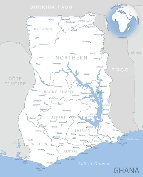
Blue-gray Detailed Map Of Ghana Administrative Divisions And Location On The Globe. Vector Illustration

Vector, 10.33MB, 5256 × 6467 eps
stock vector Africa contoured map with highlighted Malawi.

Africa Contoured Map With Highlighted Malawi.

Vector, 1.26MB, 5000 × 5000 eps
stock vector Ghana country detailed editable map

Ghana Country Detailed Editable Map

Vector, 1.38MB, 4902 × 6000 eps
stock vector Nigeria and West Africa countries on the Gulf of Guinea, political map. Ghana, Togo, Benin, Nigeria, Cameroon, Equatorial Guinea, and Sao Tome And Principe, with borders, capitals and largest cities.

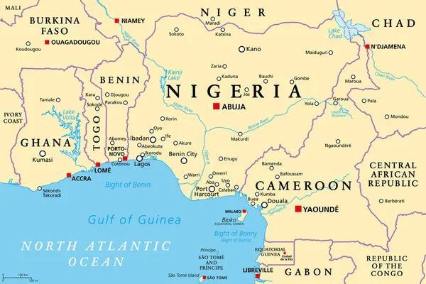
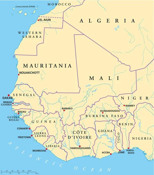
Nigeria And West Africa Countries On The Gulf Of Guinea, Political Map. Ghana, Togo, Benin, Nigeria, Cameroon, Equatorial Guinea, And Sao Tome And Principe, With Borders, Capitals And Largest Cities.

Vector, 3.62MB, 9000 × 6000 eps
stock vector All flags of Africa. Vector illustration

All Flags Of Africa. Vector Illustration

Vector, 8.36MB, 6250 × 5000 eps
stock vector Vector map of Africa with flags

Vector Map Of Africa With Flags

Vector, 2.19MB, 5000 × 5000 eps
Page 1 >> Next