
Stock image Map Of Leon

Mexico, Leon Flat Landmarks Vector Illustration. Mexico, Leon Line City With Famous Travel Sights, Skyline, Design.
Vector, 3.12MB, 6000 × 3000 eps

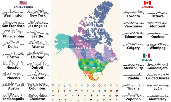
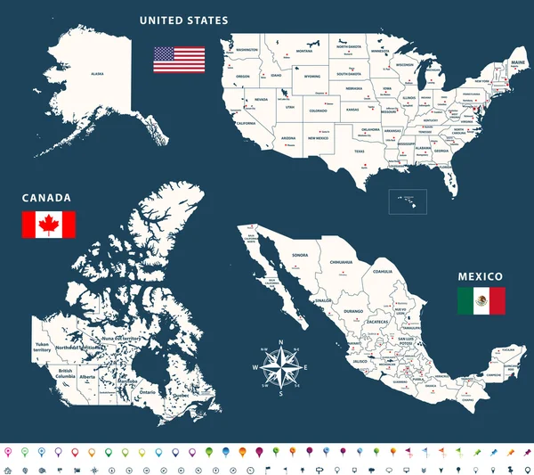
Canada, United States And Mexico Detailed Map With States Names And Borders. Flags And Largest Cities Skylines Outline Icons Of United States, Canada And Mexico
Vector, 13.55MB, 8333 × 4975 eps


North America High Detailed Vector Map With States Borders Of Canada, USA And Mexico. All Elements Separated In Detached Layers
Vector, 9.05MB, 5950 × 7292 eps


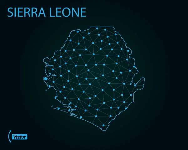
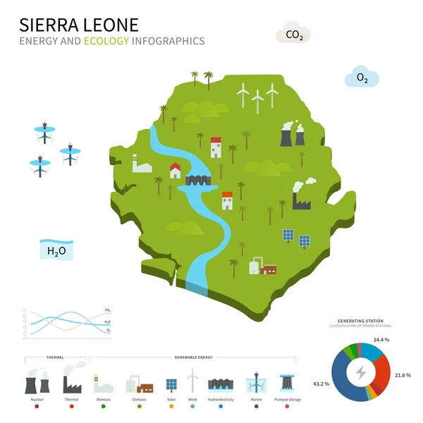
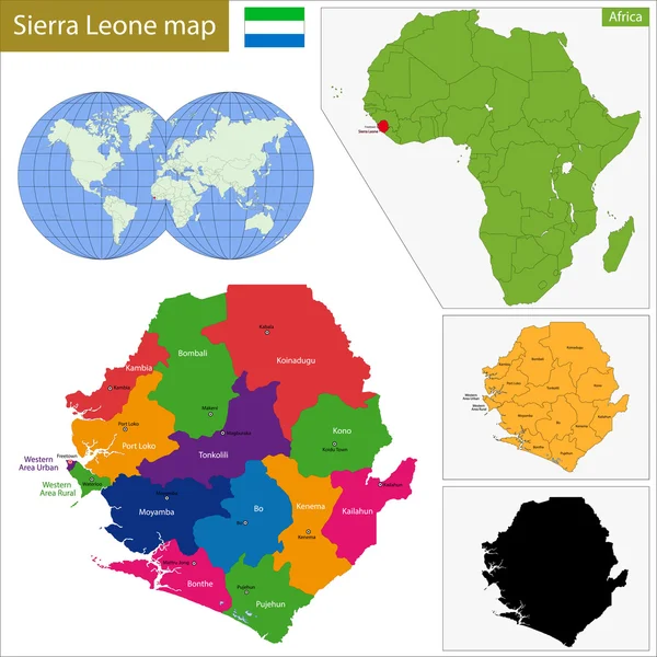
Location Map Of Sierra Leone On Map Africa. 3d Republic Of Sierra Leone Flag Map Marker Location Pin. High Quality Map Of Sierra Leone. Vector Illustration EPS10.
Vector, 7.64MB, 6960 × 6669 eps
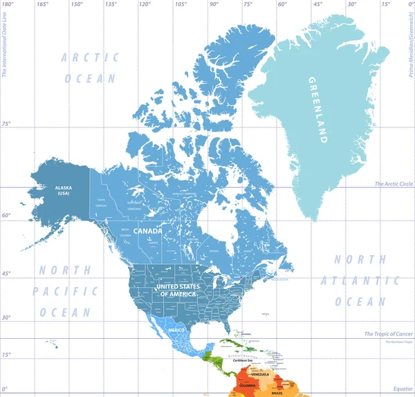
North America High Detailed Political Map. All Layers Detached And Labeled.
Vector, 12.82MB, 7296 × 6992 eps
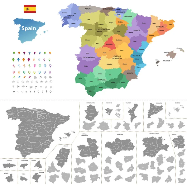
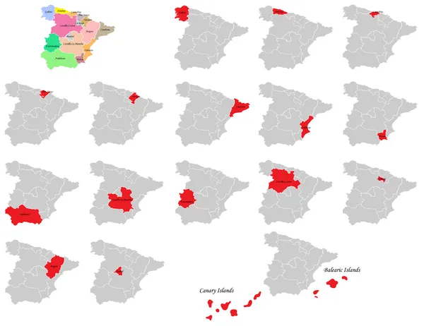
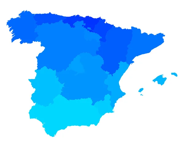
Spain Map (colored By Autonomous Communities) With Administrative Divisions
Vector, 12.58MB, 7292 × 7292 eps
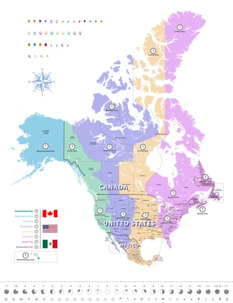
Canada, United States And Mexico Time Zones Map. All Elements Separated In Detached And Labeled Layers. Vector
Vector, 11.23MB, 8017 × 10417 eps

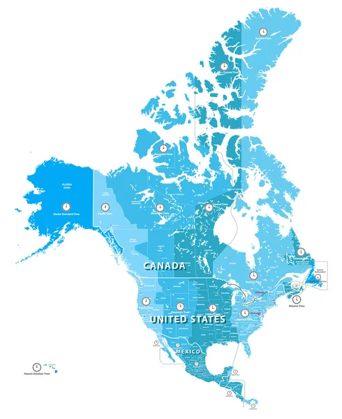
High Detailed North America Time Zones Map. All Elements Separated In Detached And Labeled Layers
Vector, 10.79MB, 5967 × 7292 eps
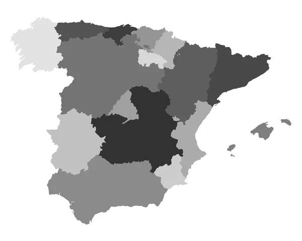
Blue Map Of Spain And The Islands, With Administrative Divisions Into Autonomous Communities And Islands, Vector Illustration On A White Background
Vector, 3.14MB, 8858 × 4411 eps


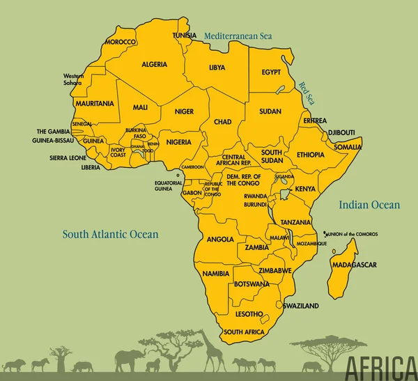
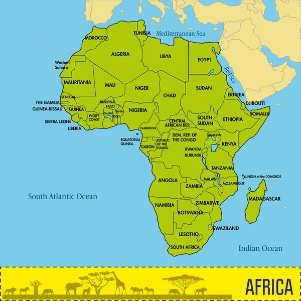
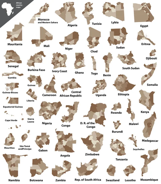
Vector Isometric Maps Set - Africa Continent. Maps Of African Countries With Administrative Division And Cities. Part 2.
Vector, 10.57MB, 5600 × 3500 eps


Castile And Leon On The Map Of Iberian Peninsula In Soft Grunge And Vintage Style On Old Paper.
Image, 16.6MB, 6000 × 6000 jpg


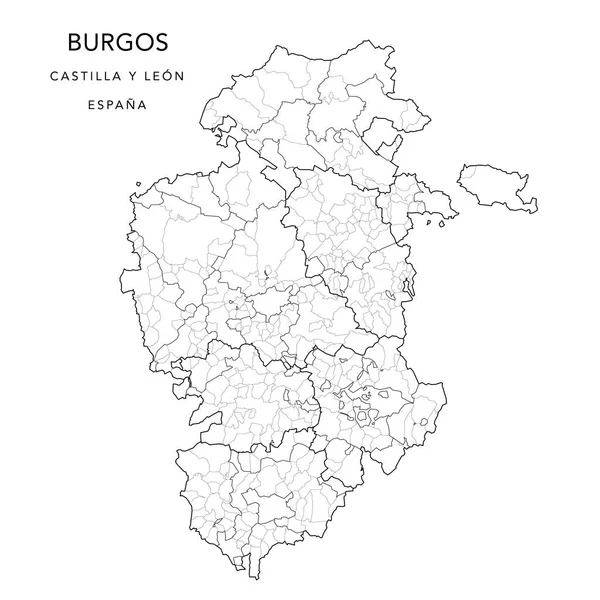
Geopolitical Vector Map Of The Province Of Burgos (Castile And Leon) With Jurisdictions (Partidos Judiciales), UBOST And Municipalities (Municipios) As Of 2022 - Spain
Vector, 7.8MB, 3000 × 3000 eps
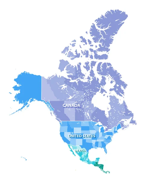
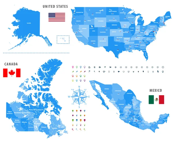
Maps Of Canada, United States And Mexico With Flags And Location\navigation Icons.
Vector, 10.24MB, 7294 × 6485 eps


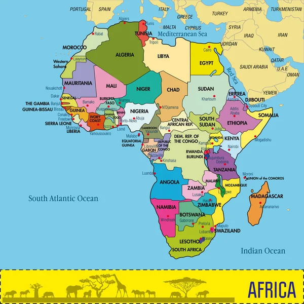
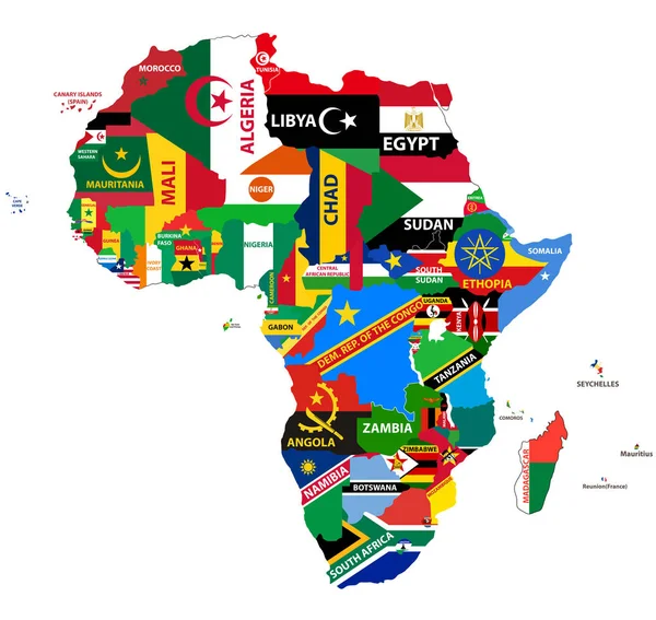
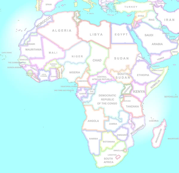
Vector Map Of Africa Continent Colored By Regions. All Flags Of African Countries Arranged In Alphabetical Order And Singled Out By Regions
Vector, 8.46MB, 8334 × 5379 eps
Maps Of Canada, United States And Mexico With Flags And Location\navigation Icons. All Layers Detached And Labeled.
Vector, 10.79MB, 7292 × 5990 eps
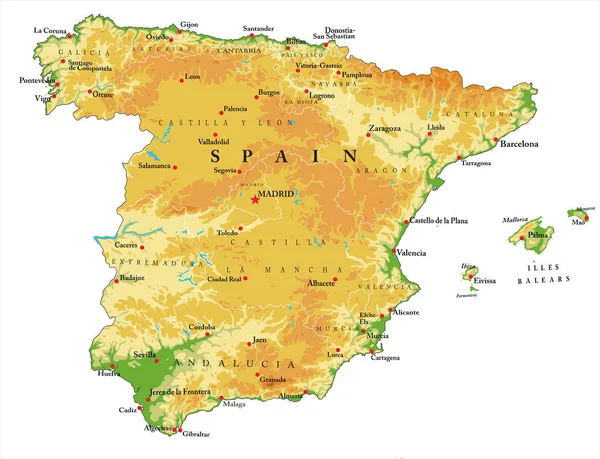
Highly Detailed Physical Map Of Spain,in Vector Format,with All The Relief Forms,regions And Big Cities.
Vector, 3.06MB, 5000 × 3832 eps
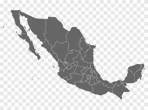
Blank Map Mexico. Map Of Mexico With The Provinces. High Quality Map Of Mexico On Gray For Your Web Site Design, Logo, App. Mexican United States. EPS10.
Vector, 0.27MB, 6668 × 4996 eps

Canada, United States And Mexico Vector Map With States Borders On Dark Blue Background
Vector, 11.46MB, 8813 × 10417 eps
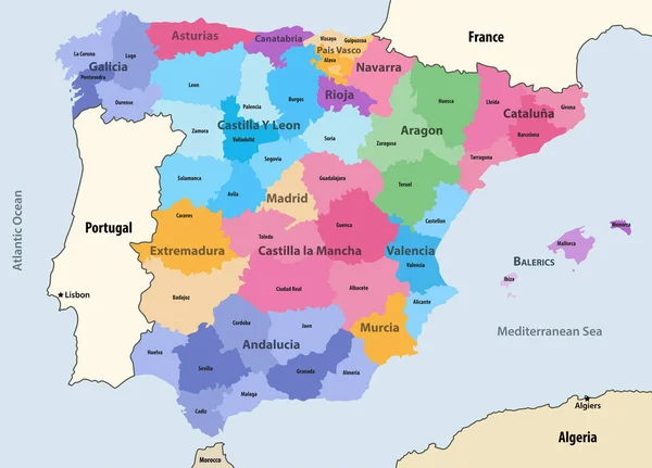
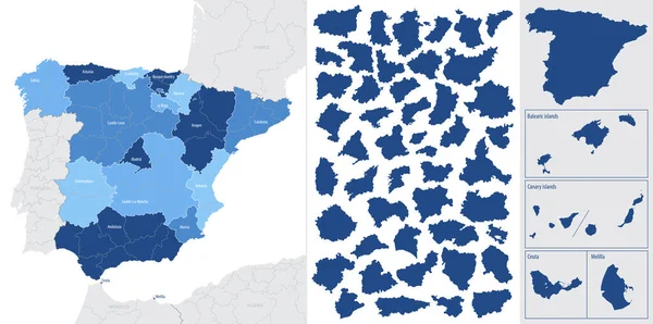
Spain Autonomous Communities And Provinces Vector Map With Neighbouring Countries And Territories
Vector, 6.42MB, 8312 × 5979 eps
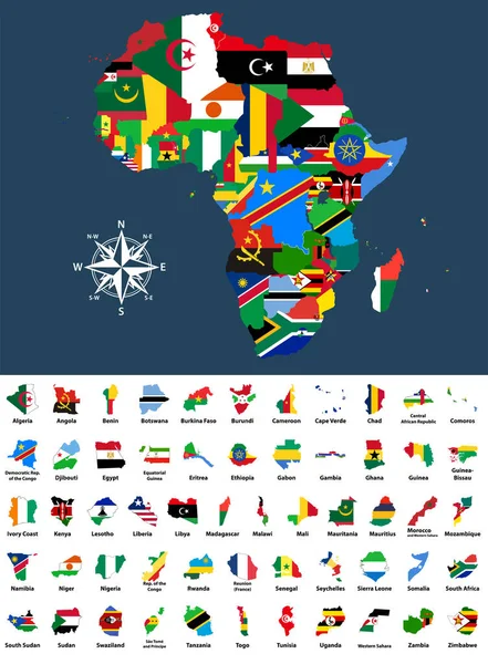
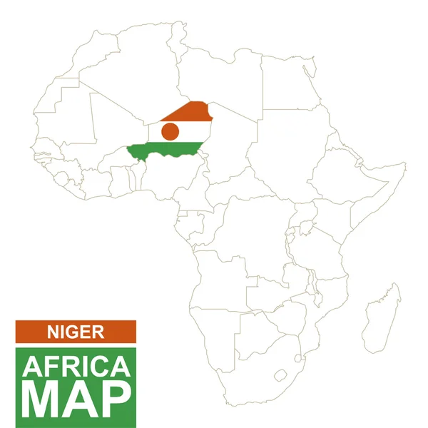
Vector Map Of Africa Mixed With Countries Flags. Collection Of All African Maps Combined With Flags Isolated On White Background
Vector, 10.1MB, 6125 × 8334 eps
Page 1 >> Next