photo free
Home Images Vectors Videos

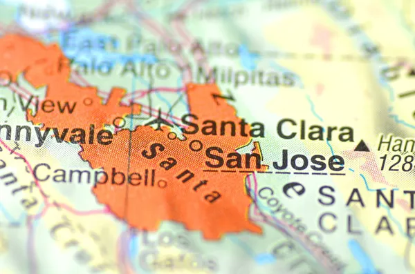
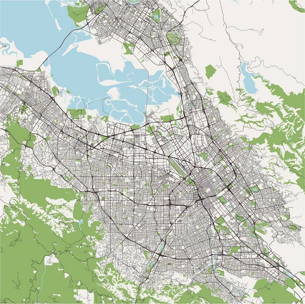
Stock image Map Of San Jose

stock vector Vector map of Californias San Andreas Fault

Vector Map Of Californias San Andreas Fault

Vector, 0.64MB, 3100 × 3483 eps
stock image San Jose, California in the USA on the map

San Jose, California In The USA On The Map

Image, 4.56MB, 4928 × 3264 jpg
stock image Costa Rica outlined on the relief orthographic map. Capital, administrative borders and graticule

Costa Rica Outlined On The Relief Orthographic Map. Capital, Administrative Borders And Graticule

Image, 4.62MB, 3840 × 2160 jpg
stock image Costa Rica extruded on the relief orthographic map. Capital, administrative borders and graticule

Costa Rica Extruded On The Relief Orthographic Map. Capital, Administrative Borders And Graticule

Image, 5.25MB, 3840 × 2160 jpg
stock vector map of the city of San Jose, California, USA

Map Of The City Of San Jose, California, USA

Vector, 13.36MB, 4901 × 6863 eps
stock vector map of the city of San Jose, California, USA

Map Of The City Of San Jose, California, USA

Vector, 4.46MB, 5487 × 4595 eps
stock image Map of North America with capital sits in Pastellorange

Map Of North America With Capital Sits In Pastellorange

Image, 0MB, 5690 × 2886 jpg
stock vector Global logistics network concept. Communications network map of Costa Rica on the world background.  Map of  Costa Rica  with nodes in polygonal style and national flag. America. EPS10.

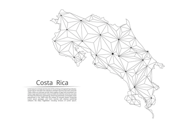
Global Logistics Network Concept. Communications Network Map Of Costa Rica On The World Background. Map Of Costa Rica With Nodes In Polygonal Style And National Flag. America. EPS10.

Vector, 2.21MB, 5000 × 5000 eps
stock vector Costa Rica communication network map. Vector low poly image of a global map with lights in the form of cities in or population density consisting of points and shapes in the form of stars and space.

Costa Rica Communication Network Map. Vector Low Poly Image Of A Global Map With Lights In The Form Of Cities In Or Population Density Consisting Of Points And Shapes In The Form Of Stars And Space.

Vector, 1.32MB, 4100 × 2800 eps
stock vector map of the city of San Jose, California, USA

Map Of The City Of San Jose, California, USA

Vector, 16.79MB, 4886 × 4875 eps
stock vector Empty vector map of San Jose, California, USA

Empty Vector Map Of San Jose, California, USA

Vector, 5.69MB, 7168 × 4060 eps
stock vector Light grey and white San Jose city area vector background map, streets and water cartography illustration. Widescreen proportion, digital flat design streetmap.

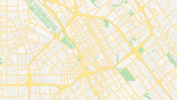
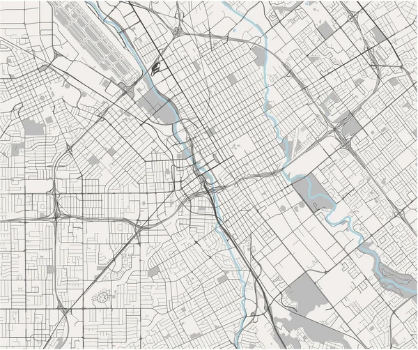
Light Grey And White San Jose City Area Vector Background Map, Streets And Water Cartography Illustration. Widescreen Proportion, Digital Flat Design Streetmap.

Vector, 3.1MB, 5334 × 3001 eps
stock vector Travel destination Costa Rica, tourism mockup with travel equipment and world map with magnifying glass on a Costa Rica.

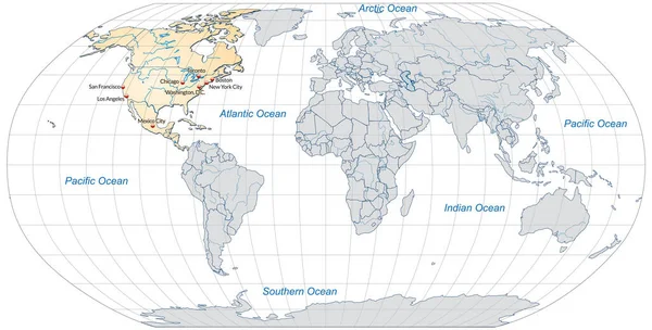
Travel Destination Costa Rica, Tourism Mockup With Travel Equipment And World Map With Magnifying Glass On A Costa Rica.

Vector, 4.53MB, 6000 × 4000 eps
stock vector map of the city of San Jose, California, USA

Map Of The City Of San Jose, California, USA

Vector, 12.96MB, 6842 × 4585 eps
stock vector map of the city of San Jose, California, USA

Map Of The City Of San Jose, California, USA

Vector, 8.95MB, 4714 × 5327 eps
stock vector Costa Rica communication network map. Vector low poly image of a global map with lights in the form of cities

Costa Rica Communication Network Map. Vector Low Poly Image Of A Global Map With Lights In The Form Of Cities

Vector, 10.26MB, 8192 × 5600 eps
stock image Berkeley. USA map

Berkeley. USA Map

Image, 16.2MB, 6000 × 4000 jpg
stock vector Costa Rica map. Cities regions Vector illustration

Costa Rica Map. Cities Regions Vector Illustration

Vector, 1.19MB, 5920 × 5501 eps
stock vector Costa Rica physical map

Costa Rica Physical Map

Vector, 4.42MB, 7500 × 6252 eps
stock image California, state of United States of America. Colored elevation map with lakes and rivers. Locations of major cities of the region. Corner auxiliary location maps

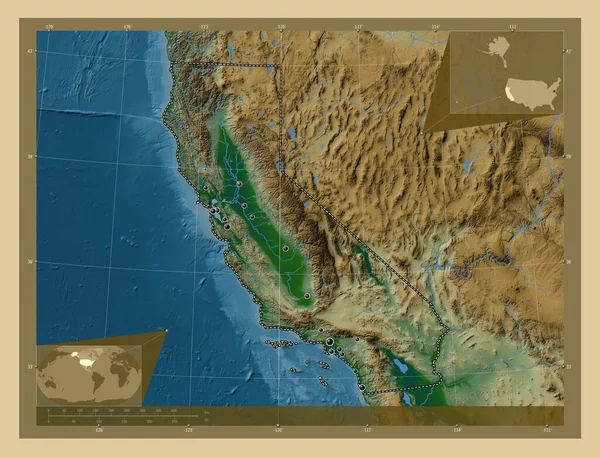
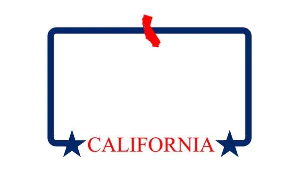
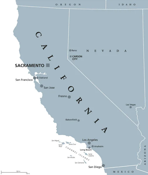
California, State Of United States Of America. Colored Elevation Map With Lakes And Rivers. Locations Of Major Cities Of The Region. Corner Auxiliary Location Maps

Image, 10.14MB, 4930 × 3770 jpg
stock vector Green San Jose city area vector background map, streets and water cartography illustration. Widescreen proportion, digital flat design streetmap.

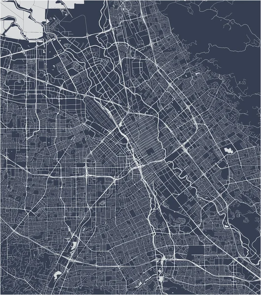
Green San Jose City Area Vector Background Map, Streets And Water Cartography Illustration. Widescreen Proportion, Digital Flat Design Streetmap.

Vector, 3.1MB, 5334 × 3001 eps
stock vector Guatemala Political Map

Guatemala Political Map

Vector, 4.68MB, 6000 × 6952 eps
stock image Zoomed-in view of Costa Rica outline with perspective lines against a global map in the Mollweide projection. Shape centered. color physical map

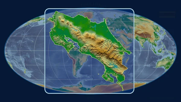
Zoomed-in View Of Costa Rica Outline With Perspective Lines Against A Global Map In The Mollweide Projection. Shape Centered. Color Physical Map

Image, 3.31MB, 2880 × 1620 jpg
stock image The highlighted area of Costa Rica with capital point and label on the desaturated map of its neighbourhood. Color physical map

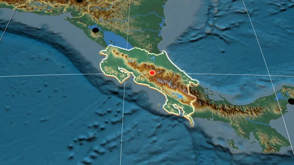
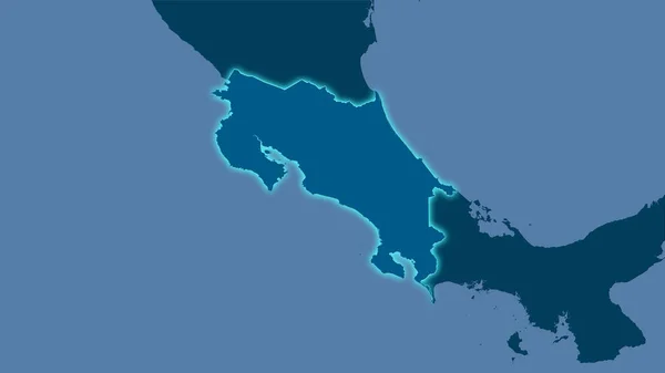
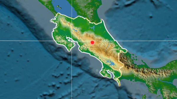
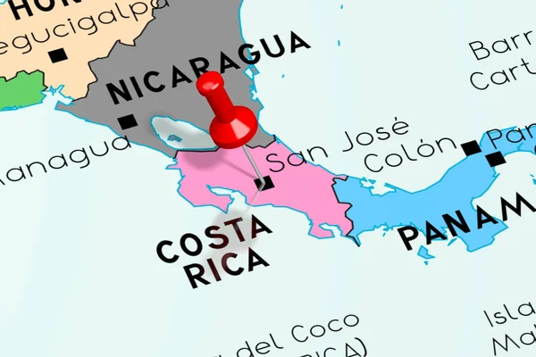
The Highlighted Area Of Costa Rica With Capital Point And Label On The Desaturated Map Of Its Neighbourhood. Color Physical Map

Image, 2.52MB, 2880 × 1620 jpg
stock vector Highly detailed vector silhouettes of US state maps, Division United States into counties, political and geographic subdivisions of a states, Pacific - Washington, Oregon, California - set 16 of 17

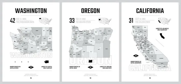
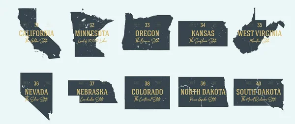
Highly Detailed Vector Silhouettes Of US State Maps, Division United States Into Counties, Political And Geographic Subdivisions Of A States, Pacific - Washington, Oregon, California - Set 16 Of 17

Vector, 10.41MB, 9608 × 4501 eps
stock image San Jose, Costa Rica. Political map.

San Jose, Costa Rica. Political Map.

Image, 11.62MB, 5472 × 3648 jpg
stock vector Costa Rica - highly detailed blue map. Vector illustration

Costa Rica - Highly Detailed Blue Map. Vector Illustration

Vector, 0.94MB, 8872 × 4759 eps
stock vector Stickers in form of New Mexico state, USA

Stickers In Form Of New Mexico State, USA

Vector, 0.53MB, 5500 × 5500 eps
stock vector Abstract vector color map of Costa Rica with transparent paint effect.

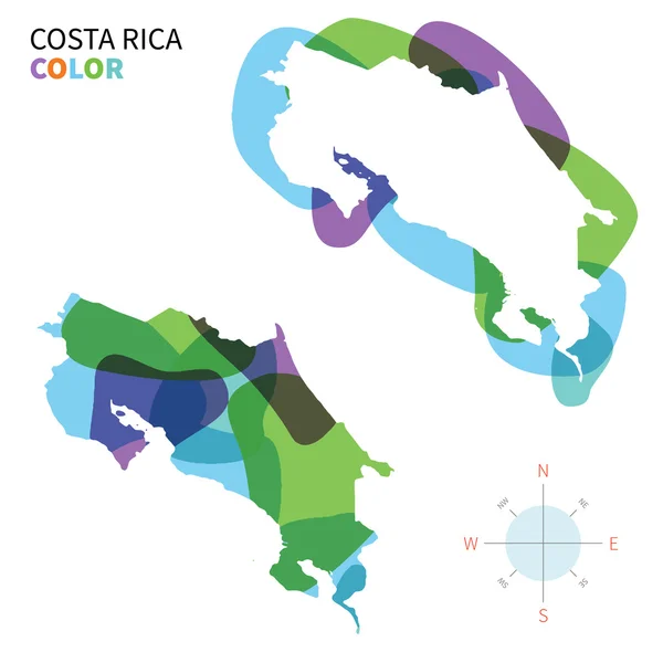
Abstract Vector Color Map Of Costa Rica With Transparent Paint Effect.

Vector, 3.5MB, 5867 × 5867 eps
stock image Costa Rica area on the solid map in the stereographic projection - raw composition of raster layers with light glowing outline

Costa Rica Area On The Solid Map In The Stereographic Projection - Raw Composition Of Raster Layers With Light Glowing Outline

Image, 0.4MB, 2880 × 1620 jpg
stock vector Typography composition of city names, silhouettes maps of the states of America, vector detailed posters, Division Pacific - Washington, Oregon, California - set 16 of 17

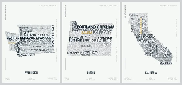
Typography Composition Of City Names, Silhouettes Maps Of The States Of America, Vector Detailed Posters, Division Pacific - Washington, Oregon, California - Set 16 Of 17

Vector, 3.81MB, 8896 × 4168 eps
stock vector Central America Political Map

Central America Political Map

Vector, 2.78MB, 9296 × 7183 eps
stock image Detailed Earth at night. The western part of South America. Peru

Detailed Earth At Night. The Western Part Of South America. Peru

Image, 8.59MB, 8000 × 4000 jpg
stock vector 31 of 50 sets, US State Posters with name and Information in 3 Design Styles, Detailed vector art print California map

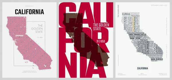
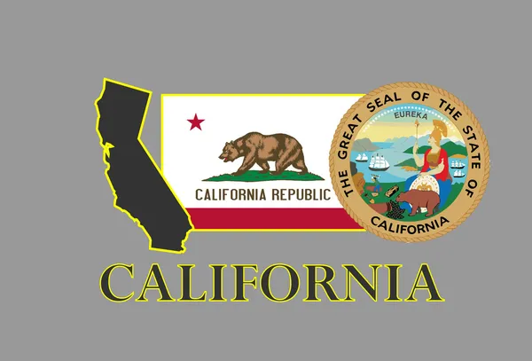
31 Of 50 Sets, US State Posters With Name And Information In 3 Design Styles, Detailed Vector Art Print California Map

Vector, 3.49MB, 8896 × 4168 eps
stock vector Republic of Costa Rica

Republic Of Costa Rica

Vector, 2.93MB, 5104 × 4905 eps
stock image Costa Rica outlined on the physical orthographic map. Capital, administrative borders and graticule

Costa Rica Outlined On The Physical Orthographic Map. Capital, Administrative Borders And Graticule

Image, 4.39MB, 3840 × 2160 jpg
stock vector Stamp Postal of Costa Rica. Map Silhouette rubber Seal.  Design Retro Travel. Seal of Map Costa Rica grunge  for your design.  EPS10

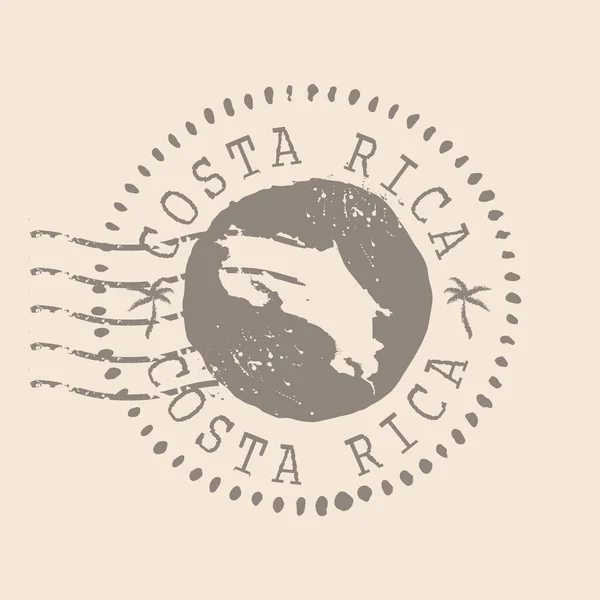
Stamp Postal Of Costa Rica. Map Silhouette Rubber Seal. Design Retro Travel. Seal Of Map Costa Rica Grunge For Your Design. EPS10

Vector, 3.97MB, 5000 × 5000 eps
stock image Extended area of Costa Rica. Satellite imagery. 3D rendering

Extended Area Of Costa Rica. Satellite Imagery. 3D Rendering

Image, 5.15MB, 3000 × 2000 jpg
stock vector 31 of 50 states of the United States with a name, nickname, and

31 Of 50 States Of The United States With A Name, Nickname, And

Vector, 1.45MB, 7311 × 4112 eps
stock image Costa Rica, San Jose - capital city, pinned on political map

Costa Rica, San Jose - Capital City, Pinned On Political Map

Image, 1.42MB, 6000 × 4000 jpg
stock vector Costa Rica Political Map

Costa Rica Political Map

Vector, 1.26MB, 7760 × 8796 eps
stock vector Shiny icon in form of New Mexico state, USA

Shiny Icon In Form Of New Mexico State, USA

Vector, 1.27MB, 5500 × 5500 eps
stock vector California frame

California Frame

Vector, 1.42MB, 5000 × 3000 eps
stock vector administrative vector map of the central american state of costa rica

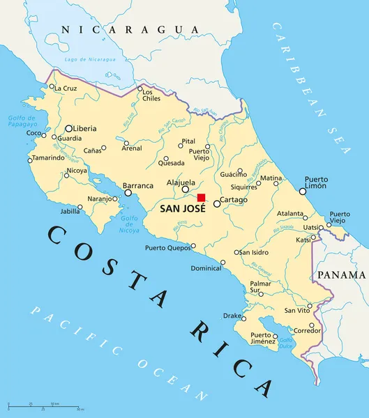
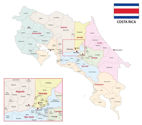
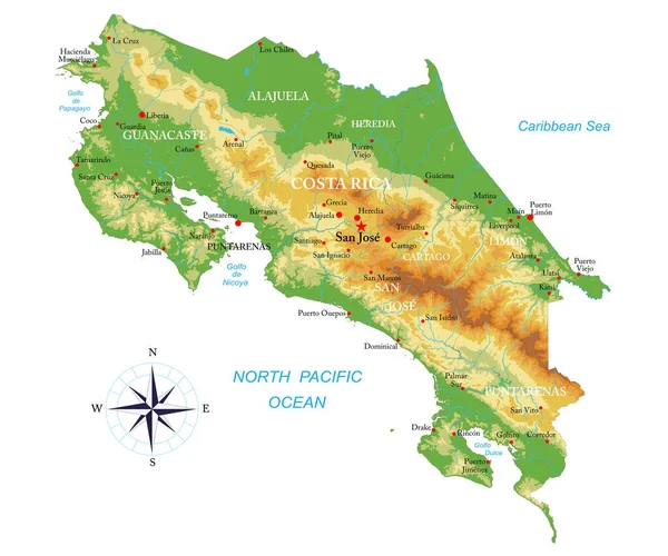
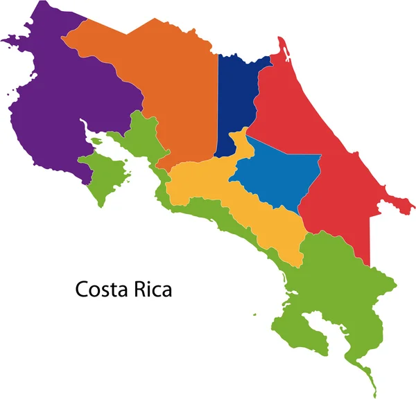
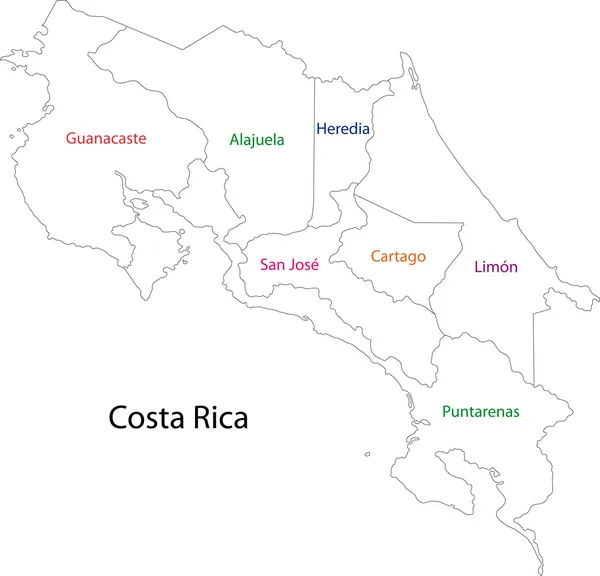
Administrative Vector Map Of The Central American State Of Costa Rica

Vector, 1.45MB, 3525 × 3101 eps
stock vector Set 4 of 5 Highly detailed vector silhouettes of USA state maps

Set 4 Of 5 Highly Detailed Vector Silhouettes Of USA State Maps

Vector, 5.44MB, 8858 × 3738 eps
stock vector Outline Costa Rica map

Outline Costa Rica Map

Vector, 2.96MB, 5104 × 4905 eps
stock vector USA Heart and words cloud with larger cities

USA Heart And Words Cloud With Larger Cities

Vector, 0.69MB, 4752 × 4401 eps
stock vector California

California

Vector, 5.49MB, 2800 × 1900 eps
stock image San Jose de David, a city and corregimiento located in west Panama. It is capital of the province Chiriqui.

San Jose De David, A City And Corregimiento Located In West Panama. It Is Capital Of The Province Chiriqui.

Image, 5.92MB, 3244 × 2157 jpg
stock vector California United States political map

California United States Political Map

Vector, 3.29MB, 7315 × 8666 eps
Page 1 >> Next